Typhoon2000 STORM UPDATE #16
Name: TYPHOON EWINIAR [ESTER/04W/0603]
Issued: 7:00 PM MANILA TIME (11:00 GMT) FRI 07 JULY 2006
Next Update: 7:00 AM (23:00 GMT) SAT 08 JULY 2006
Source: JTWC TROPICAL CYCLONE WARNING #031
_______________________________________________________________________
Next Update: 7:00 AM (23:00 GMT) SAT 08 JULY 2006
Source: JTWC TROPICAL CYCLONE WARNING #031
_______________________________________________________________________
TYPHOON EWINIAR (ESTER) MOVING NORTH-NORTHWEST DURING THE
PAST SIX HOURS, CLOSER TO YAEYAMA-OKINAWA AREA.
PAST SIX HOURS, CLOSER TO YAEYAMA-OKINAWA AREA.
+ FORECAST OUTLOOK: EWINIAR is expected to move NNW'ly for
the next 24-48 hours then shall begin turning northward
over the East China Sea. Its core (Eye+EyeWall)is expected
to pass west of Okinawa, Japan approximately 165 km west
of Kadena Air Base Sunday early morning (July 8), around 1
to 2 AM HK Time. The 3 to 5-Day Advance Forecast (July 10-
12) shows the system passing over the "fantasy & mystery"
Island of Cheju (around 5 to 6 AM HK time Monday, July 10)
before making landfall over South Korea as a weakened Ca-
tegory 1 Typhoon by noontime Monday (around 12 to 1 PM HK
Time July 10). EWINIAR shall pass approx 150 km SE of
Seoul Monday afternoon before moving out into the Sea
of Japan (as a downgraded Tropical Storm).
+ EFFECTS: EWINIAR's large circulation is now moving slowly
closer to Yaeyama-Okinawa-Ryukyu Area. However, its Outer
and Inner Rain Bands is forecast to reach the mentioned
Islands tomorrow morning - depending on the typhoon's for-
ward speed. The storm's outer/inner bands is expected to
bring moderate to heavy rains with damaging winds that
could produce flying debris, life-threatening flash floods
and mudslides along river banks, low-lying areas and moun-
tain slopes over the affected island. Residents residing
along the coastal beachfront areas of Yaeyama-Okinawa-Ryukyu
Islands are advised to seek higher grounds due to possible
high waves from the sea. Coastal Storm Surge flooding from
9 to 12 feet can be expected along the path of this approa-
ching typhoon, thereby advising all sea vessels to remain
at port and avoid passing over it.
+ CURRENT MONSOON INTENSITY: The Southwest Monsoon continues
to be enhanced by EWINIAR and is currently affecting Metro
Manila, Western Luzon & Western Visayas (except for Palawan).
This monsoon system will bring cloudy skies with moderate to
sometimes strong SW'ly winds (approx. 30 to 60 km/hr), accom-
panied with moderate to heavy occasional rains. These rains
may produce life-threatening flash floods and mudslides along
river banks, low-lying areas and mountain slopes of the
affected areas.
+ TROPICAL CYCLONE WATCH: The Tropical Disturbance (LPA/98W/
1006 mb) continues to consolidate south of the Marianas. The
possibility of becoming a well-develop Tropical Cyclone with-
in the next 24 to 48 hours remains. The disturbance was last
located approximately 455 km SW of Hagatna, Guam (9.8N
142.8E). Stay tuned for more updates on this developing
system.
outlook, effects, current monsoon intensity, and tropical
cyclone watch changes every 06 to 12 hours!
_______________________________________________________________________
TIME/DATE: 5:00 PM MANILA TIME (09:00 GMT) 07 JULY
LOCATION OF EYE: LATITUDE 21.8º N...LONGITUDE 127.2º E {SatFix}
DISTANCE 1: 560 KM (302 NM) ENE OF BASCO, BATANES, PH
DISTANCE 2: 530 KM (287 NM) SSW OF OKINAWA, JAPAN
DISTANCE 3: 675 KM (365 NM) SE OF TAIPEI, TAIWAN
TIME/DATE: 5:00 PM MANILA TIME (09:00 GMT) 07 JULY
LOCATION OF EYE: LATITUDE 21.8º N...LONGITUDE 127.2º E {SatFix}
DISTANCE 1: 560 KM (302 NM) ENE OF BASCO, BATANES, PH
DISTANCE 2: 530 KM (287 NM) SSW OF OKINAWA, JAPAN
DISTANCE 3: 675 KM (365 NM) SE OF TAIPEI, TAIWAN
MAX SUSTAINED WINDS [1-MIN AVG]: 185 KM/HR (100 KTS)
PEAK WIND GUSTS: 230 KM/HR (125 KTS)
MINIMUM CENTRAL PRESSURE (est.): 944 MILLIBARS (hPa)
MAX WAVE HEIGHT**: 36 FEET (10.9 METERS)
SAFFIR-SIMPSON SCALE: CATEGORY THREE (3)
RECENT MOVEMENT: NNW @ 11 KM/HR (06 KTS)
GENERAL DIRECTION: YAEYAMA-OKINAWA-RYUKYU AREA
STORM'S SIZE (IN DIAMETER): 815 KM (440 NM)/LARGE
VIEW T2K TRACKING MAP: 5 PM FRI JULY 07
TSR WIND PROBABILITIES: CURRENT TO 120 HRS LEAD
PHILIPPINE STORM SIGNALS*:
#01 - NORTHERN CAGAYAN, CALAYAN GROUP OF ISLANDS,
& BATANES GROUP OF ISLANDS.
09-21 HR. FORECAST:
> 2 AM (18 GMT) 08 JULY: 22.4N 127.0E / 195-240 KPH
> 2 PM (06 GMT) 08 JULY: 24.2N 126.6E / 195-240 KPH
REMARKS: 2 PM (06 GMT) 07 JULY POSITION: 21.3N 127.4E.
^TY EWINIAR IS TRACKING NORTHWESTWARD AROUND THE WESTERN
PERIPHERY OF A SUBTROPICAL HIGH PRESSURE RIDGE (STHPR)
ANCHORED EAST OF OKINAWA. A MIDLATITUDE LOW PRESSURE
TROUGH TO THE NORTH OF TY EWINIAR HAS WEAKENED THE STHPR
SUFFICIENTLY TO ALLOW THE STORM TO TAKE A MORE NORTHWARD
TRACK EARLY IN THE FORECAST PERIOD. THE STHPR IS EXPEC-
TED TO BUILD SLIGHTLY BEHIND THIS TROUGH AND STEER THE
STORM ON A NORTH-NORTHWESTWARD TRACK. A SECOND TROUGH
APPROACHING EASTERN CHINA IS EXPECTED TO BEGIN ABSORBING
TY EWINIAR INTO THE MIDLATITUDE FLOW AROUND 72 HOURS...
(more info)
>> EWINIAR {pronounced: ee~win~yar}, meaning: Chuuk
traditional storm God. Name contributed by: Micronesia.
_______________________________________________________________________
PAGASA CURRENT POSITION, MOVEMENT AND INTENSITY (10-min. ave.):
> 4 PM (08 GMT) 07 JULY: 21.5N 127.3E / NW @ 09 KPH / 165 kph
:: For the complete PAGASA bulletin, kindly visit their website
at: http://www.pagasa.dost.gov.ph/wb/tcupdate.shtml
_________________________________________________________________________________
:: For the complete PAGASA bulletin, kindly visit their website
at: http://www.pagasa.dost.gov.ph/wb/tcupdate.shtml
_________________________________________________________________________________
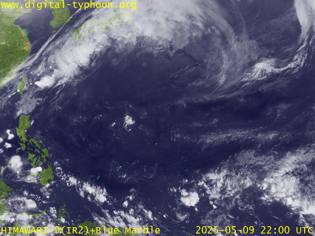
RECENT MTSAT-1R SATELLITE IMAGE:

> Image source: Digital-Typhoon.org (Nat'l. Institute of Informatics, Japan) (http://www.digital-typhoon.org)
__________________________________________________________________________________________
LATEST T2K TRACKING CHART:

_______________________________________________________________________________________
NOTES:

> Image source: Digital-Typhoon.org (Nat'l. Institute of Informatics, Japan) (http://www.digital-typhoon.org)
__________________________________________________________________________________________
LATEST T2K TRACKING CHART:

_______________________________________________________________________________________
NOTES:
^ - JTWC commentary remarks (for Meteorologists) from their
latest warning.
latest warning.
* - Based on PAGASA's Philippine Storm Warning Signals,
# 4 being the highest. Red letters indicate new areas
being hoisted. For more explanations on these signals,
visit: http://www.typhoon2000.ph/signals.htm
** - Based on the Tropical Cyclone's Sea Wave Height near
its center.
__________________________________________________________________________________________
>> To know the meteorological terminologies and acronyms
used on this update visit the ff:
http://typhoon2000.ph/tcterm.htm
http://www.nhc.noaa.gov/aboutgloss.shtml
http://www.srhnoaa.gov/oun/severewx/glossary.php
http://www.srh.weather.gov/fwd/glossarynation.html
http://www.nhc.noaa.gov/acronyms.shtml
__________________________________________________________________________________________
:: Typhoon2000.com (T2K) Mobile >> Powered by: Synermaxx
Receive the latest storm updates directly to your mobile phones! To know more:
Send T2K HELP to: 2800 (GLOBE & TM) | OFFLINE (SMART & TNT) | 2288 (SUN)
__________________________________________________________________________________________
For the complete details on the TY EWINIAR (ESTER/04W)...go visit
our website @:
> http://www.typhoon2000.com
> http://www.maybagyo.com
Visit Your Group | Yahoo! Groups Terms of Use | Unsubscribe
New Message Search
Find the message you want faster. Visit your group to try out the improved message search.
.
__,_._,___
No comments:
Post a Comment