Typhoon2000 STORM UPDATE #09
Name: TYPHOON EWINIAR [ESTER/04W/0603]
Issued: 7:00 AM MANILA TIME (23:00 GMT) TUE 04 JULY 2006
Next Update: 7:00 PM (11:00 GMT) TUE 04 JULY 2006
Source: JTWC TROPICAL CYCLONE WARNING #017
_______________________________________________________________________
Next Update: 7:00 PM (11:00 GMT) TUE 04 JULY 2006
Source: JTWC TROPICAL CYCLONE WARNING #017
_______________________________________________________________________
TYPHOON EWINIAR (ESTER) CONTINUES TO STRENGTHEN AND IS NOW
CATEGORY THREE ON THE SAFFIR-SIMPSON TROPICAL CYCLONE
SCALE...CIRCULATION EXPANDING ACROSS PHILIPPINE SEA AS IT
THREATENS OKINAWA-RYUKYU AREA.
CATEGORY THREE ON THE SAFFIR-SIMPSON TROPICAL CYCLONE
SCALE...CIRCULATION EXPANDING ACROSS PHILIPPINE SEA AS IT
THREATENS OKINAWA-RYUKYU AREA.
+ FORECAST OUTLOOK: EWINIAR is expected to intensify fur-
ther & continue tracking NW'ly across the Philippine Sea
for the next 24 to 48 hours. The 3 to 5-Day Advance Fore-
cast (July 6-8) remains the same - showing the system tur-
ning Northward, then recurving NE'ly - passing just to the
east of Okinawa, Japan around 12 AM Saturday, July 8
(approximately 150 km east of Naha, Okinawa).
+ EFFECTS: EWINIAR is currently not affecting any land or
islands at this moment. However, the outer (feeder) bands
is forecast to reach Okinawa-Ryukyu Area sometime Thursday
or Friday (July 6 or 7). The storm's outer bands is charac-
terize with passing moderate to heavy rains with moderate
to sometimes strong winds that could produce flying debris,
life-threatening flash floods and mudslides along river
banks, low-lying areas and mountain slopes over the
affected island.
+ CURRENT MONSOON INTENSITY: None yet. However, this po-
werful typhoon is expected to enhance & strengthen the
Southwest (SW) Monsoon across the Philippines especially
the western sections beginning late Wednesday until week-
end (July 05-09). This monsoon system will bring cloudy
skies with winds of 30 to 60 km/hr, accompanied with light,
moderate to heavy rains. These rains may produce life-
threatening flash floods and mudslides along river banks,
low-lying areas and mountain slopes of the affected areas.
+ TROPICAL CYCLONE WATCH: The Low Pressure Area (aka. Tro-
pical Disturbance) over Central Micronesia expanding as it
remains disorganize. The disturbance was located approxi-
mately 1,130 km SSE of Hagatna, Guam (4.5N 149.8E). It may
likely become a significant Tropical Cyclone within a day
or two. Stay tuned for more updates on this system. Click
here to view latest sat pic on the disturbance
(and EWINIAR).
Important Note: Please keep in mind that the above forecast pical Disturbance) over Central Micronesia expanding as it
remains disorganize. The disturbance was located approxi-
mately 1,130 km SSE of Hagatna, Guam (4.5N 149.8E). It may
likely become a significant Tropical Cyclone within a day
or two. Stay tuned for more updates on this system. Click
here to view latest sat pic on the disturbance
(and EWINIAR).
outlook, effects, current monsoon intensity, and tropical
cyclone watch changes every 06 to 12 hours!
_______________________________________________________________________
TIME/DATE: 5:00 AM MANILA TIME (21:00 GMT) 04 JULY
LOCATION OF EYE: LATITUDE 15.2º N...LONGITUDE 133.2º E
DISTANCE 1: 1,245 KM (672 NM) EAST OF CENTRAL LUZON, PH
TIME/DATE: 5:00 AM MANILA TIME (21:00 GMT) 04 JULY
LOCATION OF EYE: LATITUDE 15.2º N...LONGITUDE 133.2º E
DISTANCE 1: 1,245 KM (672 NM) EAST OF CENTRAL LUZON, PH
MAX SUSTAINED WINDS [1-MIN AVG]: 185 KM/HR (100 KTS)
PEAK WIND GUSTS: 230 KM/HR (125 KTS)
MINIMUM CENTRAL PRESSURE (est.): 944 MILLIBARS (hPa)
MAX WAVE HEIGHT**: 32 FEET (9.7 METERS)
SAFFIR-SIMPSON SCALE: CATEGORY THREE (3)
RECENT MOVEMENT: NW @ 19 KM/HR (10 KTS)
GENERAL DIRECTION: OKINAWA-RYUKYU AREA
STORM'S SIZE (IN DIAMETER): 740 KM (400 NM)/LARGE
VIEW T2K TRACKING MAP: 5 AM TUE JULY 04
TSR WIND PROBABILITIES: CURRENT TO 120 HRS LEAD
PHILIPPINE STORM SIGNALS*: N/A
09-21 HR. FORECAST:
> 2 PM (06 GMT) 04 JULY: 16.4N 132.3E / 215-260 KPH
> 2 AM (18 GMT) 05 JULY: 17.6N 131.2E / 220-270 KPH
REMARKS: 2 AM (18 GMT) 04 JULY POSITION: 14.8N 133.5E.
^PERIPHERAL RIDGING TO THE SOUTHEAST OF TY EWINIAR HAS
INTENSIFIED CAUSING THE SYSTEM TO TRACK MORE NORTHERLY
OVER THE LAST 12 HOURS. RECENT ANIMATED INFRARED IMA-
GERY REVEALS THAT OVER THE LAST 6 HOURS, THE SUBTROPI-
CAL RIDGE (STR) HAS BEGUN TO STEER THE SYSTEM TO THE
NORTH-NORTHWEST & NORTHWEST...(more info)
>> EWINIAR {pronounced: ee~win~yar}, meaning: Chuuk
traditional storm God. Name contributed by: Micronesia.
_______________________________________________________________________
PAGASA CURRENT POSITION, MOVEMENT AND INTENSITY (10-min. ave.):
> 2 AM (18 GMT) 04 JULY: 14.7N 133.5E / NW @ 17 KPH / 150 kph
:: For the complete PAGASA bulletin, kindly visit their website
at: http://www.pagasa.dost.gov.ph/wb/tcupdate.shtml
_________________________________________________________________________________
:: For the complete PAGASA bulletin, kindly visit their website
at: http://www.pagasa.dost.gov.ph/wb/tcupdate.shtml
_________________________________________________________________________________
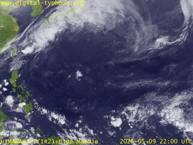
RECENT MTSAT-1R SATELLITE IMAGE:

> Image source: Digital-Typhoon.org (Nat'l. Institute of Informatics, Japan) (http://www.digital-typhoon.org)
__________________________________________________________________________________________
LATEST T2K TRACKING CHART:

_______________________________________________________________________________________
NOTES:

> Image source: Digital-Typhoon.org (Nat'l. Institute of Informatics, Japan) (http://www.digital-typhoon.org)
__________________________________________________________________________________________
LATEST T2K TRACKING CHART:

_______________________________________________________________________________________
NOTES:
^ - JTWC commentary remarks (for Meteorologists) from their
latest warning.
latest warning.
* - Based on PAGASA's Philippine Storm Warning Signals,
# 4 being the highest. Red letters indicate new areas
being hoisted. For more explanations on these signals,
visit: http://www.typhoon2000.ph/signals.htm
** - Based on the Tropical Cyclone's Sea Wave Height near
its center.
__________________________________________________________________________________________
>> To know the meteorological terminologies and acronyms
used on this update visit the ff:
http://typhoon2000.ph/tcterm.htm
http://www.nhc.noaa.gov/aboutgloss.shtml
http://www.srhnoaa.gov/oun/severewx/glossary.php
http://www.srh.weather.gov/fwd/glossarynation.html
http://www.nhc.noaa.gov/acronyms.shtml
__________________________________________________________________________________________
:: Typhoon2000.com (T2K) Mobile >> Powered by: Synermaxx
Receive the latest storm updates directly to your mobile phones! To know more:
Send T2K HELP to: 2800 (GLOBE & TM) | OFFLINE (SMART & TNT) | 2288 (SUN)
__________________________________________________________________________________________
For the complete details on the TS EWINIAR (ESTER/04W)...go visit
our website @:
> http://www.typhoon2000.com
> http://www.maybagyo.com
Visit Your Group | Yahoo! Groups Terms of Use | Unsubscribe
New Message Search
Find the message you want faster. Visit your group to try out the improved message search.
SPONSORED LINKS
.
__,_._,___
No comments:
Post a Comment