Saturday, May 31, 2008

Typhoon NAKRI (ENTENG) - Update #007


Typhoon2000 STORM UPDATE #007
Name: TYPHOON NAKRI [ENTENG/06W/0805] 
Issued: 1:00 PM MANILA TIME (05:00 GMT) SAT 31 MAY 2008
Source: JTWC TROPICAL CYCLONE WARNING NUMBER 017
Note: Kindly refer to your country's official warnings or bulletins. This update is for additional information purposes only.
_____________________________________________________________________________
 
 
TYPHOON NAKRI (06W) NOW TURNING NORTHWARD SLOWLY AWAY FROM THE NORTHERN
PHILIPPINE SEA...DOWNGRADED TO CATEGORY ONE...EXPECTED TO LEAVE THE
PHILIPPINE AREA OF RESPONSIBILITY (PAR) TOMORROW.

+ FORECAST OUTLOOK: NAKRI is expected to continue tracking North for the
next 24 hours, & shall continue losing strength. The 2 to 4-day long range
forecast shows NAKRI downgraded to Tropical Storm while recurving NNEward
late Sunday evening, June 01 & exiting PAR. It shall start transitioning
into an Extratropical Cyclone Monday morning (June 2) as it passes in
between Southern Japan and Chichi Jima Island. 

+ EFFECTS: NAKRI's weakening eyewall with its radial, spiral cloud band
circulation remains over the Northeastern Philippine Sea and is not
affecting any small or large landmass at this time.

+ CURRENT ITCZ/MONSOON TROUGHITCZ (aka. Monsoon Trough) affecting
NCR,
Luzon, Rest of Visayas and Mindanao - may continue to bring scattered
rains and chances of isolated thunderstorms - most especially in the
afternoon or evening.
 
Important Note: Please keep in mind that the above forecast outlook,
effects & current monsoon intensity, and tropical cyclone watch changes 
every 06 to 12 hours!

_____________________________________________________________________________

TIME/DATE: 11:00 AM MANILA TIME (03:00 GMT) 30 MAY
LOCATION OF EYE: LATITUDE 18.7º N...LONGITUDE 132.9º E {Sat Fix}
DISTANCE 1: 1,000 KM (540
NM) SSE OF OKINAWA, JAPAN 
DISTANCE 2: 1,100 KM (593 NM) SW OF IWO TO 
DISTANCE 3: 1,180 KM (638 NM) ENE OF APARRI, CAGAYAN, PH
DISTANCE 4: 1,170 KM (632 NM) ESE OF BASCO, BATANES, PH  
DISTANCE 5: 1,360 KM (735 NM) SE OF TAIPEI, TAIWAN    
MAX WINDS [1-MIN AVG]: 150 KM/HR (80 KTS) NEAR THE CENTER
PEAK WIND GUSTS: 185 KM/HR (100 KTS)
SAFFIR-SIMPSON SCALE: CATEGORY ONE (1) 
MINIMUM CENTRAL PRESSURE (est.): 963 MILLIBARS (hPa)
RECENT MOVEMENT: NORTH @ 07 KM/HR (04 KTS)
GENERAL DIRECTION: NORTH PACIFIC OCEAN
STORM'S SIZE (IN DIAMETER): 390 KM (210 NM)/AVERAGE
MAX WAVE HEIGHT**: 27 FEET (8.2 METERS)
VIEW TRACKING MAP: 8 AM MANILA TIME SAT MAY 31
TSR WIND PROBABILITIESCURRENT TO 96 HRS LEAD  
PHILIPPINE STORM SIGNALS*: N/A

12, 24, 48 & 72 HR. FORECAST:
8 PM (12 GMT) 31 MAY: 19.6N 132.8E / 140-165 KPH / N @ 17 KPH
8 AM (00 GMT) 01 JUNE: 21.3N 132.9E / 130-160 KPH / NNE @ 20 KPH
8 AM (00 GMT) 02 JUNE: 25.9N 135.0E / 110-140 KPH / NE @ 31 KPH
8 AM (00 GMT) 03 JUNE: 30.8N 140.4E / 85-100 KPH / ENE @ 37 KPH

REMARKS: 8 AM (00 GMT) 31 MAY POSITION: 18.3N 132.9E.
^TYPHOON (TY) 06W (NAKRI) HAS TAKEN A POLEWARD TURN AND WEAKENED
SIGNIFICANTLY FROM AN ESTIMATED INTENSITY OF 11O KNOTS TO 80
KNOTS OVER THE PAST 12 HOURS. FORWARD TRACK SPEED HAS SLOWED
TO 04 KNOTS AS THE STORM PROGRESSES THROUGH ITS TURN
...(more)

>> NAKRI {pronounced: na~kree}, meaning: A kind of flower
   
Name contributed by: Cambodia.

_____________________________________________________________________________
_____________________________________________________________________________


RECENT WUNDERGROUND.COM TRACKING CHART:


_______________________________________________________________________________________

 
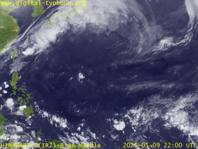
RECENT MTSAT-1R SATELLITE IMAGE:


> Image source:  Digital-Typhoon.Org (http://www.digital-typhoon.org/)
__________________________________________________________________________________________

NOTES:
 
  ^ - JTWC commentary remarks (for Meteorologists) from their 
      latest warning.
 
  * - Based on PAGASA's Philippine Storm Warning Signals, 
      # 4 being the highest. Red letters indicate new areas 
      being hoisted.
For more explanations on these signals, 
      visit:
http://www.typhoon2000.ph/signals.htm

 ** - Based on the Tropical Cyclone's Wave Height near 
      its center.

__________________________________________________________________________________________

>>
To know the meteorological terminologies and acronyms 
   used on this update visit the ff:

    http://typhoon2000.ph/tcterm.htm  
    http://www.nhc.noaa.gov/aboutgloss.shtml
    http://www.srh.noaa.gov/oun/severewx/glossary.php
    http://www.srh.weather.gov/fwd/glossarynation.html
    http://www.nhc.noaa.gov/acronyms.shtml
__________________________________________________________________________________________

:: Typhoon2000.com (T2K) Mobile >> Powered by: Synermaxx
Receive the latest storm updates directly to your mobile phones! To know more:
Send T2K HELP to: 2800
(GLOBE & TM) | 216 (SMART & TNT) | 2288 (SUN) 
Note: Globe & Smart charges P2.50 per message, while Sun at P2.00.
__________________________________________________________________________________________

For the complete details on TY NAKRI (ENTENG/06W)...go visit
our website @:

>
http://www.typhoon2000.com
http://www.maybagyo.com

:: Kindly view our site's disclaimer at: 
   
http://www.typhoon2000.ph/disclaimer.htm


Copyright © 2008 Typhoon2000.com All Rights Reserved

__._,_.___
Recent Activity
Visit Your Group
Popular Y! Groups

Is your group one?

Check it out and

see.

Yahoo! Groups

Everyday Wellness Zone

Check out featured

healthy living groups.

Learn to live

a full life with these

healthy living

groups on Yahoo!

.

__,_._,___

Friday, May 30, 2008

Typhoon NAKRI (ENTENG) - Update #006


Typhoon2000 STORM UPDATE #006
Name: TYPHOON NAKRI [ENTENG/06W/0805] 
Issued: 6:00 PM MANILA TIME (10:00 GMT) FRI 30 MAY 2008
Source: JTWC TROPICAL CYCLONE WARNING NUMBER 014
Note: Kindly refer to your country's official warnings or bulletins. This update is for additional information purposes only.
_____________________________________________________________________________
 
 
TYPHOON NAKRI (06W) HAS REACHED ITS PEAK INTENSITY AND IS NOW WEA-
KENING...ACCELERATING NORTHWEST ACROSS THE NORTHEASTERN PHILIPPINE
SEA...REMAINS NO THREAT TO THE PHILIPPINES.

+ FORECAST OUTLOOK: NAKRI is expected to begin turning towards the NNW to
Northward within the next 24 to 36 hours, & shall continue losing strength.
The 2 to 5-day long range forecast shows NAKRI recurving NNEward on Sunday
morning, June 01 - exiting PAR Sunday evening. It shall start transitioning
into an Extratropical Cyclone as it passes in between Southern Japan and
Chichi Jima Island on Monday evening, June 2. 

+ EFFECTS: NAKRI's intense eyewall with its radial, spiral cloud band
circulation remains over the Northeastern Philippine Sea and is not
affecting any small or large landmass at this time.

+ CURRENT ITCZ/MONSOON TROUGH: Weak ITCZ (aka. Monsoon Trough) affecting
NCR,
Luzon, Rest of Visayas and Mindanao - may continue to bring scattered
rains and chances of isolated thunderstorms - most especially in the
afternoon or evening.
 
Important Note: Please keep in mind that the above forecast outlook,
effects & current monsoon intensity, and tropical cyclone watch changes 
every 06 to 12 hours!

_____________________________________________________________________________

TIME/DATE: 5:00 PM MANILA TIME (09:00 GMT) 30 MAY
LOCATION OF EYE: LATITUDE 17.3º N...LONGITUDE 133.8º E {Sat Fix}
DISTANCE 1: 1,085 KM (585
NM) ENE OF BICOL REGION, PH 
DISTANCE 2: 1,185 KM (640 NM) SSE OF OKINAWA, JAPAN 
DISTANCE 3: 1,250 KM (675 NM) ENE OF CASIGURAN, AURORA, PH
DISTANCE 4: 1,285 KM (693 NM) ESE OF APARRI, CAGAYAN, PH  
DISTANCE 5: 1,290 KM (695 NM) ESE OF BASCO, BATANES, PH   
MAX WINDS [1-MIN AVG]: 205 KM/HR (110 KTS) NEAR THE CENTER
PEAK WIND GUSTS: 250 KM/HR (135 KTS)
SAFFIR-SIMPSON SCALE: CATEGORY FOUR (4) 
MINIMUM CENTRAL PRESSURE (est.): 935 MILLIBARS (hPa)
RECENT MOVEMENT: NW @ 15 KM/HR (08 KTS)
GENERAL DIRECTION: NORTHERN PHILIPPINE SEA
STORM'S SIZE (IN DIAMETER): 555 KM (300 NM)/AVERAGE
MAX WAVE HEIGHT**: 32 FEET (9.7 METERS)
VIEW TRACKING MAP: 2 PM MANILA TIME FRI MAY 30
TSR WIND PROBABILITIESCURRENT TO 120 HRS LEAD  
PHILIPPINE STORM SIGNALS*: N/A

12, 24, 48 & 72 HR. FORECAST:
2 AM (18 GMT) 31 MAY: 18.1N 133.6E / 230-280 KPH / N @ 13 KPH
2 PM (06 GMT) 31 MAY: 19.5N 133.4E / 215-260 KPH / N @ 15 KPH
2 PM (06 GMT) 01 JUNE: 22.9N 134.2E / 165-205 KPH / NNE @ 24 KPH
2 PM (06 GMT) 02 JUNE: 27.2N 137.3E / 100-130 KPH / NE @ 39 KPH

REMARKS: 2 PM (06 GMT) 30 MAY POSITION: 17.0N 134.1E.
^TYPHOON (TY) 06W (NAKRI) HAS REMAINED NEARLY QUASISTATIONARY
OVER THE PAST 12 HOURS AND MAINTAINED AN INTENSITY OF 125 KNOTS.
THE EXTENSION OF THE SUBTROPICAL RIDGING TO THE NORTH OF THE
SYSTEM HAS PROMOTED A CONTINUED WEST TO WEST-NORTHWESTWARD TRACK.
INDICATIONS OF THE WEAKENING OF THIS RIDGE ARE INHERENT IN A MORE
RECENT GAIN IN LATITUDE. EQUATORWARD OUTFLOW ALOFT HAS REMAINED
THE PRIMARY EXHAUST MECHANISM IN CONJUNCTION WITH THE RADIAL
OUTFLOW FROM THE SYSTEM'S MESOSCALE ANTICYCLONE
...(more)

>> NAKRI {pronounced: na~kree}, meaning: A kind of flower
   
Name contributed by: Cambodia.

_____________________________________________________________________________
_____________________________________________________________________________

RECENT WUNDERGROUND.COM TRACKING CHART:


_______________________________________________________________________________________

 
RECENT MTSAT-1R SATELLITE IMAGE:


> Image source:  Digital-Typhoon.Org (http://www.digital-typhoon.org/)
__________________________________________________________________________________________

NOTES:
 
  ^ - JTWC commentary remarks (for Meteorologists) from their 
      latest warning.
 
  * - Based on PAGASA's Philippine Storm Warning Signals, 
      # 4 being the highest. Red letters indicate new areas 
      being hoisted.
For more explanations on these signals, 
      visit:
http://www.typhoon2000.ph/signals.htm

 ** - Based on the Tropical Cyclone's Wave Height near 
      its center.

__________________________________________________________________________________________

>>
To know the meteorological terminologies and acronyms 
   used on this update visit the ff:

    http://typhoon2000.ph/tcterm.htm  
    http://www.nhc.noaa.gov/aboutgloss.shtml
    http://www.srh.noaa.gov/oun/severewx/glossary.php
    http://www.srh.weather.gov/fwd/glossarynation.html
    http://www.nhc.noaa.gov/acronyms.shtml
__________________________________________________________________________________________

:: Typhoon2000.com (T2K) Mobile >> Powered by: Synermaxx
Receive the latest storm updates directly to your mobile phones! To know more:
Send T2K HELP to: 2800
(GLOBE & TM) | 216 (SMART & TNT) | 2288 (SUN) 
Note: Globe & Smart charges P2.50 per message, while Sun at P2.00.
__________________________________________________________________________________________

For the complete details on TY NAKRI (06W)...go visit
our website @:

>
http://www.typhoon2000.com
http://www.maybagyo.com

:: Kindly view our site's disclaimer at: 
   
http://www.typhoon2000.ph/disclaimer.htm


Copyright © 2008 Typhoon2000.com All Rights Reserved

__._,_.___
Recent Activity
Visit Your Group
Best of Y! Groups

Check it out

and nominate your

group to be featured.

Check out the

Y! Groups blog

Stay up to speed

on all things Groups!

Discover Tips

on healthy living

and healthy eating

on Yahoo! Groups.

.

__,_._,___

Powerful Typhoon NAKRI (ENTENG) - Update #005


Typhoon2000 STORM UPDATE #005
Name: TYPHOON NAKRI [ENTENG/06W/0805] 
Issued: 7:00 AM MANILA TIME (23:00 GMT) FRI 30 MAY 2008
Source: JTWC TROPICAL CYCLONE WARNING NUMBER 012
Note: Kindly refer to your country's official warnings or bulletins. This update is for additional information purposes only.
_____________________________________________________________________________
 
 
TYPHOON NAKRI (06W) ENTERS THE PHILIPPINE AREA OF RESPONSIBILITY (PAR) AND
IS NOW LOCALLY NAMED BY THE PHILIPPINE WEATHER BUREAU (PAGASA) AS ENTENG...
DRIFTING WESTWARD DURING THE PAST 3 HOURS...NOW WITH 230 KM/HR WINDS. THIS
SYSTEM IS STILL NOT A THREAT TO THE PHILIPPINES.

+ FORECAST OUTLOOK: NAKRI is expected to change its course towards the
North within the next 24 to 48 hours, & shall start to weaken. The 3 to
5-day long range forecast shows NAKRI turning NNEward on Sunday, June 01.
It shall start transitioning into an Extratropical Cyclone as it passes
in between Southern Japan and Chichi Jima Island on Tuesday morning, June 2. 

+ EFFECTS: NAKRI's compact and intense eyewall with its radial, spiral
cloud bands remains over the Northeastern Philippine Sea and is not
affecting any small or large landmass at this time.

+ CURRENT ITCZ/MONSOON TROUGHITCZ (aka. Monsoon Trough) affecting NCR,
Luzon, Rest of Visayas and Mindanao - will continue to bring scattered
rains and thunderstorms - most especially in the afternoon or evening.
 
Important Note: Please keep in mind that the above forecast outlook,
effects & current monsoon intensity, and tropical cyclone watch changes 
every 06 to 12 hours!

_____________________________________________________________________________

TIME/DATE: 5:00 AM MANILA TIME (21:00 GMT) 30 MAY
LOCATION OF EYE: LATITUDE 16.4º N...LONGITUDE 134.8º E {Sat Fix}
DISTANCE 1: 1,155 KM (620
NM) SW OF IWO TO 
DISTANCE 2: 1,160 KM (627 NM) ENE OF BICOL REGION, PH 
DISTANCE 3: 1,325 KM (715 NM) SE OF OKINAWA, JAPAN
DISTANCE 4: 1,355 KM (732 NM) EAST OF CASIGURAN, AURORA, PH  
DISTANCE 5: 1,405 KM (760 NM) ESE OF APARRI, CAGAYAN, PH   
MAX WINDS [1-MIN AVG]: 230 KM/HR (125 KTS) NEAR THE CENTER
PEAK WIND GUSTS: 280 KM/HR (150 KTS)
SAFFIR-SIMPSON SCALE: CATEGORY FOUR (4) 
MINIMUM CENTRAL PRESSURE (est.): 929 MILLIBARS (hPa)
RECENT MOVEMENT: WEST @ 07 KM/HR (04 KTS)
GENERAL DIRECTION: NORTHERN PHILIPPINE SEA
STORM'S SIZE (IN DIAMETER): 500 KM (270 NM)/AVERAGE
MAX WAVE HEIGHT**: 32 FEET (9.7 METERS)
VIEW TRACKING MAP: 2 AM MANILA TIME FRI MAY 30
TSR WIND PROBABILITIESCURRENT TO 120 HRS LEAD  
PHILIPPINE STORM SIGNALS*: N/A

12, 24, 48 & 72 HR. FORECAST:
2 PM (06 GMT) 30 MAY: 17.3N 134.1E / 220-270 KPH / NNW @ 11 KPH
2 AM (18 GMT) 31 MAY: 18.4N 133.5E / 205-250 KPH / N @ 15 KPH
2 AM (18 GMT) 01 JUNE: 22.2N 133.7E / 165-205 KPH / NNE @ 20 KPH
2 AM (18 GMT) 02 JUNE: 26.2N 136.0E / 140-165 KPH / NE @ 28 KPH

REMARKS: 2 AM (18 GMT) 30 MAY POSITION: 16.4N 135.1E.
^TYPHOON (TY) 06W (NAKRI) HAS RAPIDLY INTENSIFIED OVER
THE PAST 12 HOURS MOVING WESTWARD AT APPROXIMATELY 03 KNOTS.
THE SMALL IRREGULAR EYE HAS PERSISTED, THOUGH RECENTLY IT
APPEARS TO BE FILLING. INTENSITY INCREASED SIGNIFICANTLY DUE
TO ENHANCED EQUATORWARD OUTFLOW WHICH REMAINS THE PRIMARY
EXHAUST MECHANISM FOR THE SYSTEM
...(more)

>> NAKRI {pronounced: na~kree}, meaning: A kind of flower
   
Name contributed by: Cambodia.

_____________________________________________________________________________
_____________________________________________________________________________

RECENT WUNDERGROUND.COM TRACKING CHART:


_______________________________________________________________________________________

 
RECENT MTSAT-1R SATELLITE IMAGE:


> Image source:  Digital-Typhoon.Org (http://www.digital-typhoon.org/)
__________________________________________________________________________________________

NOTES:
 
  ^ - JTWC commentary remarks (for Meteorologists) from their 
      latest warning.
 
  * - Based on PAGASA's Philippine Storm Warning Signals, 
      # 4 being the highest. Red letters indicate new areas 
      being hoisted.
For more explanations on these signals, 
      visit:
http://www.typhoon2000.ph/signals.htm

 ** - Based on the Tropical Cyclone's Wave Height near 
      its center.

__________________________________________________________________________________________

>>
To know the meteorological terminologies and acronyms 
   used on this update visit the ff:

    http://typhoon2000.ph/tcterm.htm  
    http://www.nhc.noaa.gov/aboutgloss.shtml
    http://www.srh.noaa.gov/oun/severewx/glossary.php
    http://www.srh.weather.gov/fwd/glossarynation.html
    http://www.nhc.noaa.gov/acronyms.shtml
__________________________________________________________________________________________

:: Typhoon2000.com (T2K) Mobile >> Powered by: Synermaxx
Receive the latest storm updates directly to your mobile phones! To know more:
Send T2K HELP to: 2800
(GLOBE & TM) | 216 (SMART & TNT) | 2288 (SUN) 
Note: Globe & Smart charges P2.50 per message, while Sun at P2.00.
__________________________________________________________________________________________

For the complete details on TY NAKRI (06W)...go visit
our website @:

>
http://www.typhoon2000.com
http://www.maybagyo.com

:: Kindly view our site's disclaimer at: 
   
http://www.typhoon2000.ph/disclaimer.htm


Copyright © 2008 Typhoon2000.com All Rights Reserved

__._,_.___
Recent Activity
Visit Your Group
Get in Shape

on Yahoo! Groups

Find a buddy

and lose weight.

Cat Groups

on Yahoo! Groups

discuss everything

related to cats.

Home Improvement

on Yahoo! Groups

Find tips & tricks

for doing it yourself.

.

__,_._,___

Thursday, May 29, 2008

Powerful Typhoon NAKRI (06W) - Update #004


Typhoon2000 STORM UPDATE #004
Name: TYPHOON NAKRI [06W/0805] 
Issued: 7:00 PM MANILA TIME (11:00 GMT) THU 29 MAY 2008
Source: JTWC TROPICAL CYCLONE WARNING NUMBER 010
Note: Kindly refer to your country's official warnings or bulletins. This update is for additional information purposes only.
_____________________________________________________________________________
 
 
TYPHOON NAKRI (06W) RAPIDLY INTENSIFIES TO NEAR SUPER TYPHOON STRENGTH...
SHALL ENTER THE PHILIPPINE AREA OF RESPONSIBILITY (PAR) TOMORROW MORNING.

*The Dvorak Satellite Technique Analysis on NAKRI corresponds to a T-Number of 6.0
which results to a 1-min. wind speed average of 220 km/hr (120 knots) - making it a
Category 4 system.


+ FORECAST OUTLOOK: NAKRI is expected to change its course towards the NW
within the next 12 hours, & shall then enter PAR shortly tomorrow morning.
The 2 to 5-day long range forecast shows NAKRI turning Northward before
recurving NNE to NE on Saturday, May 31..transitioning into an Extratro-
ical Cyclone as it passes close to the north of Chichi Jima Island by
early Tuesday morning, June 2. 

+ EFFECTS: NAKRI's compact and intense eyewall with its radial, spiral
cloud bands remains at sea and is not affecting any small or large
landmass at this time.

+ CURRENT ITCZ/MONSOON TROUGHITCZ (aka. Monsoon Trough) affecting NCR,
Luzon, Rest of Visayas and Mindanao - will continue to bring scattered
rains and thunderstorms - most especially in the afternoon or evening.
 
Important Note: Please keep in mind that the above forecast outlook,
effects & current monsoon intensity, and tropical cyclone watch changes 
every 06 to 12 hours!

_____________________________________________________________________________

TIME/DATE: 5:00 PM MANILA TIME (09:00 GMT) 29 MAY
LOCATION OF EYE: LATITUDE 16.2º N...LONGITUDE 135.7º E {Sat Fix}
DISTANCE 1: 75 KM (40
NM) EAST OF PAR 
DISTANCE 2: 1,120 KM (605 NM) SSW OF IWO TO 
DISTANCE 3: 1,250 KM (675 NM) ENE OF BICOL REGION, PH
DISTANCE 4: 1,395 KM (755 NM) SE OF OKINAWA, JAPAN  
DISTANCE 5: 1,450 KM (783 NM) EAST OF CASIGURAN, AURORA, PH  
MAX WINDS [1-MIN AVG]: 220 KM/HR (120 KTS) NEAR THE CENTER
PEAK WIND GUSTS: 270 KM/HR (145 KTS)
SAFFIR-SIMPSON SCALE: CATEGORY FOUR (4) 
MINIMUM CENTRAL PRESSURE (est.): 933 MILLIBARS (hPa)
RECENT MOVEMENT: WNW @ 05 KM/HR (03 KTS)
GENERAL DIRECTION: NORTHERN PHILIPPINE SEA
STORM'S SIZE (IN DIAMETER): 500 KM (270 NM)/AVERAGE
MAX WAVE HEIGHT**: 29 FEET (8.8 METERS)
VIEW TRACKING MAP: 2 PM MANILA TIME THU MAY 29
TSR WIND PROBABILITIESCURRENT TO 120 HRS LEAD  
PHILIPPINE STORM SIGNALS*: N/A

12, 24, 48 & 72 HR. FORECAST:
2 AM (18 GMT) 30 MAY: 16.9N 135.3E / 230-280 KPH / NNW @ 11 KPH
2 PM (06 GMT) 30 MAY: 17.9N 134.8E / 230-280 KPH / N @ 11 KPH
2 PM (06 GMT) 31 MAY: 20.7N 135.0E / 205-250 KPH / NNE @ 20 KPH
2 PM (06 GMT) 01 JUNE: 24.4N 137.3E / 160-195 KPH / NE @ 37 KPH

REMARKS: 2 PM (06 GMT) 29 MAY POSITION: 16.2N 135.8E.
^TYPHOON (TY) 06W (NAKRI) HAS RAPIDLY INTENSIFIED OVER THE PAST
12 HOURS AND HAS BECOME QUASISTATIONARY. A SMALL AND IRREGULAR
EYE HAD DEVELOPED AS WELL, COINCIDING WITH A MODERATE INCREASE
IN INTENSITY. POLEWARD OUTFLOW HAS BEEN HAMPERED BY A MID TO
UPPER-LEVEL EXTENSION OF THE SUBTROPICAL RIDGE BUILDING TO THE
NORTH OF THE SYSTEM. THUS, EQUATORWARD OUTFLOW HAS REMAINED
THE PRIMARY EXHAUST CHANNEL
...(more)

>> NAKRI {pronounced: na~kree}, meaning: A kind of flower
   
Name contributed by: Cambodia.

_____________________________________________________________________________
_____________________________________________________________________________

RECENT WUNDERGROUND.COM TRACKING CHART:


_______________________________________________________________________________________

 
RECENT MTSAT-1R SATELLITE IMAGE:


> Image source:  Digital-Typhoon.Org (http://www.digital-typhoon.org/)
__________________________________________________________________________________________

NOTES:
 
  ^ - JTWC commentary remarks (for Meteorologists) from their 
      latest warning.
 
  * - Based on PAGASA's Philippine Storm Warning Signals, 
      # 4 being the highest. Red letters indicate new areas 
      being hoisted.
For more explanations on these signals, 
      visit:
http://www.typhoon2000.ph/signals.htm

 ** - Based on the Tropical Cyclone's Wave Height near 
      its center.

__________________________________________________________________________________________

>>
To know the meteorological terminologies and acronyms 
   used on this update visit the ff:

    http://typhoon2000.ph/tcterm.htm  
    http://www.nhc.noaa.gov/aboutgloss.shtml
    http://www.srh.noaa.gov/oun/severewx/glossary.php
    http://www.srh.weather.gov/fwd/glossarynation.html
    http://www.nhc.noaa.gov/acronyms.shtml
__________________________________________________________________________________________

:: Typhoon2000.com (T2K) Mobile >> Powered by: Synermaxx
Receive the latest storm updates directly to your mobile phones! To know more:
Send T2K HELP to: 2800
(GLOBE & TM) | 216 (SMART & TNT) | 2288 (SUN) 
Note: Globe & Smart charges P2.50 per message, while Sun at P2.00.
__________________________________________________________________________________________

For the complete details on TY NAKRI (06W)...go visit
our website @:

>
http://www.typhoon2000.com
http://www.maybagyo.com

:: Kindly view our site's disclaimer at: 
   
http://www.typhoon2000.ph/disclaimer.htm


Copyright © 2008 Typhoon2000.com All Rights Reserved

__._,_.___
Recent Activity
Visit Your Group
Do-It-Yourselfers

on Yahoo! Groups

How-to ideas,

projects and more.

Dog Fanatics

on Yahoo! Groups

Find people who are

crazy about dogs.

Weight Loss Group

on Yahoo! Groups

Get support and

make friends online.

.

__,_._,___