Typhoon2000 STORM UPDATE #003
Name: TYPHOON RAMMASUN [BUTCHOY/03W/0802]
Issued: 7:00 AM MANILA TIME (23:00 GMT) SAT 10 MAY 2008
Source: JTWC TROPICAL CYCLONE WARNING NUMBER 011
Note: Kindly refer to your country's official warnings or bulletins. This update is for additional information purposes only.
Source: JTWC TROPICAL CYCLONE WARNING NUMBER 011
Note: Kindly refer to your country's official warnings or bulletins. This update is for additional information purposes only.
_____________________________________________________________________________
TYPHOON RAMMASUN (BUTCHOY) RAPIDLY INTENSIFIED..JUMPING FROM CATEGORY
TWO TO THREE IN JUST SIX HOURS...MAINTAINED ITS NORTHWWARD TREK ACROSS
THE CENTRAL PHILIPPINE SEA...THREAT TO THE PHILIPPINE ISLANDS TOTALLY
DIMINISHED.
+ FORECAST OUTLOOK: RAMMASUN is expected to continue intensifying,
+ FORECAST OUTLOOK: RAMMASUN is expected to continue intensifying,
reaching Category 4 strength of 215 km/hr tonight or early tomorrow
morning. It shall be maintaing its Northerly track for the next 24 to
36 hours. The 2 to 3-day medium-range forecast shows the typhoon recur-
ving NE'ly, passing north of Chichi Jima Island on Monday evening as an
ppine Sea, not affecting any coastal areas - except for the tiny islands
of Yap and Ulithi, which are under the southern outer (rain) bands of
the typhoon. Far-fetched storm surge is possible along coastal areas of
Eastern Philippines with surf reaching 2-3 feet at most.
+ TROPICAL CYCLONE WATCH: An area of cloud cluster has been seen on
+ TROPICAL CYCLONE WATCH: An area of cloud cluster has been seen on
latest satellite imageries over the Southen part of the South China Sea
or about 255 km. WNW of Puerto Princesa, Palawan (10.5N 116.5E). This
suspect area may likely become a Tropical Disturbance (LPA) within the
next 24-48 hours. It has been forecast on almost all of the Numerical
Global Models that this new system is likely to become a Tropical Cy-
clone next week. Long-range forecast shows it strengthening into a
Tropical Storm in the next 3 to 4 days and affecting Western Luzon
by next weekend (May 16-18). Stay tuned for more updates soon.
+ CURRENT MONSOON INTENSITY: Light to Moderate Southwest (SW) Monsoon
+ CURRENT MONSOON INTENSITY: Light to Moderate Southwest (SW) Monsoon
which is locally induced by RAMMASUN, continues to affect Western &
Southern Mindanao particularly Zamboanga. This monsoon system may
start to affect Western Visayas & Palawan today. The monsoon-affected
areas will have cloudy skies with moderate to heavy rains, thunderstorms
& SW'ly winds not exceeding 40 km/hr today and tomorrow. Landslides,
mudflows (lahars) and flooding is likely to occur along steep mountain/
volcano slopes, river banks, low-lying & flood-prone areas of the
affected areas. Meanwhile, big sea waves or surges generated by
this monsoon can affect the coastal and beach-front areas of the
abovementioned areas.
Important Note: Please keep in mind that the above forecast outlook,
effects & current monsoon intensity, and tropical cyclone watch changes
every 06 to 12 hours!
_____________________________________________________________________________
TIME/DATE: 5:00 AM MANILA TIME (21:00 GMT) 10 MAY
LOCATION OF EYE: LATITUDE 14.2º N...LONGITUDE 132.1º E
DISTANCE 1: 915 KM (495 NM) ENE OF VIRAC, CATANDUANES, PH
effects & current monsoon intensity, and tropical cyclone watch changes
every 06 to 12 hours!
____________
LOCATION OF EYE: LATITUDE 14.2º N...LONGITUDE 132.1º E
DISTANCE 1: 915 KM (495 NM) ENE OF VIRAC, CATANDUANES, PH
DISTANCE 2: 835 KM (450 NM) ENE OF LEGAZPI CITY, PH
DISTANCE 3: 805 KM (435 NM) ENE OF NAGA CITY, PH
DISTANCE 4: 675 KM (365 NM) EAST OF METRO MANILA, PH
DISTANCE 5: 875 KM (472 NM) ESE OF CASIGURAN, AURORA, PH
MAX WINDS [1-MIN AVG]: 185 KM/HR (100 KTS) NEAR THE CENTER
PEAK WIND GUSTS: 230 KM/HR (125 KTS)
SAFFIR-SIMPSON SCALE: CATEGORY THREE (3)
MINIMUM CENTRAL PRESSURE (est.): 948 MILLIBARS (hPa)
RECENT MOVEMENT: NORTH @ 15 KM/HR (08 KTS)
GENERAL DIRECTION: NORTHERN PHILIPPINE SEA
STORM'S SIZE (IN DIAMETER): 720 KM (390 NM)/LARGE
MAX WAVE HEIGHT**: 23 FEET (7.0 METERS)
VIEW TRACKING MAP: 2 AM MANILA TIME SAT MAY 10
TSR WIND PROBABILITIES: CURRENT TO 72 HRS LEAD
PHILIPPINE STORM SIGNALS*: N/A
12, 24 & 48 HR. FORECAST:
2 PM (06 GMT) 10 MAY: 15.8N 132.1E / 195-240 KPH / N @ 22 KPH
2 AM (18 GMT) 11 MAY: 18.2N 132.4E / 215-260 KPH / NNE @ 24 KPH
2 AM (18 GMT) 12 MAY: 23.6N 135.7E / 160-195 KPH / NE @ 45 KPH
_____________________________________________________________________________
PAGASA CURRENT POSITION, MOVEMENT AND INTENSITY (10-min. ave.):
____________
PAGASA CURRENT POSITION, MOVEMENT AND INTENSITY (10-min. ave.):
> 2 AM (18 GMT) 10 MAY: 13.7N 132.0E / NORTH @ 19 KPH / 150 kph
:: For the complete PAGASA bulletin, kindly visit their website at:
http://www.pagasa.dost.gov.ph/wb/tcupdate.shtml
:: For the complete PAGASA bulletin, kindly visit their website at:
http://www.pagasa.
_____________________________________________________________________________
RECENT WUNDERGROUND.COM TRACKING CHART :
RECENT WUNDERGROUND.
________________________
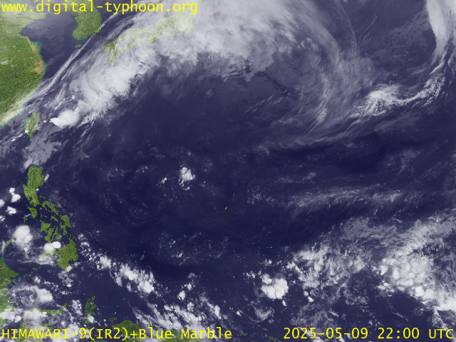
RECENT MTSAT-1R SATELLITE IMAGE:

> Image source: Digital-Typhoon.Org (http://www.digital-typhoon.org/ )
__________________________________________________________________________________________
NOTES:

> Image source: Digital-Typhoon.
^ - JTWC commentary remarks (for Meteorologists) from their
latest warning.
latest warning.
* - Based on PAGASA's Philippine Storm Warning Signals,
# 4 being the highest. Red letters indicate new areas
being hoisted. For more explanations on these signals,
visit: http://www.typhoon2000.ph/signals.htm
** - Based on the Tropical Cyclone's Wave Height near
its center.
__________________________________________________________________________________________
>> To know the meteorological terminologies and acronyms
used on this update visit the ff:
http://typhoon2000.ph/tcterm.htm
http://www.nhc.noaa.gov/aboutgloss.shtml
http://www.srh.noaa.gov/oun/severewx/glossary.php
http://www.srh.weather.gov/fwd/glossarynation.html
http://www.nhc.noaa.gov/acronyms.shtml
__________________________________________________________________________________________
:: Typhoon2000.com (T2K) Mobile >> Powered by: Synermaxx
Receive the latest storm updates directly to your mobile phones! To know more:
Send T2K HELP to: 2800 (GLOBE & TM) | 216 (SMART & TNT) | 2288 (SUN)
Note: Globe & Smart charges P2.50 per message, while Sun at P2.00.
__________________________________________________________________________________________
For the complete details on TY RAMMASUN (BUTCHOY)...go visit
our website @:
> http://www.typhoon2000.com
> http://www.maybagyo.com
# 4 being the highest. Red letters indicate new areas
being hoisted. For more explanations on these signals,
visit: http://www.typhoon2
** - Based on the Tropical Cyclone's Wave Height near
its center.
____________
>> To know the meteorological terminologies and acronyms
used on this update visit the ff:
http://typhoon2000.
http://www.nhc.
http://www.srh.
http://www.srh.
http://www.nhc.
____________
:: Typhoon2000.
Receive the latest storm updates directly to your mobile phones! To know more:
Send T2K HELP to: 2800 (GLOBE & TM) | 216 (SMART & TNT) | 2288 (SUN)
Note: Globe & Smart charges P2.50 per message, while Sun at P2.00.
For the complete details on TY RAMMASUN (BUTCHOY)...
our website @:
> http://www.typhoon2
> http://www.maybagyo
Copyright © 2008 Typhoon2000.
Change settings via the Web (Yahoo! ID required)
Change settings via email: Switch delivery to Daily Digest | Switch format to Traditional
Visit Your Group | Yahoo! Groups Terms of Use | Unsubscribe
.
__,_._,___
No comments:
Post a Comment