Sunday, December 30, 2007

T2K Philippine Tropical Outlook [for week Dec 31, 2007-Jan 06, 2008]


Typhoon2000 Philippine Tropical Outlook
For Week: DEC 31, 2007-JAN 06, 2008 [MONDAY TO SUNDAY] 
Issued: 7:00 AM MANILA TIME (23:00 GMT) SAT 30 DECEMBER 2007
Next Update: 7:00 AM (23:00 GMT) SAT 05 JANUARY 2008

_____________________________________________________________________________
 
 
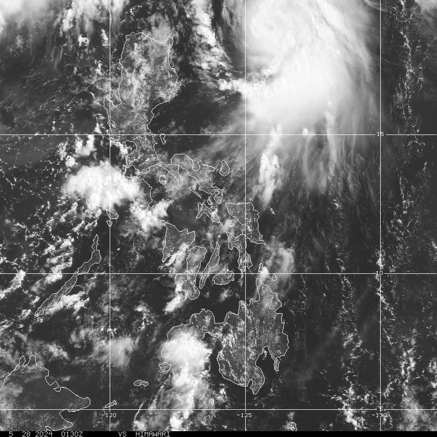
[1] Continued chance of above-average rainfall for South China Sea,
Southern Philippines, Southern Philippine Sea.
The continued presence
of MJO's wet-phase & La Nina associated rainfall is expected to result in
wet weather during this period. Confidence: HIGH.

[2] The passage of Mid-Latitude Frontal System over Southern Japan
& strong High Pressure Area over China may bring strong & cool north-
easterly winds accompanied with some rainshowers along Northern
& Central Philippines (from Batanes down to Bicol & Northern Visayas).

This wind system is commonly known as the Northeast (NE) Monsoon which
started in November and ends in March.
Confidence: HIGH.

Important Note:
 
Please keep in mind that the above weekly tropical forecast outlook, does not guarantee
100% accuracy! Errors & changes can happen 
within the designated outlook week.
_____________________________________________________________________________

> This outlook is issued for planners every Saturday. The next Outlook will 
  be issued on January 05, 2008.

Sources: NOAA Global Benefits/Hazards Assessment & Various Numerical Computer Models
_____________________________________________________________________________
>>
To know the meteorological terminologies and acronyms 
   used on this update visit the ff:

    http://typhoon2000.ph/tcterm.htm  
    http://www.nhc.noaa.gov/aboutgloss.shtml
    http://www.srh.noaa.gov/oun/severewx/glossary.php
    http://www.srh.weather.gov/fwd/glossarynation.html
    http://www.nhc.noaa.gov/acronyms.shtml
_____________________________________________________________________________

:: Typhoon2000.com (T2K) Mobile >>
 
Powered by: Synermaxx
Receive the latest storm updates directly to your mobile phones! To know more:
Send T2K HELP to: 2800
(GLOBE & TM) | 216 (SMART & TNT) | 2288 (SUN) 
Note: Globe & Smart charges P2.50 per message, while Sun at P2.00.


_____________________________________________________________________________

Always visit these web addresses for the latest info on Philippine Tropical
Cyclones:

>
http://www.typhoon2000.com
http://www.maybagyo.com

:: Kindly view our site's disclaimer at: 
   
http://www.typhoon2000.ph/disclaimer.htm


Copyright © 2007  Typhoon2000.com All Rights Reserved

__._,_.___
Recent Activity
Visit Your Group
Parenting Zone

Your home for

parenting information

on Yahoo! Groups.

Best of Y! Groups

Check it out

and nominate your

group to be featured.

Fitness Zone

on Yahoo! Groups

Find Groups all

about healthy living.

.

__,_._,___

Saturday, December 22, 2007

T2K Philippine Tropical Outlook [for week Dec 24-30, 2007]


Typhoon2000 Philippine Tropical Outlook
For Week: DECEMBER 24-30, 2007 [MONDAY TO SUNDAY] 
Issued: 7:00 AM MANILA TIME (23:00 GMT) SAT 22 DECEMBER 2007
Next Update: 7:00 AM (23:00 GMT) SAT 29 DECEMBER

_____________________________________________________________________________
 
 
[1] An increased chance of above-average rainfall for South China Sea,
Visayas, Palawan, Mindanao & Southern Philippine Sea.
The continued
presence of MJO's wet-phase & La Nina associated rainfall is expected to
result in wet weather during this period. Confidence: HIGH.
 
[2] The passage of Mid-Latitude Frontal System over Southern Japan
& strong High Pressure Area over China may bring strong & cool north-
easterly winds accompanied with some rainshowers along Northeastern
& Eastern Luzon (from Batanes down to Bicol Region).
This wind system
is commonly known as the Northeast (NE) Monsoon which started in November
and ends in March. Confidence: MODERATE.

Important Note:
 
Please keep in mind that the above weekly tropical forecast outlook, does not guarantee
100% accuracy! Errors & changes can happen 
within the designated outlook week.
_____________________________________________________________________________

> This outlook is issued for planners every Saturday. The next Outlook will 
  be issued on December 29.

Sources: NOAA Global Benefits/Hazards Assessment & Various Numerical Computer Models
_____________________________________________________________________________
>>
To know the meteorological terminologies and acronyms 
   used on this update visit the ff:

    http://typhoon2000.ph/tcterm.htm  
    http://www.nhc.noaa.gov/aboutgloss.shtml
    http://www.srh.noaa.gov/oun/severewx/glossary.php
    http://www.srh.weather.gov/fwd/glossarynation.html
    http://www.nhc.noaa.gov/acronyms.shtml
_____________________________________________________________________________

:: Typhoon2000.com (T2K) Mobile >>
 
Powered by: Synermaxx
Receive the latest storm updates directly to your mobile phones! To know more:
Send T2K HELP to: 2800
(GLOBE & TM) | 216 (SMART & TNT) | 2288 (SUN) 
Note: Globe & Smart charges P2.50 per message, while Sun at P2.00.


_____________________________________________________________________________

Always visit these web addresses for the latest info on Philippine Tropical
Cyclones:

>
http://www.typhoon2000.com
http://www.maybagyo.com

:: Kindly view our site's disclaimer at: 
   
http://www.typhoon2000.ph/disclaimer.htm


Copyright © 2007  Typhoon2000.com All Rights Reserved

__._,_.___
Yahoo! Groups

Find Green Groups

Share with others

Help the Planet.

Real Food Group

Share recipes

and favorite meals

w/ Real Food lovers.

Best of Y! Groups

Discover groups

that are the best

of their class.

.

__,_._,___

Saturday, December 15, 2007

T2K Philippine Tropical Outlook [for week Dec 17-23, 2007]


Typhoon2000 Philippine Tropical Outlook
For Week: DECEMBER 17-23, 2007 [MONDAY TO SUNDAY] 
Issued: 7:00 AM MANILA TIME (23:00 GMT) SAT 15 DECEMBER 2007
Next Update: 7:00 AM (23:00 GMT) SAT 22 DECEMBER

_____________________________________________________________________________
 
 
[1] An increased chance of above-average rainfall for South China Sea &
Southern Philippines (Palawan & Mindanao).
 The arrival of enhanced, wet-
phase of MJO & the reorganization of La NiƱa associated rainfall is expected to
result in wet weather during the period.
Confidence: HIGH. 
 
[2] The passage of Mid-Latitude Frontal System over Southern Japan &
strong High Pressure Area over China may bring strong & cool north-
easterly winds accompanied with some rainshowers along Northeastern
& Eastern Luzon (from Batanes down to Bicol Region).
  This wind system
is commonly known as the Northeast (NE) Monsoon which started in November
and ends in March.
Confidence: LOW.

Important Note:
 
Please keep in mind that the above weekly tropical forecast outlook, does not guarantee
100% accuracy! Errors & changes can happen 
within the designated outlook week.
_____________________________________________________________________________

> This outlook is issued for planners every Saturday. The next Outlook will 
  be issued on December 22.

Sources: NOAA Global Benefits/Hazards Assessment & Various Numerical Computer Models
_____________________________________________________________________________
>>
To know the meteorological terminologies and acronyms 
   used on this update visit the ff:

    http://typhoon2000.ph/tcterm.htm  
    http://www.nhc.noaa.gov/aboutgloss.shtml
    http://www.srh.noaa.gov/oun/severewx/glossary.php
    http://www.srh.weather.gov/fwd/glossarynation.html
    http://www.nhc.noaa.gov/acronyms.shtml
_____________________________________________________________________________

:: Typhoon2000.com (T2K) Mobile >>
 
Powered by: Synermaxx
Receive the latest storm updates directly to your mobile phones! To know more:
Send T2K HELP to: 2800
(GLOBE & TM) | 216 (SMART & TNT) | 2288 (SUN) 
Note: Globe & Smart charges P2.50 per message, while Sun at P2.00.


_____________________________________________________________________________

Always visit these web addresses for the latest info on Philippine Tropical
Cyclones:

>
http://www.typhoon2000.com
http://www.maybagyo.com

:: Kindly view our site's disclaimer at: 
   
http://www.typhoon2000.ph/disclaimer.htm


Copyright © 2007  Typhoon2000.com All Rights Reserved

__._,_.___
Wellness Spot

Embrace Change

Break the Yo-Yo

weight loss cycle.

Shedding Pounds

on Yahoo! Groups

Read sucess stories

& share your own.

Featured Y! Groups

and category pages.

There is something

for everyone.

.

__,_._,___

Tuesday, December 11, 2007

T2K Philippine Tropical Outlook [for week Dec 10-16, 2007]


Typhoon2000 Philippine Tropical Outlook
For Week: DECEMBER 10-16, 2007 [MONDAY TO SUNDAY] 
Issued: 7:00 AM MANILA TIME (23:00 GMT) SAT 08 DECEMBER 2007
Next Update: 7:00 AM (23:00 GMT) SAT 15 DECEMBER

_____________________________________________________________________________
 
 
[1] Continued chance of below-average rainfall for the South China Sea
& Western Philippines.
This temporary suppressed convection & dry conditions
in this area, which is interrupting the general widespread wet conditions typical
during La NiƱa may extend up to this week. Confidence: MODERATE.
 
 
[2] The passage of a Mid-Latitude Frontal System over Southern Japan
& China's High Pressure Area may continue to bring strong & cool north-
easterly winds accompanied with some rainshowers along Eastern Luzon
(from Batanes down to Bicol Region).
This wind system is commonly known
as the Northeast (NE) Monsoon which starts in November and ends in March.
Confidence: HIGH.

[3] Strong Easterly Trade Winds from the Western Pacific Ocean and the
Philippine Sea is expected to bring wet weather conditions across Eastern
& Central portions of Visayas & Mindanao.
These conditions are mostly
typical during a moderate La NiƱa event.
Confidence: HIGH.

Important Note: Please keep in mind that the above weekly tropical forecast outlook, does not guarantee
100% accuracy! Errors & changes can happen 
within the designated outlook week.
_____________________________________________________________________________

> This outlook is issued for planners every Saturday. The next Outlook will 
  be issued on December 15.

Sources: NOAA Global Benefits/Hazards Assessment & Various Numerical Computer Models
_____________________________________________________________________________
>>
To know the meteorological terminologies and acronyms 
   used on this update visit the ff:

    http://typhoon2000.ph/tcterm.htm  
    http://www.nhc.noaa.gov/aboutgloss.shtml
    http://www.srh.noaa.gov/oun/severewx/glossary.php
    http://www.srh.weather.gov/fwd/glossarynation.html
    http://www.nhc.noaa.gov/acronyms.shtml
_____________________________________________________________________________

:: Typhoon2000.com (T2K) Mobile >>
 
Powered by: Synermaxx
Receive the latest storm updates directly to your mobile phones! To know more:
Send T2K HELP to: 2800
(GLOBE & TM) | 216 (SMART & TNT) | 2288 (SUN) 
Note: Globe & Smart charges P2.50 per message, while Sun at P2.00.


_____________________________________________________________________________

Always visit these web addresses for the latest info on Philippine Tropical
Cyclones:

>
http://www.typhoon2000.com
http://www.maybagyo.com

:: Kindly view our site's disclaimer at: 
   
http://www.typhoon2000.ph/disclaimer.htm


Copyright © 2007  Typhoon2000.com All Rights Reserved

__._,_.___
Recent Activity
Visit Your Group
Endurance Zone

on Yahoo! Groups

Communities about

higher endurance.

Real Food Group

Share recipes

and favorite meals

w/ Real Food lovers.

Fitness Challenge

on Yahoo! Groups

Get in shape w/the

Special K Challenge.

.

__,_._,___

Saturday, December 01, 2007

T2K Philippine Tropical Outlook [for week Dec 03-09, 2007]


Typhoon2000 Philippine Tropical Outlook
For Week: DECEMBER 03-09, 2007 [MONDAY TO SUNDAY] 
Issued: 7:00 AM MANILA TIME (23:00 GMT) SAT 01 DECEMBER 2007
Next Update: 7:00 AM (23:00 GMT) SAT 08 DECEMBER

_____________________________________________________________________________
 
 
[1] An increased chance of below-average rainfall for the South China Sea,
The Philippines & the Philippine Sea.
This temporary suppressed convection
and dry conditions in this area, which is interrupting the general widespread
wet conditions typical during La NiƱa may extend until next week.
Confidence: MODERATE.
 
 
[2] The presence of strong winter High Pressure Area over China & a passage
of a Middle-Latitude Frontal System over Southern Japan may bring strong &
cool northeasterly winds accompanied with some rainshowers along the
Eastern parts of the Philippines (from Batanes, Bicol down to Surigao area).
This wind system is commonly known as the Northeast (NE) Monsoon which
climatically starts in November and ends until early March. Confidence: HIGH.


Important Note: Please keep in mind that the above weekly tropical forecast outlook, does not guarantee
100% accuracy! Errors & changes can happen 
within the designated outlook week.
_____________________________________________________________________________

> This outlook is issued for planners every Saturday. The next Outlook will 
  be issued on December 08.

Sources: NOAA Global Benefits/Hazards Assessment & Various Numerical Computer Models
_____________________________________________________________________________
>>
To know the meteorological terminologies and acronyms 
   used on this update visit the ff:

    http://typhoon2000.ph/tcterm.htm  
    http://www.nhc.noaa.gov/aboutgloss.shtml
    http://www.srh.noaa.gov/oun/severewx/glossary.php
    http://www.srh.weather.gov/fwd/glossarynation.html
    http://www.nhc.noaa.gov/acronyms.shtml
_____________________________________________________________________________

:: Typhoon2000.com (T2K) Mobile >>
 
Powered by: Synermaxx
Receive the latest storm updates directly to your mobile phones! To know more:
Send T2K HELP to: 2800
(GLOBE & TM) | 216 (SMART & TNT) | 2288 (SUN) 
Note: Globe & Smart charges P2.50 per message, while Sun at P2.00.


_____________________________________________________________________________

Always visit these web addresses for the latest info on Philippine Tropical
Cyclones:

>
http://www.typhoon2000.com
http://www.maybagyo.com

:: Kindly view our site's disclaimer at: 
   
http://www.typhoon2000.ph/disclaimer.htm


Copyright © 2007  Typhoon2000.com All Rights Reserved

__._,_.___
Recent Activity
Visit Your Group
Yahoo! Groups

Parenting Zone

Share experiences

with other parents.

Win free airfare

from Yahoo!

Fly home for the

Holidays on us.

Yahoo! Groups

Special K Challenge

Learn how others are

shedding the pounds.

.

__,_._,___

Thursday, November 29, 2007

TD HAGIBIS (LANDO) - Final Update


Typhoon2000 STORM UPDATE #010
Name: TROPICAL DEPRESSION HAGIBIS [LANDO/23W/0724] 
Issued: 8:00 AM MANILA TIME (00:00 GMT) THU 29 NOVEMBER 2007
Source: JMA TROPICAL CYCLONE ADVISORY: 27/06UTC
Note: Kindly refer to your country's official warnings or bulletins. This update is for additional information purposes only.
_____________________________________________________________________________
 
 
HAGIBIS (LANDO) DOWNGRADED TO A TROPICAL DEPRESSION...DISSPATION
EXPECTED.

**THIS IS THE FINAL UPDATE ON THIS LONG-LIVED SYSTEM.
 
 
Important Note: Please keep in mind that the above forecast outlook,
effects & current monsoon intensity, and tropical cyclone watch changes 
every 06 to 12 hours!

_____________________________________________________________________________

TIME/DATE: 2:00 PM MANILA TIME (06:00 GMT) 28 NOVEMBER
LOCATION OF CENTER: LATITUDE 15.0Āŗ N...LONGITUDE 126.0Āŗ E
DISTANCE 1: 250 KM (135
NM) NE OF VIRAC, CATANDUANES, PH 
DISTANCE 2: 340 KM (185 NM) ENE OF NAGA CITY, PH 
MAX WINDS [10-MIN AVG]: 45 KM/HR (25 KTS) NEAR THE CENTER
PEAK WIND GUSTS: 65 KM/HR (35 KTS)
SAFFIR-SIMPSON SCALE: N/A 
MINIMUM CENTRAL PRESSURE (est.): 1004 MILLIBARS (hPa)
RECENT MOVEMENT: ENE @ 07 KM/HR (04 KTS)
GENERAL DIRECTION: PHILIPPINE SEA
STORM'S SIZE (IN DIAMETER): 610 KM (330 NM)/AVERAGE
MAX WAVE HEIGHT**: 10 FEET (3.0 METERS)
VIEW T2K TRACKING MAP: 11 AM MANILA TIME WED NOVEMBER 28
TSR WIND PROBABILITIESCURRENT TO 24 HRS LEAD  
PHILIPPINE STORM SIGNALS*: None
_____________________________________________________________________________
_____________________________________________________________________________


RECENT T2K TRACKING CHART:


_______________________________________________________________________________________

 
RECENT MTSAT-1R SATELLITE IMAGE:


> Image source:  NOAA 
__________________________________________________________________________________________

NOTES:
 
  ^ - JTWC commentary remarks (for Meteorologists) from their 
      latest warning.
 
  * - Based on PAGASA's Philippine Storm Warning Signals, 
      # 4 being the highest. Red letters indicate new areas 
      being hoisted.
For more explanations on these signals, 
      visit:
http://www.typhoon2000.ph/signals.htm

 ** - Based on the Tropical Cyclone's Wave Height near 
      its center.

__________________________________________________________________________________________

>>
To know the meteorological terminologies and acronyms 
   used on this update visit the ff:

    http://typhoon2000.ph/tcterm.htm  
    http://www.nhc.noaa.gov/aboutgloss.shtml
    http://www.srh.noaa.gov/oun/severewx/glossary.php
    http://www.srh.weather.gov/fwd/glossarynation.html
    http://www.nhc.noaa.gov/acronyms.shtml
__________________________________________________________________________________________

:: Typhoon2000.com (T2K) Mobile >> Powered by: Synermaxx
Receive the latest storm updates directly to your mobile phones! To know more:
Send T2K HELP to: 2800
(GLOBE & TM) | 216 (SMART & TNT) | 2288 (SUN) 
Note: Globe & Smart charges P2.50 per message, while Sun at P2.00.
__________________________________________________________________________________________

For the complete details on TD HAGIBIS (LANDO)...go visit
our website @:

>
http://www.typhoon2000.com
http://www.maybagyo.com

:: Kindly view our site's disclaimer at: 
   
http://www.typhoon2000.ph/disclaimer.htm


__._,_.___
Recent Activity
Visit Your Group
Best of Y! Groups

Discover groups

that are the best

of their class.

Yahoo! Groups

Real Food Group

Share recipes

and favorite meals.

Fitness Zone

on Yahoo! Groups

Find Groups all

about healthy living.

.

__,_._,___