Typhoon2000 STORM UPDATE #01
Name: TROPICAL DEPRESSION 05W [UNNAMED]
Issued: 1:00 PM MANILA TIME (05:00 GMT) SAT 08 JULY 2006
Next Update: 1:00 AM (17:00 GMT) SUN 09 JULY 2006
Source: JTWC TROPICAL CYCLONE WARNING #001
_______________________________________________________________________
Next Update: 1:00 AM (17:00 GMT) SUN 09 JULY 2006
Source: JTWC TROPICAL CYCLONE WARNING #001
_______________________________________________________________________
TROPICAL DEPRESSION 05W (UNNAMED) NEWLY FORMED BETWEEN YAP
AND GUAM...SLOWLY CONSOLIDATING WITH A VERY LARGE CIRCULA-
TION.
AND GUAM...SLOWLY CONSOLIDATING WITH A VERY LARGE CIRCULA-
TION.
+ FORECAST OUTLOOK: 05W is expected to move WNW into the
Philippine Sea for the rest of the forecast period (up to
July 12). Forecast to enter the Philippine Area of Respon-
sibility (PAR) Monday afternoon, July 10 as a strong Tropi-
cal Storm (estimated winds of 85 to 100 kph).
+ EFFECTS: Due to its very large circulation (a characte-
ristics of a Monsoon Depression), 05W's Outer bands is now
covering the entire Mariana and Caroline Islands. The outer
bands is expected to bring passing rains with gale force
winds (most especially along the southern part, which is
associated with the surge of Monsoon winds) reaching 55
km/hr today. Large and dangerous surf can be expected over
the exposed beaches of the abovementioned Pacific Islands.
Kindly take precautionary measures against these hazardous
surf.
+ CURRENT MONSOON INTENSITY: The Southwest Monsoon is being
enhanced by 05W...currently affecting the Micronesian Is-
lands of Yap, Ulithi, Palau and among other small islets.
This monsoon system will bring cloudy skies with moderate
to sometimes strong SW'ly winds (approx. 30 to 60 km/hr),
accompanied with moderate to heavy occasional rains. These
rains may produce life-threatening flash floods and mud-
slides along river banks, low-lying areas and mountain
slopes of the affected areas.
outlook, effects, current monsoon intensity, and tropical
cyclone watch changes every 06 to 12 hours!
_______________________________________________________________________
TIME/DATE: 11:00 AM MANILA TIME (03:00 GMT) 08 JULY
LOCATION OF CENTER: LATITUDE 11.3º N...LONGITUDE 142.1º E {SatFix}
DISTANCE 1: 375 KM (202 NM) SW OF HAGATNA, GUAM, CNMI
DISTANCE 2: 480 KM (260 NM) ENE OF COLONIA, YAP, FSM
TIME/DATE: 11:00 AM MANILA TIME (03:00 GMT) 08 JULY
LOCATION OF CENTER: LATITUDE 11.3º N...LONGITUDE 142.1º E {SatFix}
DISTANCE 1: 375 KM (202 NM) SW OF HAGATNA, GUAM, CNMI
DISTANCE 2: 480 KM (260 NM) ENE OF COLONIA, YAP, FSM
MAX SUSTAINED WINDS [1-MIN AVG]: 45 KM/HR (25 KTS)
PEAK WIND GUSTS: 65 KM/HR (35 KTS)
MINIMUM CENTRAL PRESSURE (est.): 1002 MILLIBARS (hPa)
MAX WAVE HEIGHT**: 14 FEET (4.2 METERS)
SAFFIR-SIMPSON SCALE: N/A
RECENT MOVEMENT: WNW @ 11 KM/HR (06 KTS)
GENERAL DIRECTION: PHILIPPINE SEA
STORM'S SIZE (IN DIAMETER): ... KM (... NM)/UNDETERMINED
VIEW T2K TRACKING MAP: 11 AM SAT JULY 08
TSR WIND PROBABILITIES: CURRENT TO 72 HRS LEAD
PHILIPPINE STORM SIGNALS*: N/A
09-21 HR. FORECAST:
> 8 PM (12 GMT) 08 JULY: 11.6N 141.3E / 55-75 KPH
> 8 AM (00 GMT) 09 JULY: 12.4N 139.9E / 65-85 KPH
REMARKS: 8 AM (00 GMT) 08 JULY POSITION: 11.2N 142.4E.
^BASED ON RECENT RADAR AND MICROWAVE IMAGERY TD 05W HAS
BEEN RELOCATED APPROXIMATELY ONE DEGREE NORTH OF THE PREV-
IOUSLY IDENTIFIED POSITION. ANIMATED MULTISPECTRAL IMAGERY
INDICATES THAT THE LOW-LEVEL CIRCULATION CENTER IS LOCATED
ON THE EASTERN SIDE OF A BROAD AREA OF CYCLONIC TURNING...
(more info)
_________________________________________________________________________________
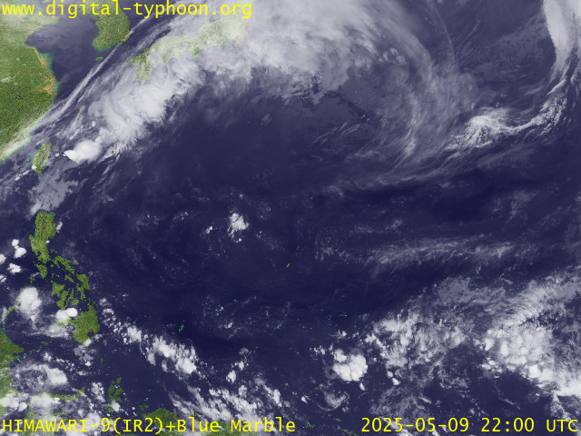
RECENT MTSAT-1R SATELLITE IMAGE:

> Image source: Digital-Typhoon.org (Nat'l. Institute of Informatics, Japan) (http://www.digital-typhoon.org)
__________________________________________________________________________________________
LATEST T2K TRACKING CHART:

_______________________________________________________________________________________
NOTES:

> Image source: Digital-Typhoon.org (Nat'l. Institute of Informatics, Japan) (http://www.digital-typhoon.org)
__________________________________________________________________________________________
LATEST T2K TRACKING CHART:

_______________________________________________________________________________________
NOTES:
^ - JTWC commentary remarks (for Meteorologists) from their
latest warning.
latest warning.
* - Based on PAGASA's Philippine Storm Warning Signals,
# 4 being the highest. Red letters indicate new areas
being hoisted. For more explanations on these signals,
visit: http://www.typhoon2000.ph/signals.htm
** - Based on the Tropical Cyclone's Sea Wave Height near
its center.
__________________________________________________________________________________________
>> To know the meteorological terminologies and acronyms
used on this update visit the ff:
http://typhoon2000.ph/tcterm.htm
http://www.nhc.noaa.gov/aboutgloss.shtml
http://www.srhnoaa.gov/oun/severewx/glossary.php
http://www.srh.weather.gov/fwd/glossarynation.html
http://www.nhc.noaa.gov/acronyms.shtml
__________________________________________________________________________________________
:: Typhoon2000.com (T2K) Mobile >> Powered by: Synermaxx
Receive the latest storm updates directly to your mobile phones! To know more:
Send T2K HELP to: 2800 (GLOBE & TM) | OFFLINE (SMART & TNT) | 2288 (SUN)
__________________________________________________________________________________________
For the complete details on the TD 05W (UNNAMED)...go visit
our website @:
> http://www.typhoon2000.com
> http://www.maybagyo.com
Visit Your Group | Yahoo! Groups Terms of Use | Unsubscribe
New Message Search
Find the message you want faster. Visit your group to try out the improved message search.
SPONSORED LINKS
.
__,_._,___
No comments:
Post a Comment