Typhoon2000 STORM UPDATE #08
Name: TYPHOON EWINIAR [ESTER/04W/0603]
Issued: 7:00 PM MANILA TIME (11:00 GMT) MON 03 JULY 2006
Next Update: 7:00 AM (23:00 GMT) TUE 04 JULY 2006
Source: JTWC TROPICAL CYCLONE WARNING #013
_______________________________________________________________________
Next Update: 7:00 AM (23:00 GMT) TUE 04 JULY 2006
Source: JTWC TROPICAL CYCLONE WARNING #013
_______________________________________________________________________
EWINIAR (ESTER) BECOMES THE SECOND TYPHOON OF THE 2006
SEASON OF THE WESTERN PACIFIC BASIN...CONTINUES TO IN-
TENSIFY WHILE DRIFTING NORTHERLY OVER THE PAST 12 HOURS.
LATEST SATELLITE IMAGERY REVEALS A SMALL, RAGGED "EYE."
SEASON OF THE WESTERN PACIFIC BASIN...CONTINUES TO IN-
TENSIFY WHILE DRIFTING NORTHERLY OVER THE PAST 12 HOURS.
LATEST SATELLITE IMAGERY REVEALS A SMALL, RAGGED "EYE."
+ FORECAST OUTLOOK: EWINIAR is expected to continue tra-
cking NW'ly across the Philippine Sea for the next 3 days.
The 3 to 5-Day Advance Forecast (July 6-8) continues to
show the system turning Northward passing just to the east
of Okinawa, Japan around Saturday morning, July 8...further
strengthening of this typhoon will continue.
+ EFFECTS: EWINIAR is currently not affecting any land or
islands along its path.
+ TROPICAL CYCLONE WATCH: The Low Pressure Area (aka.
Tropical Disturbance) over Central Micronesia was located
approximately 1,245 km SSE of Hagatna, Guam (4.0N 151.0E).
It is likely to become a significant Tropical Cyclone
within the next day or two.
Important Note: Please keep in mind that the above forecast Tropical Disturbance) over Central Micronesia was located
approximately 1,245 km SSE of Hagatna, Guam (4.0N 151.0E).
It is likely to become a significant Tropical Cyclone
within the next day or two.
outlook, effects, current monsoon intensity, and tropical
cyclone watch changes every 06 to 12 hours!
_______________________________________________________________________
TIME/DATE: 5:00 PM MANILA TIME (09:00 GMT) 03 JULY
LOCATION OF EYE: LATITUDE 13.4º N...LONGITUDE 134.2º E
DISTANCE 1: 1,070 KM (578 NM) EAST OF BICOL REGION, PH
TIME/DATE: 5:00 PM MANILA TIME (09:00 GMT) 03 JULY
LOCATION OF EYE: LATITUDE 13.4º N...LONGITUDE 134.2º E
DISTANCE 1: 1,070 KM (578 NM) EAST OF BICOL REGION, PH
MAX SUSTAINED WINDS [1-MIN AVG]: 140 KM/HR (75 KTS)
PEAK WIND GUSTS: 165 KM/HR (90 KTS)
MINIMUM CENTRAL PRESSURE (est.): 967 MILLIBARS (hPa)
MAX WAVE HEIGHT**: 31 FEET (9.4 METERS)
SAFFIR-SIMPSON SCALE: CATEGORY ONE (1)
RECENT MOVEMENT: NORTH @ 13 KM/HR (07 KTS)
GENERAL DIRECTION: PHILIPPINE SEA
STORM'S SIZE (IN DIAMETER): 665 KM (360 NM)/AVG~LARGE
VIEW T2K TRACKING MAP: 5 PM MON JULY 03
TSR WIND PROBABILITIES: CURRENT TO 120 HRS LEAD
PHILIPPINE STORM SIGNALS*: N/A
09-21 HR. FORECAST:
> 2 AM (18 GMT) 04 JULY: 14.2N 133.7E / 165-205 KPH
> 2 PM (06 GMT) 04 JULY: 15.5N 132.8E / 185-230 KPH
REMARKS: 2 PM (06 GMT) 03 JULY POSITION: 13.1N 134.4E.
^MID-LEVEL HIGH PRESSURE RIDGING TO THE SOUTHEAST OF
TY EWINIAR HAS ENHANCED THE NORTHWARD COMPONENT OF THE
STEERING FLOW. AS THE SYSTEM CONTINUES TO MOVE NORTHWARD
THE SUBTROPICAL HIGH PRESSURE RIDGE WILL BEGIN TO STEER
TY EWINIAR TO THE NORTHWEST...(more info)
>> EWINIAR {pronounced: ee~win~yar}, meaning: Chuuk
traditional storm God. Name contributed by: Micronesia.
_______________________________________________________________________
PAGASA CURRENT POSITION, MOVEMENT AND INTENSITY (10-min. ave.):
> 2 PM (06 GMT) 03 JULY: 13.0N 134.4E / NW @ 09 KPH / 120 kph
:: For the complete PAGASA bulletin, kindly visit their website
at: http://www.pagasa.dost.gov.ph/wb/tcupdate.shtml
_________________________________________________________________________________
:: For the complete PAGASA bulletin, kindly visit their website
at: http://www.pagasa.dost.gov.ph/wb/tcupdate.shtml
_________________________________________________________________________________
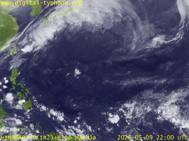
RECENT MTSAT-1R SATELLITE IMAGE:

> Image source: Digital-Typhoon.org (Nat'l. Institute of Informatics, Japan) (http://www.digital-typhoon.org)
__________________________________________________________________________________________
LATEST T2K TRACKING CHART:

_______________________________________________________________________________________
NOTES:

> Image source: Digital-Typhoon.org (Nat'l. Institute of Informatics, Japan) (http://www.digital-typhoon.org)
__________________________________________________________________________________________
LATEST T2K TRACKING CHART:

_______________________________________________________________________________________
NOTES:
^ - JTWC commentary remarks (for Meteorologists) from their
latest warning.
latest warning.
* - Based on PAGASA's Philippine Storm Warning Signals,
# 4 being the highest. Red letters indicate new areas
being hoisted. For more explanations on these signals,
visit: http://www.typhoon2000.ph/signals.htm
** - Based on the Tropical Cyclone's Sea Wave Height near
its center.
__________________________________________________________________________________________
>> To know the meteorological terminologies and acronyms
used on this update visit the ff:
http://typhoon2000.ph/tcterm.htm
http://www.nhc.noaa.gov/aboutgloss.shtml
http://www.srhnoaa.gov/oun/severewx/glossary.php
http://www.srh.weather.gov/fwd/glossarynation.html
http://www.nhc.noaa.gov/acronyms.shtml
__________________________________________________________________________________________
:: Typhoon2000.com (T2K) Mobile >> Powered by: Synermaxx
Receive the latest storm updates directly to your mobile phones! To know more:
Send T2K HELP to: 2800 (GLOBE & TM) | OFFLINE (SMART & TNT) | 2288 (SUN)
__________________________________________________________________________________________
For the complete details on the TS EWINIAR (ESTER/04W)...go visit
our website @:
> http://www.typhoon2000.com
> http://www.maybagyo.com
Visit Your Group | Yahoo! Groups Terms of Use | Unsubscribe
New Message Search
Find the message you want faster. Visit your group to try out the improved message search.
SPONSORED LINKS
.
__,_._,___
No comments:
Post a Comment