Typhoon2000 STORM UPDATE #15
Name: TYPHOON EWINIAR [ESTER/04W/0603]
Issued: 7:00 AM MANILA TIME (23:00 GMT) FRI 07 JULY 2006
Next Update: 7:00 PM (11:00 GMT) FRI 07 JULY 2006
Source: JTWC TROPICAL CYCLONE WARNING #029
_______________________________________________________________________
Next Update: 7:00 PM (11:00 GMT) FRI 07 JULY 2006
Source: JTWC TROPICAL CYCLONE WARNING #029
_______________________________________________________________________
TYPHOON EWINIAR (ESTER) MAINTAINS CATEGORY THREE STATUS
BUT LOSES A LITTLE BIT OF STRENGTH WHILE DRIFTING NORTH-
WEST...OUTER BANDS APPROACHING YAEYAMA ISLANDS AND
OKINAWA AREA.
BUT LOSES A LITTLE BIT OF STRENGTH WHILE DRIFTING NORTH-
WEST...OUTER BANDS APPROACHING YAEYAMA ISLANDS AND
OKINAWA AREA.
+ FORECAST OUTLOOK: A change in the storm's forecast path
has been initiated. EWINIAR is now expected to move NNW'ly
for the next 24-48 hours then shall begin turning north-
ward. Its core (Eye+EyeWall) is expected to pass west of
Okinawa, Japan approx 175 km west of Kadena Air Base Sa-
turday evening (July 8), around 9 PM HK Time. The 3 to 5-
Day Advance Forecast (July 10-12) now shows the system pa-
ssing over the "fantasy & mystery" Island of Cheju (around
3 AM HK time Monday, July 10) before making landfall over
South Korea as a weakened Category 1 Typhoon on Monday
morning (July 10) (around 8 AM HK Time). EWINIAR shall
pass about 150 km SE of Seoul Monday afternoon before
moving out into the Sea of Japan (as a downgraded
tropical storm).
+ EFFECTS: EWINIAR's large circulation remains over the
Northern Philippine Sea for almost 3 days now. however,
its Northern Outer (Feeder) Bands is forecast to reach
Okinawa-Ryukyu Islands late today. The storm's outer bands
is expected to bring occasional rains with moderate to
sometimes strong winds that could produce flying debris,
life-threatening flash floods and mudslides along river
banks, low-lying areas and mountain slopes over the
affected island.
+ CURRENT MONSOON INTENSITY: The Southwest Monsoon conti-
nues to affect Luzon & the western sections of Visayas &
Mindanao (including Metro Manila, Western Bicol except for
Palawan). This monsoon system will bring cloudy skies with
moderate to sometimes strong SW'ly winds (approx. 30 to 60
km/hr), accompanied with moderate to heavy occasional rains.
These rains may produce life-threatening flash floods and
mudslides along river banks, low-lying areas and mountain
slopes of the affected areas.
+ TROPICAL CYCLONE WATCH: The Tropical Disturbance (LPA/98W/
1006 mb) continues to consolidate south of the Marianas. The
possibility of becoming a well-develop Tropical Cyclone is
likely within the next 24 to 48 hours. The disturbance was
last located approximately 445 km South of Hagatna, Guam
(9.4N 144.7E). Stay tuned for more updates on this develo-
ping system.
outlook, effects, current monsoon intensity, and tropical
cyclone watch changes every 06 to 12 hours!
_______________________________________________________________________
TIME/DATE: 5:00 AM MANILA TIME (21:00 GMT) 07 JULY
LOCATION OF EYE: LATITUDE 20.6º N...LONGITUDE 127.5º E {SatFix}
DISTANCE 1: 655 KM (355 NM) ENE OF APARRI, CAGAYAN, PH
DISTANCE 2: 575 KM (310 NM) EAST OF BASCO, BATANES, PH
DISTANCE 3: 660 KM (356 NM) SSW OF OKINAWA, JAPAN
TIME/DATE: 5:00 AM MANILA TIME (21:00 GMT) 07 JULY
LOCATION OF EYE: LATITUDE 20.6º N...LONGITUDE 127.5º E {SatFix}
DISTANCE 1: 655 KM (355 NM) ENE OF APARRI, CAGAYAN, PH
DISTANCE 2: 575 KM (310 NM) EAST OF BASCO, BATANES, PH
DISTANCE 3: 660 KM (356 NM) SSW OF OKINAWA, JAPAN
MAX SUSTAINED WINDS [1-MIN AVG]: 185 KM/HR (100 KTS)
PEAK WIND GUSTS: 230 KM/HR (125 KTS)
MINIMUM CENTRAL PRESSURE (est.): 944 MILLIBARS (hPa)
MAX WAVE HEIGHT**: 35 FEET (10.6 METERS)
SAFFIR-SIMPSON SCALE: CATEGORY THREE (3)
RECENT MOVEMENT: NW @ 11 KM/HR (06 KTS)
GENERAL DIRECTION: YAEYAMA-OKINAWA AREA
STORM'S SIZE (IN DIAMETER): 890 KM (480 NM)/LARGE
VIEW T2K TRACKING MAP: 5 AM FRI JULY 07
TSR WIND PROBABILITIES: CURRENT TO 120 HRS LEAD
PHILIPPINE STORM SIGNALS*:
#01 - NORTHERN CAGAYAN, CALAYAN GROUP OF ISLANDS,
& BATANES GROUP OF ISLANDS.
09-21 HR. FORECAST:
> 2 PM (06 GMT) 07 JULY: 21.6N 127.3E / 185-230 KPH
> 2 AM (18 GMT) 08 JULY: 23.1N 126.6E / 185-230 KPH
REMARKS: 2 AM (18 GMT) 07 JULY POSITION: 20.6N 127.8E.
^TY EWINIAR IS CURRENTLY BEING STEERED BY THE SUBTRO-
PICAL HIGH PRESSURE RIDGE (STHPR) THAT IS LOCATED TO
THE NORTHEAST. THE MIDLATITUDE LOW PRESSURE TROUGH THAT
CREATED THE WEAKNESS IN THE RIDGE HAS PERSISTED OVER
THE NORTHERN PORTION OF THE EAST CHINA SEA, ALLOWING
TY EWINIAR TO MAINTAIN ITS NORTH-NORTHWESTWARD TRACK
THROUGH 72 HRS. AT 72 HRS, TY EWINIAR WILL BEGIN TO
BE INFLUENCED BY ANOTHER MIDLATITUDE LOW PRESSURE SYS-
TEM THAT IS CURRENTLY UPSTREAM NEAR NORTH CENTRAL
CHINA, TAKING THE TRACK TO THE NORTH-NORTHEAST...
(more info)
>> EWINIAR {pronounced: ee~win~yar}, meaning: Chuuk
traditional storm God. Name contributed by: Micronesia.
_______________________________________________________________________
PAGASA CURRENT POSITION, MOVEMENT AND INTENSITY (10-min. ave.):
> 4 AM (20 GMT) 07 JULY: 20.8N 127.5E / NW @ 11 KPH / 165 kph
:: For the complete PAGASA bulletin, kindly visit their website
at: http://www.pagasa.dost.gov.ph/wb/tcupdate.shtml
_________________________________________________________________________________
:: For the complete PAGASA bulletin, kindly visit their website
at: http://www.pagasa.dost.gov.ph/wb/tcupdate.shtml
_________________________________________________________________________________
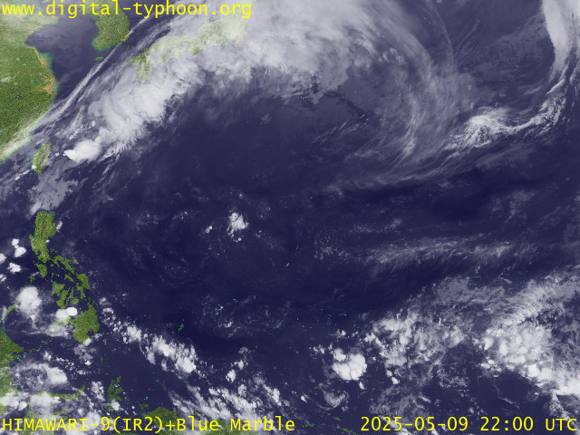
RECENT MTSAT-1R SATELLITE IMAGE:

> Image source: Digital-Typhoon.org (Nat'l. Institute of Informatics, Japan) (http://www.digital-typhoon.org)
__________________________________________________________________________________________
LATEST T2K TRACKING CHART:

_______________________________________________________________________________________
NOTES:

> Image source: Digital-Typhoon.org (Nat'l. Institute of Informatics, Japan) (http://www.digital-typhoon.org)
__________________________________________________________________________________________
LATEST T2K TRACKING CHART:

_______________________________________________________________________________________
NOTES:
^ - JTWC commentary remarks (for Meteorologists) from their
latest warning.
latest warning.
* - Based on PAGASA's Philippine Storm Warning Signals,
# 4 being the highest. Red letters indicate new areas
being hoisted. For more explanations on these signals,
visit: http://www.typhoon2000.ph/signals.htm
** - Based on the Tropical Cyclone's Sea Wave Height near
its center.
__________________________________________________________________________________________
>> To know the meteorological terminologies and acronyms
used on this update visit the ff:
http://typhoon2000.ph/tcterm.htm
http://www.nhc.noaa.gov/aboutgloss.shtml
http://www.srhnoaa.gov/oun/severewx/glossary.php
http://www.srh.weather.gov/fwd/glossarynation.html
http://www.nhc.noaa.gov/acronyms.shtml
__________________________________________________________________________________________
:: Typhoon2000.com (T2K) Mobile >> Powered by: Synermaxx
Receive the latest storm updates directly to your mobile phones! To know more:
Send T2K HELP to: 2800 (GLOBE & TM) | OFFLINE (SMART & TNT) | 2288 (SUN)
__________________________________________________________________________________________
For the complete details on the TY EWINIAR (ESTER/04W)...go visit
our website @:
> http://www.typhoon2000.com
> http://www.maybagyo.com
Visit Your Group | Yahoo! Groups Terms of Use | Unsubscribe
New Message Search
Find the message you want faster. Visit your group to try out the improved message search.
SPONSORED LINKS
.
__,_._,___
No comments:
Post a Comment