Typhoon2000 STORM UPDATE #03
Name: TROPICAL DEPRESSION HENRY [96W]
Issued: 7:00 AM MANILA TIME (23:00 GMT) SUN 30 JULY 2006
Next Update: 7:00 PM (11:00 GMT) SUN 30 JULY 2006
Source: PAGASA BULLETIN-WARNING #006
_______________________________________________________________________
Next Update: 7:00 PM (11:00 GMT) SUN 30 JULY 2006
Source: PAGASA BULLETIN-WARNING #006
____________
TROPICAL DEPRESSION HENRY (96W) HAS SLIGHTLY ACCELERATED
WEST-NORTHWESTWARD AND IS NOW EYEING CENTRAL AND NOR-
THERN LUZON...WESTERN RAINBANDS AFFECTING THE WHOLE
BICOL REGION, SOUTHERN QUEZON, NORTHERN AND EASTERN
VISAYAS
.WEST-NORTHWESTWARD AND IS NOW EYEING CENTRAL AND NOR-
THERN LUZON...WESTERN RAINBANDS AFFECTING THE WHOLE
BICOL REGION, SOUTHERN QUEZON, NORTHERN AND EASTERN
VISAYAS
+ FORECAST OUTLOOK: HENRY is expected to move WNW for the
next 2 days and shall make landfall along Aurora-Isabela
or just to the north of Casiguran tomorrow noontime (Mon,
Jul 31). It shall then cross Northern Luzon tomorrow late
afternoon before moving out into the South China Sea via
Ilocos Sur around early Tuesday morning (Aug 1). The 3-
day forecast (72 hours) shows the system over South China
Sea moving towards Guangdong-Hong Kong area.
+ EFFECTS: HENRY's western rain bands continues to affect
Bicol Region, Masbate, Samar & Leyte Provinces and is now
spreading across Southern Quezon and Northern Visayas.
These bands will continue to bring cloudy skies with sca-
ttered moderate to sometimes heavy rains. Residents li
ving along river banks, steep mountain slopes and low-
lying areas are advised to stay alert and foresee evacua-
tion for possible flashfloods and mudslides. People li-
ving around the slopes of Mayon Volcano in Albay especia-
lly along the area where possible LAHAR FLOWS (mixture of
volcanic mud and water) are located - must stay on alert
at all times for immediate evacuation.
+ CURRENT MONSOON INTENSITY: Weak to Moderate Southwest
(SW) Monsoon continues to affect the western sections of
Mindanao & Visayas including Palawan. Cloudy weather con-
ditions with light to moderate or sometimes heavy rain-
fall can be expected tonight and tomorrow. Southwesterly
winds of 30 km/hr with higher gusts may be expected
along the affected areas.
outlook, effects, current monsoon intensity, and tropical
cyclone watch changes every 06 to 12 hours!
_______________________________________________________________________
TIME/DATE: 4:00 AM MANILA TIME (20:00 GMT) 30 JULY
LOCATION OF CENTER: LATITUDE 14.5º N...LONGITUDE 126.1º E
DISTANCE 1: 220 KM (120 NM) NE OF VIRAC, CATANDUANES, PH
DISTANCE 2: 330 KM (180 NM) ENE OF NAGA CITY, PH
DISTANCE 3: 300 KM (162 NM) NE OF LEGAZPI CITY, PH
DISTANCE 4: 350 KM (190 NM) ENE OF DAET, CAM. NORTE, PH
MAX SUSTAINED WINDS [10-MIN AVG]: 55 KM/HR (30 KTS)
PEAK WIND GUSTS: 70 KM/HR (38 KTS)
MINIMUM CENTRAL PRESSURE (est.): 1000 MILLIBARS (hPa)
MAX WAVE HEIGHT**: 06 FEET (1.8 METERS)
SAFFIR-SIMPSON SCALE: N/A
RECENT MOVEMENT: WNW @ 15 KM/HR (08 KTS)
GENERAL DIRECTION: CENTRAL AND NORTHERN LUZON
STORM'S SIZE (IN DIAMETER): 555 KM (300 NM)/AVERAGE
VIEW T2K TRACKING MAP: 4 AM SUN JULY 30
PHILIPPINE STORM SIGNALS*:
#01 - CAMARINES NORTE, CAMARINES SUR, ALBAY, SORSOGON
& CATANDUANES.
24-48 HR. FORECAST:
> 2 AM (18 GMT) 31 JULY: 15.9N 123.6E
> 2 AM (18 GMT) 01 AUGUST: 17.4N 120.5E
REMARKS: 2 AM (18 GMT) 30 JULY POSITION: 14.3N 126.4E.
_________________________________________________________________________________
_________________________________________________________________________________
REMARKS: 2 AM (18 GMT) 30 JULY POSITION: 14.3N 126.4E.
____________
____________
LATEST T2K TRACKING CHART:

________________________
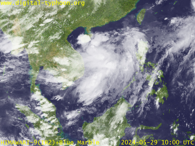
RECENT MTSAT-1R SATELLITE IMAGE:

> Image source: Digital-Typhoon.
NOTES:
^ - JTWC commentary remarks (for Meteorologists) from their
latest warning.
latest warning.
* - Based on PAGASA's Philippine Storm Warning Signals,
# 4 being the highest. Red letters indicate new areas
being hoisted. For more explanations on these signals,
visit: http://www.typhoon2000.ph/signals.htm
** - Based on the Tropical Cyclone's Sea Wave Height near
its center.
__________________________________________________________________________________________
>> To know the meteorological terminologies and acronyms
used on this update visit the ff:
http://typhoon2000.ph/tcterm.htm
http://www.nhc.noaa.gov/aboutgloss.shtml
http://www.srh..........noaa.gov/oun/severewx/glossary.php
http://www.srh.weather.gov/fwd/glossarynation.html
http://www.nhc.noaa.gov/acronyms.shtml
__________________________________________________________________________________________
:: Typhoon2000.com (T2K) Mobile >> Powered by: Synermaxx
Receive the latest storm updates directly to your mobile phones! To know more:
Send T2K HELP to: 2800 (GLOBE & TM) | 216 (SMART & TNT) | 2288 (SUN)
__________________________________________________________________________________________
For the complete details on the TD HENRY (96W)...go visit
our website @:
> http://www.typhoon2000.com
> http://www.maybagyo.com
# 4 being the highest. Red letters indicate new areas
being hoisted. For more explanations on these signals,
visit: http://www.typhoon2
** - Based on the Tropical Cyclone's Sea Wave Height near
its center.
____________
>> To know the meteorological terminologies and acronyms
used on this update visit the ff:
http://typhoon2000.
http://www.nhc.
http://www.srh.
http://www.srh.
http://www.nhc.
____________
:: Typhoon2000.
Receive the latest storm updates directly to your mobile phones! To know more:
Send T2K HELP to: 2800 (GLOBE & TM) | 216 (SMART & TNT) | 2288 (SUN)
____________
For the complete details on the TD HENRY (96W)...go visit
our website @:
> http://www.typhoon2
> http://www.maybagyo
You are receiving Individual Emails Change Delivery Settings
Visit Your Group | Yahoo! Groups Terms of Use | Unsubscribe
SPONSORED LINKS
.
__,_._,___
No comments:
Post a Comment