
for Wednesday, 07 October 2009 [7:07 PM PST]


<<<Typhoon2000.com Mobile >>>
Get the latest 6-hrly SMS Storm Alerts on PEPENG!
For more details: Text T2K TYPHOON to
2800 (Globe/TM) | 216 (Smart/TNT) | 2288 (Sun)
*only P2.50 (Smart/Globe) / P2.00 (Sun) per msg received.
powered by: Synermaxx
Typhoon2000 (T2K) NEWS (Tue October 06 2009):
Currently issuing 6-hrly SMS, web & e-mail advisories (except 12:00 AM) on TS PARMA (PEPENG).
PARMA (PEPENG) MAX WIND SPEED PER AGENCY:
+ Hong Kong (HKO/10-min avg): 65 km/hr
+ Beijing (NMC/2-min avg): 65 kph
+ Taiwan (CWB/10-min avg): 65 km/hr
+ Korea (KMA/10-min avg): 65 km/hr
+ Japan (JMA/10-min avg): 65 km/hr
+ USA (JTWC/1-min avg): 65 km/hr
+ Philippines (PAGASA/10-min avg): 55 km/hr
TROPICAL STORM PARMA [PEPENG/19W/0917]
T2K PUBLIC ADVISORY NUMBER 029
6:00 PM PST (10:00 GMT) Wed 07 October 2009
Source: T2K ANALYSIS / JTWC WARNING #039
View: Advisory Archives (2004-2009)
The weak Tropical Storm PARMA (PEPENG) barely moving off the east coast of Cagayan & Isabela...may turn back again to the West and cross Northern Luzon for the 3rd time. Widespread rains across parts of Northern Luzon to continue.
*Residents and visitors along Northern Luzon should closely monitor the progress of PARMA.
*Kindly refer to your local warnings & bulletins issued by your country's official weather agency. This advisory is intended for additional information purposes only.
+ Forecast Outlook: PARMA is expected track westerly & cross Northern Luzon again, but it may be just a TD. The 3 to 5-day Long-Range Forecast shows PARMA regaining TS strength as it reaches the South China Sea on Saturday, Oct 10.
+ Effects: PARMA's loose and weak circulation trying to reform while off the east coast of Cagayan/Isabela...will continue to dump excessive amounts of rainfall across most of Northern Luzon, where possible flooding is likely. 1-day rainfall accumulations of 75 up to 200 mm (moderate to heavy rain) can be expected along PARMA's rainbands...with isolated accumulations of up to 300 mm (very heavy rain) near the center of PARMA or along mountains slopes. Residents in low-lying areas & steep slopes must remain alert & seek evacuation for possible life-threatening flash floods, mudslides & landslides due to the anticipated heavy rains brought about by this system. Precautionary measures must be initiated if necessary.
+ Tropical Cyclone Watch:
(1) Typhoon MELOR (QUEDAN) moving fast closer to Southern Japan...shall make landfall off SW Honshu tomorrow. Click here to view latest T2K advisory.
Kindly click the cool T2K Graphical Satellite Analysis, issued every afternoon, and shows various tropical systems roaming across the South China Sea and the Western Pacific Ocean.
[Important Note: Please keep in mind that the above forecast outlook, effects, current monsoon intensity, & tropical cyclone watch changes every 6 to 12 hrs!]
Time/Date: 6:00 PM PST Wed October 07 2009
Location of Center: 17.7º N Lat 122.3º E Lon
Distance 1: 65 km (35 nm) East of Tuguegarao City
Distance 2: 75 km (40 nm) NE of Ilagan, Isabela
Distance 3: 100 km (55 nm) SE of Aparri, Cagayan
Distance 4: 190 km (103 nm) ESE of Laoag City
Distance 5: 170 km (92 nm) North of Casiguran, Aurora
Distance 6: 370 km (200 nm) NNE of Metro Manila
MaxWinds (1-min avg): 65 kph (35 kts) near the eye
Peak Wind Gusts: 85 kph (45 kts)
Saffir-Simpson Typhoon Scale: Tropical Storm
Coastal Storm Surge Height: 1-3 feet [0.3-0.9 m]
Minimum Central Pressure: 996 millibars (hPa)
Recent Movement: ENE @ 02 kph (01 kt)
Projected Area of Impact: Northern Luzon
Size (in Diameter): 665 km (360 nm) / Avg/Large
Max Sea Wave Height (near center): 20 ft (6.0 m)
T2K TrackMap #016 (for Public): 6 PM PST Wed Oct 07
JTWC Ship Avoidance TrackMap: 2 PM Wed Oct 7
Multi-Agency Forecast TrackMap: 2 PM Wed Oct 7
TSR Wind Probabilities: Current to 5-days Ahead
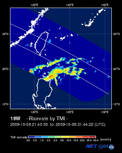
EORC-JAXA TRMM Viewer: Real-Time Rainrate Image
NASA-JAXA TMI Viewer: Latest Rainrate Image
Zoomed Satellite Pic: Near Real-Time
Wunderground Animation: 6-12 hr. GIF Loop
PHILIPPINE STORM WARNING SIGNAL # ONE (1)
In Effect: NUEVA VIZCAYA, NORTHERN AURORA, BENGUET, BATANES-BABUYAN-CALAYAN ISLAND GROUP, CAGAYAN, ILOCOS NORTE, APAYAO, ABRA, KALINGA, ILOCOS SUR, MOUNTAIN PROVINCE, ISABELA AND IFUGAO.
The above areas will have rains and winds of not more than 60 kph tonight and tomorrow. Coastal waters will be moderate to rough.
Residents living in low-lying and mountainous areas under Public Storm Warning Signal Number 1 are alerted against flashfloods, mudflows, mudslides and landslides.
<<<Typhoon2000.
Get the latest 6-hrly SMS Storm Alerts on PEPENG!
For more details: Text T2K TYPHOON to
2800 (Globe/TM) | 216 (Smart/TNT) | 2288 (Sun)
*only P2.50 (Smart/Globe) / P2.00 (Sun) per msg received.
powered by: Synermaxx
Typhoon2000 (T2K) NEWS (Tue October 06 2009):
Currently issuing 6-hrly SMS, web & e-mail advisories (except 12:00 AM) on TS PARMA (PEPENG).
PARMA (PEPENG) MAX WIND SPEED PER AGENCY:
+ Hong Kong (HKO/10-min avg): 65 km/hr
+ Beijing (NMC/2-min avg): 65 kph
+ Taiwan (CWB/10-min avg): 65 km/hr
+ Korea (KMA/10-min avg): 65 km/hr
+ Japan (JMA/10-min avg): 65 km/hr
+ USA (JTWC/1-min avg): 65 km/hr
+ Philippines (PAGASA/10-min avg): 55 km/hr
TROPICAL STORM PARMA [PEPENG/19W/
T2K PUBLIC ADVISORY NUMBER 029
6:00 PM PST (10:00 GMT) Wed 07 October 2009
Source: T2K ANALYSIS / JTWC WARNING #039
View: Advisory Archives (2004-2009)
*Residents and visitors along Northern Luzon should closely monitor the progress of PARMA.
*Kindly refer to your local warnings & bulletins issued by your country's official weather agency. This advisory is intended for additional information purposes only.
+ Forecast Outlook: PARMA is expected track westerly & cross Northern Luzon again, but it may be just a TD. The 3 to 5-day Long-Range Forecast shows PARMA regaining TS strength as it reaches the South China Sea on Saturday, Oct 10.
+ Effects: PARMA's loose and weak circulation trying to reform while off the east coast of Cagayan/Isabela.
(1) Typhoon MELOR (QUEDAN) moving fast closer to Southern Japan...shall make landfall off SW Honshu tomorrow. Click here to view latest T2K advisory.
Kindly click the cool T2K Graphical Satellite Analysis, issued every afternoon, and shows various tropical systems roaming across the South China Sea and the Western Pacific Ocean.
[Important Note: Please keep in mind that the above forecast outlook, effects, current monsoon intensity, & tropical cyclone watch changes every 6 to 12 hrs!]
Time/Date: 6:00 PM PST Wed October 07 2009
Location of Center: 17.7º N Lat 122.3º E Lon
Distance 1: 65 km (35 nm) East of Tuguegarao City
Distance 2: 75 km (40 nm) NE of Ilagan, Isabela
Distance 3: 100 km (55 nm) SE of Aparri, Cagayan
Distance 4: 190 km (103 nm) ESE of Laoag City
Distance 5: 170 km (92 nm) North of Casiguran, Aurora
Distance 6: 370 km (200 nm) NNE of Metro Manila
MaxWinds (1-min avg): 65 kph (35 kts) near the eye
Peak Wind Gusts: 85 kph (45 kts)
Saffir-Simpson Typhoon Scale: Tropical Storm
Coastal Storm Surge Height: 1-3 feet [0.3-0.9 m]
Minimum Central Pressure: 996 millibars (hPa)
Recent Movement: ENE @ 02 kph (01 kt)
Projected Area of Impact: Northern Luzon
Size (in Diameter): 665 km (360 nm) / Avg/Large
Max Sea Wave Height (near center): 20 ft (6.0 m)
T2K TrackMap #016 (for Public): 6 PM PST Wed Oct 07
JTWC Ship Avoidance TrackMap: 2 PM Wed Oct 7
Multi-Agency Forecast TrackMap: 2 PM Wed Oct 7
TSR Wind Probabilities: Current to 5-days Ahead
EORC-JAXA TRMM Viewer: Real-Time Rainrate Image
NASA-JAXA TMI Viewer: Latest Rainrate Image
Zoomed Satellite Pic: Near Real-Time
Wunderground Animation: 6-12 hr. GIF Loop
PHILIPPINE STORM WARNING SIGNAL # ONE (1)
In Effect: NUEVA VIZCAYA, NORTHERN AURORA, BENGUET, BATANES-BABUYAN-
The above areas will have rains and winds of not more than 60 kph tonight and tomorrow. Coastal waters will be moderate to rough.
Residents living in low-lying and mountainous areas under Public Storm Warning Signal Number 1 are alerted against flashfloods, mudflows, mudslides and landslides.
_______________________________________________________________________________________________________________________________________
RECENT T2K TRACKING CHART:
RECENT T2K TRACKING CHART:

________________________
RECENT MTSAT-1R SATELLITE IMAGE:

> Image source: NOAA SATELLITE CENTER
RECENT WUNDERGROUND SATELLITE ANIMATION:

> Image source: Wunderground.com (http://www.wunderground.com/ ) ____________________________________________________________________________________________________________________
> Image source: NOAA SATELLITE CENTER
____________________________________________________________________________________________________________________
RECENT WUNDERGROUND SATELLITE ANIMATION:
> Image source: Wunderground.
NOTE:
^ - JTWC commentary remarks (for Meteorologists) from their latest warning.
__________________________________________________________________________________________
>> To know the meteorological terminologies and acronyms used on this update visit the ff:
http://typhoon2000.ph/tcterm.htm
http://www.nhc.noaa.gov/aboutgloss.shtml
http://www.srh.noaa.gov/oun/severewx/glossary.php
http://www.srh.weather.gov/fwd/glossarynation.html
http://www.nhc.noaa.gov/acronyms.shtml
__________________________________________________________________________________________
For the complete details on TS PARMA (PEPENG)...go visit our website @:
> http://www.typhoon2000.com
> http://www.maybagyo.com
>> To know the meteorological terminologies and acronyms used on this update visit the ff:
http://typhoon2000.
http://www.nhc.
http://www.srh.
http://www.srh.
http://www.nhc.
____________
> http://www.typhoon2
> http://www.maybagyo
Copyright © 2009 Typhoon2000.
__._,_.___
MARKETPLACE
Change settings via the Web (Yahoo! ID required)
Change settings via email: Switch delivery to Daily Digest | Switch format to Traditional
Visit Your Group | Yahoo! Groups Terms of Use | Unsubscribe
.
__,_._,___

No comments:
Post a Comment