
for Wednesday, 14 October 2009 [11:28 AM PST]


<<<Typhoon2000.com Mobile >>>
Get the latest SMS Storm Alerts!
For more details: Text T2K HELP to
2800 (Globe/TM) | 216 (Smart/TNT) | 2288 (Sun)
*only P2.50 (Smart/Globe) / P2.00 (Sun) per msg received.
powered by: Synermaxx
Typhoon2000 (T2K) NEWS (Tue October 13 2009):
Currently issuing 6-hrly web advisories (except 12:00 AM) on TS PARMA (PEPENG)
PARMA (PEPENG) MAX WIND SPEED PER AGENCY:
+ USA (JTWC/1-min avg): 65 km/hr
+ Beijing (NMC/2-min avg): 85 kph
+ Hong Kong (HKO/10-min avg): 55 km/hr
+ Korea (KMA/10-min avg): 65 km/hr
+ Japan (JMA/10-min avg): 55 km/hr
+ Taiwan (CWB/10-min avg): 65 km/hr
TROPICAL STORM PARMA [PEPENG/19W/0917]
T2K PUBLIC ADVISORY NUMBER 046 [FINAL]
11:00 PM PST (15:00 GMT) Wed 14 October 2009
Source: T2K ANALYSIS / JTWC WARNING #068 [FINAL]
View: Advisory Archives (2004-2009)
Tropical Storm PARMA (PEPENG) now overland...dissipating quickly SE of Hanoi.
*This is the Final Advisory on this year's longevity cyclone.
*Kindly refer to your local warnings & bulletins issued by your country's official weather agency. This advisory is intended for additional information purposes only.
+ Forecast Outlook: N/A.
+ Effects: N/A.
[Important Note: Please keep in mind that the above forecast outlook, effects, current monsoon intensity, & tropical cyclone watch changes every 6 to 12 hrs!]
Time/Date: 11:00 PM PST Wed October 14 2009
Location of Center: 20.7º N Lat 106.6º E Lon
Distance 1: 90 km (48 nm) ESE of Hanoi, Vietnam
MaxWinds (1-min avg): 65 kph (35 kts) near the center
Peak Wind Gusts: 85 kph (45 kts)
Saffir-Simpson Typhoon Scale: Tropical Storm
Coastal Storm Surge Height: 1-3 feet [0.3-0.9 m]
Minimum Central Pressure: 996 millibars (hPa)
Recent Movement: NW @ 05 kph (03 kts)
Projected Area of Impact: Northern Vietnam
Size (in Diameter): 370 km (200 nm) / Average
Max Sea Wave Height (near center): 9 ft (2.7 m)
Wunder TrackMap (for Public): 8 PM PST Wed Oct 14
JTWC Ship Avoidance TrackMap: 8 PM Wed Oct 14
Multi-Agency Forecast TrackMap: 8 PM Wed Oct 14
TSR Wind Probabilities: Current to 1-day Ahead
EORC-JAXA TRMM Image: Latest Rainrate 01
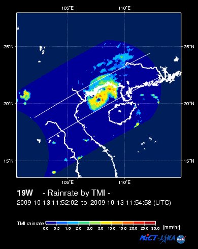
NASA-JAXA TMI Image: Latest Rainrate 02
Zoomed Satellite Pic: Near Real-Time
Wunderground Animation: 6-12 hr. GIF Loop
JTWC (US NAVY/AIR FORCE) 12 & 24 HR. FORECAST & REMARKS:
8 AM (18 GMT) 15 OCTOBER: 21.0N 106.0E / W @ 05 KPH
<<<Typhoon2000.
Get the latest SMS Storm Alerts!
For more details: Text T2K HELP to
2800 (Globe/TM) | 216 (Smart/TNT) | 2288 (Sun)
*only P2.50 (Smart/Globe) / P2.00 (Sun) per msg received.
powered by: Synermaxx
Typhoon2000 (T2K) NEWS (Tue October 13 2009):
Currently issuing 6-hrly web advisories (except 12:00 AM) on TS PARMA (PEPENG)
PARMA (PEPENG) MAX WIND SPEED PER AGENCY:
+ USA (JTWC/1-min avg): 65 km/hr
+ Beijing (NMC/2-min avg): 85 kph
+ Hong Kong (HKO/10-min avg): 55 km/hr
+ Korea (KMA/10-min avg): 65 km/hr
+ Japan (JMA/10-min avg): 55 km/hr
+ Taiwan (CWB/10-min avg): 65 km/hr
TROPICAL STORM PARMA [PEPENG/19W/
T2K PUBLIC ADVISORY NUMBER 046 [FINAL]
11:00 PM PST (15:00 GMT) Wed 14 October 2009
Source: T2K ANALYSIS / JTWC WARNING #068 [FINAL]
View: Advisory Archives (2004-2009)
*This is the Final Advisory on this year's longevity cyclone.
*Kindly refer to your local warnings & bulletins issued by your country's official weather agency. This advisory is intended for additional information purposes only.
+ Forecast Outlook: N/A.
+ Effects: N/A.
[Important Note: Please keep in mind that the above forecast outlook, effects, current monsoon intensity, & tropical cyclone watch changes every 6 to 12 hrs!]
Time/Date: 11:00 PM PST Wed October 14 2009
Location of Center: 20.7º N Lat 106.6º E Lon
Distance 1: 90 km (48 nm) ESE of Hanoi, Vietnam
MaxWinds (1-min avg): 65 kph (35 kts) near the center
Peak Wind Gusts: 85 kph (45 kts)
Saffir-Simpson Typhoon Scale: Tropical Storm
Coastal Storm Surge Height: 1-3 feet [0.3-0.9 m]
Minimum Central Pressure: 996 millibars (hPa)
Recent Movement: NW @ 05 kph (03 kts)
Projected Area of Impact: Northern Vietnam
Size (in Diameter): 370 km (200 nm) / Average
Max Sea Wave Height (near center): 9 ft (2.7 m)
Wunder TrackMap (for Public): 8 PM PST Wed Oct 14
JTWC Ship Avoidance TrackMap: 8 PM Wed Oct 14
Multi-Agency Forecast TrackMap: 8 PM Wed Oct 14
TSR Wind Probabilities: Current to 1-day Ahead
EORC-JAXA TRMM Image: Latest Rainrate 01
NASA-JAXA TMI Image: Latest Rainrate 02
Zoomed Satellite Pic: Near Real-Time
Wunderground Animation: 6-12 hr. GIF Loop
8 AM (18 GMT) 15 OCTOBER: 21.0N 106.0E / W @ 05 KPH
8 PM (06 GMT) 15 OCTOBER: 21.0N 105.3E
REMARKS: 8 PM (12 GMT) 14 OCTOBER POSITION: 20.7N 106.6E.
*PARMA IS OVER LAND AND AS IS RAPIDLY DECAYING AS A TROPICAL CYCLONE. NO
DEEP CONVECTION REMAINS. THIS IS THE FINAL WARNING ON THIS SYSTEM BY THE
JOINT TYPHOON WARNING CENTER (NAVMARFCSTCEN)
CLOSELY MONITORED FOR SIGNS OF REGENERATION.
>> PARMA, meaning: Macanese food (ham with chicken livers and mushrooms). Name contributed by: Macau, China.
____________
_______________________________________________________________________________________________________________________________________
RECENT WUNDERGROUND.
________________________
RECENT MTSAT-1R SATELLITE IMAGE:

> Image source: NOAA SATELLITE CENTER
RECENT WUNDERGROUND SATELLITE ANIMATION:

> Image source: Wunderground.com (http://www.wunderground.com/ ) ____________________________________________________________________________________________________________________
> Image source: NOAA SATELLITE CENTER
____________________________________________________________________________________________________________________
RECENT WUNDERGROUND SATELLITE ANIMATION:
> Image source: Wunderground.
NOTE:
^ - JTWC commentary remarks (for Meteorologists) from their latest warning.
__________________________________________________________________________________________
>> To know the meteorological terminologies and acronyms used on this update visit the ff:
http://typhoon2000.ph/tcterm.htm
http://www.nhc.noaa.gov/aboutgloss.shtml
http://www.srh.noaa.gov/oun/severewx/glossary.php
http://www.srh.weather.gov/fwd/glossarynation.html
http://www.nhc.noaa.gov/acronyms.shtml
__________________________________________________________________________________________
For the complete details on TS PARMA (PEPENG)...go visit our website @:
> http://www.typhoon2000.com
> http://www.maybagyo.com
>> To know the meteorological terminologies and acronyms used on this update visit the ff:
http://typhoon2000.
http://www.nhc.
http://www.srh.
http://www.srh.
http://www.nhc.
____________
> http://www.typhoon2
> http://www.maybagyo
Copyright © 2009 Typhoon2000.
__._,_.___
Change settings via the Web (Yahoo! ID required)
Change settings via email: Switch delivery to Daily Digest | Switch format to Traditional
Visit Your Group | Yahoo! Groups Terms of Use | Unsubscribe
.
__,_._,___

No comments:
Post a Comment