
for Monday, 12 October 2009 [5:33 PM PST]


<<<Typhoon2000.com Mobile >>>
Get the latest SMS Storm Alerts!
For more details: Text T2K HELP to
2800 (Globe/TM) | 216 (Smart/TNT) | 2288 (Sun)
*only P2.50 (Smart/Globe) / P2.00 (Sun) per msg received.
powered by: Synermaxx
Typhoon2000 (T2K) NEWS (Sun October 11 2009):
Currently issuing 6-hrly web advisories (except 12:00 AM) on TS PARMA (PEPENG).
PARMA (PEPENG) MAX WIND SPEED PER AGENCY:
+ Beijing (NMC/2-min avg): 85 kph
+ Hong Kong (HKO/10-min avg): 75 km/hr
+ USA (JTWC/1-min avg): 65 km/hr
+ Taiwan (CWB/10-min avg): 65 km/hr
+ Japan (JMA/10-min avg): 65 km/hr
+ Korea (KMA/10-min avg): 60 km/hr
TROPICAL STORM PARMA [PEPENG/19W/0917]
T2K PUBLIC ADVISORY NUMBER 039
6:00 PM PST (10:00 GMT) Mon 12 October 2009
Source: T2K ANALYSIS / JTWC WARNING #059
View: Advisory Archives (2004-2009)
Tropical Storm PARMA (PEPENG) still traversing Hainan...dumping heavy to extreme rainfall across the island.
*Residents and visitors along Hainan Island and Vietnam should closely monitor the progress of PARMA.
*Kindly refer to your local warnings & bulletins issued by your country's official weather agency. This advisory is intended for additional information purposes only.
+ Forecast Outlook: PARMA is expected to weaken into a TD after crossing Hainan Island and exiting through the Gulf of Tonkin. The 2-day Short-Range Forecast shows PARMA moving into the Gulf of Tonkin late tonight...and dissipating over Vietnam tomorrow evening or on Wednesday Oct 14.
+ Effects: PARMA's heavy circulation particularly its thick rainbands remains over Hainan Island and portions of Western Guangdong...these rainbands expected to reach Vietnam tomorrow. 1-day rainfall accumulations of 75 up to 200 mm (moderate to heavy rain) can be expected along PARMA's rainbands...with isolated accumulations of up to 400 mm (heavy to extreme rain) near the center of PARMA or along mountains slopes particularly along its path. Residents in low-lying areas & steep slopes must remain alert & seek evacuation for possible life-threatening flash floods, mudslides & landslides due to the anticipated heavy rains brought about by this system. Precautionary measures must be initiated if necessary.
+ Tropical Cyclone Watch:
(1) Tropical Storm NEPARTAK [21W] weakens as it continues to track ENE across the Western Pacific Ocean. Click here to view the latest T2K advisory.
[Important Note: Please keep in mind that the above forecast outlook, effects, current monsoon intensity, & tropical cyclone watch changes every 6 to 12 hrs!]
Time/Date: 6:00 PM PST Mon October 12 2009
Location of Center: 19.8º N Lat 109.6º E Lon
Distance 1: 35 km (20 nm) N of Danzhou, Hainan Is.
Distance 2: 80 km (43 nm) WSW of Haikou, Hainan Is.
Distance 3: 115 km (63 nm) WNW of Qionghai, Hainan Is.
Distance 4: 180 km (97 nm) North of Sanya, Hainan Is.
Distance 5: 420 km (227 nm) ESE of Hanoi, Vietnam
MaxWinds (1-min avg): 65 kph (35 kts) near the center
Peak Wind Gusts: 85 kph (45 kts)
Saffir-Simpson Typhoon Scale: Tropical Storm
Coastal Storm Surge Height: 1-3 feet [0.3-0.9 m]
Minimum Central Pressure: 996 millibars (hPa)
Recent Movement: WNW @ 13 kph (07 kts)
Projected Area of Impact: Gulf of Tonkin-Vietnam
Size (in Diameter): 465 km (250 nm) / Average
Max Sea Wave Height (near center): 12 ft (3.6 m)
Wunder TrackMap (for Public): 2 PM PST Mon Oct 12
JTWC Ship Avoidance TrackMap: 2 PM Mon Oct 12
Multi-Agency Forecast TrackMap: 2 PM Mon Oct 12
TSR Wind Probabilities: Current to 2-days Ahead
EORC-JAXA TRMM Image: Latest Rainrate 01
NASA-JAXA TMI Image: Latest Rainrate 02
Zoomed Satellite Pic: Near Real-Time
Wunderground Animation: 6-12 hr. GIF Loop
JTWC (US NAVY/AIR FORCE) 12, 24, & 48 HR. FORECAST & REMARKS:
2 AM (18 GMT) 13 OCTOBER: 19.8N 108.7E / 55-75 KPH (TD) / W @ 09 KPH
<<<Typhoon2000.
Get the latest SMS Storm Alerts!
For more details: Text T2K HELP to
2800 (Globe/TM) | 216 (Smart/TNT) | 2288 (Sun)
*only P2.50 (Smart/Globe) / P2.00 (Sun) per msg received.
powered by: Synermaxx
Typhoon2000 (T2K) NEWS (Sun October 11 2009):
Currently issuing 6-hrly web advisories (except 12:00 AM) on TS PARMA (PEPENG).
PARMA (PEPENG) MAX WIND SPEED PER AGENCY:
+ Beijing (NMC/2-min avg): 85 kph
+ Hong Kong (HKO/10-min avg): 75 km/hr
+ USA (JTWC/1-min avg): 65 km/hr
+ Taiwan (CWB/10-min avg): 65 km/hr
+ Japan (JMA/10-min avg): 65 km/hr
+ Korea (KMA/10-min avg): 60 km/hr
TROPICAL STORM PARMA [PEPENG/19W/
T2K PUBLIC ADVISORY NUMBER 039
6:00 PM PST (10:00 GMT) Mon 12 October 2009
Source: T2K ANALYSIS / JTWC WARNING #059
View: Advisory Archives (2004-2009)
*Residents and visitors along Hainan Island and Vietnam should closely monitor the progress of PARMA.
*Kindly refer to your local warnings & bulletins issued by your country's official weather agency. This advisory is intended for additional information purposes only.
+ Forecast Outlook: PARMA is expected to weaken into a TD after crossing Hainan Island and exiting through the Gulf of Tonkin. The 2-day Short-Range Forecast shows PARMA moving into the Gulf of Tonkin late tonight...and dissipating over Vietnam tomorrow evening or on Wednesday Oct 14.
+ Effects: PARMA's heavy circulation particularly its thick rainbands remains over Hainan Island and portions of Western Guangdong...
(1) Tropical Storm NEPARTAK [21W] weakens as it continues to track ENE across the Western Pacific Ocean. Click here to view the latest T2K advisory.
[Important Note: Please keep in mind that the above forecast outlook, effects, current monsoon intensity, & tropical cyclone watch changes every 6 to 12 hrs!]
Time/Date: 6:00 PM PST Mon October 12 2009
Location of Center: 19.8º N Lat 109.6º E Lon
Distance 1: 35 km (20 nm) N of Danzhou, Hainan Is.
Distance 2: 80 km (43 nm) WSW of Haikou, Hainan Is.
Distance 3: 115 km (63 nm) WNW of Qionghai, Hainan Is.
Distance 4: 180 km (97 nm) North of Sanya, Hainan Is.
Distance 5: 420 km (227 nm) ESE of Hanoi, Vietnam
MaxWinds (1-min avg): 65 kph (35 kts) near the center
Peak Wind Gusts: 85 kph (45 kts)
Saffir-Simpson Typhoon Scale: Tropical Storm
Coastal Storm Surge Height: 1-3 feet [0.3-0.9 m]
Minimum Central Pressure: 996 millibars (hPa)
Recent Movement: WNW @ 13 kph (07 kts)
Projected Area of Impact: Gulf of Tonkin-Vietnam
Size (in Diameter): 465 km (250 nm) / Average
Max Sea Wave Height (near center): 12 ft (3.6 m)
Wunder TrackMap (for Public): 2 PM PST Mon Oct 12
JTWC Ship Avoidance TrackMap: 2 PM Mon Oct 12
Multi-Agency Forecast TrackMap: 2 PM Mon Oct 12
TSR Wind Probabilities: Current to 2-days Ahead
EORC-JAXA TRMM Image: Latest Rainrate 01
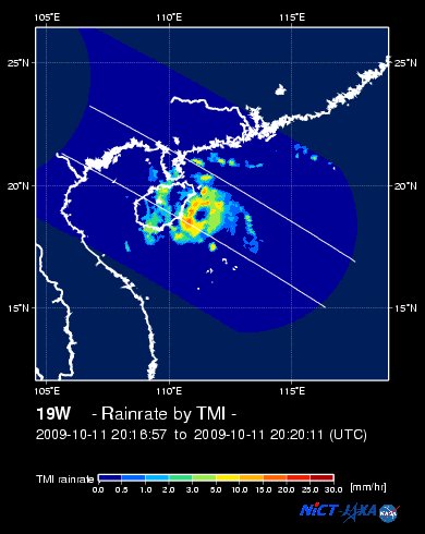
NASA-JAXA TMI Image: Latest Rainrate 02
Zoomed Satellite Pic: Near Real-Time
Wunderground Animation: 6-12 hr. GIF Loop
2 AM (18 GMT) 13 OCTOBER: 19.8N 108.7E / 55-75 KPH (TD) / W @ 09 KPH
2 PM (06 GMT) 13 OCTOBER: 19.9N 107.5E / 55-75 KPH (TD) / W @ 09 KPH
2 PM (06 GMT) 14 OCTOBER: 19.8N 105.4E / 35-55KPH (LPA) / - @ -- KPH
2 PM (06 GMT) 14 OCTOBER: 19.8N 105.4E / 35-55KPH (LPA) / - @ -- KPH
REMARKS: 2 PM (06 GMT) 12 OCTOBER POSITION: 19.4N 110.1E.
*ANIMATED MULTISPECTRAL IMAGERY SHOWS THAT PARMA
HAS MAINTAINED AN ORGANIZED CONVECTIVE STRUCTURE OVER LAND THOUGH
THE DEEP CONVECTION HAS STARTED TO WANE. THE CURRENT INTENSITY IS
SUPPORTED BY A 120600Z SURFACE REPORT (ZJHK) LOCATED 45 NM NORTHEAST
OF THE SYSTEM CENTER WHICH REPORTED 30-KNOT WINDS OUT OF THE EAST.
PARMA WILL CONTINUE TO TRACK WESTWARD ALONG THE SUBTROPICAL RIDGE
OVER THE NEXT 48 HOURS AND IS EXPECTED TO WEAKEN IN THE GULF OF
TONKIN AS IT ENCOUNTERS UNFAVORABLE NORTHEASTERLY VERTICAL WIND
SHEAR. FINALLY, PARMA SHOULD DISSIPATE IN VIETNAM, SOUTH OF HANOI,
BY TAU 48...(more)
>> PARMA, meaning: Macanese food (ham with chicken livers and mushrooms). Name contributed by: Macau, China.
____________
_______________________________________________________________________________________________________________________________________
RECENT WUNDERGROUND.
________________________
RECENT MTSAT-1R SATELLITE IMAGE:

> Image source: NOAA SATELLITE CENTER
RECENT WUNDERGROUND SATELLITE ANIMATION:

> Image source: Wunderground.com (http://www.wunderground.com/ ) ____________________________________________________________________________________________________________________
> Image source: NOAA SATELLITE CENTER
____________________________________________________________________________________________________________________
RECENT WUNDERGROUND SATELLITE ANIMATION:
> Image source: Wunderground.
NOTE:
^ - JTWC commentary remarks (for Meteorologists) from their latest warning.
__________________________________________________________________________________________
>> To know the meteorological terminologies and acronyms used on this update visit the ff:
http://typhoon2000.ph/tcterm.htm
http://www.nhc.noaa.gov/aboutgloss.shtml
http://www.srh.noaa.gov/oun/severewx/glossary.php
http://www.srh.weather.gov/fwd/glossarynation.html
http://www.nhc.noaa.gov/acronyms.shtml
__________________________________________________________________________________________
For the complete details on TD PARMA (PEPENG)...go visit our website @:
> http://www.typhoon2000.com
> http://www.maybagyo.com
>> To know the meteorological terminologies and acronyms used on this update visit the ff:
http://typhoon2000.
http://www.nhc.
http://www.srh.
http://www.srh.
http://www.nhc.
____________
> http://www.typhoon2
> http://www.maybagyo
Copyright © 2009 Typhoon2000.
__._,_.___
MARKETPLACE
Change settings via the Web (Yahoo! ID required)
Change settings via email: Switch delivery to Daily Digest | Switch format to Traditional
Visit Your Group | Yahoo! Groups Terms of Use | Unsubscribe
.
__,_._,___

No comments:
Post a Comment