
for Friday, 09 October 2009 [12:18 PM PST]


<<<Typhoon2000.com Mobile >>>
Get the latest 6-hrly SMS Storm Alerts on PEPENG!
For more details: Text T2K TYPHOON to
2800 (Globe/TM) | 216 (Smart/TNT) | 2288 (Sun)
*only P2.50 (Smart/Globe) / P2.00 (Sun) per msg received.
powered by: Synermaxx
Typhoon2000 (T2K) NEWS (Tue October 06 2009):
Currently issuing 6-hrly SMS, web & e-mail advisories (except 12:00 AM) on TD PARMA (PEPENG).
PARMA (PEPENG) MAX WIND SPEED PER AGENCY:
+ Beijing (NMC/2-min avg): 75 kph
+ Taiwan (CWB/10-min avg): 65 km/hr
+ Korea (KMA/10-min avg): 70 km/hr
+ Japan (JMA/10-min avg): 65 km/hr
+ Hong Kong (HKO/10-min avg): 65 km/hr
+ USA (JTWC/1-min avg): 55 km/hr
+ Philippines (PAGASA/10-min avg): 55 km/hr
TROPICAL DEPRESSION PARMA [PEPENG/19W/0917]
T2K PUBLIC ADVISORY NUMBER 032
12:00 PM PST (04:00 GMT) Fri 09 October 2009
Source: T2K ANALYSIS / JTWC TC FIX
View: Advisory Archives (2004-2009)
Tropical Depression PARMA (PEPENG) continues to drift westward into the South China...moving away from Western Luzon.
*Residents and visitors along Hainan Island and Vietnam should closely monitor the progress of PARMA.
*Kindly refer to your local warnings & bulletins issued by your country's official weather agency. This advisory is intended for additional information purposes only.
+ Forecast Outlook: PARMA is expected to accelerate West to WNW-ward across the South China Sea and exit PAR tomorrow. The 2 to 5-day Long-Range Forecast shows PARMA accelerating WNW, regaining back to TS status. It is forecast to make landfall over the southern coast of Hainan Island early Tuesday Oct 13, with forecast wind velocity of 75 kph.
+ Effects: PARMA's circulation continues to move away from Western Luzon...Light rains from La Union down to Bataan can still be expected from its outer bands. 1-day rainfall accumulations of 100 up to 200 mm (moderate to heavy rain) can be expected along PARMA's rainbands...with isolated accumulations of up to 300 mm (very heavy rain) near the center of PARMA or along mountains slopes particularly along its path. Residents in low-lying areas & steep slopes must remain alert & seek evacuation for possible life-threatening flash floods, mudslides & landslides due to the anticipated heavy rains brought about by this system. Precautionary measures must be initiated if necessary.
+ Tropical Cyclone Watch:
(1) Tropical Depression 21W [NONAME] drifting slowly Northward...following the path of MELOR (QUEDAN) off Kuril Islands. Watch for the separate page on this system today. Kindly click the cool T2K Graphical Satellite Analysis, issued every afternoon, and shows various tropical systems roaming across the South China Sea and the Western Pacific Ocean.
[Important Note: Please keep in mind that the above forecast outlook, effects, current monsoon intensity, & tropical cyclone watch changes every 6 to 12 hrs!]
Time/Date: 12:00 PM PST Fri October 09 2009
Location of Center: 17.0º N Lat 119.8º E Lon
Distance 1: 70 km (38 nm) NW of San Fernando City
Distance 2: 90 km (48 nm) SW of Vigan City
Distance 3: 110 km (60 nm) NW of Baguio City
Distance 4: 125 km (67 nm) NNW of Dagupan City
Distance 5: 300 km (160 nm) NNW of Metro Manila
MaxWinds (1-min avg): 55 kph (30 kts) near the center
Peak Wind Gusts: 75 kph (40 kts)
Saffir-Simpson Typhoon Scale: Tropical Depression
Coastal Storm Surge Height: 0 feet [0 m]
Minimum Central Pressure: 1000 millibars (hPa)
Recent Movement: West @ 11 kph (06 kts)
Projected Area of Impact: South China Sea
Size (in Diameter): 665 km (360 nm) / Avg/Large
Max Sea Wave Height (near center): 12 ft (3.6 m)
T2K TrackMap #020 (for Public): 12 PM PST Fri Oct 09
JTWC Ship Avoidance TrackMap: 8 AM Fri Oct 9
Multi-Agency Forecast TrackMap: 8 AM Fri Oct 9
TSR Wind Probabilities: Current to 5-days Ahead
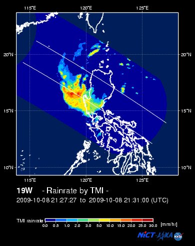
EORC-JAXA TRMM Viewer: Real-Time Rainrate Image
NASA-JAXA TMI Viewer: Latest Rainrate Image
Zoomed Satellite Pic: Near Real-Time
Wunderground Animation: 6-12 hr. GIF Loop
PHILIPPINE STORM WARNING SIGNAL # ONE (1)
In Effect: ILOCOS NORTE, ILOCOS SUR, ABRA, LA UNION & PANGASINAN.
The above areas will have rains and winds of not more than 60 kph today. Coastal waters will be moderate to rough.
Residents living in low-lying and mountainous areas under Public Storm Warning Signal Number 1 are alerted against flashfloods, mudflows, mudslides and landslides.
JTWC (US NAVY/AIR FORCE) 12, 24, 48 & 72 HR. FORECAST & REMARKS:
8 PM (12 GMT) 09 OCTOBER: 16.6N 119.2E / 55-75 KPH (TD) / W @ 09 KPH
<<<Typhoon2000.
Get the latest 6-hrly SMS Storm Alerts on PEPENG!
For more details: Text T2K TYPHOON to
2800 (Globe/TM) | 216 (Smart/TNT) | 2288 (Sun)
*only P2.50 (Smart/Globe) / P2.00 (Sun) per msg received.
powered by: Synermaxx
Typhoon2000 (T2K) NEWS (Tue October 06 2009):
Currently issuing 6-hrly SMS, web & e-mail advisories (except 12:00 AM) on TD PARMA (PEPENG).
PARMA (PEPENG) MAX WIND SPEED PER AGENCY:
+ Beijing (NMC/2-min avg): 75 kph
+ Taiwan (CWB/10-min avg): 65 km/hr
+ Korea (KMA/10-min avg): 70 km/hr
+ Japan (JMA/10-min avg): 65 km/hr
+ Hong Kong (HKO/10-min avg): 65 km/hr
+ USA (JTWC/1-min avg): 55 km/hr
+ Philippines (PAGASA/10-min avg): 55 km/hr
TROPICAL DEPRESSION PARMA [PEPENG/19W/
T2K PUBLIC ADVISORY NUMBER 032
12:00 PM PST (04:00 GMT) Fri 09 October 2009
Source: T2K ANALYSIS / JTWC TC FIX
View: Advisory Archives (2004-2009)
*Residents and visitors along Hainan Island and Vietnam should closely monitor the progress of PARMA.
*Kindly refer to your local warnings & bulletins issued by your country's official weather agency. This advisory is intended for additional information purposes only.
+ Forecast Outlook: PARMA is expected to accelerate West to WNW-ward across the South China Sea and exit PAR tomorrow. The 2 to 5-day Long-Range Forecast shows PARMA accelerating WNW, regaining back to TS status. It is forecast to make landfall over the southern coast of Hainan Island early Tuesday Oct 13, with forecast wind velocity of 75 kph.
+ Effects: PARMA's circulation continues to move away from Western Luzon...Light rains from La Union down to Bataan can still be expected from its outer bands. 1-day rainfall accumulations of 100 up to 200 mm (moderate to heavy rain) can be expected along PARMA's rainbands...
(1) Tropical Depression 21W [NONAME] drifting slowly Northward...
[Important Note: Please keep in mind that the above forecast outlook, effects, current monsoon intensity, & tropical cyclone watch changes every 6 to 12 hrs!]
Time/Date: 12:00 PM PST Fri October 09 2009
Location of Center: 17.0º N Lat 119.8º E Lon
Distance 1: 70 km (38 nm) NW of San Fernando City
Distance 2: 90 km (48 nm) SW of Vigan City
Distance 3: 110 km (60 nm) NW of Baguio City
Distance 4: 125 km (67 nm) NNW of Dagupan City
Distance 5: 300 km (160 nm) NNW of Metro Manila
MaxWinds (1-min avg): 55 kph (30 kts) near the center
Peak Wind Gusts: 75 kph (40 kts)
Saffir-Simpson Typhoon Scale: Tropical Depression
Coastal Storm Surge Height: 0 feet [0 m]
Minimum Central Pressure: 1000 millibars (hPa)
Recent Movement: West @ 11 kph (06 kts)
Projected Area of Impact: South China Sea
Size (in Diameter): 665 km (360 nm) / Avg/Large
Max Sea Wave Height (near center): 12 ft (3.6 m)
T2K TrackMap #020 (for Public): 12 PM PST Fri Oct 09
JTWC Ship Avoidance TrackMap: 8 AM Fri Oct 9
Multi-Agency Forecast TrackMap: 8 AM Fri Oct 9
TSR Wind Probabilities: Current to 5-days Ahead
EORC-JAXA TRMM Viewer: Real-Time Rainrate Image
NASA-JAXA TMI Viewer: Latest Rainrate Image
Zoomed Satellite Pic: Near Real-Time
Wunderground Animation: 6-12 hr. GIF Loop
PHILIPPINE STORM WARNING SIGNAL # ONE (1)
In Effect: ILOCOS NORTE, ILOCOS SUR, ABRA, LA UNION & PANGASINAN.
The above areas will have rains and winds of not more than 60 kph today. Coastal waters will be moderate to rough.
Residents living in low-lying and mountainous areas under Public Storm Warning Signal Number 1 are alerted against flashfloods, mudflows, mudslides and landslides.
8 PM (12 GMT) 09 OCTOBER: 16.6N 119.2E / 55-75 KPH (TD) / W @ 09 KPH
8 AM (00 GMT) 10 OCTOBER: 16.8N 118.2E / 55-75 KPH (TD) / W @ 11 KPH
8 AM (00 GMT) 11 OCTOBER: 17.3N 115.5E / 65-85 KPH (TS) / WNW @ 13 KPH
8 AM (00 GMT) 12 OCTOBER: 18.0N 112.8E / 75-95 KPH (TS) / W @ 11 KPH
8 AM (00 GMT) 11 OCTOBER: 17.3N 115.5E / 65-85 KPH (TS) / WNW @ 13 KPH
8 AM (00 GMT) 12 OCTOBER: 18.0N 112.8E / 75-95 KPH (TS) / W @ 11 KPH
REMARKS: 8 AM (00 GMT) 09 OCTOBER POSITION: 16.6N 120.0E.
*THE SYSTEM HAS MOVED BACK OVER WATER AND IS TRACKING WESTWARD
UNDER THE INFLUENCE OF THE SUBTROPICAL RIDGE OVER SOUTHERN CHINA. AS
THE SYSTEM TRAVELS OVER WATER IT IS EXPECTED TO REINTENSIFY SLOWLY
TO A WEAK TROPICAL STORM BEFORE MAKING LANDFALL IN VIETNAM AROUND
120 HOURS...(more)
>> PARMA, meaning: Macanese food (ham with chicken livers and mushrooms). Name contributed by: Macau, China.
____________
PAGASA CURRENT POSITION, MOVEMENT AND INTENSITY (10-min. ave.):
> 10 AM (02 GMT) 09 OCTOBER: 17.1N 119.9E / West @ 11 kph / 55 kph
:: For the complete PAGASA bulletin, kindly visit their website at:
http://www.pagasa.dost.gov.ph/wb/tcupdate.shtml
:: For the complete PAGASA bulletin, kindly visit their website at:
http://www.pagasa.
_______________________________________________________________________________________________________________________________________
RECENT T2K TRACKING CHART:

________________________
RECENT MTSAT-1R SATELLITE IMAGE:

> Image source: NOAA SATELLITE CENTER
RECENT WUNDERGROUND SATELLITE ANIMATION:

> Image source: Wunderground.com (http://www.wunderground.com/ ) ____________________________________________________________________________________________________________________
> Image source: NOAA SATELLITE CENTER
____________________________________________________________________________________________________________________
RECENT WUNDERGROUND SATELLITE ANIMATION:
> Image source: Wunderground.
NOTE:
^ - JTWC commentary remarks (for Meteorologists) from their latest warning.
__________________________________________________________________________________________
>> To know the meteorological terminologies and acronyms used on this update visit the ff:
http://typhoon2000.ph/tcterm.htm
http://www.nhc.noaa.gov/aboutgloss.shtml
http://www.srh.noaa.gov/oun/severewx/glossary.php
http://www.srh.weather.gov/fwd/glossarynation.html
http://www.nhc.noaa.gov/acronyms.shtml
__________________________________________________________________________________________
For the complete details on TD PARMA (PEPENG)...go visit our website @:
> http://www.typhoon2000.com
> http://www.maybagyo.com
>> To know the meteorological terminologies and acronyms used on this update visit the ff:
http://typhoon2000.
http://www.nhc.
http://www.srh.
http://www.srh.
http://www.nhc.
____________
> http://www.typhoon2
> http://www.maybagyo
Copyright © 2009 Typhoon2000.
__._,_.___
Change settings via the Web (Yahoo! ID required)
Change settings via email: Switch delivery to Daily Digest | Switch format to Traditional
Visit Your Group | Yahoo! Groups Terms of Use | Unsubscribe
.
__,_._,___

No comments:
Post a Comment