Typhoon2000 STORM UPDATE #012
Name: TYPHOON SOULIK [21W/0618]
Issued: 7:00 AM MANILA TIME (23:00 GMT) SUN 15 OCTOBER 2006
Next Update: 7:00 PM (11:00 GMT) SUN 15 OCTOBER 2006
Source: JTWC TROPICAL CYCLONE WARNING #024
_______________________________________________________________________
Next Update: 7:00 PM (11:00 GMT) SUN 15 OCTOBER 2006
Source: JTWC TROPICAL CYCLONE WARNING #024
____________
TYPHOON SOULIK (21W) NOW ACCELERATING NORTHWARD AWAY
FROM IWO JIMA...WEAKENS RAPIDLY.
+ FORECAST OUTLOOK: SOULIK is expected to turn towards FROM IWO JIMA...WEAKENS RAPIDLY.
the NE with a more accelerating speed this afternoon.
This system shall weaken into a Tropical Storm later
tomorrow and becoming an Extratropical Cyclone by Mon-
day night or early Tuesday morning (Oct 18).
+ EFFECTS: SOULIK's large Eye is now passing to the
west of Bonin Island (which is under the Eastern Eye-
Wall). Typhoon conditions will prevail over the island
with the arrival of strong Southerly to SW'ly winds in
excess of 100 km/hr accompanied with very heavy rain-
fall that could last for 6 hours. Meanwhile, Iwo Jima
is now free from the storm's wrath as the area is now
under its Outer bands. Decreasing winds of not more
than 55 km/hr with light rainfall can be expected over
Iwo Jima this morning...with improving sunlit condi-
tions in the afternoon. Coastal Storm Surge flooding of
4 to 5 feet above normal tide levels...along with large
and dangerous battering waves will continue to prevail
for the next 6 hours along Bonin & nearby islands.
+ TROPICAL CYCLONE WATCH: Two Tropical Disturbances (LPAs)
are currently organizing to the west of Guam and over
Micronesia (along Pohnpei & Kosrae Islands). The first
disturbance (92W/1006 mb) was located about 1,495 km East
of Bicol Region (13.0N 138.0E)...while the second distur-
bance (93W/1006 mb) was located about 1,810 km SE of Guam
(6.0N 159.5E)...both systems have wind speeds of 30 km/hr.
These disturbances will be monitored closely for possible
development into a Tropical Cyclone within the next 3
to 5 days.
outlook, effects & current monsoon intensity, and tropical
cyclone watch changes every 06 to 12 hours!
____________
TIME/DATE: 5:00 AM MANILA TIME (21:00 GMT) 15 OCTOBER
LOCATION OF EYE: LATITUDE 27.0º N...LONGITUDE 141.4º E
DISTANCE 1: 245 KM (132 NM) NORTH OF IWO JIMA
DISTANCE 2: 1,330 KM (718 NM) ENE OF OKINAWA, JAPAN
MAX SUSTAINED WINDS [1-MIN AVG]: 140 KM/HR (75 KTS)
PEAK WIND GUSTS: 165 KM/HR (90 KTS)
SAFFIR-SIMPSON SCALE: CATEGORY ONE (1)
MINIMUM CENTRAL PRESSURE (est.): 967 MILLIBARS (hPa)
RECENT MOVEMENT: NORTH @ 17 KM/HR (09 KTS)
GENERAL DIRECTION: NORTH PACIFIC OCEAN
STORM'S SIZE (IN DIAMETER): 850 KM (460 NM)/LARGE
MAX WAVE HEIGHT**: 31 FEET (9.4 METERS)
VIEW TRACKING MAP: 3 AM JST SUN OCTOBER 15
TSR WIND PROBABILITIES: CURRENT TO 48 HRS LEAD
PHILIPPINE STORM SIGNALS*: N/A
12, 24 & 48 HR. FORECAST:
2 PM (06 GMT) 15 OCT: 28.8N 142.3E / 120-150 KPH / NE @ 37 KPH
2 AM (18 GMT) 16 OCT: 31.6N 145.7E / 100-130 KPH / NE @ 52 KPH
2 AM (18 GMT) 17 OCT: 37.3N 159.4E / 65-85 KPH / ENE @ 65 KPH
REMARKS: 2 AM (18 GMT) 15 OCTOBER POSITION: 26.4N 141.1E.
^TY Soulik (21W) is currently tracking along the western
periphery of a north-south oriented subtropical ridge (str)
that extends to 30N. Upper level analysis reveals a strong
zonal subtropical jet stretching from central China across
southern honshu with strong westerlies beginning to impinge
on the northwestern quadrant of TY Soulik. TY Soulik has
increased its speed to the north under enhanced flow between
the str and an approaching midlatitude trough. TY Soulik
will rapidly accelerate northeastward after 12 hours as it
encounters strong westerlies south of Honshu. Within the
next 12 hours, the system will begin extratropical transi-
tion as it entrains cooler, drier air and encounters in-
creasing midlatitude westerlies. TY Soulik will complete
extratropical transition by 48 hours...(more info)
>> SOULIK {pronounced: sow~lick}, meaning: Traditional Pohnpei
Chief's title. Name contributed by: Micronesia
____________
_______________________________________________________________________
RECENT WUNDERGROUND.
________________________
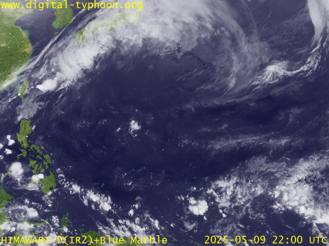
RECENT MTSAT-1R SATELLITE IMAGE:

> Image source: Digital-Typhoon.org (Nat'l. Institute of Informatics) (http://www.digital-typhoon.org )
__________________________________________________________________________________________
NOTES:

> Image source: Digital-Typhoon.
^ - JTWC commentary remarks (for Meteorologists) from their
latest warning.
latest warning.
* - Based on PAGASA's Philippine Storm Warning Signals,
# 4 being the highest. Red letters indicate new areas
being hoisted. For more explanations on these signals,
visit: http://www.typhoon2000.ph/signals.htm
** - Based on the Tropical Cyclone's Wave Height near
its center.
__________________________________________________________________________________________
>> To know the meteorological terminologies and acronyms
used on this update visit the ff:
http://typhoon2000.ph/tcterm.htm
http://www.nhc.noaa.gov/aboutgloss.shtml
http://www.srh.noaa.gov/oun/severewx/glossary.php
http://www.srh.weather.gov/fwd/glossarynation.html
http://www.nhc.noaa.gov/acronyms.shtml
__________________________________________________________________________________________
:: Typhoon2000.com (T2K) Mobile >> Powered by: Synermaxx
Receive the latest storm updates directly to your mobile phones! To know more:
Send T2K HELP to: 2800 (GLOBE & TM) | 216 (SMART & TNT) | 2288 (SUN)
Note: Globe & Smart charges P2.50 per message, while Sun at P2.00.
Offline Status: Servers under migration to a new location..services will resume
October 16 or 17 (Monday or Tuesday). Sorry for the inconvenience.
__________________________________________________________________________________________
For the complete details on TY SOULIK (21W)...go visit
our website @:
> http://www.typhoon2000.com
> http://www.maybagyo.com
# 4 being the highest. Red letters indicate new areas
being hoisted. For more explanations on these signals,
visit: http://www.typhoon2
** - Based on the Tropical Cyclone's Wave Height near
its center.
____________
>> To know the meteorological terminologies and acronyms
used on this update visit the ff:
http://typhoon2000.
http://www.nhc.
http://www.srh.
http://www.srh.
http://www.nhc.
____________
:: Typhoon2000.
Receive the latest storm updates directly to your mobile phones! To know more:
Send T2K HELP to: 2800 (GLOBE & TM) | 216 (SMART & TNT) | 2288 (SUN)
Note: Globe & Smart charges P2.50 per message, while Sun at P2.00.
Offline Status: Servers under migration to a new location..services will resume
October 16 or 17 (Monday or Tuesday). Sorry for the inconvenience.
____________
For the complete details on TY SOULIK (21W)...go visit
our website @:
> http://www.typhoon2
> http://www.maybagyo
Change settings via the Web (Yahoo! ID required)
Change settings via email: Switch delivery to Daily Digest | Switch format to Traditional
Visit Your Group | Yahoo! Groups Terms of Use | Unsubscribe
SPONSORED LINKS
.
__,_._,___
No comments:
Post a Comment