
Typhoon2000 STORM UPDATE #002
Name: TROPICAL STORM CIMARON [PAENG/22W/0619]
Issued: 7:00 PM MANILA TIME (11:00 GMT) FRI 27 OCTOBER 2006
Next Update: 7:00 AM (23:00 GMT) SAT 28 OCTOBER 2006
Source: JTWC TROPICAL CYCLONE WARNING #003
_______________________________________________________________________
Next Update: 7:00 AM (23:00 GMT) SAT 28 OCTOBER 2006
Source: JTWC TROPICAL CYCLONE WARNING #003
____________
22W (PAENG) BECOMES TROPICAL STORM CIMARON...ACCELE-
RATING WESTWARD CLOSER TO BICOL & QUEZON PROVINCES.
...ALL INTERESTS IN THE BICOL REGION, SAMAR AND QUEZON
PROVINCES SHOULD CLOSELY MONITOR THE PROGRESS OF TROPICAL
STORM CIMARON.
RATING WESTWARD CLOSER TO BICOL & QUEZON PROVINCES.
...ALL INTERESTS IN THE BICOL REGION, SAMAR AND QUEZON
PROVINCES SHOULD CLOSELY MONITOR THE PROGRESS OF TROPICAL
STORM CIMARON.
+ FORECAST OUTLOOK: CIMARON is expected to slow its WNW
track and intensify for the next 24 to 48 hours due to
favorable environment along its path. The center is fore-
cast to reach near-typhoon strength (110 km/hr) while pa-
ssing to the north of Bicol Region by Sunday morning (Oct
29), with a distance of approximately 170 km NNE of Naga
City around 11 AM. The 3 to 5-day (Oct 30-Nov 1) Long
Range Forecast shows CIMARON making landfall just to the
south of Baler, Aurora or over the Southern Sierra Madre
Mountains by midnight of Monday (Oct 29) and shall weaken
as it crosses Central Luzon passing over the provinces Au-
rora, Nueva Ecija, Tarlac & Pangasinan. The center shall
be over the west coast of Pangasinan or over the South
China Sea around 2 PM Monday Oct 30 & shall weaken over
the South China Sea due to poor atmospheric environment.
Watch for more forecast outlook every 6 hours, as its
track may change later.
+ EFFECTS: The system's outer bands is expected to arrive
over the Bicol Region & Samar Provinces sometime tomorrow.
Please take all necessary precautions and start boarding
up as this system may cause considerable damage to its
projected path.
+ CURRENT MONSOON INTENSITY: Moderate to strong Northeas-
terly Windflow embedded within a weak tropical disturbance
(LPA) will continue to bring widespread rains and winds
across Northern Luzon.
outlook, effects & current monsoon intensity, and tropical
cyclone watch changes every 06 to 12 hours!
____________
TIME/DATE: 5:00 PM MANILA TIME (09:00 GMT) 27 OCTOBER
LOCATION OF CENTER: LATITUDE 12.9º N...LONGITUDE 130.4º E
DISTANCE 1: 665 KM (360 NM) ESE OF VIRAC, CATANDUANES
DISTANCE 2: 725 KM (390 NM) ESE OF LEGAZPI CITY
DISTANCE 3: 785 KM (425 NM) ESE OF NAGA CITY
DISTANCE 4: 1,020 KM (550 NM) ESE OF METRO MANILA
PEAK WIND GUSTS: 85 KM/HR (45 KTS)
SAFFIR-SIMPSON SCALE: N/A
MINIMUM CENTRAL PRESSURE (est.): 997 MILLIBARS (hPa)
RECENT MOVEMENT: WEST @ 26 KM/HR (14 KTS)
GENERAL DIRECTION: BICOL REGION-QUEZON AREA
STORM'S SIZE (IN DIAMETER): 260 KM (140 NM)/SMALL
MAX WAVE HEIGHT**: 13 FEET (3.9 METERS)
VIEW TRACKING MAP: 5 PM PST FRI OCTOBER 27
TSR WIND PROBABILITIES: CURRENT TO 120 HRS LEAD
PHILIPPINE STORM SIGNALS*:
#01 - CATANDUANES.
12, 24 & 48 HR. FORECAST:
2 AM (18 GMT) 28 OCT: 13.4N 128.7E / 75-95 KPH / WNW @ 20 KPH
2 PM (06 GMT) 28 OCT: 14.2N 126.6E / 95-120 KPH / WNW @ 19 KPH
2 PM (06 GMT) 29 OCT: 15.3N 123.0E / 110-140 KPH / WNW @ 17 KPH
REMARKS: 2 PM (06 GMT) 27 OCTOBER POSITION: 12.8N 130.9E.
^TS CIMARON (22W) IS TRACKING WESTWARD ON THE SOUTHERN PE-
RIPHERY OF THE SUBTROPICAL RIDGE (STR) ANCHORED EAST OF
TAIWAN. A WEST TO WEST-NORTHWESTWARD TRACK WILL CONTINUE
THROUGH 72 HOURS. THE SYSTEM WILL REACH ITS MAXIMUM IN-
TENSITY JUST PRIOR TO MAKING LANDFALL OVER LUZON AROUND
60 HOURS...(more info)
>> CIMARON {pronounced: see~mah~ron}
Wild Ox. Name contributed by: Philippines
____________
PAGASA CURRENT POSITION, MOVEMENT AND INTENSITY (10-min. ave.):
> 4 PM (08 GMT) 27 OCTOBER: 13.0N 130.7E / WNW @ 15 KPH / 65 kph
:: For the complete PAGASA bulletin, kindly visit their website
at: http://www.pagasa.dost.gov.ph/wb/tcupdate.shtml
:: For the complete PAGASA bulletin, kindly visit their website
at: http://www.pagasa.
_______________________________________________________________________
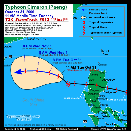
RECENT T2K TRACKING CHART:
________________________
RECENT MTSAT-1R SATELLITE IMAGE:

> Image source: Digital-Typhoon.org (Nat'l. Institute of Informatics) (http://www.digital-typhoon.org )
__________________________________________________________________________________________
NOTES:
> Image source: Digital-Typhoon.
^ - JTWC commentary remarks (for Meteorologists) from their
latest warning.
latest warning.
* - Based on PAGASA's Philippine Storm Warning Signals,
# 4 being the highest. Red letters indicate new areas
being hoisted. For more explanations on these signals,
visit: http://www.typhoon2000.ph/signals.htm
** - Based on the Tropical Cyclone's Wave Height near
its center.
__________________________________________________________________________________________
>> To know the meteorological terminologies and acronyms
used on this update visit the ff:
http://typhoon2000.ph/tcterm.htm
http://www.nhc.noaa.gov/aboutgloss.shtml
http://www.srh.noaa.gov/oun/severewx/glossary.php
http://www.srh.weather.gov/fwd/glossarynation.html
http://www.nhc.noaa.gov/acronyms.shtml
__________________________________________________________________________________________
:: Typhoon2000.com (T2K) Mobile >> Powered by: Synermaxx
Receive the latest storm updates directly to your mobile phones! To know more:
Send T2K HELP to: 2800 (GLOBE & TM) | 216 (SMART & TNT) | 2288 (SUN)
Note: Globe & Smart charges P2.50 per message, while Sun at P2.00.
SMS Status: All services now operational.
__________________________________________________________________________________________
For the complete details on TS CIMARON (PAENG)...go visit
our website @:
> http://www.typhoon2000.com
> http://www.maybagyo.com
# 4 being the highest. Red letters indicate new areas
being hoisted. For more explanations on these signals,
visit: http://www.typhoon2
** - Based on the Tropical Cyclone's Wave Height near
its center.
____________
>> To know the meteorological terminologies and acronyms
used on this update visit the ff:
http://typhoon2000.
http://www.nhc.
http://www.srh.
http://www.srh.
http://www.nhc.
____________
:: Typhoon2000.
Receive the latest storm updates directly to your mobile phones! To know more:
Send T2K HELP to: 2800 (GLOBE & TM) | 216 (SMART & TNT) | 2288 (SUN)
Note: Globe & Smart charges P2.50 per message, while Sun at P2.00.
SMS Status: All services now operational.
For the complete details on TS CIMARON (PAENG)...go visit
our website @:
> http://www.typhoon2
> http://www.maybagyo
Change settings via the Web (Yahoo! ID required)
Change settings via email: Switch delivery to Daily Digest | Switch format to Traditional
Visit Your Group | Yahoo! Groups Terms of Use | Unsubscribe
SPONSORED LINKS
.
__,_._,___

No comments:
Post a Comment