Typhoon2000 STORM UPDATE #002
Name: TROPICAL STORM SOULIK [21W/0618]
Issued: 7:00 AM MANILA TIME (23:00 GMT) TUE 10 OCTOBER 2006
Next Update: 7:00 PM (11:00 GMT) TUE 10 OCTOBER 2006
Source: JTWC TROPICAL CYCLONE WARNING #004
_______________________________________________________________________
Next Update: 7:00 PM (11:00 GMT) TUE 10 OCTOBER 2006
Source: JTWC TROPICAL CYCLONE WARNING #004
____________
21W (UNNAMED) STRENGHTENS INTO TROPICAL STORM NOW NAMED
SOULIK...TURNING TOWARDS THE WEST-NORTHWEST AS IT
SOULIK...TURNING TOWARDS THE WEST-NORTHWEST AS IT
REMAINS A THREAT TO AGRIHAN-IWO JIMA AREA.
...ALL INTERESTS IN THE NORTHERN MARIANA ISLANDS AND
IWO JIMA SHOULD CLOSELY MONITOR THE PROGRESS OF TS
SOULIK.
...ALL INTERESTS IN THE NORTHERN MARIANA ISLANDS AND
IWO JIMA SHOULD CLOSELY MONITOR THE PROGRESS OF TS
SOULIK.
+ FORECAST OUTLOOK: 21W is expected to turn WNW for the
next 2 to 3 days passing to the north of Agrihan late
Wednesday afternoon (Oct 11) and south of Iwo Jima Thurs-
day afternoon (Oct 12). The 3 to 5-day long range forecast
(Oct 13-16) shows SOULIK intensifying into a Category 2
Typhoon with projected winds of 175 km/hr and heading
more to the West that could bring a major threat to
Okinawa-Ryukyu Islands.
+ EFFECTS: 21W's consolidating circulation continues to
improve with its outer rainbands expected to reach the
Northernmost Marianas beginning tonight. As of the moment,
this system is not yet affecting any Pacific Islands.
outlook, effects & current monsoon intensity, and tropical
cyclone watch changes every 06 to 12 hours!
____________
TIME/DATE: 5:00 AM MANILA TIME (21:00 GMT) 10 OCTOBER
LOCATION OF CENTER: LATITUDE 17.7º N...LONGITUDE 153.7º E
DISTANCE 1: 895 KM (483 NM) ENE OF SAIPAN, CNMI
DISTANCE 2: 1,065 KM (575 NM) NE OF HAGATNA, GUAM, CNMI
DISTANCE 3: 1,505 KM (813 NM) SE OF IWO JIMA
DISTANCE 4: 3,315 KM (1,790 NM) EAST OF NORTHERN LUZON, PH
PEAK WIND GUSTS: 95 KM/HR (50 KTS)
SAFFIR-SIMPSON SCALE: N/A
MINIMUM CENTRAL PRESSURE (est.): 994 MILLIBARS (hPa)
RECENT MOVEMENT: NW @ 28 KM/HR (15 KTS)
GENERAL DIRECTION: AGRIHAN-IWO JIMA AREA
STORM'S SIZE (IN DIAMETER): 370 KM (200 NM)/AVERAGE
MAX WAVE HEIGHT**: 12 FEET (3.6 METERS)
VIEW TRACKING MAP: 3 AM JST TUE OCTOBER 10
TSR WIND PROBABILITIES: CURRENT TO 120 HRS LEAD
PHILIPPINE STORM SIGNALS*: N/A
12, 24 & 48 HR. FORECAST:
2 PM (06 GMT) 10 OCT: 18.7N 151.7E / 85-100 KPH / WNW @ 28 KPH
2 AM (18 GMT) 11 OCT: 19.7N 148.8E / 95-120 KPH / WNW @ 28 KPH
2 AM (18 GMT) 12 OCT: 21.3N 143.3E / 110-140 KPH / WNW @ 24 KPH
REMARKS: 2 AM (18 GMT) 10 OCTOBER POSITION: 17.3N 154.4E.
^TS SOULIK IS TRACKING ALONG THE SOUTHWESTERN PERIPHERY OF
A SUBTROPICAL RIDGE (STR) ANCHORED NORTH OF WAKE ISLAND.
AS A MIDLATITUDE TROUGH CURRENTLY TO THE EAST OF JAPAN
LIFTS OUT, THE SUBTROPICAL STEERING RIDGE WILL CONTINUE
TO BUILD WESTWARD TO THE NORTH OF THE STORM, NUDGING THE
SYSTEM TOWARD A WEST-NORTHWESTWARD TRACK...(more info)
>> SOULIK {pronounced: sow~lick}, meaning: Traditional Pohnpei
Chief's title. Name contributed by: Micronesia
____________
_______________________________________________________________________
RECENT WUNDERGROUND.
________________________
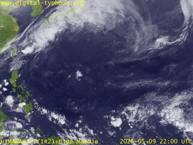
RECENT MTSAT-1R SATELLITE IMAGE:

> Image source: Digital-Typhoon.org (Nat'l. Institute of Informatics) (http://www.digital-typhoon.org )
__________________________________________________________________________________________
NOTES:

> Image source: Digital-Typhoon.
^ - JTWC commentary remarks (for Meteorologists) from their
latest warning.
latest warning.
* - Based on PAGASA's Philippine Storm Warning Signals,
# 4 being the highest. Red letters indicate new areas
being hoisted. For more explanations on these signals,
visit: http://www.typhoon2000.ph/signals.htm
** - Based on the Tropical Cyclone's Wave Height near
its center.
__________________________________________________________________________________________
>> To know the meteorological terminologies and acronyms
used on this update visit the ff:
http://typhoon2000.ph/tcterm.htm
http://www.nhc.noaa.gov/aboutgloss.shtml
http://www.srh.noaa.gov/oun/severewx/glossary.php
http://www.srh.weather.gov/fwd/glossarynation.html
http://www.nhc.noaa.gov/acronyms.shtml
__________________________________________________________________________________________
:: Typhoon2000.com (T2K) Mobile >> Powered by: Synermaxx
Receive the latest storm updates directly to your mobile phones! To know more:
Send T2K HELP to: 2800 (GLOBE & TM) | 216 (SMART & TNT) | 2288 (SUN)
Note: Globe & Smart charges P2.50 per message, while Sun at P2.00.
__________________________________________________________________________________________
For the complete details on TS SOULIK (21W)...go visit
our website @:
> http://www.typhoon2000.com
> http://www.maybagyo.com
# 4 being the highest. Red letters indicate new areas
being hoisted. For more explanations on these signals,
visit: http://www.typhoon2
** - Based on the Tropical Cyclone's Wave Height near
its center.
____________
>> To know the meteorological terminologies and acronyms
used on this update visit the ff:
http://typhoon2000.
http://www.nhc.
http://www.srh.
http://www.srh.
http://www.nhc.
____________
:: Typhoon2000.
Receive the latest storm updates directly to your mobile phones! To know more:
Send T2K HELP to: 2800 (GLOBE & TM) | 216 (SMART & TNT) | 2288 (SUN)
Note: Globe & Smart charges P2.50 per message, while Sun at P2.00.
For the complete details on TS SOULIK (21W)...go visit
our website @:
> http://www.typhoon2
> http://www.maybagyo
Change settings via the Web (Yahoo! ID required)
Change settings via email: Switch delivery to Daily Digest | Switch format to Traditional
Visit Your Group | Yahoo! Groups Terms of Use | Unsubscribe
SPONSORED LINKS
.
__,_._,___
No comments:
Post a Comment