Typhoon2000 STORM UPDATE #008
Name: TROPICAL DEPRESSION BEBINCA [NENENG/19W/0616]
Issued: 7:00 AM MANILA TIME (23:00 GMT) THU 05 OCTOBER 2006
Source: JTWC TROPICAL CYCLONE WARNING #014
_______________________________________________________________________
Source: JTWC TROPICAL CYCLONE WARNING #014
____________
BEBINCA (NENENG) HAS WEAKENED INTO A TROPICAL DEPRESSION AS
IT ACCELERATED NORTH-NORTHEAST.
*Due to its poor circulation and slow movement, this will
*Due to its poor circulation and slow movement, this will
be the last and final advisory on this system...unless re-
intensification and new threat occurs, advisories will
be re-issued.
+ FORECAST OUTLOOK: BEBINCA is expected to continue moving
NE to ENE for the next 2 to 3 days and re-intensify into a
65-km/hr storm.
+ EFFECTS: None.
+ TROPICAL CYCLONE WATCH: Tropical Storm RUMBIA remained
over the open waters of the Western Pacific Ocean...cu-
rrently not a threat to any Pacific Islands except for
Marcus Island...its center was located about 1,130 km
ESE of Iwo Jima (22.2 N Lat 152.0 E Lon)...with 10-min
sustained winds of 85 km/hr...almost stationary.
Important Note: Please keep in mind that the above forecast
outlook, effects & current monsoon intensity, and tropical
cyclone watch changes every 06 to 12 hours!
_______________________________________________________________________
TIME/DATE: 5:00 AM MANILA TIME (21:00 GMT) 05 OCTOBER
LOCATION OF CENTER: LATITUDE 21.2º N...LONGITUDE 134.8º E
DISTANCE 1: 910 KM (490 NM) SE OF OKINAWA, JAPAN
ESE of Iwo Jima (22.2 N Lat 152.0 E Lon)...with 10-min
sustained winds of 85 km/hr...almost stationary.
Important Note: Please keep in mind that the above forecast
outlook, effects & current monsoon intensity, and tropical
cyclone watch changes every 06 to 12 hours!
____________
TIME/DATE: 5:00 AM MANILA TIME (21:00 GMT) 05 OCTOBER
LOCATION OF CENTER: LATITUDE 21.2º N...LONGITUDE 134.8º E
DISTANCE 1: 910 KM (490 NM) SE OF OKINAWA, JAPAN
DISTANCE 2: 1,330 KM (720 NM) ENE OF BASCO, BATANES
DISTANCE 3: 1,450 KM (783 NM) NE OF CASIGURAN, AURORA
PEAK WIND GUSTS: 75 KM/HR (40 KTS)
SAFFIR-SIMPSON SCALE: N/A
MINIMUM CENTRAL PRESSURE (est.): 1000 MILLIBARS (hPa)
RECENT MOVEMENT: ENE @ 17 KM/HR (09 KTS)
GENERAL DIRECTION: SOUTHERN JAPAN
STORM'S SIZE (IN DIAMETER): 1,155 KM (625 NM)/VERY LARGE
MAX WAVE HEIGHT**: 15 FEET (4.5 METERS)
VIEW TRACKING MAP: 2 AM HKT THU OCTOBER 05
TSR WIND PROBABILITIES: CURRENT TO 72 HRS LEAD
PHILIPPINE STORM SIGNALS*: N/A
12, 24 & 48 HR. FORECAST:
2 PM (06 GMT) 05 OCT: 22.3N 135.9E / 55-75 KPH / NNE @ 19 KPH
2 AM (18 GMT) 06 OCT: 23.1N 136.9E / 65-85 KPH / NE @ 11 KPH
2 AM (18 GMT) 07 OCT: 23.7N 139.2E / 65-85 KPH / ENE @ 07 KPH
REMARKS: 2 AM (18 GMT) 05 OCTOBER POSITION: 20.8N 134.5E.
^TD BEBINCA HAS TRACKED NORTHEASTWARD UNDER THE STEERING
INFLUENCE OF A PERIPHERAL ANTICYCLONE TO THE SOUTHEAST OF
THE SYSTEM. THE DEPRESSION CENTER HAS ACCELERATED MORE QUICKLY
THAN PREVIOUSLY FORECAST ALONG A PSEUDO REVERSE-ORIENTED
MONSOON TROUGH. RECENT MICROWAVE SATELLITE IMAGERY, REVEAL
THAT INCREASING VERTICAL WIND SHEAR OVER THE STORM CENTER
HAS LEFT THE LOW LEVEL CIRCULATION CENTER FULLY EXPOSED
TO THE SOUTH AND EAST OF THE DEEPEST CONVECTION ASSOCIATED
WITH THIS SYSTEM. THE LOW TO MID-LEVEL CIRCULATION IS EX-
PECTED TO CONTINUE TRACKING NORTHEASTWARD UNDER THE STEE-
RING INFLUENCE OF THE AFOREMENTIONED PERIPHERAL ANTICY-
CLONE THROUGH 72 HOURS...(more info)
>> BEBINCA {pronounced: be~bin~ca}, meaning: Milk Pudding.
Name contributed by: Macau
____________
PAGASA CURRENT POSITION, MOVEMENT AND INTENSITY (10-min. ave.):
> 2 AM (02 GMT) 05 OCTOBER: 21.5N 133.4E / NNE @ 11 KPH / 75 kph
:: For the complete PAGASA bulletin, kindly visit their website
at: http://www.pagasa.dost.gov.ph/wb/tcupdate.shtml
_______________________________________________________________________
:: For the complete PAGASA bulletin, kindly visit their website
at: http://www.pagasa.
____________
RECENT WUNDERGROUND TRACKING CHART:
________________________
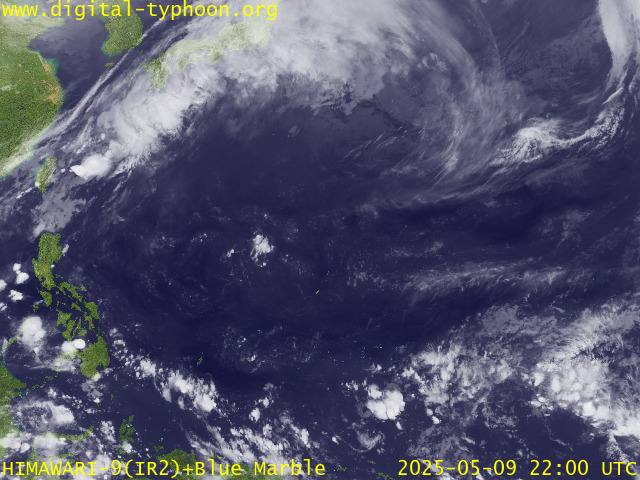
RECENT MTSAT-1R SATELLITE IMAGE:

> Image source: Digital-Typhoon.org (Nat'l. Institute of Informatics) (http://www.digital-typhoon.org )
__________________________________________________________________________________________
NOTES:

> Image source: Digital-Typhoon.
^ - JTWC commentary remarks (for Meteorologists) from their
latest warning.
latest warning.
* - Based on PAGASA's Philippine Storm Warning Signals,
# 4 being the highest. Red letters indicate new areas
being hoisted. For more explanations on these signals,
visit: http://www.typhoon2000.ph/signals.htm
** - Based on the Tropical Cyclone's Wave Height near
its center.
__________________________________________________________________________________________
>> To know the meteorological terminologies and acronyms
used on this update visit the ff:
http://typhoon2000.ph/tcterm.htm
http://www.nhc.noaa.gov/aboutgloss.shtml
http://www.srh.noaa.gov/oun/severewx/glossary.php
http://www.srh.weather.gov/fwd/glossarynation.html
http://www.nhc.noaa.gov/acronyms.shtml
__________________________________________________________________________________________
:: Typhoon2000.com (T2K) Mobile >> Powered by: Synermaxx
Receive the latest storm updates directly to your mobile phones! To know more:
Send T2K HELP to: 2800 (GLOBE & TM) | 216 (SMART & TNT) | 2288 (SUN)
Note: Globe & Smart charges P2.50 per message, while Sun at P2.00.
__________________________________________________________________________________________
For the complete details on TD BEBINCA (NENENG)...go visit
our website @:
> http://www.typhoon2000.com
> http://www.maybagyo.com
# 4 being the highest. Red letters indicate new areas
being hoisted. For more explanations on these signals,
visit: http://www.typhoon2
** - Based on the Tropical Cyclone's Wave Height near
its center.
____________
>> To know the meteorological terminologies and acronyms
used on this update visit the ff:
http://typhoon2000.
http://www.nhc.
http://www.srh.
http://www.srh.
http://www.nhc.
____________
:: Typhoon2000.
Receive the latest storm updates directly to your mobile phones! To know more:
Send T2K HELP to: 2800 (GLOBE & TM) | 216 (SMART & TNT) | 2288 (SUN)
Note: Globe & Smart charges P2.50 per message, while Sun at P2.00.
For the complete details on TD BEBINCA (NENENG)...go visit
our website @:
> http://www.typhoon2
> http://www.maybagyo
Change settings via the Web (Yahoo! ID required)
Change settings via email: Switch delivery to Daily Digest | Switch format to Traditional
Visit Your Group | Yahoo! Groups Terms of Use | Unsubscribe
SPONSORED LINKS
.
__,_._,___
No comments:
Post a Comment