Typhoon2000 STORM UPDATE #004
Name: TROPICAL STORM SOULIK [21W/0618]
Issued: 7:00 AM MANILA TIME (23:00 GMT) WED 11 OCTOBER 2006
Next Update: 7:00 PM (11:00 GMT) WED 11 OCTOBER 2006
Source: JTWC TROPICAL CYCLONE WARNING #008
_______________________________________________________________________
Next Update: 7:00 PM (11:00 GMT) WED 11 OCTOBER 2006
Source: JTWC TROPICAL CYCLONE WARNING #008
____________
TROPICAL STORM SOULIK (21W) SPEEDING TOWARDS THE WEST-
NORTHWEST...TO BECOME A TYPHOON TODAY .
...ALL INTERESTS IN THE NORTHERN MARIANA ISLANDS AND
IWO JIMA SHOULD CLOSELY MONITOR THE PROGRESS OF SOULIK.
NORTHWEST...
...ALL INTERESTS IN THE NORTHERN MARIANA ISLANDS AND
IWO JIMA SHOULD CLOSELY MONITOR THE PROGRESS OF SOULIK.
+ FORECAST OUTLOOK: SOULIK is expected to continue moving
WNW for the next 2 days passing to the north of Agrihan
this afternoon and south of Iwo Jima tomorrow afternoon,
Thursday (Oct 12) as a 140-km/hr Category 1 Typhoon. The 3
to 5-day long range forecast (Oct 14-16) shows SOULIK in-
tensifying into a Category 4 Typhoon with projected winds
of 220 km/hr and a turn slightly Westward that could bring
a major threat to Okinawa-Ryukyu Islands & SW Japan early
next week.
+ EFFECTS: SOULIK's outer bands has been expanding lately
and has reached Guam with most of it spreading across
Saipan and Northermost Marianas. Its southern inner bands
approaching Agrihan Island that could bring moderate to
heavy rains with winds of not more than 75 km/hr. Mean-
while, conditions under the storm's outer bands may bring
light to moderate rainfall associated with passing
squalls & increasing wind speeds of not more than
50 km/hr.
+ CURRENT MONSOON INTENSITY: Strong westerly windflow en-
hanced by SOULIK continues to bring cloudy skies with
rainshowers & thunderstorms across the Marianas,
Carolines and Micronesia.
+ TROPICAL CYCLONE WATCH: A weak & small Tropical Distur-
bance (91W/LPA/1008 mb) has re-formed and is now over the
Philippine Sea about 850 km ENE of Bicol Region (15.3N
132.0E)...with sustained winds of 30 km/hr...drifting
westward. This disturbance will be closely monitored
for further development.
outlook, effects & current monsoon intensity, and tropical
cyclone watch changes every 06 to 12 hours!
____________
TIME/DATE: 5:00 AM MANILA TIME (21:00 GMT) 11 OCTOBER
LOCATION OF CENTER: LATITUDE 19.7º N...LONGITUDE 148.2º E
DISTANCE 1: 570 KM (307 NM) NNE OF SAIPAN, CNMI
DISTANCE 2: 790 KM (427 NM) NNE OF HAGATNA, GUAM, CNMI
DISTANCE 3: 910 KM (490 NM) SE OF IWO JIMA
DISTANCE 4: 2,740 KM (1,480 NM) ENE OF CAGAYAN, PH
PEAK WIND GUSTS: 130 KM/HR (70 KTS)
SAFFIR-SIMPSON SCALE: N/A
MINIMUM CENTRAL PRESSURE (est.): 984 MILLIBARS (hPa)
RECENT MOVEMENT: WNW @ 30 KM/HR (16 KTS)
GENERAL DIRECTION: AGRIHAN-IWO JIMA AREA
STORM'S SIZE (IN DIAMETER): 535 KM (290 NM)/AVERAGE
MAX WAVE HEIGHT**: 17 FEET (5.1 METERS)
VIEW TRACKING MAP: 3 AM JST WED OCTOBER 11
TSR WIND PROBABILITIES: CURRENT TO 120 HRS LEAD
PHILIPPINE STORM SIGNALS*: N/A
12, 24 & 48 HR. FORECAST:
2 PM (06 GMT) 11 OCT: 20.4N 145.9E / 110-140 KPH / WNW @ 28 KPH
2 AM (18 GMT) 12 OCT: 21.6N 143.1E / 120-150 KPH / WNW @ 26 KPH
2 AM (18 GMT) 13 OCT: 23.1N 140.1E / 150-185 KPH / WNW @ 11 KPH
REMARKS: 2 AM (18 GMT) 11 OCTOBER POSITION: 19.4N 149.0E.
^TS SOULIK (21W) CONTINUES TO TRACK ALONG THE SOUTHWESTERN
PERIPHERY OF A SUBTROPICAL RIDGE (STR) ANCHORED NORTH OF
WAKE ISLAND. THE STR WILL REMAIN TO THE NORTHEAST OF THE
SYSTEM AND TS SOULIK WILL MAINTAIN A WEST-NORTHWESTWARD
TRACK THROUGH 48 HOURS. AFTER THIS TIME, TS SOULIK WILL
BRIEFLY TRACK JUST SOUTH OF WEST UNDER THE STEERING IN-
FLUENCE OF A COMPETING STR SITUATED OVER SOUTHEASTERN
CHINA...(more info)
>> SOULIK {pronounced: sow~lick}, meaning: Traditional Pohnpei
Chief's title. Name contributed by: Micronesia
____________
_______________________________________________________________________
RECENT WUNDERGROUND.
________________________
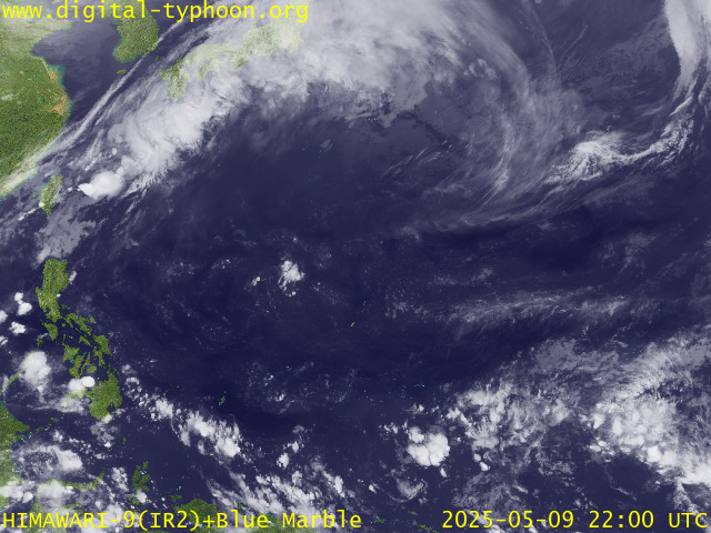
RECENT MTSAT-1R SATELLITE IMAGE:

> Image source: Digital-Typhoon.org (Nat'l. Institute of Informatics) (http://www.digital-typhoon.org )
__________________________________________________________________________________________
NOTES:

> Image source: Digital-Typhoon.
^ - JTWC commentary remarks (for Meteorologists) from their
latest warning.
latest warning.
* - Based on PAGASA's Philippine Storm Warning Signals,
# 4 being the highest. Red letters indicate new areas
being hoisted. For more explanations on these signals,
visit: http://www.typhoon2000.ph/signals.htm
** - Based on the Tropical Cyclone's Wave Height near
its center.
__________________________________________________________________________________________
>> To know the meteorological terminologies and acronyms
used on this update visit the ff:
http://typhoon2000.ph/tcterm.htm
http://www.nhc.noaa.gov/aboutgloss.shtml
http://www.srh.noaa.gov/oun/severewx/glossary.php
http://www.srh.weather.gov/fwd/glossarynation.html
http://www.nhc.noaa.gov/acronyms.shtml
__________________________________________________________________________________________
:: Typhoon2000.com (T2K) Mobile >> Powered by: Synermaxx
Receive the latest storm updates directly to your mobile phones! To know more:
Send T2K HELP to: 2800 (GLOBE & TM) | 216 (SMART & TNT) | 2288 (SUN)
Note: Globe & Smart charges P2.50 per message, while Sun at P2.00.
__________________________________________________________________________________________
For the complete details on TS SOULIK (21W)...go visit
our website @:
> http://www.typhoon2000.com
> http://www.maybagyo.com
# 4 being the highest. Red letters indicate new areas
being hoisted. For more explanations on these signals,
visit: http://www.typhoon2
** - Based on the Tropical Cyclone's Wave Height near
its center.
____________
>> To know the meteorological terminologies and acronyms
used on this update visit the ff:
http://typhoon2000.
http://www.nhc.
http://www.srh.
http://www.srh.
http://www.nhc.
____________
:: Typhoon2000.
Receive the latest storm updates directly to your mobile phones! To know more:
Send T2K HELP to: 2800 (GLOBE & TM) | 216 (SMART & TNT) | 2288 (SUN)
Note: Globe & Smart charges P2.50 per message, while Sun at P2.00.
For the complete details on TS SOULIK (21W)...go visit
our website @:
> http://www.typhoon2
> http://www.maybagyo
Change settings via the Web (Yahoo! ID required)
Change settings via email: Switch delivery to Daily Digest | Switch format to Traditional
Visit Your Group | Yahoo! Groups Terms of Use | Unsubscribe
SPONSORED LINKS
.
__,_._,___
No comments:
Post a Comment