Typhoon2000 STORM UPDATE #007
Name: TYPHOON YAGI [16W/0614]
Issued: 7:00 PM MANILA TIME (11:00 GMT) WED 20 SEPTEMBER 2006
Next Update: 7:00 AM (23:00 GMT) THU 21 SEPTEMBER 2006
Source: JTWC TROPICAL CYCLONE WARNING #014
_______________________________________________________________________
Next Update: 7:00 AM (23:00 GMT) THU 21 SEPTEMBER 2006
Source: JTWC TROPICAL CYCLONE WARNING #014
____________
YAGI (16W) ACCELERATING RAPIDLY TO THE WEST...LIKELY TO
BECOME A SUPER TYPHOON TOMORROW...AGRIHAN AND IWO JIMA
ISLANDS UNDER SERIOUS THREAT.
BECOME A SUPER TYPHOON TOMORROW...AGRIHAN AND IWO JIMA
ISLANDS UNDER SERIOUS THREAT.
+ FORECAST OUTLOOK: YAGI is expected to continue moving on
a fast westerly track for the next 12 hours & intensify. By
tomorrow afternoon (Thu Sep 21), YAGI may reach Super Typhoon
and start moving WNW with a turn to the NW in the direction
of Iwo Jima Island. The eye & its core (eyewall) shall pass
some 225 km NE of Iwo Jima Friday evening (Sep 22). The 3 to
5-day (Sep 23-25) Long Range Forecast shows the system doing
a sharp Northward turn, recurving later to the NE - sparing
Kyuhsu, Japan on a direct hit. During this time-frame, YAGI
shall move into an environment of increasing shear and lower
sea surface temperatures (SSTs), its strength weakening
rapidly down to a Category 2 typhoon and eventually losing
tropical characteristics (becoming Extratropical)
rests in Iwo Jima, Northernmost Marianas & Southeastern Japan
especially Honshu should continue closely monitor the progress
of this approaching typhoon.
+ EFFECTS: At this moment, YAGI is not yet affecting any Wes-
tern Pacific islands. However, the typhoon's southern outer
rainbands shall reach Agrihan Island tomorrow morning or
afternoon (Sep 21). Increasing dangerous storm tides with
large battering waves can be expected along the Northernmost
Mariana & Iwo Jima Islands tomorrow until Saturday (Sep 23)
...coastal flooding expected (13 to 18 feet).
Important Note: Please keep in mind that the above forecast
outlook, effects & current monsoon intensity, and tropical
cyclone watch changes every 06 to 12 hours!
____________
TIME/DATE: 5:00 PM MANILA TIME (09:00 GMT) 20 SEPTEMBER
LOCATION OF EYE: LATITUDE 19.7º N...LONGITUDE 153.3º E
DISTANCE 1: 950 KM (513 NM) NE OF SAIPAN, CNMI
DISTANCE 2: 1,145 KM (618 NM) NE OF HAGATNA, GUAM, CNMI
DISTANCE 3: 1,360 KM (735 NM) SE OF IWO JIMA ISLAND
MAX SUSTAINED WINDS [1-MIN AVG]: 220 KM/HR (120 KTS)
PEAK WIND GUSTS: 270 KM/HR (145 KTS)
SAFFIR-SIMPSON SCALE: CATEGORY FOUR (4)
MINIMUM CENTRAL PRESSURE (est.): 922 MILLIBARS (hPa)
RECENT MOVEMENT: WEST @ 28 KM/HR (15 KTS)
GENERAL DIRECTION: AGRIHAN-IWO JIMA AREA
STORM'S SIZE (IN DIAMETER): 630 KM (340 NM)/AVERAGE
MAX WAVE HEIGHT**: 39 FEET (11.8 METERS)
VIEW TRACKING MAP: 3 PM JST TIME WED SEPTEMBER 20
TSR WIND PROBABILITIES: CURRENT TO 120 HRS LEAD
PHILIPPINE STORM SIGNALS*: N/A
12, 24 & 48 HR. FORECAST:
2 AM (18 GMT) 21 SEP: 19.9N 151.0E / 230-280 KPH / W @ 28 KPH
2 PM (06 GMT) 21 SEP: 20.8N 148.2E / 240-295 KPH / WNW @ 26 KPH
2 PM (06 GMT) 22 SEP: 24.1N 144.3E / 240-295 KPH / NW @ 22 KPH
REMARKS: 2 PM (06 GMT) 20 SEPTEMBER POSITION: 19.6N 154.1E.
^TY YAGI IS CONTINUING TO TRACK WESTWARD UNDER THE INFLUENCE
OF A STRONG SUBTROPICAL HIGH PRESSURE RIDGE TO THE EAST OF
HONSHU, JAPAN. AT 36 HOURS, A DEEP MIDLATITUDE LOW PRESSURE
TROUGH WILL BEGIN TO BREAK DOWN THE SUBTROPICAL RIDGE. TY
YAGI WILL TAKE A NORTHWESTWARD TURN AS IT TRACKS ALONG THE
SOUTHWESTERN PERIPHERY OF THE RIDGE, REACHING THE RIDGE
AXIS NEAR 72 HOURS...(more info)
>> YAGI {pronounced: ya~gi}, meaning: Capricornus (goat).
Name contributed by: Japan
____________
____________
RECENT WEATHER UNDERGROUND TRACKING CHART:
Track Source: The Weather Underground Tropical Page (http://www.wundergr
________________________
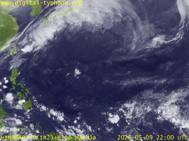
RECENT MTSAT-1R SATELLITE IMAGE:

> Image source: Digital-Typhoon.org (Nat'l. Institute of Informatics) (http://www.digital-typhoon.org )
__________________________________________________________________________________________
NOTES:

> Image source: Digital-Typhoon.
^ - JTWC commentary remarks (for Meteorologists) from their
latest warning.
latest warning.
* - Based on PAGASA's Philippine Storm Warning Signals,
# 4 being the highest. Red letters indicate new areas
being hoisted. For more explanations on these signals,
visit: http://www.typhoon2000.ph/signals.htm
** - Based on the Tropical Cyclone's Wave Height near
its center.
__________________________________________________________________________________________
>> To know the meteorological terminologies and acronyms
used on this update visit the ff:
http://typhoon2000.ph/tcterm.htm
http://www.nhc.noaa.gov/aboutgloss.shtml
http://www.srh.....noaa.gov/oun/severewx/glossary.php
http://www.srh.weather.gov/fwd/glossarynation.html
http://www.nhc.noaa.gov/acronyms.shtml
__________________________________________________________________________________________
:: Typhoon2000.com (T2K) Mobile >> Powered by: Synermaxx
Receive the latest storm updates directly to your mobile phones! To know more:
Send T2K HELP to: 2800 (GLOBE & TM) | 216 (SMART & TNT) | 2288 (SUN)
Note: Globe & Smart charges P2.50 per message, while Sun at P2.00.
__________________________________________________________________________________________
For the complete details on TY YAGI (16W)...go visit
our website @:
> http://www.typhoon2000.com
> http://www.maybagyo.com
# 4 being the highest. Red letters indicate new areas
being hoisted. For more explanations on these signals,
visit: http://www.typhoon2
** - Based on the Tropical Cyclone's Wave Height near
its center.
____________
>> To know the meteorological terminologies and acronyms
used on this update visit the ff:
http://typhoon2000.
http://www.nhc.
http://www.srh.
http://www.srh.
http://www.nhc.
____________
:: Typhoon2000.
Receive the latest storm updates directly to your mobile phones! To know more:
Send T2K HELP to: 2800 (GLOBE & TM) | 216 (SMART & TNT) | 2288 (SUN)
Note: Globe & Smart charges P2.50 per message, while Sun at P2.00.
For the complete details on TY YAGI (16W)...go visit
our website @:
> http://www.typhoon2
> http://www.maybagyo
Change settings via the Web (Yahoo! ID required)
Change settings via email: Switch delivery to Daily Digest | Switch format to Traditional
Visit Your Group | Yahoo! Groups Terms of Use | Unsubscribe
SPONSORED LINKS
.
__,_._,___
No comments:
Post a Comment