Typhoon2000 STORM UPDATE #01
Name: TROPICAL DEPRESSION 14W [LUIS]
Issued: 7:00 PM MANILA TIME (11:00 GMT) SUN 10 SEPTEMBER 2006
Next Update: 7:00 AM (23:00 GMT) MON 11 SEPTEMBER 2006
Source: JTWC TROPICAL CYCLONE WARNING #002
_______________________________________________________________________
Next Update: 7:00 AM (23:00 GMT) MON 11 SEPTEMBER 2006
Source: JTWC TROPICAL CYCLONE WARNING #002
____________
THE STRONG TROPICAL DISTURBANCE (LPA) WEST OF GUAM HAS
STRENGTHENED INTO A TROPICAL DEPRESSION 14W
...ENTERINGSTRENGTHENED INTO A TROPICAL DEPRESSION 14W
THE PHILIPPINE AREA OF RESPONSIBILITY (PAR)...NOW LOCALLY
NAMED AS "LUIS."
+ FORECAST OUTLOOK: 14W is expected to continue moving NW'ly
for the next 2 days and become a Tropical Storm early tomorrow
morning. 3-day Long Range Forecast (Sep 13) shows 14W turning
slightly to the West in the direction of Okinawa and the Ryukyu
Island Chain.
+ EFFECTS: N/A.
+ CURRENT MONSOON INTENSITY: Weak Southwest (SW) Monsoon cu-
rrently enhanced by a Tropical Disturbance (LPA) in the vicinity
of Batanes and is currently bringing cloudy skies with scattered
rains & thunderstorms across Luzon becoming more frequent along
the western sections including Quezon and Bicol Region.
+ TROPICAL CYCLONE WATCH: The broad Tropical Disturbance (LPA/95W/
1006 mb) West of Batanes Group of Islands is now over the South
China Sea or about 255 km NNW of Laoag City (20.4N 120.0E)...
it was moving West at 19 kph towards the Southern China.
Important Note: Please keep in mind that the above forecast outlook,
effects & current monsoon intensity, and tropical cyclone watch
changes every 06 to 12 hours!
____________
TIME/DATE: 5:00 PM MANILA TIME (09:00 GMT) 10 SEPTEMBER
LOCATION OF CENTER: LATITUDE 17.0º N...LONGITUDE 134.5º E
DISTANCE 1: 1,360 KM (735 NM) ESE OF TUGUEGARAO CITY, PH
DISTANCE 2: 1,325 KM (715 NM) ENE OF CASIGURAN, AURORA, PH
DISTANCE 3: 1,270 KM (685 NM) ENE OF NAGA CITY, PH
DISTANCE 4: 1,460 KM (790 NM) ENE OF METRO MANILA, PH
MAX SUSTAINED WINDS [1-MIN AVG]: 55 KM/HR (30 KTS)
PEAK WIND GUSTS: 75 KM/HR (40 KTS)
MINIMUM CENTRAL PRESSURE (est.): 1000 MILLIBARS (hPa)
MAX WAVE HEIGHT**: 11 FEET (3.3 METERS)
SAFFIR-SIMPSON SCALE: N/A
RECENT MOVEMENT: NW @ 22 KM/HR (12 KTS)
GENERAL DIRECTION: TAIWAN-OKINAWA AREA
STORM'S SIZE (IN DIAMETER): 445 KM (240 NM)/AVERAGE
VIEW TRACKING MAP: 2 PM SUN SEPTEMBER 10
TSR WIND PROBABILITIES: CURRENT TO 72 HRS LEAD
PHILIPPINE STORM SIGNALS*: N/A
12, 24 & 48 HR. FORECAST:
> 2 AM (18 GMT) 11 SEPTEMBER: 18.1N 133.7E / 65-85 KPH
> 2 PM (06 GMT) 11 SEPTEMBER: 19.4N 132.9E / 75-95 KPH
> 2 PM (06 GMT) 12 SEPTEMBER: 21.7N 131.2E / 95-120 KPH
REMARKS: 2 PM (06 GMT) 10 SEPTEMBER POSITION: 16.6N 134.8E.
^ANIMATED MULTISPECTRAL SATELLITE IMAGERY DEPICT AN INCREA-
SINGLY DEVELOPED LOW LEVEL CIRCULATION CENTER (LLCC). TD
14W IS TRACKING NORTHWESTWARD TOWARDS A WEAKNESS IN THE
SUBTROPICAL HIGH PRESSURE RIDGE (STHPR). THROUGH 72 HRS.
TD 14W WILL CONTINUE TO TRACK NORTHWESTWARD AROUND THE
SOUTHWESTERN PERIPHERY OF THE STHPR...(more info)
_______________________________________________________________________
REMARKS: 2 PM (06 GMT) 10 SEPTEMBER POSITION: 16.6N 134.8E.
^ANIMATED MULTISPECTRAL SATELLITE IMAGERY DEPICT AN INCREA-
SINGLY DEVELOPED LOW LEVEL CIRCULATION CENTER (LLCC). TD
14W IS TRACKING NORTHWESTWARD TOWARDS A WEAKNESS IN THE
SUBTROPICAL HIGH PRESSURE RIDGE (STHPR). THROUGH 72 HRS.
TD 14W WILL CONTINUE TO TRACK NORTHWESTWARD AROUND THE
SOUTHWESTERN PERIPHERY OF THE STHPR...(more info)
____________
PAGASA CURRENT POSITION, MOVEMENT AND INTENSITY (10-min. ave.):
> 4 PM (08 GMT) 10 SEPTEMBER: 15.8N 135.3E / NW @ 15 KPH / 55 kph
:: For the complete PAGASA bulletin, kindly visit their website
at: http://www.pagasa.dost.gov.ph/wb/tcupdate.shtml
_________________________________________________________________________________
RECENT WEATHER UNDERGROUND TRACKING CHART:
:: For the complete PAGASA bulletin, kindly visit their website
at: http://www.pagasa.
____________
RECENT WEATHER UNDERGROUND TRACKING CHART:
Track Source: The Weather Underground Tropical Page (http://www.wundergr
________________________
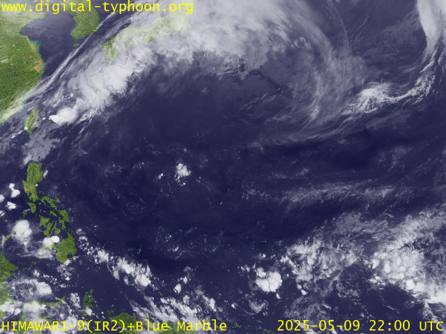
RECENT MTSAT-1R SATELLITE IMAGE:

> Image source: Digital-Typhoon.org (Nat'l. Institute of Informatics) (http://www.digital-typhoon.org )
__________________________________________________________________________________________
NOTES:

> Image source: Digital-Typhoon.
^ - JTWC commentary remarks (for Meteorologists) from their
latest warning.
latest warning.
* - Based on PAGASA's Philippine Storm Warning Signals,
# 4 being the highest. Red letters indicate new areas
being hoisted. For more explanations on these signals,
visit: http://www.typhoon2000.ph/signals.htm
** - Based on the Tropical Cyclone's Wave Height near
its center.
__________________________________________________________________________________________
>> To know the meteorological terminologies and acronyms
used on this update visit the ff:
http://typhoon2000.ph/tcterm.htm
http://www.nhc.noaa.gov/aboutgloss.shtml
http://www.srh.noaa.gov/oun/severewx/glossary.php
http://www.srh.weather.gov/fwd/glossarynation.html
http://www.nhc.noaa.gov/acronyms.shtml
__________________________________________________________________________________________
:: Typhoon2000.com (T2K) Mobile >> Powered by: Synermaxx
Receive the latest storm updates directly to your mobile phones! To know more:
Send T2K HELP to: 2800 (GLOBE & TM) | 216 (SMART & TNT) | 2288 (SUN)
__________________________________________________________________________________________
For the complete details on TD 14W (LUIS)...go visit
our website @:
> http://www.typhoon2000.com
> http://www.maybagyo.com
# 4 being the highest. Red letters indicate new areas
being hoisted. For more explanations on these signals,
visit: http://www.typhoon2
** - Based on the Tropical Cyclone's Wave Height near
its center.
____________
>> To know the meteorological terminologies and acronyms
used on this update visit the ff:
http://typhoon2000.
http://www.nhc.
http://www.srh.
http://www.srh.
http://www.nhc.
____________
:: Typhoon2000.
Receive the latest storm updates directly to your mobile phones! To know more:
Send T2K HELP to: 2800 (GLOBE & TM) | 216 (SMART & TNT) | 2288 (SUN)
For the complete details on TD 14W (LUIS)...go visit
our website @:
> http://www.typhoon2
> http://www.maybagyo
Change settings via the Web (Yahoo! ID required)
Change settings via email: Switch delivery to Daily Digest | Switch format to Traditional
Visit Your Group | Yahoo! Groups Terms of Use | Unsubscribe
SPONSORED LINKS
.
__,_._,___
No comments:
Post a Comment