Typhoon2000 STORM UPDATE #02
Name: TROPICAL STORM SHANSHAN [LUIS/14W/0613]
Issued: 7:00 AM MANILA TIME (23:00 GMT) MON 11 SEPTEMBER 2006
Next Update: 7:00 PM (11:00 GMT) MON 11 SEPTEMBER 2006
Source: JTWC TROPICAL CYCLONE WARNING #004
_______________________________________________________________________
Next Update: 7:00 PM (11:00 GMT) MON 11 SEPTEMBER 2006
Source: JTWC TROPICAL CYCLONE WARNING #004
____________
...14W (LUIS) HAS RAPIDLY STRENGTHENED INTO A STRONG
TROPICAL STORM
...NOW INTERNATIONALLY KNOWN AS TROPICAL STORM
SHANSHAN...AIMING FOR TAIWAN-YAEYAMA-
+ FORECAST OUTLOOK: SHANSHAN is expected to continue moving
NW'ly for the next 12 hours and shall become a Typhoon later
today..turning more to the WNW tomorrow due to a building High
Pressure north of the system. The 3 to 5-day Long Range Forecast
(Sep 14-16) shows the system in a slow WNW to NW path closer to
Yaeyama Island Chain as a strong Category 2 Typhoon. Meanwhile,
Japan Meteorological Agency (JMA) & other computer models depicts
a more Westerly component - bringing the system closer to Extreme
Northern Luzon (Batanes-Cagayan-
(Sep 14).
+ EFFECTS: N/A.
+ CURRENT MONSOON INTENSITY: Southwest (SW) Monsoon currently en-
hanced by a Tropical Disturbance (LPA) west of Batanes and is
currently bringing cloudy skies with occasional rains & thunder-
storms across Luzon becoming more frequent along the western
sections including Metro Manila, Quezon and Bicol Provinces.
+ TROPICAL CYCLONE WATCH: The broad Tropical Disturbance (LPA/
95W/1006 mb) West of Batanes Group of Islands is now over the
South China Sea or about 300 km NW of Laoag City (20.2N 118.7E)
..it was moving West at 15 kph towards the Southern China.
Important Note: Please keep in mind that the above forecast outlook,
effects & current monsoon intensity, and tropical cyclone watch
changes every 06 to 12 hours!
____________
TIME/DATE: 5:00 AM MANILA TIME (21:00 GMT) 11 SEPTEMBER
LOCATION OF CENTER: LATITUDE 18.0º N...LONGITUDE 133.9º E
DISTANCE 1: 1,290 KM (695 NM) EAST OF APARRI, CAGAYAN, PH
DISTANCE 2: 1,290 KM (695 NM) ENE OF TUGUEGARAO CITY, PH
DISTANCE 3: 1,270 KM (685 NM) ENE OF CASIGURAN, AURORA, PH
DISTANCE 4: 1,415 KM (765 NM) NE OF METRO MANILA, PH
MAX SUSTAINED WINDS [1-MIN AVG]: 100 KM/HR (55 KTS)
PEAK WIND GUSTS: 130 KM/HR (70 KTS)
MINIMUM CENTRAL PRESSURE (est.): 984 MILLIBARS (hPa)
MAX WAVE HEIGHT**: 19 FEET (5.7 METERS)
SAFFIR-SIMPSON SCALE: N/A
RECENT MOVEMENT: NW @ 15 KM/HR (08 KTS)
GENERAL DIRECTION: TAIWAN-OKINAWA AREA
STORM'S SIZE (IN DIAMETER): 480 KM (260 NM)/AVERAGE
VIEW TRACKING MAP: 2 AM MON SEPTEMBER 11
TSR WIND PROBABILITIES: CURRENT TO 120 HRS LEAD
PHILIPPINE STORM SIGNALS*: N/A
12, 24 & 48 HR. FORECAST:
> 2 PM (06 GMT) 11 SEPTEMBER: 19.0N 133.2E / 130-160 KPH
> 2 AM (18 GMT) 12 SEPTEMBER: 20.2N 132.2E / 140-165 KPH
> 2 AM (18 GMT) 13 SEPTEMBER: 21.5N 130.2E / 150-185 KPH
REMARKS: 2 AM (18 GMT) 11 SEPTEMBER POSITION: 17.7N 134.1E.
^TS SHANSHAN (14W )IS TRACKING NORTHWESTWARD ALONG THE
SOUTHWESTERN PERIPHERY OF A SUBTROPICAL HIGH PRESSURE
STEERING RIDGE. THE STORM IS EXPECTED TO TURN TOWARD A
MORE WESTWARD TRACK AS THE STEERING RIDGE EXTENDS WESTWARD
TO THE NORTH OF THE STORM. THE AVAILABLE DYNAMIC AIDS ARE
IN FAIR AGREEMENT IN THEIR DEPICTION OF A STEADY NORTH-
WESTWARD TO WEST-NORTHWESTWARD TRACK THROUGH 72
HRS...(more info)
>> SHANSHAN {pronounced: sarn~sarn}, meaning: A fairly
common pet name for young girls. Name contributed
by: Hong Kong, China
_______________________________________________________________________
REMARKS: 2 AM (18 GMT) 11 SEPTEMBER POSITION: 17.7N 134.1E.
^TS SHANSHAN (14W )IS TRACKING NORTHWESTWARD ALONG THE
SOUTHWESTERN PERIPHERY OF A SUBTROPICAL HIGH PRESSURE
STEERING RIDGE. THE STORM IS EXPECTED TO TURN TOWARD A
MORE WESTWARD TRACK AS THE STEERING RIDGE EXTENDS WESTWARD
TO THE NORTH OF THE STORM. THE AVAILABLE DYNAMIC AIDS ARE
IN FAIR AGREEMENT IN THEIR DEPICTION OF A STEADY NORTH-
WESTWARD TO WEST-NORTHWESTWARD TRACK THROUGH 72
HRS...(more info)
>> SHANSHAN {pronounced: sarn~sarn}, meaning: A fairly
common pet name for young girls. Name contributed
by: Hong Kong, China
____________
PAGASA CURRENT POSITION, MOVEMENT AND INTENSITY (10-min. ave.):
> 2 AM (18 GMT) 11 SEPTEMBER: 17.7N 134.2E / NW @ 15 KPH / 65 kph
:: For the complete PAGASA bulletin, kindly visit their website
at: http://www.pagasa.dost.gov.ph/wb/tcupdate.shtml
_________________________________________________________________________________
RECENT WEATHER UNDERGROUND TRACKING CHART:
:: For the complete PAGASA bulletin, kindly visit their website
at: http://www.pagasa.
____________
RECENT WEATHER UNDERGROUND TRACKING CHART:
Track Source: The Weather Underground Tropical Page (http://www.wundergr
________________________
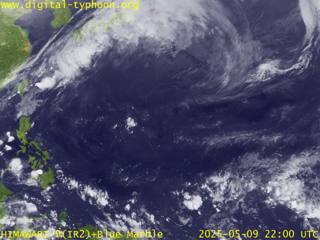
RECENT MTSAT-1R SATELLITE IMAGE:

> Image source: Digital-Typhoon.org (Nat'l. Institute of Informatics) (http://www.digital-typhoon.org )
__________________________________________________________________________________________
NOTES:

> Image source: Digital-Typhoon.
^ - JTWC commentary remarks (for Meteorologists) from their
latest warning.
latest warning.
* - Based on PAGASA's Philippine Storm Warning Signals,
# 4 being the highest. Red letters indicate new areas
being hoisted. For more explanations on these signals,
visit: http://www.typhoon2000.ph/signals.htm
** - Based on the Tropical Cyclone's Wave Height near
its center.
__________________________________________________________________________________________
>> To know the meteorological terminologies and acronyms
used on this update visit the ff:
http://typhoon2000.ph/tcterm.htm
http://www.nhc.noaa.gov/aboutgloss.shtml
http://www.srh...noaa.gov/oun/severewx/glossary.php
http://www.srh.weather.gov/fwd/glossarynation.html
http://www.nhc.noaa.gov/acronyms.shtml
__________________________________________________________________________________________
:: Typhoon2000.com (T2K) Mobile >> Powered by: Synermaxx
Receive the latest storm updates directly to your mobile phones! To know more:
Send T2K HELP to: 2800 (GLOBE & TM) | 216 (SMART & TNT) | 2288 (SUN)
__________________________________________________________________________________________
For the complete details on TS SHANSHAN (LUIS)...go visit
our website @:
> http://www.typhoon2000.com
> http://www.maybagyo.com
# 4 being the highest. Red letters indicate new areas
being hoisted. For more explanations on these signals,
visit: http://www.typhoon2
** - Based on the Tropical Cyclone's Wave Height near
its center.
____________
>> To know the meteorological terminologies and acronyms
used on this update visit the ff:
http://typhoon2000.
http://www.nhc.
http://www.srh.
http://www.srh.
http://www.nhc.
____________
:: Typhoon2000.
Receive the latest storm updates directly to your mobile phones! To know more:
Send T2K HELP to: 2800 (GLOBE & TM) | 216 (SMART & TNT) | 2288 (SUN)
For the complete details on TS SHANSHAN (LUIS)...go visit
our website @:
> http://www.typhoon2
> http://www.maybagyo
Change settings via the Web (Yahoo! ID required)
Change settings via email: Switch delivery to Daily Digest | Switch format to Traditional
Visit Your Group | Yahoo! Groups Terms of Use | Unsubscribe
SPONSORED LINKS
.
__,_._,___
No comments:
Post a Comment