Typhoon2000 STORM UPDATE #010
Name: SUPER TYPHOON YAGI [16W/0614]
Issued: 7:00 AM MANILA TIME (23:00 GMT) FRI 22 SEPTEMBER 2006
Next Update: 7:00 PM (11:00 GMT) FRI 22 SEPTEMBER 2006
Source: JTWC TROPICAL CYCLONE WARNING #020
_______________________________________________________________________
Next Update: 7:00 PM (11:00 GMT) FRI 22 SEPTEMBER 2006
Source: JTWC TROPICAL CYCLONE WARNING #020
____________
SUPER TYPHOON YAGI (16W) STRENGTHENED TO A 260-KM/HR
CATEGORY FIVE CYCLONE...MOVING CLOSER TO IWO JIMA-BONIN
ISLANDS...OUTER BANDS NOW OVER THE AREA.
CATEGORY FIVE CYCLONE...MOVING CLOSER TO IWO JIMA-BONIN
ISLANDS...OUTER BANDS NOW OVER THE AREA.
+ FORECAST OUTLOOK: YAGI is expected to continue moving
WNW to NW'ly for the next 24 hours, with the eye & core
(eyewall) passing very close to Iwo Jima Island tonight
approx 7 PM Japan Standard Time (JST). The 2 to 4-day
(Sep 24-26) Long Range Forecast shows the system doing
a sharp Northward turn & recurving to the NE - sparing
Kyushu, Japan on a direct hit. This dangerous super ty-
phoon is forecast to move into an environment of increa-
sing wind shear and lower sea surface temperatures (SSTs),
thus, gradual weakening can be expected and eventually
losing tropical characteristics sometime Monday (Sep 25)
- becoming an Extratropical Cyclone. All interests in Iwo
Jima & Southeastern Japan especially Honshu should con-
tinue closely monitoring the progress of this approa-
ching super typhoon.
+ EFFECTS: The typhoon's western outer bands has arrived
over Iwo Jima & Bonin Islands. These islands must expect
deteriotating weather conditions later today as the Inner
Bands and its core approaches. Dangerous storm tides with
large battering waves can be expected along the coastal
areas of Iwo Jima & Bonin Islands & Kyushu, Japan today
until Sunday (Sep 24)...Coastal Storm Surge flooding of
until Sunday (Sep 24)...Coastal Storm Surge flooding of
greater than than 18 feet is most likely to occur near
YAGI's core.
+ TROPICAL CYCLONE WATCH: The Tropical Disturbance (LPA/
96W/1006 mb) over the South China Sea now intensifying.
Its ill-defined center was located about 650 km WSW of
Manila (13.8N 115.0E)...drifting West during the past 6
hours w/ winds of 35 km/hr. This system will be closely
monitored for possible development into a Tropical De-
pression within a day or two.
Important Note: Please keep in mind that the above forecast
outlook, effects & current monsoon intensity, and tropical
cyclone watch changes every 06 to 12 hours!
_______________________________________________________________________
TIME/DATE: 5:00 AM MANILA TIME (21:00 GMT) 22 SEPTEMBER
LOCATION OF EYE: LATITUDE 23.1º N...LONGITUDE 144.1º E
DISTANCE 1: 340 KM (183 NM) SE OF IWO JIMA ISLAND
YAGI's core.
+ TROPICAL CYCLONE WATCH: The Tropical Disturbance (LPA/
96W/1006 mb) over the South China Sea now intensifying.
Its ill-defined center was located about 650 km WSW of
Manila (13.8N 115.0E)...drifting West during the past 6
hours w/ winds of 35 km/hr. This system will be closely
monitored for possible development into a Tropical De-
pression within a day or two.
Important Note: Please keep in mind that the above forecast
outlook, effects & current monsoon intensity, and tropical
cyclone watch changes every 06 to 12 hours!
____________
TIME/DATE: 5:00 AM MANILA TIME (21:00 GMT) 22 SEPTEMBER
LOCATION OF EYE: LATITUDE 23.1º N...LONGITUDE 144.1º E
DISTANCE 1: 340 KM (183 NM) SE OF IWO JIMA ISLAND
DISTANCE 2: 895 KM (485 NM) NNW OF SAIPAN, CNMI
MAX SUSTAINED WINDS [1-MIN AVG]: 260 KM/HR (140 KTS)DISTANCE 3: 1,080 KM (583 NM) NORTH OF HAGATNA, GUAM, CNMI
DISTANCE 4: 1,455 KM (785 NM) SSE OF TOKYO, JAPAN
PEAK WIND GUSTS: 315 KM/HR (170 KTS)
SAFFIR-SIMPSON SCALE: CATEGORY FIVE (5)
MINIMUM CENTRAL PRESSURE (est.): 898 MILLIBARS (hPa)
RECENT MOVEMENT: NW @ 31 KM/HR (17 KTS)
GENERAL DIRECTION: IWO JIMA-BONIN ISLAND AREA
STORM'S SIZE (IN DIAMETER): 665 KM (360 NM)/AVERAGE/LARGE
MAX WAVE HEIGHT**: 42 FEET (12.8 METERS)
VIEW TRACKING MAP: 3 AM JST TIME FRI SEPTEMBER 22
TSR WIND PROBABILITIES: CURRENT TO 96 HRS LEAD
PHILIPPINE STORM SIGNALS*: N/A
12, 24 & 48 HR. FORECAST:
2 PM (06 GMT) 22 SEP: 24.5N 142.4E / 260-315 KPH / NW @ 28 KPH
2 AM (18 GMT) 23 SEP: 26.4N 141.2E / 250-305 KPH / NNW @ 20 KPH
2 AM (18 GMT) 24 SEP: 31.5N 142.1E / 205-250 KPH / NNE @ 28 KPH
REMARKS: 2 AM (18 GMT) 22 SEPTEMBER POSITION: 22.6N 144.7E.
^STY YAGI CONTINUES TO TRACK NORTHWESTWARD ALONG THE SOUTH-
WESTERN PERIPHERY OF A STRONG SUBTROPICAL RIDGE CENTERED
SOUTHEAST OF HONSHU. STY YAGI IS FORECAST TO REACH THE AXIS
OF THE STEERING RIDGE BY 24 HOURS AND BEGIN TO TRACK NORTH-
NORTHEASTWARD. STY YAGI IS EXPECTED TO ACCELERATE AND BEGIN
EXTRATROPICAL TRANSITION NEAR 48 HOURS...(more info)
>> YAGI {pronounced: ya~gi}, meaning: Capricornus (goat).
Name contributed by: Japan
____________
____________
RECENT WEATHER UNDERGROUND TRACKING CHART:
Track Source: The Weather Underground Tropical Page (http://www.wundergr
________________________
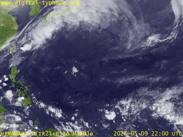
RECENT MTSAT-1R SATELLITE IMAGE:

> Image source: Digital-Typhoon.org (Nat'l. Institute of Informatics) (http://www.digital-typhoon.org )
__________________________________________________________________________________________
NOTES:

> Image source: Digital-Typhoon.
^ - JTWC commentary remarks (for Meteorologists) from their
latest warning.
latest warning.
* - Based on PAGASA's Philippine Storm Warning Signals,
# 4 being the highest. Red letters indicate new areas
being hoisted. For more explanations on these signals,
visit: http://www.typhoon2000.ph/signals.htm
** - Based on the Tropical Cyclone's Wave Height near
its center.
__________________________________________________________________________________________
>> To know the meteorological terminologies and acronyms
used on this update visit the ff:
http://typhoon2000.ph/tcterm.htm
http://www.nhc.noaa.gov/aboutgloss.shtml
http://www.srh........noaa.gov/oun/severewx/glossary.php
http://www.srh.weather.gov/fwd/glossarynation.html
http://www.nhc.noaa.gov/acronyms.shtml
__________________________________________________________________________________________
:: Typhoon2000.com (T2K) Mobile >> Powered by: Synermaxx
Receive the latest storm updates directly to your mobile phones! To know more:
Send T2K HELP to: 2800 (GLOBE & TM) | 216 (SMART & TNT) | 2288 (SUN)
Note: Globe & Smart charges P2.50 per message, while Sun at P2.00.
__________________________________________________________________________________________
For the complete details on STY YAGI (16W)...go visit
our website @:
> http://www.typhoon2000.com
> http://www.maybagyo.com
# 4 being the highest. Red letters indicate new areas
being hoisted. For more explanations on these signals,
visit: http://www.typhoon2
** - Based on the Tropical Cyclone's Wave Height near
its center.
____________
>> To know the meteorological terminologies and acronyms
used on this update visit the ff:
http://typhoon2000.
http://www.nhc.
http://www.srh.
http://www.srh.
http://www.nhc.
____________
:: Typhoon2000.
Receive the latest storm updates directly to your mobile phones! To know more:
Send T2K HELP to: 2800 (GLOBE & TM) | 216 (SMART & TNT) | 2288 (SUN)
Note: Globe & Smart charges P2.50 per message, while Sun at P2.00.
For the complete details on STY YAGI (16W)...go visit
our website @:
> http://www.typhoon2
> http://www.maybagyo
Change settings via the Web (Yahoo! ID required)
Change settings via email: Switch delivery to Daily Digest | Switch format to Traditional
Visit Your Group | Yahoo! Groups Terms of Use | Unsubscribe
SPONSORED LINKS
.
__,_._,___
No comments:
Post a Comment