Typhoon2000 STORM UPDATE #009
Name: TYPHOON SHANSHAN [LUIS/14W/0613]
Issued: 7:00 PM MANILA TIME (11:00 GMT) THU 14 SEPTEMBER 2006
Next Update: 7:00 AM (23:00 GMT) FRI 15 SEPTEMBER 2006
Source: JTWC TROPICAL CYCLONE WARNING #018
_______________________________________________________________________
Next Update: 7:00 AM (23:00 GMT) FRI 15 SEPTEMBER 2006
Source: JTWC TROPICAL CYCLONE WARNING #018
____________
TYPHOON SHANSHAN (LUIS) REGAINS CATEGORY TWO STRENGTH WITH
WINDS OF 160 KM/HR...NOW TURNING WEST-NORTHWEST SLOWLY.
WINDS OF 160 KM/HR...NOW TURNING WEST-NORTHWEST SLOWLY.
+ FORECAST OUTLOOK: SHANSHAN is expected to continue moving
WNW slowly for the next 12 hours, turning more Northerly
tomorrow until early morning Saturday (Sep 16) - passing
over the islands of Yaeyama as a Category 3 system (185
km/hr). The core (eye & eyewall) shall pass some 200 km NW
of Okinawa, Japan by Saturday evening (Sep 16). The 3 to
5-day Long Range Forecast (Sep 17-19) shows the system re-
curving and gaining speed towards the NE (Sunday afternoon)
moving across the Korea Strait. All interests in South
Korea & the main Japanese Island of Kyushu should closely
monitor the progress of Typhoon SHANSHAN.
+ EFFECTS: The typhoon's outer rainbands are now approa-
ching the Batanes and NE Luzon area...expected to reach
the area tonight or early tomorrow, and over Eastern Tai-
wan & Yaeyama Islands tomorrow through Saturday (Sep 15
or 16). Passing moderate to heavy rains with increasing
gale force winds of up to 60 km/hr can be expected along
its outer bands. Large ocean swells generated by SHANSHAN
are now affecting the beach-front areas of Northern Luzon,
Batanes-Calayan-
Taiwan. Precautionary measures must be implemented if ne-
cessary, along the affected areas. Meanwhile, coastal
Storm Surge flooding of 9 to 12 feet above normal tide
levels...along with large and dangerous battering waves...
can be expected near and to the north of where the center
makes a passby over Eastern Taiwan-Yaeyama-
Saturday & Sunday
+ CURRENT MONSOON INTENSSITY: The Southwest (SW) Monsoon may
be slightly enhanced along the western sections of Visayas
and Luzon beginning tonight. Cloudy skies with widespread
rains & thunderstorms can be expected.
+ TROPICAL CYCLONE WATCH: The new active Tropical Disturbance
(LPA/96W/1006 mb) has been disorganized over the past 6 hours
and was estimated about 1,190 km ESE of Guam (12.3N 155.7E)
...moving North slowly with winds of 30 km/hr. This distur-
bance will be closely monitored for further development
into a Tropical Depression within a day or two.
Important Note: Please keep in mind that the above forecast outlook,
effects & current monsoon intensity, and tropical cyclone watch
changes every 06 to 12 hours!
____________
TIME/DATE: 5:00 PM MANILA TIME (09:00 GMT) 14 SEPTEMBER
LOCATION OF EYE: LATITUDE 20.5º N...LONGITUDE 125.2º E
DISTANCE 1: 335 KM (182 NM) EAST OF BASCO, BATANES, PH
DISTANCE 2: 435 KM (235 NM) NE OF APARRI, CAGAYAN, PH
DISTANCE 3: 725 KM (390 NM) SSW OF OKINAWA, JAPAN
DISTANCE 4: 620 KM (335 NM) SE OF TAIPEI, TAIWAN
MAX SUSTAINED WINDS [1-MIN AVG]: 160 KM/HR (85 KTS)
PEAK WIND GUSTS: 195 KM/HR (105 KTS)
SAFFIR-SIMPSON SCALE: CATEGORY TWO (2)
MINIMUM CENTRAL PRESSURE (est.): 958 MILLIBARS (hPa)
RECENT MOVEMENT: WNW @ 09 KM/HR (05 KTS)
GENERAL DIRECTION: TAIWAN-YAEYAMA ISLANDS AREA
STORM'S SIZE (IN DIAMETER): 555 KM (300 NM)/AVERAGE
MAX WAVE HEIGHT**: 32 FEET (9.7 METERS)
VIEW TRACKING MAP: 2 PM HKT TIME THU SEPTEMBER 14
TSR WIND PROBABILITIES: CURRENT TO 120 HRS LEAD
PHILIPPINE STORM SIGNALS*:
#02 - BATANES, CALAYAN & BABUYAN GROUP OF ISLANDS &
NORTHERN CAGAYAN.
#01 - REST OF CAGAYAN, APAYAO & ILOCOS NORTE.
12, 24 & 48 HR. FORECAST:
> 2 AM (18 GMT) 15 SEPTEMBER: 21.0N 124.4E / 175-215 KPH
> 2 PM (06 GMT) 15 SEPTEMBER: 22.4N 123.7E / 185-230 KPH
> 2 PM (06 GMT) 16 SEPTEMBER: 26.3N 125.2E / 175-215 KPH
REMARKS: 2 PM (06 GMT) 14 SEPTEMBER POSITION: 20.3N 125.5E.
^TY SHANSHAN HAS CONTINUED TO MAINTAIN A WESTWARD TRACK
OVER THE LAST 12 HOURS ON THE SOUTHERN PERIPHERY OF A SUB-
TROPICAL RIDGE SOUTH OF JAPAN. TY SHANSHAN IS EXPECTED TO
BEGIN A POLEWARD TURN AROUND 24 HOURS. THE ANALYSIS OF THE
SUBTROPICAL RIDGE TO THE NORTH OF THE SYSTEM SHOWS THAT THE
RIDGING IS NOT BREAKING DOWN AS QUICKLY AS PREVIOUSLY FORE-
CAST. THE SHORTWAVE LOW PRESSURE TROUGHS PASSING NORTH OF
THE RIDGING HAVE NOT BEEN SUFFICIENTLY DEEP ENOUGH TO
WEAKEN THE RIDGE AS THE DYNAMIC AIDS DEPICT. THE FORECAST
IS BASED ON A CONSENSUS OF ALL AVAILABLE DYNAMIC AIDS, BUT
DUE TO THE SLOWER TIMING OF THE RIDGE BREAKDOWN AND RECUR-
VATURE, THE TRACK IS WESTWARD OF THE CONSENSUS...(more info)
>> SHANSHAN {pronounced: sarn~sarn}, meaning: A fairly
common pet name for young girls. Name contributed
by: Hong Kong, China
_______________________________________________________________________
REMARKS: 2 PM (06 GMT) 14 SEPTEMBER POSITION: 20.3N 125.5E.
^TY SHANSHAN HAS CONTINUED TO MAINTAIN A WESTWARD TRACK
OVER THE LAST 12 HOURS ON THE SOUTHERN PERIPHERY OF A SUB-
TROPICAL RIDGE SOUTH OF JAPAN. TY SHANSHAN IS EXPECTED TO
BEGIN A POLEWARD TURN AROUND 24 HOURS. THE ANALYSIS OF THE
SUBTROPICAL RIDGE TO THE NORTH OF THE SYSTEM SHOWS THAT THE
RIDGING IS NOT BREAKING DOWN AS QUICKLY AS PREVIOUSLY FORE-
CAST. THE SHORTWAVE LOW PRESSURE TROUGHS PASSING NORTH OF
THE RIDGING HAVE NOT BEEN SUFFICIENTLY DEEP ENOUGH TO
WEAKEN THE RIDGE AS THE DYNAMIC AIDS DEPICT. THE FORECAST
IS BASED ON A CONSENSUS OF ALL AVAILABLE DYNAMIC AIDS, BUT
DUE TO THE SLOWER TIMING OF THE RIDGE BREAKDOWN AND RECUR-
VATURE, THE TRACK IS WESTWARD OF THE CONSENSUS...(more info)
>> SHANSHAN {pronounced: sarn~sarn}, meaning: A fairly
common pet name for young girls. Name contributed
by: Hong Kong, China
____________
PAGASA CURRENT POSITION, MOVEMENT AND INTENSITY (10-min. ave.):
> 4 PM (08 GMT) 14 SEPTEMBER: 20.4N 125.3E / WEST @ 11 KPH / 150 kph
:: For the complete PAGASA bulletin, kindly visit their website
at: http://www.pagasa.dost.gov.ph/wb/tcupdate.shtml
_________________________________________________________________________________
RECENT WEATHER UNDERGROUND TRACKING CHART:
:: For the complete PAGASA bulletin, kindly visit their website
at: http://www.pagasa.
____________
RECENT WEATHER UNDERGROUND TRACKING CHART:
Track Source: The Weather Underground Tropical Page (http://www.wundergr
________________________
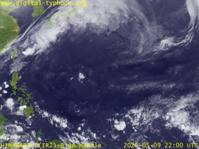
RECENT MTSAT-1R SATELLITE IMAGE:

> Image source: Digital-Typhoon.org (Nat'l. Institute of Informatics) (http://www.digital-typhoon.org )
__________________________________________________________________________________________
NOTES:

> Image source: Digital-Typhoon.
^ - JTWC commentary remarks (for Meteorologists) from their
latest warning.
latest warning.
* - Based on PAGASA's Philippine Storm Warning Signals,
# 4 being the highest. Red letters indicate new areas
being hoisted. For more explanations on these signals,
visit: http://www.typhoon2000.ph/signals.htm
** - Based on the Tropical Cyclone's Wave Height near
its center.
__________________________________________________________________________________________
>> To know the meteorological terminologies and acronyms
used on this update visit the ff:
http://typhoon2000.ph/tcterm.htm
http://www.nhc.noaa.gov/aboutgloss.shtml
http://www.srh.noaa.gov/oun/severewx/glossary.php
http://www.srh.weather.gov/fwd/glossarynation.html
http://www.nhc.noaa.gov/acronyms.shtml
__________________________________________________________________________________________
:: Typhoon2000.com (T2K) Mobile >> Powered by: Synermaxx
Receive the latest storm updates directly to your mobile phones! To know more:
Send T2K HELP to: 2800 (GLOBE & TM) | OFFLINE (SMART & TNT) | 2288 (SUN)
Note: Globe & Smart charges P2.50 per message, while Sun at P2.00.
__________________________________________________________________________________________
For the complete details on TY SHANSHAN (LUIS)...go visit
our website @:
> http://www.typhoon2000.com
> http://www.maybagyo.com
# 4 being the highest. Red letters indicate new areas
being hoisted. For more explanations on these signals,
visit: http://www.typhoon2
** - Based on the Tropical Cyclone's Wave Height near
its center.
____________
>> To know the meteorological terminologies and acronyms
used on this update visit the ff:
http://typhoon2000.
http://www.nhc.
http://www.srh.
http://www.srh.
http://www.nhc.
____________
:: Typhoon2000.
Receive the latest storm updates directly to your mobile phones! To know more:
Send T2K HELP to: 2800 (GLOBE & TM) | OFFLINE (SMART & TNT) | 2288 (SUN)
Note: Globe & Smart charges P2.50 per message, while Sun at P2.00.
For the complete details on TY SHANSHAN (LUIS)...go visit
our website @:
> http://www.typhoon2
> http://www.maybagyo
Change settings via the Web (Yahoo! ID required)
Change settings via email: Switch delivery to Daily Digest | Switch format to Traditional
Visit Your Group | Yahoo! Groups Terms of Use | Unsubscribe
SPONSORED LINKS
.
__,_._,___
No comments:
Post a Comment