Typhoon2000 STORM UPDATE #001
Name: TROPICAL DEPRESSION 25W [SENIANG]
Issued: 7:00 PM MANILA TIME (11:00 GMT) THU 07 DECEMBER 2006
Next Update: 7:00 AM (23:00 GMT) FRI 08 DECEMBER 2006
Source: JTWC TROPICAL CYCLONE WARNING #002
Next Update: 7:00 AM (23:00 GMT) FRI 08 DECEMBER 2006
Source: JTWC TROPICAL CYCLONE WARNING #002
To all subscribers: I would like to thank you so much for all
your touching emails and of course your continued support on
my typhoon information service. God bless! ~ Michael Padua
_______________________________________________________________________
____________
TROPICAL DEPRESSION 25W (SENIANG) NEWLY-FORMED NEAR PALAU
ISLAND...ENTERS THE PHILIPPINE AREA OF RESPONSIBILITY
(PAR)...THREATENS SAMAR-LEYTE AREA
...All interests in the Samar, Surigao & Bicol Provinces
particularly along the slopes of Mayon Volcano should
closely monitor the progress of this potential storm.
...All interests in the Samar, Surigao & Bicol Provinces
particularly along the slopes of Mayon Volcano should
closely monitor the progress of this potential storm.
+ FORECAST OUTLOOK: 25W is expected to turn more West-
ward for the next 2 to 3 days and shall cross Eastern
& Central Visayas, making landfall over Northern Leyte
or in the vicinity of Ormoc City Saturday afternoon,
Dec 9 as a 150-km/hr Typhoon and pass over the northern
tip of Cebu, the coastal areas of Northern Negros in
the evening (Dec 9). The center is forecast to cross
Central Panay early morning Sunday (Dec 10). Take note
that the long range forecast are bound for large margin
of errors.
+ EFFECTS: The circulation of 25W continues to affect
the small islands of Palau, Yap and Ulithi. Moderate
to heavy rains with moderate winds will continue to
prevail over the area today.
outlook, effects & current monsoon intensity, and tropical
cyclone watch changes every 06 to 12 hours!
____________
TIME/DATE: 5:00 PM MANILA TIME (09:00 GMT) 07 DECEMBER
LOCATION OF CENTER: LATITUDE 9.7º N...LONGITUDE 134.7º E
DISTANCE 1: 1,010 KM (545 NM) EAST OF SURIGAO CITY
DISTANCE 2: 1,255 KM (678 NM) ESE OF LEGAZPI CITY
DISTANCE 3: 1,325 KM (715 NM) ESE OF NAGA CITY
DISTANCE 4: 1,075 KM (580 NM) ESE OF TACLOBAN CITY
DISTANCE 5: 1,185 KM (640 NM) ESE OF CEBU CITY
PEAK WIND GUSTS: 65 KM/HR (35 KTS)
SAFFIR-SIMPSON SCALE: N/A
MINIMUM CENTRAL PRESSURE (est.): 1002 MILLIBARS (hPa)
RECENT MOVEMENT: WNW @ 28 KM/HR (15 KTS)
GENERAL DIRECTION: SOUTHERN SAMAR-NORTHERN LEYTE AREA
STORM'S SIZE (IN DIAMETER): ... KM (... NM)/N/A
MAX WAVE HEIGHT**: 12 FEET (3.6 METERS)
VIEW TRACKING MAP: 5 PM PST THU DECEMBER 07
TSR WIND PROBABILITIES: CURRENT TO 120 HRS LEAD
PHILIPPINE STORM SIGNALS*: None
12, 24 & 48 HR. FORECAST:
2 AM (18 GMT) 08 DEC: 10.0N 132.6E / 65-85 KPH / W @ 24 KPH
2 PM (06 GMT) 08 DEC: 10.5N 130.0E / 95-120 KPH / W @ 24 KPH
2 PM (06 GMT) 09 DEC: 11.0N 124.E7 / 150-185 KPH / W @ 20 KPH
REMARKS: 2 PM (06 GMT) 07 DECEMBER POSITION: 9.6N 135.4E.
^Animated infrared satellite imagery indicates that con-
vection is slowly organizing in the vicinity of the low-
level circulation center. An SSMI/S pass indicates weak
banding on the northeastern and southwestern quadrants
of the disturbance. TD 25W continues to track westward
on the southern periphery of a strong mid-level subtro-
pical ridge (str) extending from Guam through the Luzon
straight. Due to the high zonal midlatitude pattern, no
modifications to the steering ridge are forecast through
72 hours, and thus TD 25W will continue on its westward
track...(more info)
____________
PAGASA CURRENT POSITION, MOVEMENT AND INTENSITY (10-min. ave.):
> 2 PM (06 GMT) 07 DECEMBER: 10.0N 135.9E / W @ 19 KPH / 55 kph
:: For the complete PAGASA bulletin, kindly visit their website
at: http://www.pagasa.dost.gov.ph/wb/tcupdate.shtml
:: For the complete PAGASA bulletin, kindly visit their website
at: http://www.pagasa.
_______________________________________________________________________
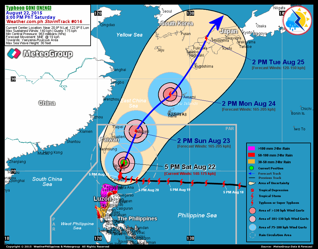
RECENT T2K TRACKING CHART:

________________________
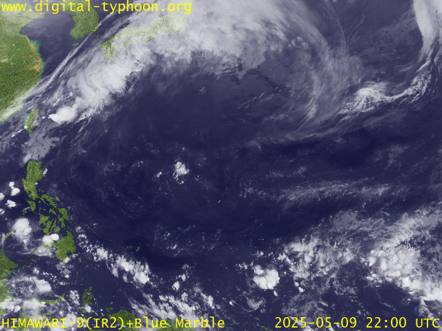
RECENT MTSAT-1R SATELLITE IMAGE:

> Image source: Digital-Typhoon.org (Nat'l. Institute of Informatics) (http://www.digital-typhoon.org )
__________________________________________________________________________________________
NOTES:

> Image source: Digital-Typhoon.
^ - JTWC commentary remarks (for Meteorologists) from their
latest warning.
latest warning.
* - Based on PAGASA's Philippine Storm Warning Signals,
# 4 being the highest. Red letters indicate new areas
being hoisted. For more explanations on these signals,
visit: http://www.typhoon2000.ph/signals.htm
** - Based on the Tropical Cyclone's Wave Height near
its center.
__________________________________________________________________________________________
>> To know the meteorological terminologies and acronyms
used on this update visit the ff:
http://typhoon2000.ph/tcterm.htm
http://www.nhc.noaa.gov/aboutgloss.shtml
http://www.srh.noaa.gov/oun/severewx/glossary.php
http://www.srh.weather.gov/fwd/glossarynation.html
http://www.nhc.noaa.gov/acronyms.shtml
__________________________________________________________________________________________
:: Typhoon2000.com (T2K) Mobile >> Powered by: Synermaxx
Receive the latest storm updates directly to your mobile phones! To know more:
Send T2K HELP to: 2800 (GLOBE & TM) | 216 (SMART & TNT) | 2288 (SUN)
Note: Globe & Smart charges P2.50 per message, while Sun at P2.00.
__________________________________________________________________________________________
For the complete details on TD 25W (SENIANG)...go visit
our website @:
> http://www.typhoon2000.com
> http://www.maybagyo.com
# 4 being the highest. Red letters indicate new areas
being hoisted. For more explanations on these signals,
visit: http://www.typhoon2
** - Based on the Tropical Cyclone's Wave Height near
its center.
____________
>> To know the meteorological terminologies and acronyms
used on this update visit the ff:
http://typhoon2000.
http://www.nhc.
http://www.srh.
http://www.srh.
http://www.nhc.
____________
:: Typhoon2000.
Receive the latest storm updates directly to your mobile phones! To know more:
Send T2K HELP to: 2800 (GLOBE & TM) | 216 (SMART & TNT) | 2288 (SUN)
Note: Globe & Smart charges P2.50 per message, while Sun at P2.00.
For the complete details on TD 25W (SENIANG)...
our website @:
> http://www.typhoon2
> http://www.maybagyo
Change settings via the Web (Yahoo! ID required)
Change settings via email: Switch delivery to Daily Digest | Switch format to Traditional
Visit Your Group | Yahoo! Groups Terms of Use | Unsubscribe
SPONSORED LINKS
.
__,_._,___
No comments:
Post a Comment