Typhoon2000 STORM UPDATE #005
Name: TYPHOON KALMAEGI [HELEN/08W/0807]
Issued: 12:00 PM MANILA TIME (04:00 GMT) THU 17 JULY 2008
Source: JTWC TROPICAL CYCLONE WARNING #012
Note: Kindly refer to your country's official warnings or bulletins. This update is for additional information purposes only.
Source: JTWC TROPICAL CYCLONE WARNING #012
Note: Kindly refer to your country's official warnings or bulletins. This update is for additional information purposes only.
_____________________________________________________________________________
KALMAEGI (HELEN) rapidly becomes the 6th Typhoon of 2008...accelerating
NNW towards Taiwan...threat to Philippines diminishes.
+ FORECAST OUTLOOK: KALMAEGI is expected to continue moving NNW to Northward
+ FORECAST OUTLOOK: KALMAEGI is expected to continue moving NNW to Northward
for the next 24 hours, passing over the NE tip of Taiwan tonight and is
likely to reach Category 3 strength w/ forecast wind speeds of 185 km/hr.
The core shall pass some 50 km. to the east of Taiwan around midnight.
KALMAEGI shall move into the East China Sea, making landfall over Eastern
China or about 65 km. NE of Wenzhou City tomorrow evening. The 3 to 5-day
long-range forecast shows the system continuing crossing the Eastern Coast-
line Eastern China early Saturday morning (July 19) and shall turn abruptly
towards the NE across the East China-Yellow Sea area and shall make its 2nd
landfall over South Korea as a downgraded Tropical Storm Sunday afternoon.
It shall then become Extratropical upon entering the Sea of Japan.
+ EFFECTS: KALMAEGI's main circulation is now approaching Taiwan, with its
+ EFFECTS: KALMAEGI's main circulation is now approaching Taiwan, with its
inner rain bands affecting the Eastern part of Taiwan. Heavy rains of up 400
mm and winds not exceeding 100 km/hr can be expected along the inner bands.
Very rough seas is expected to prevail along the coastal areas of the affec-
ted areas. Typhoon conditions can be expected over NE Taiwan and Yaeyama
Islands as the Eye and its Core (Eyewall) makes a passby later tonight.
Meanwhile, the rest of Taiwan, Yaeyama Islands, Batanes-Calayan-Babuyan
Group of Islands remains under the effects of its Outer Rain Bands. Rains
and winds not exceeding 50 km/hr can be expected along the outer bands. Re-
sidents in low-lying areas must seek higher grounds for possible flooding &
landslides due to the anticipated heavy rains brought about by this system.
Precautionary measures must be initiated if necessary. Coastal Storm Surge
flooding of 1 to 3 feet above normal tide levels...along with large and
dangerous battering waves can be expected near and to the north of Kalmaegi's
projected path particularly when the system moves over Yaeyama Islands and
the over NE tip of Taiwan. Minimal damage is possible on this type of storm
surge. Far-fetched storm surge is possible along coastal areas of Eastern
China with surf reaching 1 feet at most.
+ CURRENT MONSOON INTENSITY: Southwest (SW) Monsoon currently enhanced by
+ CURRENT MONSOON INTENSITY: Southwest (SW) Monsoon currently enhanced by
TS KALMAEGI (HELEN) prevailing across Metro Manila, Western Luzon & Western
Visayas becoming more intense along NW Luzon. Partly Cloudy to Cloudy skies
with possible light to moderate passing rains w/ at times heavy downpour &
SW'ly winds not exceeding 40 km/hr can be expected. Landslides, mudflows
(lahars) and flooding is likely to occur along steep mountain/volcano slopes,
river banks, low-lying & flood-prone areas of the affected areas. Strong
ITCZ (aka. Monsoon Trough) affecting rest of Visayas and Mindanao bringing
scattered rains and thunderstorms - most especially in the afternoon or
evening.
Important Note: Please keep in mind that the above forecast outlook,
effects & current monsoon intensity, and tropical cyclone watch changes
every 06 to 12 hours!
_____________________________________________________________________________
TIME/DATE: 11:00 AM MANILA TIME (03:00 GMT) 17 JULY
LOCATION OF EYE: LATITUDE 22.7º N...LONGITUDE 122.7º E
DISTANCE 1: 255 KM (138 NM) NNE OF BASCO, BATANES, PH
effects & current monsoon intensity, and tropical cyclone watch changes
every 06 to 12 hours!
____________
LOCATION OF EYE: LATITUDE 22.7º N...LONGITUDE 122.7º E
DISTANCE 1: 255 KM (138 NM) NNE OF BASCO, BATANES, PH
DISTANCE 2: 185 KM (100 NM) SE OF HUALIEN, TAIWAN
DISTANCE 3: 280 KM (150 NM) SSE OF TAIPEI, TAIWAN
DISTANCE 4: 625 KM (337 NM) SSE OF WENZHOU, CHINA
MAX WINDS [1-MIN AVG]: 150 KM/HR (80 KTS) NEAR THE CENTER
PEAK WIND GUSTS: 185 KM/HR (100 KTS)
SAFFIR-SIMPSON SCALE: CATEGORY ONE (1)
MINIMUM CENTRAL PRESSURE (est.): 963 MILLIBARS (hPa)
RECENT MOVEMENT: NNW @ 20 KM/HR (11 KTS)
GENERAL DIRECTION: NORTHEASTERN TAIWAN
STORM'S SIZE (IN DIAMETER): 520 KM (280 NM)/AVERAGE
MAX WAVE HEIGHT**: 24 FEET (7.3 METERS)
VIEW TRACKING MAP: 8 AM MANILA TIME THU JULY 17
TSR WIND PROBABILITIES: CURRENT TO 120 HRS LEAD
PHILIPPINE STORM SIGNALS*:
#01 - BATANES AND CALAYAN GROUP OF ISLANDS.
12, 24, 48 & 72 HR. FORECAST:
8 PM (12 GMT) 17 JULY: 24.5N 122.2E / 185-230 KPH / NNW @ 20 KPH
8 AM (00 GMT) 18 JULY: 26.6N 121.4E / 195-240 KPH / N @ 17 KPH8 AM (00 GMT) 19 JULY: 30.3N 122.0E / 140-165 KPH / NNE @ 20 KPH
8 AM (00 GMT) 20 JUNE: 33.7N 125.1E / 100-130 KPH / NE @ 20 KPH
REMARKS: 8 AM (00 GMT) 17 JULY POSITION: 22.5N 123.0E.
^TYPHOON (TY) 08W HAS CONTINUED TRACKING NORTH-NORTHWESTWARD
ALONG THE SOUTHEASTERN PERIPHERY OF A SUBTROPICAL STEERING RIDGE
DURING THE PAST 12 HOURS. SLOW AND STEADY INTENSIFICATION HAS GIVEN
WAY TO A PERIOD OF RAPID DEEPENING, WITH THE ESTIMATED MAXIMUM SUS-
TAINED WIND SPEED JUMPING FROM 60 KNOTS TO 80 KNOTS OVER THE PAST 06
HOURS IN RESPONSE TO STRENGTHENING UPPER LEVEL OUTFLOW AND HIGH SEA
SURFACE TEMPERATURES. THE LOW LEVEL CIRCULATION OF TY 08W IS SHROUDED
BY AN IMPRESSIVE CENTRAL DENSE OVERCAST FEATURE. THE CYCLONE HAS
EXHIBITED A DEVELOPING EYE FEATURE IN RECENT MICROWAVE SATELLITE
IMAGERY, INCLUDING A 8:00 AM JULY 17 SSMIS PASS...(more)
>> KALMAEGI {pronounced: kal~meegi}, meaning: Seagull.
Name contributed by: DPR Korea.
_____________________________________________________________________________
PAGASA CURRENT POSITION, MOVEMENT AND INTENSITY (10-min. ave.):
RECENT JTWC TRACKING CHART:
8 AM (00 GMT) 20 JUNE: 33.7N 125.1E / 100-130 KPH / NE @ 20 KPH
REMARKS: 8 AM (00 GMT) 17 JULY POSITION: 22.5N 123.0E.
^TYPHOON (TY) 08W HAS CONTINUED TRACKING NORTH-NORTHWESTWARD
ALONG THE SOUTHEASTERN PERIPHERY OF A SUBTROPICAL STEERING RIDGE
DURING THE PAST 12 HOURS. SLOW AND STEADY INTENSIFICATION HAS GIVEN
WAY TO A PERIOD OF RAPID DEEPENING, WITH THE ESTIMATED MAXIMUM SUS-
TAINED WIND SPEED JUMPING FROM 60 KNOTS TO 80 KNOTS OVER THE PAST 06
HOURS IN RESPONSE TO STRENGTHENING UPPER LEVEL OUTFLOW AND HIGH SEA
SURFACE TEMPERATURES. THE LOW LEVEL CIRCULATION OF TY 08W IS SHROUDED
BY AN IMPRESSIVE CENTRAL DENSE OVERCAST FEATURE. THE CYCLONE HAS
EXHIBITED A DEVELOPING EYE FEATURE IN RECENT MICROWAVE SATELLITE
IMAGERY, INCLUDING A 8:00 AM JULY 17 SSMIS PASS...(more)
>> KALMAEGI {pronounced: kal~meegi}, meaning: Seagull.
Name contributed by: DPR Korea.
____________
PAGASA CURRENT POSITION, MOVEMENT AND INTENSITY (10-min. ave.):
> 10 AM (02 GMT) 17 JULY: 22.6N 123.0E / NNW @ 17 KPH / 110 kph
:: For the complete PAGASA bulletin, kindly visit their website at:
http://www.pagasa.dost.gov.ph/wb/tcupdate.shtml
_____________________________________________________________________________
:: For the complete PAGASA bulletin, kindly visit their website at:
http://www.pagasa.
____________
RECENT JTWC TRACKING CHART:

________________________
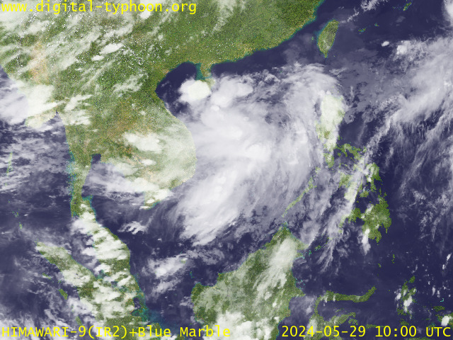
RECENT MTSAT-1R SATELLITE IMAGE:

> Image source: Digital-Typhoon.Org (http://www.digital-typhoon.org/ )
__________________________________________________________________________________________
NOTES:

> Image source: Digital-Typhoon.
^ - JTWC commentary remarks (for Meteorologists) from their
latest warning.
latest warning.
* - Based on PAGASA's Philippine Storm Warning Signals,
# 4 being the highest. Red letters indicate new areas
being hoisted. For more explanations on these signals,
visit: http://www.typhoon2000.ph/signals.htm
** - Based on the Tropical Cyclone's Wave Height near
its center.
__________________________________________________________________________________________
>> To know the meteorological terminologies and acronyms
used on this update visit the ff:
http://typhoon2000.ph/tcterm.htm
http://www.nhc.noaa.gov/aboutgloss.shtml
http://www.srh.noaa.gov/oun/severewx/glossary.php
http://www.srh.weather.gov/fwd/glossarynation.html
http://www.nhc.noaa.gov/acronyms.shtml
__________________________________________________________________________________________
:: Typhoon2000.com (T2K) Mobile >> Powered by: Synermaxx
Receive the latest storm updates directly to your mobile phones! To know more:
Send T2K HELP to: 2800 (GLOBE & TM) | 216 (SMART & TNT) | 2288 (SUN)
Note: Globe & Smart charges P2.50 per message, while Sun at P2.00.
__________________________________________________________________________________________
For the complete details on TY KALMAEGI (HELEN)...go visit
our website @:
> http://www.typhoon2000.com
> http://www.maybagyo.com
# 4 being the highest. Red letters indicate new areas
being hoisted. For more explanations on these signals,
visit: http://www.typhoon2
** - Based on the Tropical Cyclone's Wave Height near
its center.
____________
>> To know the meteorological terminologies and acronyms
used on this update visit the ff:
http://typhoon2000.
http://www.nhc.
http://www.srh.
http://www.srh.
http://www.nhc.
____________
:: Typhoon2000.
Receive the latest storm updates directly to your mobile phones! To know more:
Send T2K HELP to: 2800 (GLOBE & TM) | 216 (SMART & TNT) | 2288 (SUN)
Note: Globe & Smart charges P2.50 per message, while Sun at P2.00.
For the complete details on TY KALMAEGI (HELEN)...go visit
our website @:
> http://www.typhoon2
> http://www.maybagyo
Copyright © 2008 Typhoon2000.
MARKETPLACE
Change settings via the Web (Yahoo! ID required)
Change settings via email: Switch delivery to Daily Digest | Switch format to Traditional
Visit Your Group | Yahoo! Groups Terms of Use | Unsubscribe
.
__,_._,___
No comments:
Post a Comment