Typhoon2000 STORM UPDATE #001
Name: TROPICAL STORM 09W [IGME]
Issued: 12:00 PM MANILA TIME (04:00 GMT) FRI 25 JULY 2008
Source: JTWC TROPICAL CYCLONE WARNING NUMBER 003
Note: Kindly refer to your country's official warnings or bulletins. This update is for additional information purposes only.
Source: JTWC TROPICAL CYCLONE WARNING NUMBER 003
Note: Kindly refer to your country's official warnings or bulletins. This update is for additional information purposes only.
_____________________________________________________________________________
TROPICAL STORM 09W (IGME) NEWLY-FORMED OVER THE NORTHERN PHILIPPINE
SEA...MOVING SLOWLY WESTWARD...THREATENS EXTREME NORTHERN LUZON AND
SEA...MOVING SLOWLY WESTWARD...THREATEN
TAIWAN.
+ FORECAST OUTLOOK: 09W is expected to continue moving Westward for
+ FORECAST OUTLOOK: 09W is expected to continue moving Westward for
the next 2 days as it intensifies. The 3 to 5-day long-rang forecast
shows the system becoming a 120-kph Typhoon (Category 1) as it turns
WNW to NW-ward, passing to the north of Batanes Group of Islands on
Monday morning (July 28) and making landfall over SE Taiwan late Mon-
day afternoon, crossing the Central Taiwan in the evening and moving
out into Taiwan Strait on Tuesday morning, July 29. 09W shall make
landfall anew over Southeastern China Tuesday evening (July 29).
Complete dissipation of 09W is forecast over Fujian Province, China
on Wednesday, July 30. *Alternate Forecast Scenario: There is a po-
ssibilty that 09W may track NW to NNW-ward and pass close to Nor-
thern Taiwan or over Yaeyama Island Chain, if the High Pressure
Steering Ridge to its North weakens or retreats.
+ EFFECTS: 09W's main circulation continues to organize over the Nor-
+ EFFECTS: 09W's main circulation continues to organize over the Nor-
thern Philippine Sea, with improving spiral bands on the Northern and
Northwestern portion of the system. This storm is not yet affecting
activated once again by TS 09W (IGME) this weekend, and shall affect
Southern Luzon, Bicol Region, Metro Manila, Western Visayas and Wes-
tern Luzon. Partly Cloudy to Cloudy skies with possible light to mo-
derate passing rains w/ at times heavy downpour & SW'ly winds not
exceeding 40 km/hr can be expected. Landslides, mudflows (lahars)
and flooding is likely to occur along steep mountain/volcano slopes,
river banks, low-lying & flood-prone areas of the affected areas.
Strong ITCZ (aka. Monsoon Trough) affecting the rest of the Phili-
ppines bringing scattered rains and thunderstorms - most especially
in the afternoon or evening.
Important Note: Please keep in mind that the above forecast outlook,
effects & current monsoon intensity, and tropical cyclone watch changes
every 06 to 12 hours!
_____________________________________________________________________________
TIME/DATE: 11:00 AM MANILA TIME (03:00 GMT) 25 JULY
LOCATION OF CENTER: LATITUDE 21.6º N...LONGITUDE 131.4º E
DISTANCE 1: 645 KM (348 NM) SE OF OKINAWA, JAPAN
effects & current monsoon intensity, and tropical cyclone watch changes
every 06 to 12 hours!
____________
LOCATION OF CENTER: LATITUDE 21.6º N...LONGITUDE 131.4º E
DISTANCE 1: 645 KM (348 NM) SE OF OKINAWA, JAPAN
DISTANCE 2: 985 KM (532 NM) ENE OF BASCO, BATANES, PH
DISTANCE 3: 1,075 KM (580 NM) ENE OF APARRI, CAGAYAN, PH
DISTANCE 4: 1,070 KM (578 NM) SE OF TAIPEI, TAIWAN
MAX WINDS [1-MIN AVG]: 65 KM/HR (35 KTS) NEAR THE CENTER
PEAK WIND GUSTS: 85 KM/HR (45 KTS)
SAFFIR-SIMPSON SCALE: N/A
MINIMUM CENTRAL PRESSURE (est.): 996 MILLIBARS (hPa)
RECENT MOVEMENT: WEST @ 09 KM/HR (05 KTS)
GENERAL DIRECTION: BATANES-TAIWAN AREA
STORM'S SIZE (IN DIAMETER): --- KM (--- NM)/N/A
MAX WAVE HEIGHT**: 11 FEET (3.3 METERS)
VIEW TRACKING MAP: 8 AM MANILA TIME FRI JULY 25
TSR WIND PROBABILITIES: CURRENT TO 120 HRS LEAD
PHILIPPINE STORM SIGNALS*: None
12, 24, 48 & 72 HR. FORECAST:
8 PM (12 GMT) 25 JULY: 21.5N 130.7E / 65-85 KPH / W @ 15 KPH
12, 24, 48 & 72 HR. FORECAST:
8 PM (12 GMT) 25 JULY: 21.5N 130.7E / 65-85 KPH / W @ 15 KPH
8 AM (00 GMT) 26 JULY: 21.4N 129.0E / 75-95 KPH / W @ 17 KPH
8 AM (00 GMT) 27 JULY: 21.3N 125.2E / 100-130 KPH / WNW @ 13 KPH
8 AM (00 GMT) 28 JULY: 22.5N 122.4E / 120-150 KPH / NW @ 15 KPH
REMARKS: 8 AM (00 GMT) 25 JULY POSITION: 21.6N 131.7E.
^ANIMATED MULTISPECTRAL IMAGERY DEPICTS A LARGE, APPROXI-
MATELY 600 NM DIAMETER CIRCULATION (MONSOON DEPRESSION) WITH
A SLOWLY CONSOLIDATING SYSTEM EMBEDDED WITHIN THE SOUTHWEST
QUADRANT. A 242115Z QUIKSCAT IMAGE REFLECTS THIS WELL WITH A
BROAD LLCC CENTERED NEAR 21.6N 131.6E, THAT CORRESPONDS WITH
THE CENTROID OBSERVED IN SATELLITE IMAGERY, AND UNFLAGGED 35-
40 KNOT WINDS NEAR THE CENTER. IMAGERY ALSO SHOWS A SMALL,
EXPOSED LLCC NEAR 22.4N 132.1E, NORTHEAST OF THE SYSTEM
CENTER, WHICH IS ROTATING CYCLONICALLY AROUND THE CENTROID.
OVERALL, SYSTEM ORGANIZATION HAS SLOWLY IMPROVED WITH CURVED
CONVECTIVE BANDING EVIDENT IN A 242008Z TRMM IMAGE. THE
SYSTEM HAS BEEN UPGRADED TO TROPICAL STORM STRENGTH BASED
ON DVORAK ESTIMATES OF 35 KNOTS AND THE QUIKSCAT WINDS.
TROPICAL STORM (TS) 09W HAS TRACKED SLOWLY WEST-SOUTHWESTWARD
OVER THE PAST 12 HOURS WITHIN A WEAK STEERING ENVIRONMENT.
THE AVAILABLE MODELS REMAIN IN FAIR AGREEMENT AND ARE CONSIST-
ENT WITH PREVIOUS RUNS...(more)
_____________________________________________________________________________
PAGASA CURRENT POSITION, MOVEMENT AND INTENSITY (10-min. ave.):
RECENT WUNDERGROUND.COM TRACKING CHART :
8 AM (00 GMT) 28 JULY: 22.5N 122.4E / 120-150 KPH / NW @ 15 KPH
REMARKS: 8 AM (00 GMT) 25 JULY POSITION: 21.6N 131.7E.
^ANIMATED MULTISPECTRAL IMAGERY DEPICTS A LARGE, APPROXI-
MATELY 600 NM DIAMETER CIRCULATION (MONSOON DEPRESSION) WITH
A SLOWLY CONSOLIDATING SYSTEM EMBEDDED WITHIN THE SOUTHWEST
QUADRANT. A 242115Z QUIKSCAT IMAGE REFLECTS THIS WELL WITH A
BROAD LLCC CENTERED NEAR 21.6N 131.6E, THAT CORRESPONDS WITH
THE CENTROID OBSERVED IN SATELLITE IMAGERY, AND UNFLAGGED 35-
40 KNOT WINDS NEAR THE CENTER. IMAGERY ALSO SHOWS A SMALL,
EXPOSED LLCC NEAR 22.4N 132.1E, NORTHEAST OF THE SYSTEM
CENTER, WHICH IS ROTATING CYCLONICALLY AROUND THE CENTROID.
OVERALL, SYSTEM ORGANIZATION HAS SLOWLY IMPROVED WITH CURVED
CONVECTIVE BANDING EVIDENT IN A 242008Z TRMM IMAGE. THE
SYSTEM HAS BEEN UPGRADED TO TROPICAL STORM STRENGTH BASED
ON DVORAK ESTIMATES OF 35 KNOTS AND THE QUIKSCAT WINDS.
TROPICAL STORM (TS) 09W HAS TRACKED SLOWLY WEST-SOUTHWESTWARD
OVER THE PAST 12 HOURS WITHIN A WEAK STEERING ENVIRONMENT.
THE AVAILABLE MODELS REMAIN IN FAIR AGREEMENT AND ARE CONSIST-
ENT WITH PREVIOUS RUNS...(more)
____________
PAGASA CURRENT POSITION, MOVEMENT AND INTENSITY (10-min. ave.):
> 10 AM (02 GMT) 25 JULY: 21.8N 131.3E / W @ 11 KPH / 75 kph
:: For the complete PAGASA bulletin, kindly visit their website at:
http://www.pagasa.dost.gov.ph/wb/tcupdate.shtml
_____________________________________________________________________________
:: For the complete PAGASA bulletin, kindly visit their website at:
http://www.pagasa.
____________
RECENT WUNDERGROUND.
________________________
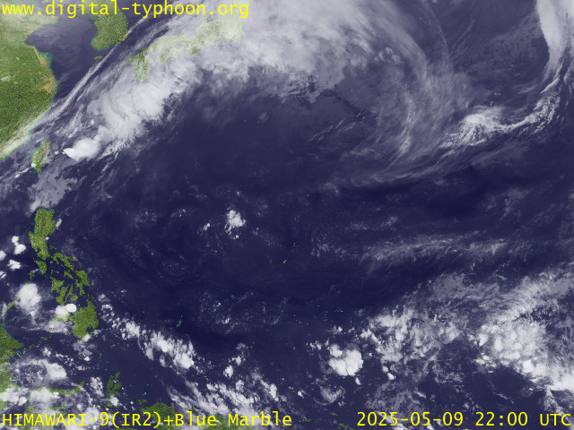
RECENT MTSAT-1R SATELLITE IMAGE:

> Image source: Digital-Typhoon.Org (http://www.digital-typhoon.org/ )
__________________________________________________________________________________________
NOTES:

> Image source: Digital-Typhoon.
^ - JTWC commentary remarks (for Meteorologists) from their
latest warning.
latest warning.
* - Based on PAGASA's Philippine Storm Warning Signals,
# 4 being the highest. Red letters indicate new areas
being hoisted. For more explanations on these signals,
visit: http://www.typhoon2000.ph/signals.htm
** - Based on the Tropical Cyclone's Wave Height near
its center.
__________________________________________________________________________________________
>> To know the meteorological terminologies and acronyms
used on this update visit the ff:
http://typhoon2000.ph/tcterm.htm
http://www.nhc.noaa.gov/aboutgloss.shtml
http://www.srh.noaa.gov/oun/severewx/glossary.php
http://www.srh.weather.gov/fwd/glossarynation.html
http://www.nhc.noaa.gov/acronyms.shtml
__________________________________________________________________________________________
:: Typhoon2000.com (T2K) Mobile >> Powered by: Synermaxx
Receive the latest 6-hrly storm updates directly to your mobile phones! To get:
Send T2K TYPHOON to: 2800 (GLOBE & TM) | 216 (SMART & TNT) | 2288 (SUN)
Note: Globe & Smart charges P2.50 per message, while Sun at P2.00.
__________________________________________________________________________________________
For the complete details on TS 09W (IGME)...go visit
our website @:
> http://www.typhoon2000.com
> http://www.maybagyo.com
# 4 being the highest. Red letters indicate new areas
being hoisted. For more explanations on these signals,
visit: http://www.typhoon2
** - Based on the Tropical Cyclone's Wave Height near
its center.
____________
>> To know the meteorological terminologies and acronyms
used on this update visit the ff:
http://typhoon2000.
http://www.nhc.
http://www.srh.
http://www.srh.
http://www.nhc.
____________
:: Typhoon2000.
Receive the latest 6-hrly storm updates directly to your mobile phones! To get:
Send T2K TYPHOON to: 2800 (GLOBE & TM) | 216 (SMART & TNT) | 2288 (SUN)
Note: Globe & Smart charges P2.50 per message, while Sun at P2.00.
For the complete details on TS 09W (IGME)...go visit
our website @:
> http://www.typhoon2
> http://www.maybagyo
Copyright © 2008 Typhoon2000.
Change settings via the Web (Yahoo! ID required)
Change settings via email: Switch delivery to Daily Digest | Switch format to Traditional
Visit Your Group | Yahoo! Groups Terms of Use | Unsubscribe
.
__,_._,___
No comments:
Post a Comment