Tuesday, July 29, 2008

TS FUNG-WONG (IGME) - Final Update


Typhoon2000 STORM UPDATE #012 **FINAL**
Name: TROPICAL STORM FUNG-WONG [IGME/09W/0808] 
Issued: 6:00 AM MANILA TIME (22:00 GMT) TUE 29 JULY 2008
Source: JTWC TROPICAL CYCLONE WARNING NUMBER 018 (FINAL)
Note: Kindly refer to your country's official warnings or bulletins. This update is for additional information purposes only.
_____________________________________________________________________________
 
 
FUNG-WONG (IGME) DOWNGRADED TO TROPICAL STORM...NOW OVER SOUTHEASTERN
CHINA AFTER IT MADE LANDFALL OVER FUJIAN PROVINCE, SOME 55 KM. TO THE
SOUTH OF FUZHOU CITY LAST NIGHT APPROXIMATELY 11:00 PM HONG KONG TIME
(15:00 GMT)...EXPECTED TO RAPIDLY DISSIPATE OVERLAND.

*THIS IS THE FINAL UPDATE ON THIS SYSTEM.


+ FORECAST OUTLOOK: FUNG-WONG is expected to continue moving NW across
Zhejiang Province within the next 12 hours and dissipate
.  

+ EFFECTS: FUNG-WONG's main circulation is now overland and is fast
dissipating. Tropical Storm conditions will continue to prevail across
SE China. Strong winds w/ gusts not exceeding 85 km/hr with up to more
than 300 mm of total rainfall is likely to persists along these areas.
Its thick & broad southern outer bands continues to spread across Tai-
wan, Southern China, Batanes Islands and the northern portion of South
China Sea. Rains and winds not in excess of 50 km/hr can be expected
along these bands. Residents in low-lying areas must seek higher grounds
for possible flooding & landslides due to the anticipated heavy rains
brought about by this system. Precautionary measures must be initiated
if necessary.

+ CURRENT MONSOON INTENSITY: The Southwest (SW) Monsoon being enhanced
by FUNG-WONG (IGME) will continue to affect Western Luzon. Partly Cloudy
to Cloudy skies with possible light to moderate passing rains w/ at times
heavy downpour & strong SW'ly winds not exceeding 50 km/hr can be expec-
ted. Landslides, mudflows (lahars) and flooding is likely to occur along
steep mountain/volcano slopes, river banks, low-lying & flood-prone areas
of the affected areas.

Important Note: Please keep in mind that the above forecast outlook,
effects & current monsoon intensity, and tropical cyclone watch changes 
every 06 to 12 hours!

_____________________________________________________________________________

TIME/DATE: 5:00 AM MANILA TIME (21:00 GMT) 29 JULY
LOCATION OF CENTER: LATITUDE 26.4º N...LONGITUDE 118.5º
DISTANCE 1: 85 KM (45
NM) WNW OF FUZHOU, CHINA
DISTANCE 2: 215 KM (115 NM) NNE OF XIAMEN, CHINA
DISTANCE 3: 345 KM (187 NM) WNW OF TAIPEI, TAIWAN 
MAX WINDS [1-MIN AVG]: 85 KM/HR (45 KTS) NEAR THE CENTER
PEAK WIND GUSTS: 100 KM/HR (55 KTS)
SAFFIR-SIMPSON SCALE: N/A 
MINIMUM CENTRAL PRESSURE (est.): 989 MILLIBARS (hPa)
RECENT MOVEMENT: NW @ 24 KM/HR (13 KTS)
GENERAL DIRECTION: ZHEJIANG PROVINCE, CHINA
STORM'S SIZE (IN DIAMETER): 945 KM (510 NM)/VERY LARGE
MAX WAVE HEIGHT**: N/A (SYSTEM OVERLAND)
VIEW TRACKING MAP: 2 AM MANILA TIME TUE JULY 29
TSR WIND PROBABILITIESCURRENT TO 12 HRS LEAD  
PHILIPPINE STORM SIGNALS*: NOW LOWERED

12 HR. FORECAST:
2 PM (06 GMT) 29 JULY: 27.7N 117.6E / 35-55 KPH / NW @ 24 KPH

REMARKS: 2 AM (18 GMT) 29 JULY POSITION: 26.0N 118.8E.
^TS FUNG-WONG MADE LANDFALL AT 28/15Z, APPROXIMATELY 30 NM SOUTH OF
FUZHOU, CHINA. SYNOPTIC OBSERVATIONS FROM THIS AREA INDICATED
MAXIMUM SUSTAINED WINDS OF 35 KNOTS GUSTING TO 52 KNOTS AND
MINIMUM SLP OF 982 MB. THIS DATA SUPPORTS THE CURRENT INTENSITY
OF 45 KNOTS AND FURTHER INDICATES THAT THE SYSTEM HAS WEAKENED
SIGNIFICANTLY OVER THE PAST SIX HOURS. THE SYSTEM IS FORECAST
TO CONTINUE TRACKING NORTHWESTWARD AND SHOULD DISSIPATE BY TAU
12. THE REMNANT LOW IS EXPECTED TO TRACK INTO THE NORTHERN WEST
SEA WITH FRONTOGENESIS OCCURRING OVER MANCHURIA IN ABOUT 72
HOURS. THIS IS THE FINAL WARNING ON THIS SYSTEM BY THE JOINT
TYPHOON WARNING CENTER (NAVMARFCSTCEN). THE SYSTEM WILL BE
CLOSELY MONITORED FOR SIGNS OF REGENERATION.//
...
(more)

>> FUNG-WONG {pronounced: fang~wang}, meaning: Phoenix (Name of Peak)
   
Name contributed by: Hong Kong, China.

_____________________________________________________________________________

PAGASA FINAL CURRENT POSITION, MOVEMENT AND INTENSITY (10-min. ave.):
 
> 4 AM (20 GMT) 29 JULY: 26.1N 118.5E / NNW @ 15 KPH / 120 kph

:: For the complete PAGASA bulletin, kindly visit their website at: 
   
http://www.pagasa.dost.gov.ph/wb/tcupdate.shtml
_____________________________________________________________________________

RECENT WUNDERGROUND.COM TRACKING CHART:


_______________________________________________________________________________________

 
RECENT MTSAT-1R SATELLITE IMAGE:
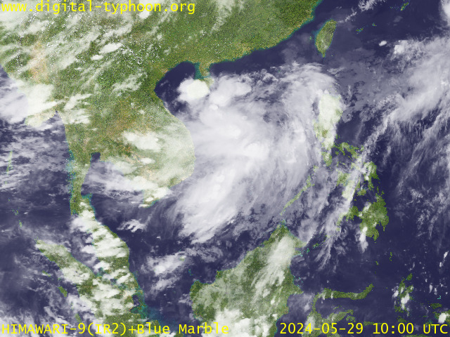

> Image source:  Digital-Typhoon.Org (http://www.digital-typhoon.org/)
__________________________________________________________________________________________

NOTES:
 
  ^ - JTWC commentary remarks (for Meteorologists) from their 
      latest warning.
 
  * - Based on PAGASA's Philippine Storm Warning Signals, 
      # 4 being the highest. Red letters indicate new areas 
      being hoisted.
For more explanations on these signals, 
      visit:
http://www.typhoon2000.ph/signals.htm

 ** - Based on the Tropical Cyclone's Wave Height near 
      its center.

__________________________________________________________________________________________

>>
To know the meteorological terminologies and acronyms 
   used on this update visit the ff:

    http://typhoon2000.ph/tcterm.htm  
    http://www.nhc.noaa.gov/aboutgloss.shtml
    http://www.srh.noaa.gov/oun/severewx/glossary.php
    http://www.srh.weather.gov/fwd/glossarynation.html
    http://www.nhc.noaa.gov/acronyms.shtml
__________________________________________________________________________________________

:: Typhoon2000.com (T2K) Mobile >> Powered by: Synermaxx
Receive the latest 6-hrly storm updates on TS IGME directly to your mobile phones! To get:
Send T2K TYPHOON to: 2800
(GLOBE & TM) | 216 (SMART & TNT) | 2288 (SUN) 
Note: Globe & Smart charges P2.50 per message, while Sun at P2.00.
__________________________________________________________________________________________

For the complete details on TS FUNG-WONG (IGME)...go visit
our website @:

>
http://www.typhoon2000.com
http://www.maybagyo.com

:: Kindly view our site's disclaimer at: 
   
http://www.typhoon2000.ph/disclaimer.htm


Copyright © 2008 Typhoon2000.com All Rights Reserved

__._,_.___
Recent Activity
Visit Your Group
Dog Groups

on Yahoo! Groups

Share pictures &

stories about dogs.

Check out the

Y! Groups blog

Stay up to speed

on all things Groups!

Best of Y! Groups

Check it out

and nominate your

group to be featured.

.

__,_._,___

Typhoon FUNG-WONG (IGME) - Update #011


Typhoon2000 STORM UPDATE #011
Name: TYPHOON FUNG-WONG [IGME/09W/0808] 
Issued: 6:00 PM MANILA TIME (10:00 GMT) MON 28 JULY 2008
Source: JTWC TROPICAL CYCLONE WARNING NUMBER 016
Note: Kindly refer to your country's official warnings or bulletins. This update is for additional information purposes only.
_____________________________________________________________________________
 
 
TYPHOON FUNG-WONG (IGME) NOW OVER TAIWAN STRAIT...LANDFALL OVER FUJIAN
PROVINCE IN SOUTHEASTERN CHINA AROUND MIDNIGHT TONIGHT...TYPHOON-FORCE
WINDS WITH HEAVY RAINS CONTINUES TO LASH TAIWAN AND IS NOW AFFECTING
SOUTHEASTERN CHINA.

+ FORECAST OUTLOOK: FUNG-WONG is expected to make its 2nd & final
landfall along Fujian Province or in between the cities of Xiamen and
Fuzhou late tonight or early tomorrow morning. The 2-day short-range
forecast shows the system tracking NW-ward overland, across the rugged
terrain of Fujian Province of China by tomorrow. Complete dissipation
of FUNG-WONG is forecast over the western part of Zhejiang Province,
China on Wednesday, July 30th.  

+ EFFECTS: FUNG-WONG's main circulation continues to cover the whole
of Taiwan, Taiwan Strait and is now moving across SE China. Typhoon
conditions to prevail across Western Taiwan and is now being felt
over SE China as its inner bands, eyewall and eye continues to tra-
verse Taiwan Strait. Very strong winds w/ gusts not exceeding 150
km/hr with up to more than 400 mm of total rainfall is likely to
persists along these areas. Its western & southern outer rain bands
continues to spread across Southern China, Batanes & Babuyan Islands
and the northern portion of South China Sea. Rains and winds not in
excess of 60 km/hr can be expected along these bands. Residents in low-
lying areas must seek higher grounds for possible flooding & landslides
due to the anticipated heavy rains brought about by this system. Precau-
tionary measures must be initiated if necessary. Coastal Storm Surge
flooding of 3 to 5 feet above normal tide levels...along with large and
dangerous battering waves can be expected near and to the north on where
the center makes landfall in Southeastern China particularly over Fujian
Province. Moderate damage is possible on this type of storm surge. Far-
fetched storm surge is possible along coastal areas of Southern China &
Batanes Group with surf reaching 4 feet at most.

+ CURRENT MONSOON INTENSITY: The Southwest (SW) Monsoon being enhanced
by Typhoon FUNG-WONG (IGME) will continue to affect Luzon...becoming
more intense along Mindoro, Northern Palawan, Western Luzon including
Metro Manila. Partly Cloudy to Cloudy skies with possible light to mo-
derate passing rains w/ at times heavy downpour & strong SW'ly winds
not exceeding 50 km/hr can be expected. Landslides, mudflows (lahars)
and flooding is likely to occur along steep mountain/volcano slopes,
river banks, low-lying & flood-prone areas of the affected areas.

Important Note: Please keep in mind that the above forecast outlook,
effects & current monsoon intensity, and tropical cyclone watch changes 
every 06 to 12 hours!

_____________________________________________________________________________

TIME/DATE: 5:00 PM MANILA TIME (09:00 GMT) 28 JULY
LOCATION OF EYE: LATITUDE 24.4º N...LONGITUDE 120.2º
DISTANCE 1: 150 KM (80
NM) WNW OF HUALIEN, TAIWAN 
DISTANCE 2: 155 KM (83 NM) WSW OF TAIPEI, TAIWAN 
DISTANCE 3: 300 KM (162 NM) NORTH OF KAOHSIUNG, TAIWAN 
DISTANCE 4: 210 KM (113 NM) SE OF FUZHOU, CHINA  
DISTANCE 5: 215 KM (115 NM) EAST OF XIAMEN, CHINA  
MAX WINDS [1-MIN AVG]: 130 KM/HR (70 KTS) NEAR THE CENTER
PEAK WIND GUSTS: 160 KM/HR (85 KTS)
SAFFIR-SIMPSON SCALE: CATEGORY ONE (1) 
MINIMUM CENTRAL PRESSURE (est.): 972 MILLIBARS (hPa)
RECENT MOVEMENT: NW @ 15 KM/HR (08 KTS)
GENERAL DIRECTION: FUJIAN PROVINCE, CHINA
STORM'S SIZE (IN DIAMETER): 890 KM (480 NM)/LARGE-VERY LARGE
MAX WAVE HEIGHT**: .. FEET (.... METERS)
VIEW TRACKING MAP: 2 PM MANILA TIME MON JULY 28
TSR WIND PROBABILITIESCURRENT TO 72 HRS LEAD  

PHILIPPINE STORM SIGNALS*:
#02 - BATANES, CALAYAN & BABUYAN GROUP OF ISLANDS.
#01 - ILOCOS PROVINCES, ABRA, MT. PROVINCE, BENGUET, LA UNION, 
      PANGASINAN, ZAMBALES, & BATAAN.


12, 24 & 48 HR. FORECAST:
2 AM (18 GMT) 29 JULY: 25.1N 119.2E / 120-150 KPH / NW @ 13 KPH
2 PM (06 GMT) 29 JULY: 26.1N 118.2E / 95-120 KPH / NW @ 13 KPH
2 PM (06 GMT) 30 JULY: 28.3N 116.1E / 35-55 KPH / NW @ 13 KPH

REMARKS: 8 AM (00 GMT) 28 JULY POSITION: 23.6N 121.3E.
^ANIMATED SATELLITE AND RADAR IMAGERY INDICATE THAT TYPHOON FUNG-WONG
(09W) HAS MADE LANDFALL ALONG THE EAST COAST OF TAIWAN NORTH OF
CHENGGONG. THE SYSTEM INTENSIFIED TO AN ESTIMATED 95 KNOTS AT
261800Z PRIOR TO MOVING ASHORE AROUND 272200Z. INTERACTION BETWEEN
TY 09W AND THE HIGH TERRAIN OF CENTRAL TAIWAN HAS INDUCED SOME
WESTWARD TILT BETWEEN THE LOW AND UPPER LEVEL CIRCULATION CENTERS
OVER THE PAST SEVERAL HOURS. CONSEQUENTLY, A 28 NM EYE FEATURE
EVIDENT IN INFRARED SATELLITE IMAGERY AT 1800Z HAS RAPIDLY
DETERIORATED
...
(more)

>> FUNG-WONG {pronounced: fang~wang}, meaning: Phoenix (Name of Peak)
   
Name contributed by: Hong Kong, China.

_____________________________________________________________________________

PAGASA CURRENT POSITION, MOVEMENT AND INTENSITY (10-min. ave.):
 
> 4 PM (08 GMT) 28 JULY: 24.8N 120.4E / NW @ 17 KPH / 120 kph

:: For the complete PAGASA bulletin, kindly visit their website at: 
   
http://www.pagasa.dost.gov.ph/wb/tcupdate.shtml
_____________________________________________________________________________


RECENT WUNDERGROUND.COM TRACKING CHART:


_______________________________________________________________________________________

 
RECENT MTSAT-1R SATELLITE IMAGE:


> Image source:  Digital-Typhoon.Org (http://www.digital-typhoon.org/)
__________________________________________________________________________________________

NOTES:
 
  ^ - JTWC commentary remarks (for Meteorologists) from their 
      latest warning.
 
  * - Based on PAGASA's Philippine Storm Warning Signals, 
      # 4 being the highest. Red letters indicate new areas 
      being hoisted.
For more explanations on these signals, 
      visit:
http://www.typhoon2000.ph/signals.htm

 ** - Based on the Tropical Cyclone's Wave Height near 
      its center.

__________________________________________________________________________________________

>>
To know the meteorological terminologies and acronyms 
   used on this update visit the ff:

    http://typhoon2000.ph/tcterm.htm  
    http://www.nhc.noaa.gov/aboutgloss.shtml
    http://www.srh.noaa.gov/oun/severewx/glossary.php
    http://www.srh.weather.gov/fwd/glossarynation.html
    http://www.nhc.noaa.gov/acronyms.shtml
__________________________________________________________________________________________

:: Typhoon2000.com (T2K) Mobile >> Powered by: Synermaxx
Receive the latest 6-hrly storm updates on TS IGME directly to your mobile phones! To get:
Send T2K TYPHOON to: 2800
(GLOBE & TM) | 216 (SMART & TNT) | 2288 (SUN) 
Note: Globe & Smart charges P2.50 per message, while Sun at P2.00.
__________________________________________________________________________________________

For the complete details on TY FUNG-WONG (IGME)...go visit
our website @:

>
http://www.typhoon2000.com
http://www.maybagyo.com

:: Kindly view our site's disclaimer at: 
   
http://www.typhoon2000.ph/disclaimer.htm


Copyright © 2008 Typhoon2000.com All Rights Reserved

__._,_.___
Recent Activity
Visit Your Group
Curves on Yahoo!

Share & discuss

Curves, fitness

and weight loss.

Special K Group

on Yahoo! Groups

Learn how others

are losing pounds.

Yahoo! Groups

Real Food Group

Share recipes

and favorite meals.

.

__,_._,___

Monday, July 28, 2008

Typhoon FUNG-WONG (IGME) traversing Taiwan...eyes Fujian, China [Update #010]


Typhoon2000 STORM UPDATE #010
Name: TYPHOON FUNG-WONG [IGME/09W/0808] 
Issued: 12:00 PM MANILA TIME (04:00 GMT) MON 28 JULY 2008
Source: JTWC TROPICAL CYCLONE WARNING NUMBER 015
Note: Kindly refer to your country's official warnings or bulletins. This update is for additional information purposes only.
_____________________________________________________________________________
 
 
EYE OF TYPHOON FUNG-WONG (IGME) HAS MADE LANDFALL OVER EASTERN TAIWAN,
JUST SOUTH OF HUALIEN CITY AROUND 6:00 AM (22:00 GMT) THIS MORNING...
NOW WEAKENING AS IT TRAVERSES THE RUGGED TERRAIN
OF CENTRAL AND WESTERN
TAIWAN
...TYPHOON-FORCE WINDS WITH HEAVY RAINS CONTINUES TO LASH THE
ISLAND NATION.

+ FORECAST OUTLOOK: FUNG-WONG is expected to emerge back to sea, into
Taiwan Strait around 2 PM this afternoon and shall be over the coast of
Fujian Province (China) after sundown. It shall make its 2nd & final
landfall along Fujian Province or in between the cities of Xiamen and
Fuzhou tonight. The 2 to 3-day medium-range forecast shows the system
tracking NW-ward overland, across the rugged terrain of Fujian Province
of China Tuesday morning through Wednesday (Jul 30). Complete dissipation
of FUNG-WONG is forecast over the western part of Zhejiang Province,
China by early Thursday morning, July 31st.  

+ EFFECTS: FUNG-WONG's main circulation continues to cover the whole
of Taiwan and Taiwan Strait. Typhoon conditions to prevail across
Taiwan as the inner bands, eyewall and eye continues to traverse the
island nation and is expected to reach Fujian Province later this
afternoon thru the evening. Very strong winds w/ gusts not exceeding
195 km/hr with up to more than 500 mm of total rainfall is likely to
persists along these areas. Its western & southern outer rain bands
continues to spread across SE & Southern China, Batanes & Babuyan Is-
lands and the northern portion of South China Sea. Rains and winds not
in excess of 60 km/hr can be expected along these bands. Residents in
low-lying areas must seek higher grounds for possible flooding &
landslides due to the anticipated heavy rains brought about by this
system. Precautionary measures must be initiated if necessary. Coastal
Storm Surge flooding of 6 to 8 feet above normal tide levels...along
with large and dangerous battering waves can be expected near and to
the north on where the center makes landfall in Eastern & Western Taiwan
& Southeastern China particularly over Fujian Province. Moderate damage
is possible on this type of storm surge. Far-fetched storm surge is po-
ssible along coastal areas of Southern China & Batanes Group with surf
reaching 4 feet at most.

+ CURRENT MONSOON INTENSITY: The Southwest (SW) Monsoon being enhanced
by Typhoon FUNG-WONG (IGME) will continue to affect Luzon...becoming
more intense along Mindoro, Northern Palawan, Western Luzon including
Metro Manila. Partly Cloudy to Cloudy skies with possible light to
moderate passing rains w/ at times heavy downpour & strong SW'ly winds
not exceeding 50 km/hr can be expected. Landslides, mudflows (lahars)
and flooding is likely to occur along steep mountain/volcano slopes,
river banks, low-lying & flood-prone areas of the affected areas.

Important Note: Please keep in mind that the above forecast outlook,
effects & current monsoon intensity, and tropical cyclone watch changes 
every 06 to 12 hours!

_____________________________________________________________________________

TIME/DATE: 11:00 AM MANILA TIME (03:00 GMT) 28 JULY
LOCATION OF EYE: LATITUDE 23.9º N...LONGITUDE 120.9º
DISTANCE 1: 70 KM (38
NM) WEST OF HUALIEN, TAIWAN 
DISTANCE 2: 140 KM (75 NM) SSW OF TAIPEI, TAIWAN 
DISTANCE 3: 155 KM (83 NM) NNE OF KAOHSIUNG, TAIWAN 
DISTANCE 4: 295 KM (160 NM) SE OF FUZHOU, CHINA  
DISTANCE 5: 395 KM (213 NM) NNW OF BASCO, BATANES, PH  
MAX WINDS [1-MIN AVG]: 160 KM/HR (85 KTS) NEAR THE CENTER
PEAK WIND GUSTS: 195 KM/HR (105 KTS)
SAFFIR-SIMPSON SCALE: CATEGORY TWO (2) 
MINIMUM CENTRAL PRESSURE (est.): 959 MILLIBARS (hPa)
RECENT MOVEMENT: NW @ 20 KM/HR (11 KTS)
GENERAL DIRECTION: FUJIAN PROVINCE, CHINA
STORM'S SIZE (IN DIAMETER): 890 KM (480 NM)/LARGE-VERY LARGE
MAX WAVE HEIGHT**: 33 FEET (10.0 METERS)
VIEW TRACKING MAP: 8 AM MANILA TIME MON JULY 28
TSR WIND PROBABILITIESCURRENT TO 72 HRS LEAD  

PHILIPPINE STORM SIGNALS*:
#02 - BATANES, CALAYAN & BABUYAN GROUP OF ISLANDS.
#01 - CAGAYAN, APAYAO, ILOCOS PROVINCES, KALINGA, ABRA, MT. 
      PROVINCE, IFUGAO, BENGUET, LA UNION, PANGASINAN, 
      ZAMBALES, & BATAAN.


12, 24, 48 & 72 HR. FORECAST:
8 PM (12 GMT) 28 JULY: 24.8N 119.6E / 140-165 KPH / NW @ 17 KPH
8 AM (00 GMT) 29 JULY: 26.2N 118.4E / 110-140 KPH / NW @ 15 KPH
8 AM (00 GMT) 30 JULY: 28.7N 116.6E / 55-75 KPH / NNW @ 09 KPH
8 AM (00 GMT) 31 JULY: 30.4N 115.6E / 35-55 KPH / NNW @ 09 KPH

REMARKS: 8 AM (00 GMT) 28 JULY POSITION: 23.6N 121.3E.
^ANIMATED SATELLITE AND RADAR IMAGERY INDICATE THAT TYPHOON FUNG-WONG
(09W) HAS MADE LANDFALL ALONG THE EAST COAST OF TAIWAN NORTH OF
CHENGGONG. THE SYSTEM INTENSIFIED TO AN ESTIMATED 95 KNOTS AT
261800Z PRIOR TO MOVING ASHORE AROUND 272200Z. INTERACTION BETWEEN
TY 09W AND THE HIGH TERRAIN OF CENTRAL TAIWAN HAS INDUCED SOME
WESTWARD TILT BETWEEN THE LOW AND UPPER LEVEL CIRCULATION CENTERS
OVER THE PAST SEVERAL HOURS. CONSEQUENTLY, A 28 NM EYE FEATURE
EVIDENT IN INFRARED SATELLITE IMAGERY AT 1800Z HAS RAPIDLY
DETERIORATED
...
(more)

>> FUNG-WONG {pronounced: fang~wang}, meaning: Phoenix (Name of Peak)
   
Name contributed by: Hong Kong, China.

_____________________________________________________________________________

PAGASA CURRENT POSITION, MOVEMENT AND INTENSITY (10-min. ave.):
 
> 10 AM (02 GMT) 28 JULY: 23.8N 121.0E / NW @ 15 KPH / 140 kph

:: For the complete PAGASA bulletin, kindly visit their website at: 
   
http://www.pagasa.dost.gov.ph/wb/tcupdate.shtml
_____________________________________________________________________________


RECENT WUNDERGROUND.COM TRACKING CHART:


_______________________________________________________________________________________

 
RECENT MTSAT-1R SATELLITE IMAGE:


> Image source:  Digital-Typhoon.Org (http://www.digital-typhoon.org/)
__________________________________________________________________________________________

NOTES:
 
  ^ - JTWC commentary remarks (for Meteorologists) from their 
      latest warning.
 
  * - Based on PAGASA's Philippine Storm Warning Signals, 
      # 4 being the highest. Red letters indicate new areas 
      being hoisted.
For more explanations on these signals, 
      visit:
http://www.typhoon2000.ph/signals.htm

 ** - Based on the Tropical Cyclone's Wave Height near 
      its center.

__________________________________________________________________________________________

>>
To know the meteorological terminologies and acronyms 
   used on this update visit the ff:

    http://typhoon2000.ph/tcterm.htm  
    http://www.nhc.noaa.gov/aboutgloss.shtml
    http://www.srh.noaa.gov/oun/severewx/glossary.php
    http://www.srh.weather.gov/fwd/glossarynation.html
    http://www.nhc.noaa.gov/acronyms.shtml
__________________________________________________________________________________________

:: Typhoon2000.com (T2K) Mobile >> Powered by: Synermaxx
Receive the latest 6-hrly storm updates on TS IGME directly to your mobile phones! To get:
Send T2K TYPHOON to: 2800
(GLOBE & TM) | 216 (SMART & TNT) | 2288 (SUN) 
Note: Globe & Smart charges P2.50 per message, while Sun at P2.00.
__________________________________________________________________________________________

For the complete details on TY FUNG-WONG (IGME)...go visit
our website @:

>
http://www.typhoon2000.com
http://www.maybagyo.com

:: Kindly view our site's disclaimer at: 
   
http://www.typhoon2000.ph/disclaimer.htm


Copyright © 2008 Typhoon2000.com All Rights Reserved

__._,_.___
Recent Activity
Visit Your Group
Yahoo! Groups

Find balance

between nutrition,

activity & well-being.

Discover Tips

on healthy living

and healthy eating

on Yahoo! Groups.

Find helpful tips

for Moderators

on the Yahoo!

Groups team blog.

.

__,_._,___