Typhoon2000 STORM UPDATE #04
Name: TROPICAL STORM BOPHA [INDAY/10W/0609]
Issued: 7:00 PM MANILA TIME (11:00 GMT) MON 07 AUGUST 2006
Next Update: 7:00 PM (11:00 GMT) TUE 08 AUGUST 2006
Sources: JTWC TROPICAL CYCLONE WARNING #005
NOTE: Updates will issued on a 24-hour basis as the author
will be out of town for 5 days. Thank you.
_______________________________________________________________________
Next Update: 7:00 PM (11:00 GMT) TUE 08 AUGUST 2006
Sources: JTWC TROPICAL CYCLONE WARNING #005
NOTE: Updates will issued on a 24-hour basis as the author
will be out of town for 5 days. Thank you.
____________
TROPICAL STORM BOPHA (INDAY) HEADING TOWARDS TAIWAN...
CIRCULATION NOT LOOKING GOOD.
CIRCULATION NOT LOOKING GOOD.
+ FORECAST OUTLOOK: BOPHA is expected to track WNW for
the next 24 hours and intensify into a minimal Typhoon.
There is a possibility that BOPHA might interact with
the fast approaching and more powerful Typhoon SAOMAI
(08W) sometime tomorrow or Wednesday (Aug 8 or 9).
Long-range forecast shows BOPHA making landfall over
Central Taiwan sometime Thursday Wednesday afternoon,
Aug 9. The storm shall dissipate after making its second
landfall along the Fujian-Guangdong border in Southern
China, Friday afternoon.
+ EFFECTS: Northern outer bands of BOPHA continues to
affect Yaeyama-Okinawa-
weather conditions expected tomorrow or Wednesday
over Taiwan as the storm approaches
+ CURRENT MONSOON INTENSITY: NONE.
outlook, effects, current monsoon intensity, and tropical
cyclone watch changes every 06 to 12 hours!
TIME/DATE: 5:00 PM MANILA TIME (09:00 GMT) 07 AUGUST
LOCATION OF CENTER: LATITUDE 23.0º N...LONGITUDE 127.8º E
DISTANCE 1: 390 KM (210 NM) SOUTH OF OKINAWA, JAPAN
DISTANCE 2: 660 KM (355 NM) NE OF BASCO, BATANES, PH
DISTANCE 3: 670 KM (362 NM) ESE OF TAIPEI, TAIWAN
MAX SUSTAINED WINDS [1-MIN AVG]: 95 KM/HR (50 KTS)
PEAK WIND GUSTS: 120 KM/HR (65 KTS)
MINIMUM CENTRAL PRESSURE (est.): 987 MILLIBARS (hPa)
MAX WAVE HEIGHT**: 15 FEET (4.5 METERS)
SAFFIR-SIMPSON SCALE: N/A
RECENT MOVEMENT: WNW @ 15 KM/HR (08 KTS)
GENERAL DIRECTION: TAIWAN
STORM'S SIZE (IN DIAMETER): 445 KM (240 NM)/AVERAGE
VIEW TRACKING MAP: 2 PM PST MON AUGUST 07
PHILIPPINE STORM SIGNALS*: N/A
12, 24 & 48 HR. FORECAST:
> 2 AM (18 GMT) 08 AUGUST: 23.2N 126.6E / 95-120 KPH
> 2 PM (06 GMT) 08 AUGUST: 23.5N 124.9E / 100-130 KPH
> 2 PM (06 GMT) 09 AUGUST: 23.5N 122.1E / 110-140 KPH
REMARKS: 2 PM (06 GMT) 06 AUGUST POSITION: 22.9N 128.2E.
^ANIMATED ENHANCED INFRARED IMAGERY DEPICTS A TIGHTLY
CURVED BAND OF DEEP CONVECTION NORTH OF THE SYSTEM
CENTER. UPPER-LEVEL ANALYSIS DEPICTS TWO MAJOR SYNOPTIC
FEATURES INFLUENCING THE STORM TRACK. THE FIRST IS A
DEEP-LAYER, BROAD SUBTROPICAL RIDGE EXTENDING FROM EAST
OF JAPAN INTO WESTERN JAPAN. THE SECOND IS A BROAD MID-
LEVEL CYCLONIC CIRCULATION (GYRE) ENTRENCHED EAST OF
THE PHILIPPINES. TS BOPHA IS CURRENTLY TRACKING SLOWLY
WESTWARD UNDER THE STEERING INFLUENCE OF THESE TWO
FEATURES. TS BOPHA IS FORECAST TO CONTINUE TRACKING
WESTWARD ALONG THE NORTHERN TO NORTHWESTERN PERIPHERY
OF THE GYRE THROUGH THE PERIOD. THE SUBTROPICAL RIDGE
IS EXPECTED TO BUILD BACK INTO THE EAST CHINA SEA BY
36 HOURS AS TS MARIA MOVES INTO A WEAKNESS IN THE
SUBTROPICAL RIDGE OVER WESTERN JAPAN...(more info)
>> BOPHA {pronounced: bo~fa}, meaning: Flower/The
name of little girl. Name contributed by: Cambodia.
_________________________________________________________________________________
_________________________________________________________________________________
REMARKS: 2 PM (06 GMT) 06 AUGUST POSITION: 22.9N 128.2E.
^ANIMATED ENHANCED INFRARED IMAGERY DEPICTS A TIGHTLY
CURVED BAND OF DEEP CONVECTION NORTH OF THE SYSTEM
CENTER. UPPER-LEVEL ANALYSIS DEPICTS TWO MAJOR SYNOPTIC
FEATURES INFLUENCING THE STORM TRACK. THE FIRST IS A
DEEP-LAYER, BROAD SUBTROPICAL RIDGE EXTENDING FROM EAST
OF JAPAN INTO WESTERN JAPAN. THE SECOND IS A BROAD MID-
LEVEL CYCLONIC CIRCULATION (GYRE) ENTRENCHED EAST OF
THE PHILIPPINES. TS BOPHA IS CURRENTLY TRACKING SLOWLY
WESTWARD UNDER THE STEERING INFLUENCE OF THESE TWO
FEATURES. TS BOPHA IS FORECAST TO CONTINUE TRACKING
WESTWARD ALONG THE NORTHERN TO NORTHWESTERN PERIPHERY
OF THE GYRE THROUGH THE PERIOD. THE SUBTROPICAL RIDGE
IS EXPECTED TO BUILD BACK INTO THE EAST CHINA SEA BY
36 HOURS AS TS MARIA MOVES INTO A WEAKNESS IN THE
SUBTROPICAL RIDGE OVER WESTERN JAPAN...(more info)
>> BOPHA {pronounced: bo~fa}, meaning: Flower/The
name of little girl. Name contributed by: Cambodia.
____________
____________
RECENT WEATHER UNDERGROUND TRACKING CHART:
Track Source: The Weather Underground Tropical Page (http://www.wundergr
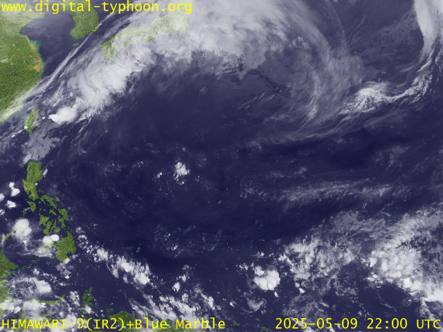
RECENT MTSAT-1R SATELLITE IMAGE:

> Image source: Digital-Typhoon.
NOTES:
^ - JTWC commentary remarks (for Meteorologists) from their
latest warning.
latest warning.
* - Based on PAGASA's Philippine Storm Warning Signals,
# 4 being the highest. Red letters indicate new areas
being hoisted. For more explanations on these signals,
visit: http://www.typhoon2000.ph/signals.htm
** - Based on the Tropical Cyclone's Sea Wave Height near
its center.
__________________________________________________________________________________________
>> To know the meteorological terminologies and acronyms
used on this update visit the ff:
http://typhoon2000.ph/tcterm.htm
http://www.nhc.noaa.gov/aboutgloss.shtml
http://www.srh.....noaa.gov/oun/severewx/glossary.php
http://www.srh.weather.gov/fwd/glossarynation.html
http://www.nhc.noaa.gov/acronyms.shtml
__________________________________________________________________________________________
:: Typhoon2000.com (T2K) Mobile >> Powered by: Synermaxx
Receive the latest storm updates directly to your mobile phones! To know more:
Send T2K HELP to: 2800 (GLOBE & TM) | 216 (SMART & TNT) | 2288 (SUN)
__________________________________________________________________________________________
For the complete details on the TS BOPHA (INDAY/10W)...go visit
our website @:
> http://www.typhoon2000.com
> http://www.maybagyo.com
# 4 being the highest. Red letters indicate new areas
being hoisted. For more explanations on these signals,
visit: http://www.typhoon2
** - Based on the Tropical Cyclone's Sea Wave Height near
its center.
____________
>> To know the meteorological terminologies and acronyms
used on this update visit the ff:
http://typhoon2000.
http://www.nhc.
http://www.srh.
http://www.srh.
http://www.nhc.
____________
:: Typhoon2000.
Receive the latest storm updates directly to your mobile phones! To know more:
Send T2K HELP to: 2800 (GLOBE & TM) | 216 (SMART & TNT) | 2288 (SUN)
____________
For the complete details on the TS BOPHA (INDAY/10W).
our website @:
> http://www.typhoon2
> http://www.maybagyo
You are receiving Individual Emails Change Delivery Settings
Visit Your Group | Yahoo! Groups Terms of Use | Unsubscribe
SPONSORED LINKS
.
__,_._,___
No comments:
Post a Comment