| My Groups | typhoon2000asiapac_stormlist Main Page | |

Typhoon2000 STORM UPDATE #09
Name: TYPHOON CHANCHU [CALOY/02W/0601]
Issued: 7:00 AM MANILA TIME (23:00 GMT) SAT 13 MAY 2006
Next Update: 7:00 PM (11:00 GMT) SAT 13 MAY 2006
Source: JTWC TROPICAL CYCLONE WARNING #017
_______________________________________________________________________
Next Update: 7:00 PM (11:00 GMT) SAT 13 MAY 2006
Source: JTWC TROPICAL CYCLONE WARNING #017
_______________________________________________________________________
TYPHOON CHANCHU (CALOY) GAINED MORE STRENGTH HOURS BEFORE MAKING
LANDFALL OVER ORIENTAL MINDORO LAST NIGHT..NOW A CATEGORY TWO
SYSTEM..THE EYE IS CURRENTLY OFF THE WESTERN COAST OF OCCIDENTAL
MINDORO..STRONG WINDS AND HEAVY RAINS CONTINUES.
+ FORECAST OUTLOOK: The core of CHANCHU is expected to move slowly
WNW away from the Island of Mindoro today and exit via Lubang
Island..it shall be out into the South China Sea this afternoon.
5-day Advance Forecast shows the typhoon intensifying into a 230-kph
howler approaching the Coast of Hong Kong, China around May 17 or 18.
+ EFFECTS: CHANCHU's cloud circulation continues to cover Central
and Western Visayas, Palawan, Western Mindanao and Luzon - with its
intense rainbands spreading across Batangas, Mindoro, Marinduque,
Romblon, Boracay, Southern Quezon. These rainbands will continue to
bring moderate to heavy rainfall with moderate to strong winds, and
could produce life-threatening flash floods and mudslides along river
banks, low-lying areas and mountain slopes over the affected areas.
Residents residing along the coastal beachfront areas of Palawan,
Western Luzon & Western Visayas are advised to seek higher grounds
due to possible high waves from the sea. Coastal Storm Surge flooding
of up to 6 to 8 feet can be expected along the path of CHANCHU advi-
sing all sea vessels to remain at port. *During the passage of this
system, near T2K Weather Station in Naga City yesterday..it has been
analyzed that the Northern Quadrant of CHANCHU has more wind than
rain. Wind gust of 72 kph blowing from the East has been recorded
at 12:27 PM May 12.
+ CURRENT MONSOON INTENSITY: This storm is currntly enhancing the
Southwest Monsoon bringing moderate to heavy rains along Western
sections of Visayas and Mindanao. These rains may produce life-
threatening flash floods and mudslides along river banks, low-
lying areas and mountain slopes of the affected areas.
Important Note: Please keep in mind that the above forecast outlook,
effects & current monsoon intensity changes every 06 to 12 hours!
_______________________________________________________________________
TIME/DATE: 5:00 AM MANILA TIME (21:00 GMT) 13 MAY
LOCATION OF CENTER: LATITUDE 12.7º N...LONGITUDE 120.8º E
DISTANCE 1: 45 KM (25 NM) NW OF SAN JOSE, OCCIDENTAL MINDORO, PH
TIME/DATE: 5:00 AM MANILA TIME (21:00 GMT) 13 MAY
LOCATION OF CENTER: LATITUDE 12.7º N...LONGITUDE 120.8º E
DISTANCE 1: 45 KM (25 NM) NW OF SAN JOSE, OCCIDENTAL MINDORO, PH
DISTANCE 2: 200 KM (108 NM) SSW OF METRO MANILA, PH
DISTANCE 3: 280 KM (150 NM) WSW OF NAGA CITY, PH
MAX SUSTAINED WINDS [1-MIN AVG]: 160 KM/HR (85 KTS)
PEAK WIND GUSTS: 195 KM/HR (105 KTS)
MINIMUM CENTRAL PRESSURE (est.): 958 MILLIBARS (hPa)
MAX WAVE HEIGHT**: 32 FEET (9.7 METERS)
SAFFIR-SIMPSON SCALE: CATEGORY 2
RECENT MOVEMENT: WSW @ 11 KM/HR (06 KTS)
GENERAL DIRECTION: SOUTH CHINA SEA
STORM'S SIZE (IN DIAMETER): 780 KM (420 NM)/LARGE
VIEW T2K TRACKING MAP: 5 AM SAT MAY 13
TSR WIND PROBABILITIES: CURRENT TO 120 HRS LEAD
PHILIPPINE STORM SIGNALS*:
#02 - MINDORO, LUBANG ISLAND, BATANGAS, CALAMIAN GROUP, ROMBLON
& MARINDUQUE.
#01 - METRO MANILA, CAVITE, LAGUNA, RIZAL, SOUTHERN QUEZON,
BATAAN, SOUTHERN ZAMBALES, AKLAN, ANTIQUE, BORACAY ISLAND
RESORT, PALAWAN & CUYO ISLAND.
09-21 HR. FORECAST:
> 2 PM (06 GMT) 13 MAY: 12.9N 119.7E / 165-205 KPH
> 2 AM (18 GMT) 14 MAY: 13.2N 118.2E / 185-230 KPH
REMARKS: 2 AM (18 GMT) 13 MAY POSITION: 12.7N 121.2E.
^ ..(more info)
>> CHANCHU {pronounced: chan~chu}, meaning: Pearl, a smooth,
rounded lustrous deposit formed in the shells of certain
oysters and is often used for jewelry. Many Macau souvenirs
are made of it. Name contributed by: Macau, China
_______________________________________________________________________
EYEWALL PASSAGE FORECAST TIMES (EPFT)*: NEW!!!
Mindoro/Lubang: Ongoing until 4PM Sat.
Note: The EyeWall - is the ring of rain clouds surrounding the "EYE" of a Typhoon. It is here where
the strongest winds and heaviest rain of a typhoon can be found. *EPFT will show what local times
on a given area the most damaging winds and heaviest rainfall could be experienced. EPFT changes
everytime a new warning synopsis is issued. Warning Note: This is only an estimate analysis, do not
use this for life/death decisions.
_______________________________________________________________________
PAGASA CURRENT POSITION, MOVEMENT AND INTENSITY (10-min. ave.):
> 4 AM (20 GMT) 13 MAY: 13.1N 120.8E / WNW @ 15 KPH / 95 kph
:: For the complete PAGASA bulletin, kindly visit their website at:
:: For the complete PAGASA bulletin, kindly visit their website at:
http://www.pagasa.dost.gov.ph/wb/tcupdate.shtml
_________________________________________________________________________________
_________________________________________________________________________________
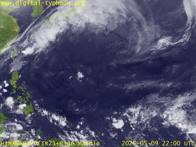
RECENT MTSAT-1R SATELLITE IMAGE:

> Image source: Digital-Typhoon.org (Nat'l. Institute of Informatics) (http://www.digital-typhoon.org)
__________________________________________________________________________________________
LATEST T2K TRACKING CHART:

_______________________________________________________________________________________
NOTES:

> Image source: Digital-Typhoon.org (Nat'l. Institute of Informatics) (http://www.digital-typhoon.org)
__________________________________________________________________________________________
LATEST T2K TRACKING CHART:

_______________________________________________________________________________________
NOTES:
^ - JTWC commentary remarks (for Meteorologists) from their latest warning.
* - Based on PAGASA's Philippine Storm Warning Signals, # 4 being the
highest. Red letters indicate new areas being hoisted. For more
explanations on these signals, visit: http://www.typhoon2000.ph/signals.htm
** - Based on the Tropical Cyclone's Sea Wave Height near its center.
__________________________________________________________________________________________
>> To know the meteorological terminologies and acronyms used on
this update visit the ff:
http://typhoon2000.ph/tcterm.htm
http://www.nhc.noaa.gov/aboutgloss.shtml
http://www.srhnoaa.gov/oun/severewx/glossary.php
http://www.srh.weather.gov/fwd/glossarynation.html
http://www.nhc.noaa.gov/acronyms.shtml
__________________________________________________________________________________________
T2K Mobile: receive the latest storm updates directly to your mobile phones! To know more,
Send T2K HELP to: 2800 (GLOBE & TM) | 386 (SMART & TNT) | 2288 (SUN)
Powered by: Synermaxx
__________________________________________________________________________________________
For the complete details on the TY CHANCHU (CALOY)...go visit our website @:
> http://www.typhoon2000.com
> http://www.maybagyo.com
:: Kindly view our site's disclaimer at: http://www.typhoon2000.ph/disclaimer.htm
YAHOO! GROUPS LINKS
- Visit your group "typhoon2000asiapac_stormlist" on the web.
- To unsubscribe from this group, send an email to:
typhoon2000asiapac_stormlist-unsubscribe@yahoogroups.com - Your use of Yahoo! Groups is subject to the Yahoo! Terms of Service.
No comments:
Post a Comment