Typhoon2000 STORM UPDATE #001
Name: TYPHOON FITOW [10W/0709]
Issued: 7:00 AM MANILA TIME (23:00 GMT) THU 30 AUGUST 2007
Next Update: 7:00 AM (23:00 GMT) FRI 31 AUGUST
Source: JTWC TROPICAL CYCLONE WARNING #005
Next Update: 7:00 AM (23:00 GMT) FRI 31 AUGUST
Source: JTWC TROPICAL CYCLONE WARNING #005
_______________________________________________________________________
NEWLY-FORMED FITOW (10W) RAPIDLY INTENSIFYING OVER
THE FAR NORTHWEST PACIFIC...BECOMES THE SEVENTHTYPHOON OF 2007...MAY BECOME A THREAT TO SOUTHERN
JAPAN IN THE COMING DAYS.
+ FORECAST OUTLOOK: FITOW is expected to resume tracking
Northerly within 12 hours and shall turn abruptly to the
+ FORECAST OUTLOOK: FITOW is expected to resume tracking
Northerly within 12 hours and shall turn abruptly to the
NNW in response to a developing high pressure steering
ridge situated to the North of Fitow. The 2 to 5-day
forecast shows the system turning more Westerly or WNW
in the direction of Southern Japan - reaching Super
Typhoon status (Category 4 - 240 km/hr) on Tuesday early
morning, Sep 4.
+ EFFECTS: FITOW's western rainbands continues to affect
+ EFFECTS: FITOW's western rainbands continues to affect
the tiny island of Marcus. Increasing winds with rains
will continue to prevail over the island today. Coastal
Storm Surge flooding of 04 to 05 feet above normal tide
levels...along with large and dangerous battering waves
can be expected near and to the north of FITOW's projec-
ted path particularly along Marcus Island.
+ CURRENT MONSOON INTENSITY: N/A.
+ CURRENT MONSOON INTENSITY: N/A.
Important Note: Please keep in mind that the above forecast
outlook, effects & current monsoon intensity, and tropical
cyclone watch changes every 06 to 12 hours!
____________
TIME/DATE: 5:00 AM MANILA TIME (21:00 GMT) 30 AUGUST
LOCATION OF EYE: LATITUDE 23.8º N...LONGITUDE 156.8º E
DISTANCE 1: 300 KM (162 NM) ESE OF MARCUS ISLAND
DISTANCE 2: 1,520 KM (820 NM) NE OF SAIPAN
DISTANCE 3: 1,575 KM (850 NM) ESE OF IWO TO
DISTANCE 4: 2,100 KM (1,135 NM) SE OF TOKYO
DISTANCE 4: 2,100 KM (1,135 NM) SE OF TOKYO
DISTANCE 5: 3,650 KM (1,970 NM) ENE OF LUZON, PH
MAX SUSTAINED WINDS [1-MIN AVG]: 120 KM/HR (65 KTS)PEAK WIND GUSTS: 150 KM/HR (80 KTS)
SAFFIR-SIMPSON SCALE: CATEGORY ONE (1)
MINIMUM CENTRAL PRESSURE (est.): 974 MILLIBARS (hPa)
RECENT MOVEMENT: NNE @ 17 KM/HR (09 KTS)
GENERAL DIRECTION: NORTH PACIFIC OCEAN
STORM'S SIZE (IN DIAMETER): 295 KM (160 NM)/SMALL
MAX WAVE HEIGHT**: 17 FEET (5.1 METERS)
VIEW TRACKING MAP: 3 AM JAPAN TIME THU AUGUST 30
TSR WIND PROBABILITIES: CURRENT TO 120 HRS LEAD
PHILIPPINE STORM SIGNALS*: N/A
12, 24 & 48 HR. FORECAST:
2 PM (06 GMT) 30 AUGUST: 25.1N 156.6E / 150-185 KPH / NNW @ 13 KPH
2 AM (18 GMT) 31 AUGUST: 26.4N 155.8E / 195-240 KPH / NW @ 17 KPH
2 AM (18 GMT) 01 SEPTEMBER: 28.5N 152.6E / 215-260 KPH / WNW @ 17 KPH
REMARKS: 2 AM (18 GMT) 30 AUGUST POSITION: 23.4N 156.9E.
^TYPHOON FITOW WILL TURN MORE POLEWARD IN THE FIRST 12-24
REMARKS: 2 AM (18 GMT) 30 AUGUST POSITION: 23.4N 156.9E.
^TYPHOON FITOW WILL TURN MORE POLEWARD IN THE FIRST 12-24
HOURS AS THE STORM REACHES THE EDGE OF THE NER. THE STORM
WILL THEN TURN WESTWARD AS IT IS PICKED UP AND STEERED BY
THE SUBTROPICAL RIDGE (STR) ANCHORED EAST OF JAPAN. THE
OBJECTIVE AIDS ARE IN AGREEMENT WITH THIS SCENARIO, HOWEVER,
EGRR PREDICTS THE WESTWARD TURN 24 HOURS EARLIER THAN THE
OTHER AIDS. THE FORECAST TRACK IS SLIGHTLY NORTH OF THE
CONSENSUS. TY FITOW WILL CONTINUE TO INTENSIFY AT A CLIMATO-
LOGICAL RATE THROUGH 24 HOURS. AFTERWARDS, THE STORM IS EX-
PECTED TO INTENSIFY AT A SLOWER RATE AS THE TUTT CELL PRE-
VIOUSLY TO ITS NORTHEAST MOVES TO THE NORTH OF THE SYSTEM,
SUPPRESSING POLEWARD OUTFLOW. ADDITIONALLY THE PRESENCE OF
THE TUTT COULD ALLOW FOR INTRUSION OF MORE STABLE, SUBSIDENT
beautiful fragrant flower. Name contributed by: Malaysia.
_______________________________________________________________________
_______________________________________________________________________
RECENT TRACKING CHART:
____________
____________
RECENT TRACKING CHART:
________________________
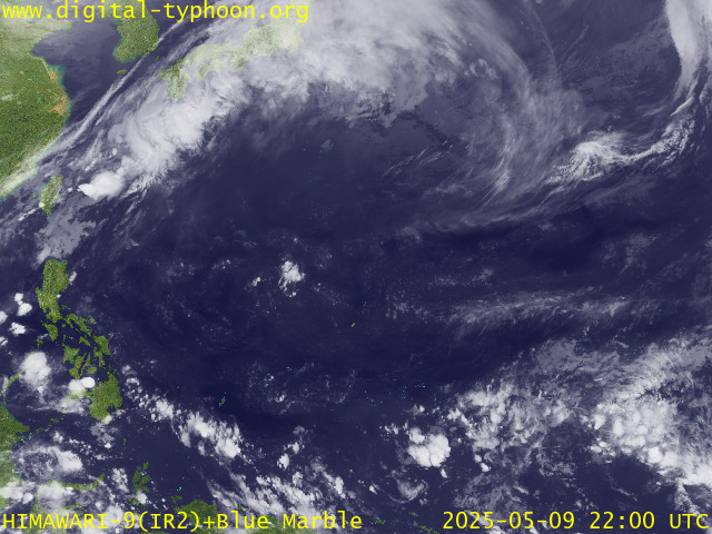
RECENT MTSAT-1R SATELLITE IMAGE:

> Image source: Digital-Typhoon.org (Nat'l. Institute of Informatics) (http://www.digital-typhoon.org )
__________________________________________________________________________________________
NOTES:

> Image source: Digital-Typhoon.
^ - JTWC commentary remarks (for Meteorologists) from their
latest warning.
latest warning.
* - Based on PAGASA's Philippine Storm Warning Signals,
# 4 being the highest. Red letters indicate new areas
being hoisted. For more explanations on these signals,
visit: http://www.typhoon2000.ph/signals.htm
** - Based on the Tropical Cyclone's Wave Height near
its center.
__________________________________________________________________________________________
>> To know the meteorological terminologies and acronyms
used on this update visit the ff:
http://typhoon2000.ph/tcterm.htm
http://www.nhc.noaa.gov/aboutgloss.shtml
http://www.srh.noaa.gov/oun/severewx/glossary.php
http://www.srh.weather.gov/fwd/glossarynation.html
http://www.nhc.noaa.gov/acronyms.shtml
__________________________________________________________________________________________
:: Typhoon2000.com (T2K) Mobile >> Powered by: Synermaxx
Receive the latest storm updates directly to your mobile phones! To know more:
Send T2K HELP to: 2800 (GLOBE & TM) | 216 (SMART & TNT) | 2288 (SUN)
Note: Globe & Smart charges P2.50 per message, while Sun at P2.00.
__________________________________________________________________________________________
For the complete details on TY FITOW (10W)...go visit
our website @:
> http://www.typhoon2000.com
> http://www.maybagyo.com
# 4 being the highest. Red letters indicate new areas
being hoisted. For more explanations on these signals,
visit: http://www.typhoon2
** - Based on the Tropical Cyclone's Wave Height near
its center.
____________
>> To know the meteorological terminologies and acronyms
used on this update visit the ff:
http://typhoon2000.
http://www.nhc.
http://www.srh.
http://www.srh.
http://www.nhc.
____________
:: Typhoon2000.
Receive the latest storm updates directly to your mobile phones! To know more:
Send T2K HELP to: 2800 (GLOBE & TM) | 216 (SMART & TNT) | 2288 (SUN)
Note: Globe & Smart charges P2.50 per message, while Sun at P2.00.
For the complete details on TY FITOW (10W)...go visit
our website @:
> http://www.typhoon2
> http://www.maybagyo
Change settings via the Web (Yahoo! ID required)
Change settings via email: Switch delivery to Daily Digest | Switch format to Traditional
Visit Your Group | Yahoo! Groups Terms of Use | Unsubscribe
.
__,_._,___
No comments:
Post a Comment