Typhoon2000 STORM UPDATE #003
Name: TROPICAL STORM 06W [UNNAMED]
Issued: 7:00 PM MANILA TIME (11:00 GMT) SAT 04 AUGUST 2007
Next Update: 7:00 AM (23:00 GMT) SUN 05 AUGUST
Source: JTWC TROPICAL CYCLONE WARNING #007
Next Update: 7:00 AM (23:00 GMT) SUN 05 AUGUST
Source: JTWC TROPICAL CYCLONE WARNING #007
_______________________________________________________________________
06W (UNNAMED) BECOMES A TROPICAL STORM...MOVING SLOWLY
WEST-NORTHWESTWARD...RAINS CONTINUES TO DUMP CENTRAL
VIETNAM.
+ FORECAST OUTLOOK: 06W is expected to turn to the NW in the direction of Hainan-Northern Vietnam area. The 2 to 5-day
forecast shows 06W accelerating slightly NW-ward passing
close to Southwestern Hainan Monday afternoon, Aug 6, upon
entering the Gulf of Tonkin. 06W shall reach its peak in-
tensity of 85 km/hr over the Gulf of Tonkin before dissi-
pating over the coast of Northern Vietnam on Thursday
afternoon Aug 09.
+ EFFECTS: 06W's circulation especially the western outer
bands continues to spread across Cambodia, Laos, Central
Vietnam & portions of Hainan Island. This outer bands
will continue to bring moderate to heavy rains with gale-
force winds across the area, most especially Central
Vietnam. Flash floods and mudslides are imminent along
river banks, low-lying and mountainous areas of the affec-
ted areas of IndoChina. Precautionary measures must be
implemented on the possible effects of this storm.
+ CURRENT MONSOON INTENSITY: Southwest (SW) Monsoon con-
tinues to be enhanced by a developing LPA over the Phili-
ppine Sea & TD 06W located over the South China Sea...
Cloudy skies with possible intermittent passing rains or
thunderstorms with SW'ly winds of 10 km/hr or higher can
be expected along the western sections of Southern Luzon,
Visayas & Mindanao particularly Mindoro, Southern Quezon,
Western Bicol, Western Zamboanga, Palawan, Western Panay
& Western Negros. This monsoon system may reach Luzon in
the next few days.
+ TROPICAL CYCLONE WATCH: The European Centre for Medium-
Range Weather Forecasts (ECMWF) continues to forecast the
formation of a Tropical Cyclone around August 7 or 8. During
the latest run of the model forecast at 8 AM Aug 04, it showed
the system forming over the Philippine Sea, just to the East
of Luzon - then heading WNW to NW in the direction of Taiwan-
Okinawa-Eastern China area as a Tropical Storm between Aug 9
to 11. This potential storm shall enhance the Southwest Mon-
soon and bring moderate to heavy rains over Luzon particu-
larly the western portions. If this happens, it may bring
relief to the dry areas of Luzon particularly over Angat Dam
and other reservoirs. This scenario remains supported by the
Global Tropics Benefits/Hazard Assessment of NOAA. Watch out
for continued updates on this potential system.
outlook, effects & current monsoon intensity, and tropical
cyclone watch changes every 06 to 12 hours!
____________
TIME/DATE: 5:00 PM MANILA TIME (09:00 GMT) 04 AUGUST
LOCATION OF CENTER: LATITUDE 14.1º N...LONGITUDE 111.3º E
DISTANCE 1: 305 KM (165 NM) NE OF NHA TRANG, VIETNAM
DISTANCE 2: 400 KM (215 NM) SE OF DA NANG, VIETNAM
DISTANCE 3: 495 KM (265 NM) SSE OF SANYA, HAINAN IS.
DISTANCE 4: 1,045 KM (565 NM) WEST OF METRO MANILA, PH
MAX SUSTAINED WINDS [1-MIN AVG]: 65 KM/HR (35 KTS)PEAK WIND GUSTS: 85 KM/HR (45 KTS)
SAFFIR-SIMPSON SCALE: N/A
MINIMUM CENTRAL PRESSURE (est.): 996 MILLIBARS (hPa)
RECENT MOVEMENT: WNW @ 11 KM/HR (06 KTS)
GENERAL DIRECTION: HAINAN-NORTHERN VIETNAM AREA
STORM'S SIZE (IN DIAMETER): 400 KM (215 NM)/AVERAGE
MAX WAVE HEIGHT**: 14 FEET (4.2 METERS)
VIEW TRACKING MAP: 2 PM HKT SAT AUGUST 04
TSR WIND PROBABILITIES: CURRENT TO 120 HRS LEAD
PHILIPPINE STORM SIGNALS*: N/A
12, 24 & 48 HR. FORECAST:
2 AM (18 GMT) 05 AUGUST: 14.7N 110.8E / 75-95 KPH / NW @ 11 KPH
2 PM (06 GMT) 05 AUGUST: 15.8N 110.1E / 75-95 KPH / NW @ 13 KPH
2 PM (06 GMT) 06 AUGUST: 17.7N 108.3E / 85-100 KPH / NW @ 05 KPH
REMARKS: 2 PM (06 GMT) 04 AUGUST POSITION: 13.9N 111.4E.
^TROPICAL STORM (TS) 06W (NONAME) HAS BEEN UPGRADED FROM A
TROPICAL DEPRESSION DUE TO A STRONG BURST OF CONVECTION
SOUTHWEST OF THE LOW LEVEL CIRCULATION CENTER (LLCC).
ANIMATED MULTISPECTRAL SATELLITE IMAGERY AND 89 GHZ MICRO-
WAVE IMAGERY HAVE SHOWN A PARTIALLY EXPOSED LLCC DUE TO
APPROXIMATELY 30 KTS OF EASTERLY VERTICAL WIND SHEAR OVER
THE STORM. TS 06W HAS REMAINED QUASI-STATIONARY OVER MUCH OF
THE LAST 12 HOURS UNDER THE COMPETING STEERING INFLUENCES OF
THE NEAR EQUATORIAL RIDGE (NER) SOUTHWEST OF SUMATRA AND THE
SUBTROPICAL RIDGE (STR) OVER SOUTHEASTERN CHINA...(more info)
____________
____________
RECENT TRACKING CHART:
________________________
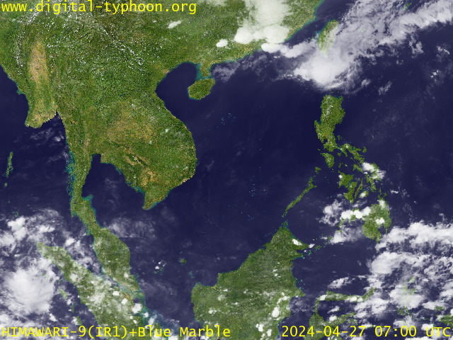
RECENT MTSAT-1R SATELLITE IMAGE:

> Image source: Digital-Typhoon.org (Nat'l. Institute of Informatics) (http://www.digital-typhoon.org )
__________________________________________________________________________________________
NOTES:

> Image source: Digital-Typhoon.
^ - JTWC commentary remarks (for Meteorologists) from their
latest warning.
latest warning.
* - Based on PAGASA's Philippine Storm Warning Signals,
# 4 being the highest. Red letters indicate new areas
being hoisted. For more explanations on these signals,
visit: http://www.typhoon2000.ph/signals.htm
** - Based on the Tropical Cyclone's Wave Height near
its center.
__________________________________________________________________________________________
>> To know the meteorological terminologies and acronyms
used on this update visit the ff:
http://typhoon2000.ph/tcterm.htm
http://www.nhc.noaa.gov/aboutgloss.shtml
http://www.srh...noaa.gov/oun/severewx/glossary.php
http://www.srh.weather.gov/fwd/glossarynation.html
http://www.nhc.noaa.gov/acronyms.shtml
__________________________________________________________________________________________
:: Typhoon2000.com (T2K) Mobile >> Powered by: Synermaxx
Receive the latest storm updates directly to your mobile phones! To know more:
Send T2K HELP to: 2800 (GLOBE & TM) | 216 (SMART & TNT) | 2288 (SUN)
Note: Globe & Smart charges P2.50 per message, while Sun at P2.00.
__________________________________________________________________________________________
For the complete details on TS 06W (UNNAMED)...go visit
our website @:
> http://www.typhoon2000.com
> http://www.maybagyo.com
# 4 being the highest. Red letters indicate new areas
being hoisted. For more explanations on these signals,
visit: http://www.typhoon2
** - Based on the Tropical Cyclone's Wave Height near
its center.
____________
>> To know the meteorological terminologies and acronyms
used on this update visit the ff:
http://typhoon2000.
http://www.nhc.
http://www.srh.
http://www.srh.
http://www.nhc.
____________
:: Typhoon2000.
Receive the latest storm updates directly to your mobile phones! To know more:
Send T2K HELP to: 2800 (GLOBE & TM) | 216 (SMART & TNT) | 2288 (SUN)
Note: Globe & Smart charges P2.50 per message, while Sun at P2.00.
For the complete details on TS 06W (UNNAMED)...
our website @:
> http://www.typhoon2
> http://www.maybagyo
Change settings via the Web (Yahoo! ID required)
Change settings via email: Switch delivery to Daily Digest | Switch format to Traditional
Visit Your Group | Yahoo! Groups Terms of Use | Unsubscribe
SPONSORED LINKS
.
__,_._,___
No comments:
Post a Comment