Typhoon2000 STORM UPDATE #003
Name: TROPICAL STORM WUTIP [DODONG/08W/0707]
Issued: 7:00 AM MANILA TIME (23:00 GMT) THU 09 AUGUST 2007
Next Update: 7:00 PM (11:00 GMT) THU 09 AUGUST
Source: JTWC TROPICAL CYCLONE WARNING #006
Next Update: 7:00 PM (11:00 GMT) THU 09 AUGUST
Source: JTWC TROPICAL CYCLONE WARNING #006
_______________________________________________________________________
TROPICAL STORM WUTIP (DODONG) HAS SLIGHTLY GAINED STRENGTH
AND SLOWED DOWN...APPROACHING THE SOUTHEASTERN COAST OF TAIWAN. THIS STORM WILL CONTINUE TO ENHANCE OR PULL THE
SOUTHWEST MONSOON, BRINGING OCCASIONAL RAINS ACROSS LUZON
AND WESTERN VISAYAS BECOMING MORE FREQUENT OVER METRO
MANILA AND NEARBY PROVINCES.
+ FORECAST OUTLOOK: WUTIP is expected to turn abruptly to
+ FORECAST OUTLOOK: WUTIP is expected to turn abruptly to
the WNW this morning, in response to the steering high
pressure north of the system - crossing Central Taiwan
before noon today. The 24-hour forecast shows WUTIP exi-
ting Taiwan into Taiwan Strait and shall make its final
landfall over Southern China tomorrow afternoon, passing
very close to Shantou, China. The system shall continue
moving overland, across the rugged terrain of China,
dissipating on the 11th of August (Saturday).
+ EFFECTS: WUTIP's broad circulation continues to osci-
+ EFFECTS: WUTIP's broad circulation continues to osci-
llate over the Bashi & Balintang Channel, with its sou-
thern outer bands affecting Batanes, Babuyan & Calayan
Group of Islands. Moderate to heavy rains and gusty
winds can be expected along the outer bands of this sys-
tem. Meanwhile, its western Inner Bands are now affec-
ting Central & Southern Taiwan. These bands may bring
gale-force winds with moderate to heavy rains. Flash
floods and mudslides are imminent along river banks,
low-lying and mountainous areas of Extreme Northern
Luzon & Taiwan. Precautionary measures must be
initiated as the system approaches.
+ CURRENT MONSOON INTENSITY: The Southwest (SW) Monsoon
+ CURRENT MONSOON INTENSITY: The Southwest (SW) Monsoon
remains strong as it is being enhanced by WUTIP...Cloudy
skies with occasional rains with SW'ly winds of 20 km/hr
or higher can be expected along Luzon (including Bicol
Region) & Visayas - becoming more frequent along the
western sections particularly Metro Manila, Zambales,
Bataan, Pangasinan, La Union, Benguet, Mindoro and the
Ilocos Provinces. Mudslides and flooding is likely along
river banks, low-lying & flood-prone areas of the affected
areas. Stay tuned for more Monsoon updates on the next
advisory.
Important Note: Please keep in mind that the above forecast
outlook, effects & current monsoon intensity, and tropical
cyclone watch changes every 06 to 12 hours!
____________
TIME/DATE: 5:00 AM MANILA TIME (21:00 GMT) 09 AUGUST
LOCATION OF CENTER: LATITUDE 22.8º N...LONGITUDE 121.9º E
DISTANCE 1: 255 KM (135 NM) NORTH OF BASCO, BATANES, PH
DISTANCE 2: 500 KM (270 NM) NORTH OF APARRI, CAGAYAN, PH
DISTANCE 3: 135 KM (72 NM) SSE OF HUALIEN, TAIWAN
DISTANCE 4: 245 KM (135 NM) SOUTH OF TAIPEI, TAIWAN
MAX SUSTAINED WINDS [1-MIN AVG]: 75 KM/HR (40 KTS)DISTANCE 4: 245 KM (135 NM) SOUTH OF TAIPEI, TAIWAN
PEAK WIND GUSTS: 95 KM/HR (50 KTS)
SAFFIR-SIMPSON SCALE: N/A
MINIMUM CENTRAL PRESSURE (est.): 993 MILLIBARS (hPa)
RECENT MOVEMENT: NW @ 13 KM/HR (07 KTS)
GENERAL DIRECTION: TAIWAN
STORM'S SIZE (IN DIAMETER): 630 KM (340 NM)/AVERAGE
MAX WAVE HEIGHT**: 13 FEET (3.9 METERS)
VIEW T2K TRACKING MAP: 2 AM MANILA TIME THU AUGUST 09
TSR WIND PROBABILITIES: CURRENT TO 48 HRS LEAD
PHILIPPINE STORM SIGNALS*:
#01 - BATANES & BABUYAN GROUP OF ISLANDS.
12, 24 & 48 HR. FORECAST:
2 PM (06 GMT) 09 AUGUST: 23.2N 120.6E / 65-85 KPH / W @ 19 KPH
2 AM (18 GMT) 10 AUGUST: 23.2N 118.5E / 65-85 KPH / W @ 19 KPH
2 AM (18 GMT) 11 AUGUST: 24.0N 114.7E / 35-55 KPH / WNW @ 15 KPH
REMARKS: 2 AM (18 GMT) 09 AUGUST POSITION: 22.6N 122.3E.
^TROPICAL STORM (TS) 08W (WUTIP) HAS CONSOLIDATED ONLY
SLIGHTLY DURING THE PAST TWELVE HOURS. RECENT MICROWAVE
IMAGERY REVEALS A MORE WELL-DEFINED LOW LEVEL CIRCULATION
CENTER (LLCC), BUT MODERATE NORTHEASTERLY VERTICAL WIND
SHEAR HAS PREVENTED SIGNIFICANT CONVECTION FROM PERSISTING
OVER THE CENTER. THE STORM CONTINUES TO TRACK ALONG THE
SOUTHERN PERIPHERY OF A SUBTROPICAL RIDGE EXTENDING
ACROSS THE WESTERN PACIFIC...(more)
>> WUTIP {pronounced: wu~teep}, meaning: Butterfly, it is
an insect with four broad, colorful wings. You can find
different kinds of butterfly in the countryside of Macau
islands during Spring and Summer. Name contributed
by: Macau, China.
_______________________________________________________________________
PAGASA CURRENT POSITION, MOVEMENT AND INTENSITY (10-min. ave.):
by: Macau, China.
____________
PAGASA CURRENT POSITION, MOVEMENT AND INTENSITY (10-min. ave.):
> 4 AM (20 GMT) 09 AUGUST: 22.3N 122.7E / NW @ 19 KPH / 75 kph
:: For the complete PAGASA bulletin, kindly visit their website
at: http://www.pagasa.dost.gov.ph/wb/tcupdate.shtml
:: For the complete PAGASA bulletin, kindly visit their website
at: http://www.pagasa.
_______________________________________________________________________
RECENT TRACKING CHART:
________________________
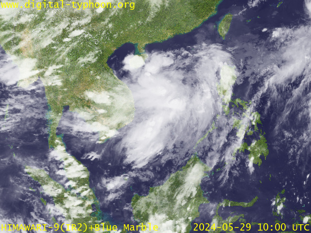
RECENT MTSAT-1R SATELLITE IMAGE:

> Image source: Digital-Typhoon.org (Nat'l. Institute of Informatics) (http://www.digital-typhoon.org )
__________________________________________________________________________________________
NOTES:

> Image source: Digital-Typhoon.
^ - JTWC commentary remarks (for Meteorologists) from their
latest warning.
latest warning.
* - Based on PAGASA's Philippine Storm Warning Signals,
# 4 being the highest. Red letters indicate new areas
being hoisted. For more explanations on these signals,
visit: http://www.typhoon2000.ph/signals.htm
** - Based on the Tropical Cyclone's Wave Height near
its center.
__________________________________________________________________________________________
>> To know the meteorological terminologies and acronyms
used on this update visit the ff:
http://typhoon2000.ph/tcterm.htm
http://www.nhc.noaa.gov/aboutgloss.shtml
http://www.srh.noaa.gov/oun/severewx/glossary.php
http://www.srh.weather.gov/fwd/glossarynation.html
http://www.nhc.noaa.gov/acronyms.shtml
__________________________________________________________________________________________
:: Typhoon2000.com (T2K) Mobile >> Powered by: Synermaxx
Receive the latest storm updates directly to your mobile phones! To know more:
Send T2K HELP to: 2800 (GLOBE & TM) | 216 (SMART & TNT) | 2288 (SUN)
Note: Globe & Smart charges P2.50 per message, while Sun at P2.00.
__________________________________________________________________________________________
For the complete details on TS WUTIP (DODONG)...go visit
our website @:
> http://www.typhoon2000.com
> http://www.maybagyo.com
# 4 being the highest. Red letters indicate new areas
being hoisted. For more explanations on these signals,
visit: http://www.typhoon2
** - Based on the Tropical Cyclone's Wave Height near
its center.
____________
>> To know the meteorological terminologies and acronyms
used on this update visit the ff:
http://typhoon2000.
http://www.nhc.
http://www.srh.
http://www.srh.
http://www.nhc.
____________
:: Typhoon2000.
Receive the latest storm updates directly to your mobile phones! To know more:
Send T2K HELP to: 2800 (GLOBE & TM) | 216 (SMART & TNT) | 2288 (SUN)
Note: Globe & Smart charges P2.50 per message, while Sun at P2.00.
For the complete details on TS WUTIP (DODONG)...go visit
our website @:
> http://www.typhoon2
> http://www.maybagyo
Change settings via the Web (Yahoo! ID required)
Change settings via email: Switch delivery to Daily Digest | Switch format to Traditional
Visit Your Group | Yahoo! Groups Terms of Use | Unsubscribe
SPONSORED LINKS
.
__,_._,___
No comments:
Post a Comment