Typhoon2000 STORM UPDATE #02
Name: TROPICAL STORM DOMENG [92W]
Issued: 7:00 AM MANILA TIME (23:00 GMT) SUN 25 JUNE 2006
Next Update: 7:00 PM (11:00 GMT) SUN 25 JUNE 2006
Source: PAGASA BULLETIN-WARNING #004
_______________________________________________________________________
Next Update: 7:00 PM (11:00 GMT) SUN 25 JUNE 2006
Source: PAGASA BULLETIN-WARNING #004
_______________________________________________________________________
DOMENG INTENSIFIED INTO A TROPICAL STORM AS IT STARTS TO CROSS LEYTE..
ITS CIRCULATION REMAINS BROAD AND HAS BEEN SLIGHTLY DISRUPTEDBY THE PHILIPPINES' LAND MASS.
+ FORECAST OUTLOOK: DOMENG is expected to make landfall over Leyte
this morning and shall be passing over Northern Cebu in the afternoon
around 2PM. This system is forecast to weaken slightly while traver-
sing the Northern Visayan Islands. 48-hr. forecast shows DOMENG
passing across the Northern Coastal areas Northern Panay affecting
Boracay Island Resort by early Monday morning, June 26 and shall pass
over Southern Mindoro (Monday) evening. Residents along the hazard-
prone areas (particularly low-lying and coastal areas) of Northern
Visayas and Southern Bicol are advised to take precautionary measures
as the storm moves over the area. Mapping out disaster preparedness
plans during DOMENG's approach must be completed now to avoid loss
of lives and properties.
+ EFFECTS: DOMENG's Inner Rainbands is now affecting Northern Visayas
and portions of Bicol Region while its Outer Bands is now spreading
across Mindoro, Southern Tagalog Provinces, and the whole of the Vi-
sayas as well as Northern Palawan. These rainbands particularly the
inner bands are expected to bring moderate to heavy torrential rains
with strong winds that could produce flying debris, life-threatening
flash floods and mudslides along river banks, low-lying areas and
mountain slopes over the affected areas.
+ CURRENT MONSOON INTENSITY: This storm is not yet enhancing the
Southwest Monsoon as of this time.
Important Note: Please keep in mind that the above forecast outlook,
effects & current monsoon intensity changes every 06 to 12 hours!
_______________________________________________________________________
TIME/DATE: 4:00 AM MANILA TIME (20:00 GMT) 25 JUNE
LOCATION OF CENTER: LATITUDE 10.8º N...LONGITUDE 125.4º E
DISTANCE 1: 50 KM (28 NM) SW OF GUIUAN, EASTERN SAMAR, PH
TIME/DATE: 4:00 AM MANILA TIME (20:00 GMT) 25 JUNE
LOCATION OF CENTER: LATITUDE 10.8º N...LONGITUDE 125.4º E
DISTANCE 1: 50 KM (28 NM) SW OF GUIUAN, EASTERN SAMAR, PH
DISTANCE 2: 70 KM (38 NM) ESE OF TACLOBAN CITY, LEYTE, PH
DISTANCE 3: 250 KM (135 NM) SE OF MASBATE, MASBATE, PH
MAX SUSTAINED WINDS [10-MIN AVG]: 75 KM/HR (40 KTS)
PEAK WIND GUSTS: 90 KM/HR (48 KTS)
MINIMUM CENTRAL PRESSURE (est.): 994 MILLIBARS (hPa)
MAX WAVE HEIGHT**: 08 FEET (2.4 METERS)
SAFFIR-SIMPSON SCALE: N/A
RECENT MOVEMENT: WNW @ 13 KM/HR (07 KTS)
GENERAL DIRECTION: LEYTE-NORTHERN CEBU AREA
STORM'S SIZE (IN DIAMETER): 400 KM (215 NM)/MEDIUM
VIEW T2K TRACKING MAP: 4 AM SUN JUNE 25
TSR WIND PROBABILITIES: N/A
PHILIPPINE STORM SIGNALS*:
#02 - ROMBLON, MASBATE, SAMAR AND LEYTE PROVINCES INCLUDING
BILIRAN ISLAND.
#01 - MARINDUQUE, CAMARINES SUR, SOUTHERN QUEZON, MINDORO
PROVINCES, SORSOGON, ALBAY, BURIAS ISLAND, CATANDUANES,
NORTHERN CEBU, AKLAN, CAPIZ, BORACAY, NORTHERN ILOILO,
NORTHERN SURIGAO, DINAGAT AND SIARGAO ISLANDS.
21-69 HR. FORECAST:
> 2 AM (18 GMT) 26 JUNE: 11.8N 122.7E [Off Northern Panay]
> 2 AM (18 GMT) 27 JUNE: 13.0N 120.3E [Off Southern Mindoro]
> 2 AM (18 GMT) 28 JUNE: 14.3N 117.8E [Off South China Sea]
REMARKS: 2 AM (18 GMT) 25 JUNE POSITION: 10.8N 125.4E.
_________________________________________________________________________________
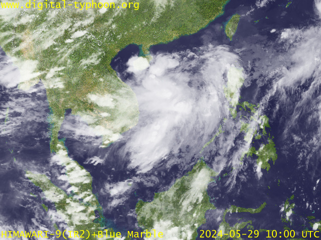
RECENT MTSAT-1R SATELLITE IMAGE:

> Image source: Digital-Typhoon.org (Nat'l. Institute of Informatics) (http://www.digital-typhoon.org)
__________________________________________________________________________________________
LATEST T2K TRACKING CHART:

_______________________________________________________________________________________
NOTES:

> Image source: Digital-Typhoon.org (Nat'l. Institute of Informatics) (http://www.digital-typhoon.org)
__________________________________________________________________________________________
LATEST T2K TRACKING CHART:

_______________________________________________________________________________________
NOTES:
^ - JTWC commentary remarks (for Meteorologists) from their latest warning.
* - Based on PAGASA's Philippine Storm Warning Signals, # 4 being the
highest. Red letters indicate new areas being hoisted. For more
explanations on these signals, visit: http://www.typhoon2000.ph/signals.htm
** - Based on the Tropical Cyclone's Sea Wave Height near its center.
__________________________________________________________________________________________
>> To know the meteorological terminologies and acronyms used on
this update visit the ff:
http://typhoon2000.ph/tcterm.htm
http://www.nhc.noaa.gov/aboutgloss.shtml
http://www.srhnoaa.gov/oun/severewx/glossary.php
http://www.srh.weather.gov/fwd/glossarynation.html
http://www.nhc.noaa.gov/acronyms.shtml
__________________________________________________________________________________________
T2K Mobile: receive the latest storm updates directly to your mobile phones! To know more,
Send T2K HELP to: 2800 (GLOBE & TM) | OFFLINE (SMART & TNT) | 2288 (SUN)
Powered by: Synermaxx
__________________________________________________________________________________________
For the complete details on the TD DOMENG (92W)...go visit our website @:
> http://www.typhoon2000.com
> http://www.maybagyo.com
:: Kindly view our site's disclaimer at: http://www.typhoon2000.ph/disclaimer.htm
Visit Your Group | Yahoo! Groups Terms of Use | Unsubscribe
SPONSORED LINKS
.
__,_._,___
No comments:
Post a Comment