Typhoon2000 STORM UPDATE #004
Name: TROPICAL STORM NURI [KAREN/13W/0812]
Issued: 7:00 PM MANILA TIME (11:00 GMT) MON 18 AUGUST 2008
Source: JTWC TROPICAL CYCLONE WARNING NUMBER 006
Note: Kindly refer to your country's official warnings or bulletins. This update is for additional information purposes only.
Source: JTWC TROPICAL CYCLONE WARNING NUMBER 006
Note: Kindly refer to your country's official warnings or bulletins. This update is for additional information purposes only.
_____________________________________________________________________________
TROPICAL STORM NURI (KAREN) MOVING RAPIDLY TO THE WEST...INCREASES ITS
THREAT TO NORTHERN LUZON...STORM WARNING SIGNAL NUMBER ONE NOW RAISED
OVER CAGAYAN AND ISABELA.
*This system may start enhancing the SW Monsoon Rains across the Philippines starting
tomorrow.
+ FORECAST OUTLOOK: NURI's forecast has dramatically changed and is now
*This system may start enhancing the SW Monsoon Rains across the Philippines starting
tomorrow.
+ FORECAST OUTLOOK: NURI's forecast has dramatically changed and is now
expected to continue its rapid movement, gradually turning WNW for the
next 2 days while traversing the Philippine Sea. NURI shall reach Typhoon
status tomorrow and cross Northern Cagayan on Wednesday afternoon, Aug 20
at approximately 2 PM local time (06 GMT). The 3 to 5-day long-range fore-
cast shows NURI gradually turning North upon passing over the Calayan Group
of Islands early Thursday morning (Aug 21), passing just to the west of Ba-
tanes Thursday afternoon. During its passage over Extreme Northern Luzon,
NURI is expected to reach Category 2 status w/ forecast winds of 160-165
km/hr. This system shall then recurve towards the NE brushing the SE &
Eastern Coast of Taiwan on Friday & Saturday (Aug 22-23) - becoming a
205-km/hr Category 3 Typhoon. *Alternate Forecast Scenario: There is a
possibilty that NURI may recurve earlier than expected, sparing Extreme
possibilty that NURI may recurve earlier than expected, sparing Extreme
Northern Luzon-Batanes Area on a direct hit, if the High Pressure Steering
Ridge to its North weakens quickly.
+ EFFECTS: NURI's radial circulation and spiral bands remains at sea, but
+ EFFECTS: NURI's radial circulation and spiral bands remains at sea, but
shall reach the eastern coast of Northern Luzon tomorrow. Also, this
storm shall begin enhancing the Southwest (SW) Monsoon tomorrow and bring
widespread rains across the Philippines particularly the Western Sections
of Luzon & Visayas including Metro Manila.
+ CURRENT MONSOON TROUGH (ITCZ) INTENSITY: Strong ITCZ (aka. Monsoon Trough)
+ CURRENT MONSOON TROUGH (ITCZ) INTENSITY: Strong ITCZ (aka. Monsoon Trough)
& Southwest Windflow affecting Southern Luzon, Eastern Visayas & Eastern
Mindanao. It shall bring widespread scattered rains and thunderstorms -
most especially in the afternoon or evening.
Important Note: Please keep in mind that the above forecast outlook,
effects & current monsoon intensity, and tropical cyclone watch changes
every 06 to 12 hours!
_____________________________________________________________________________
TIME/DATE: 5:00 PM MANILA TIME (09:00 GMT) 18 AUGUST
LOCATION OF CENTER: LATITUDE 16.2º N...LONGITUDE 130.6º E
DISTANCE 1: 735 KM (395 NM) NE OF VIRAC, CATANDUANES, PH
effects & current monsoon intensity, and tropical cyclone watch changes
every 06 to 12 hours!
____________
LOCATION OF CENTER: LATITUDE 16.2º N...LONGITUDE 130.6º E
DISTANCE 1: 735 KM (395 NM) NE OF VIRAC, CATANDUANES, PH
DISTANCE 2: 905 KM (490 NM) EAST OF CASIGURAN, AURORA, PH
DISTANCE 3: 960 KM (520 NM) ESE OF TUGUEGARAO CITY, PH
DISTANCE 4: 975 KM (525 NM) ESE OF APARRI, CAGAYAN, PH
MAX WINDS [1-MIN AVG]: 100 KM/HR (55 KTS) NEAR THE CENTER
PEAK WIND GUSTS: 130 KM/HR (70 KTS)
SAFFIR-SIMPSON SCALE: N/A
MINIMUM CENTRAL PRESSURE (est.): 982 MILLIBARS (hPa)
RECENT MOVEMENT: WEST @ 35 KM/HR (19 KTS)
GENERAL DIRECTION: CAGAYAN-BATANES AREA
STORM'S SIZE (IN DIAMETER): 650 KM (350 NM)/AVERAGE
MAX WAVE HEIGHT**: 13 FEET (3.9 METERS)
VIEW T2K TRACKING MAP: 5 PM MANILA TIME MON AUGUST 18
TSR WIND PROBABILITIES: CURRENT TO 120 HRS LEAD
PHILIPPINE STORM SIGNALS*:
# 01 - CAGAYAN AND ISABELA.
12, 24, 48 & 72 HR. FORECAST:
2 AM (18 GMT) 19 AUGUST: 16.5N 128.4E / 110-140 KPH / W @ 22 KPH
2 PM (06 GMT) 19 AUGUST: 16.9N 125.9E / 120-150 KPH / WNW @ 19 KPH
2 PM (06 GMT) 20 AUGUST: 18.3N 122.2E / 140-165 KPH / NW @ 09 KPH
2 PM (06 GMT) 21 AUGUST: 20.1N 120.9E / 160-195 KPH / N @ 11 KPH
REMARKS: 2 PM (06 GMT) 18 AUGUST POSITION: 16.1N 131.4E.
^TROPICAL STORM (TS) 13W HAS CONTINUED TO SLOWLY DEVELOP DISPLAYING
MARKEDLY IMPROVED ORGANIZATION OF THE LOW-LEVEL CIRCULATION CENTER
(LLCC) AND UPPER-LEVEL EQUATORWARD OUTFLOW OVER THE PAST 12 HOURS.
ANIMATED METSAT IMAGERY REVEALED IMPROVED CONVECTIVE BANDING OVER THE
WESTERN AND SOUTHERN PORTIONS OF THE SYSTEM WHICH CONTINUES TO TRACK
WESTWARD AT 15 KNOTS UNDER THE STEERING INFLUENCE OF THE LOW- TO MID-
LEVEL SUBTROPICAL RIDGE NORTH OF THE STORM. THE AVAILABLE DYNAMIC
MODEL AIDS ARE COMING INTO BETTER AGREEMENT REGARDING THE TRACK FORE-
CAST, HOWEVER A SIGNIFICANT DIFFERENCE STILL EXISTS IN THE MODEL
INTENSITY FORECAST WITH NOGAPS REMAINING THE MOST AGGRESSIVE OF ALL
DYNAMIC AIDS...(more)
>> NURI {pronounced: nu~ree}, meaning: Blue crowned parroquet in the
Malay language. Name contributed by: Malaysia.
_____________________________________________________________________________
PAGASA CURRENT POSITION, MOVEMENT AND INTENSITY (10-min. ave.):
RECENT T2K TRACKING CHART:
2 PM (06 GMT) 21 AUGUST: 20.1N 120.9E / 160-195 KPH / N @ 11 KPH
REMARKS: 2 PM (06 GMT) 18 AUGUST POSITION: 16.1N 131.4E.
^TROPICAL STORM (TS) 13W HAS CONTINUED TO SLOWLY DEVELOP DISPLAYING
MARKEDLY IMPROVED ORGANIZATION OF THE LOW-LEVEL CIRCULATION CENTER
(LLCC) AND UPPER-LEVEL EQUATORWARD OUTFLOW OVER THE PAST 12 HOURS.
ANIMATED METSAT IMAGERY REVEALED IMPROVED CONVECTIVE BANDING OVER THE
WESTERN AND SOUTHERN PORTIONS OF THE SYSTEM WHICH CONTINUES TO TRACK
WESTWARD AT 15 KNOTS UNDER THE STEERING INFLUENCE OF THE LOW- TO MID-
LEVEL SUBTROPICAL RIDGE NORTH OF THE STORM. THE AVAILABLE DYNAMIC
MODEL AIDS ARE COMING INTO BETTER AGREEMENT REGARDING THE TRACK FORE-
CAST, HOWEVER A SIGNIFICANT DIFFERENCE STILL EXISTS IN THE MODEL
INTENSITY FORECAST WITH NOGAPS REMAINING THE MOST AGGRESSIVE OF ALL
DYNAMIC AIDS...(more)
>> NURI {pronounced: nu~ree}, meaning: Blue crowned parroquet in the
Malay language. Name contributed by: Malaysia.
____________
PAGASA CURRENT POSITION, MOVEMENT AND INTENSITY (10-min. ave.):
> 4 PM (08 GMT) 18 AUGUST: 16.0N 131.1E / WEST @ 22 KPH / 85 kph
:: For the complete PAGASA bulletin, kindly visit their website at:
http://www.pagasa.dost.gov.ph/wb/tcupdate.shtml
:: For the complete PAGASA bulletin, kindly visit their website at:
http://www.pagasa.
_____________________________________________________________________________
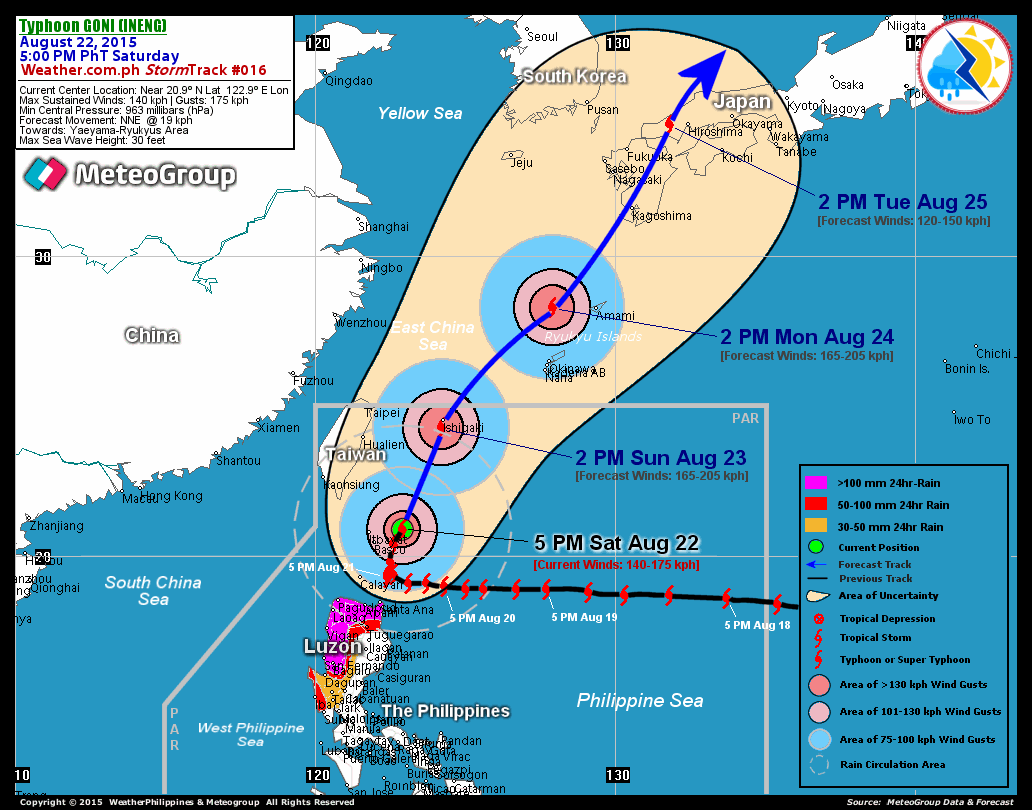
RECENT T2K TRACKING CHART:

________________________
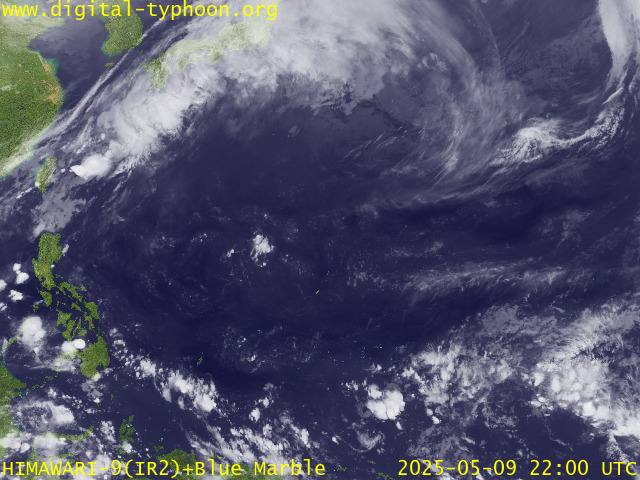
RECENT MTSAT-1R SATELLITE IMAGE:

> Image source: Digital-Typhoon.Org (http://www.digital-typhoon.org/ )
__________________________________________________________________________________________
NOTES:

> Image source: Digital-Typhoon.
^ - JTWC commentary remarks (for Meteorologists) from their
latest warning.
latest warning.
* - Based on PAGASA's Philippine Storm Warning Signals,
# 4 being the highest. For more explanations on these
signals, visit: http://www.typhoon2000.ph/signals.htm
** - Based on the Tropical Cyclone's Wave Height near
its center.
__________________________________________________________________________________________
>> To know the meteorological terminologies and acronyms
used on this update visit the ff:
http://typhoon2000.ph/tcterm.htm
http://www.nhc.noaa.gov/aboutgloss.shtml
http://www.srh.noaa.gov/oun/severewx/glossary.php
http://www.srh.weather.gov/fwd/glossarynation.html
http://www.nhc.noaa.gov/acronyms.shtml
__________________________________________________________________________________________
:: Typhoon2000.com (T2K) Mobile >> Powered by: Synermaxx
Receive the latest 6-hrly storm updates on KAREN directly to your mobile phones! To get:
Send T2K TYPHOON to: 2800 (GLOBE & TM) | 216 (SMART & TNT) | 2288 (SUN)
Note: Globe & Smart charges P2.50 per message, while Sun at P2.00.
__________________________________________________________________________________________
For the complete details on TS NURI (KAREN)...go visit
our website @:
> http://www.typhoon2000.com
> http://www.maybagyo.com
# 4 being the highest. For more explanations on these
signals, visit: http://www.typhoon2
** - Based on the Tropical Cyclone's Wave Height near
its center.
____________
>> To know the meteorological terminologies and acronyms
used on this update visit the ff:
http://typhoon2000.
http://www.nhc.
http://www.srh.
http://www.srh.
http://www.nhc.
____________
:: Typhoon2000.
Receive the latest 6-hrly storm updates on KAREN directly to your mobile phones! To get:
Send T2K TYPHOON to: 2800 (GLOBE & TM) | 216 (SMART & TNT) | 2288 (SUN)
Note: Globe & Smart charges P2.50 per message, while Sun at P2.00.
For the complete details on TS NURI (KAREN)...go visit
our website @:
> http://www.typhoon2
> http://www.maybagyo
Copyright © 2008 Typhoon2000.
Change settings via the Web (Yahoo! ID required)
Change settings via email: Switch delivery to Daily Digest | Switch format to Traditional
Visit Your Group | Yahoo! Groups Terms of Use | Unsubscribe
.
__,_._,___
No comments:
Post a Comment