Typhoon2000 STORM UPDATE #001
Name: TROPICAL DEPRESSION 13W [NONAME]
Issued: 12:00 PM MANILA TIME (04:00 GMT) SUN 17 AUGUST 2008
Source: JTWC TROPICAL CYCLONE WARNING NUMBER 001
Note: Kindly refer to your country's official warnings or bulletins. This update is for additional information purposes only.
Source: JTWC TROPICAL CYCLONE WARNING NUMBER 001
Note: Kindly refer to your country's official warnings or bulletins. This update is for additional information purposes only.
_____________________________________________________________________________
TROPICAL DEPRESSION 13W (NONAME) NEWLY-FORMED WEST OF GUAM...ACCELERATING
WEST-NORTHWEST TOWARDS THE PHILIPPINE SEA...SHALL ENTER THE PHILIPPINE
WEST-NORTHWEST TOWARDS THE PHILIPPINE SEA...SHALL ENTER THE PHILIPPINE
AREA OF RESPONSIBILITY (PAR) TOMORROW.
+ FORECAST OUTLOOK: 13W is expected to maintain its fast WNW track for the
+ FORECAST OUTLOOK: 13W is expected to maintain its fast WNW track for the
next 2 to 3 days and shall reach Tropical Storm status before entering PAR
tomorrow. The 3 to 5-day long-range forecast shows 13W turning gradually
towards the NW to NNW on Wednesday and Thursday (Aug 20-21) in the direc-
tion of Taiwan-Okinawa area. *Alternate Forecast Scenario: There is a po-
ssibilty that 13W may continue moving WNW passing over Northern Luzon-
Batanes Area, if the High Pressure Steering Ridge to its North remains
strong and extends westward.
+ EFFECTS: 13W's developing circulation and spiral bands remains at sea
ssibilty that 13W may continue moving WNW passing over Northern Luzon-
Batanes Area, if the High Pressure Steering Ridge to its North remains
strong and extends westward.
+ EFFECTS: 13W's developing circulation and spiral bands remains at sea
and is not affecting any Pacific Islands at this time. Once this system
reaches the Philippine Sea, it may enhance the Southwest (SW) Monsoon
and bring widespread rains across the Philippines next week.
+ CURRENT MONSOON TROUGH (ITCZ) INTENSITY: Strong ITCZ (aka. Monsoon Trough)
+ CURRENT MONSOON TROUGH (ITCZ) INTENSITY: Strong ITCZ (aka. Monsoon Trough)
& Southwest Windflow affecting the Philippines. It will continue to bring
widespread scattered rains and thunderstorms - most especially in the
afternoon or evening becoming more frequent across Mindoro, Palawan
and Western Visayas.
Important Note: Please keep in mind that the above forecast outlook,
effects & current monsoon intensity, and tropical cyclone watch changes
every 06 to 12 hours!
_____________________________________________________________________________
TIME/DATE: 11:00 AM MANILA TIME (03:00 GMT) 17 AUGUST
LOCATION OF CENTER: LATITUDE 14.7º N...LONGITUDE 140.8º E
DISTANCE 1: 455 KM (245 NM) WNW OF HAGATNA, GUAM, CNMI
effects & current monsoon intensity, and tropical cyclone watch changes
every 06 to 12 hours!
____________
LOCATION OF CENTER: LATITUDE 14.7º N...LONGITUDE 140.8º E
DISTANCE 1: 455 KM (245 NM) WNW OF HAGATNA, GUAM, CNMI
DISTANCE 2: 625 KM (335 NM) EAST OF PHILIPPINE AREA OF RESPONSIBILITY
DISTANCE 3: 1,785 KM (965 NM) EAST OF BICOL REGION, PH
MAX WINDS [1-MIN AVG]: 45 KM/HR (25 KTS) NEAR THE CENTER
PEAK WIND GUSTS: 65 KM/HR (35 KTS)
SAFFIR-SIMPSON SCALE: N/A
MINIMUM CENTRAL PRESSURE (est.): 1002 MILLIBARS (hPa)
RECENT MOVEMENT: WNW @ 24 KM/HR (13 KTS)
GENERAL DIRECTION: PHILIPPINE SEA
STORM'S SIZE (IN DIAMETER): --- KM (--- NM)/N/A
MAX WAVE HEIGHT**: 08 FEET (2.4 METERS)
VIEW TRACKING MAP: 8 AM MANILA TIME SUN AUGUST 17
TSR WIND PROBABILITIES: CURRENT TO 120 HRS LEAD
PHILIPPINE STORM SIGNALS*: NONE
12, 24, 48 & 72 HR. FORECAST:
8 PM (12 GMT) 17 AUGUST: 15.4N 139.1E / 55-75 KPH / WNW @ 22 KPH
8 AM (00 GMT) 18 AUGUST: 16.1N 136.7E / 65-85 KPH / WNW @ 22 KPH
8 AM (00 GMT) 19 AUGUST: 17.2N 132.2E / 85-100 KPH / WNW @ 13 KPH
8 AM (00 GMT) 20 AUGUST: 18.0N 129.5E / 95-120 KPH / NW @ 09 KPH
REMARKS: 8 AM (00 GMT) 17 AUGUST POSITION: 14.4N 141.3E.
^...(more)
_____________________________________________________________________________
RECENT WUNDERGROUND.COM TRACKING CHART :
8 AM (00 GMT) 20 AUGUST: 18.0N 129.5E / 95-120 KPH / NW @ 09 KPH
REMARKS: 8 AM (00 GMT) 17 AUGUST POSITION: 14.4N 141.3E.
^...(more)
____________
_____________________________________________________________________________
RECENT WUNDERGROUND.
________________________
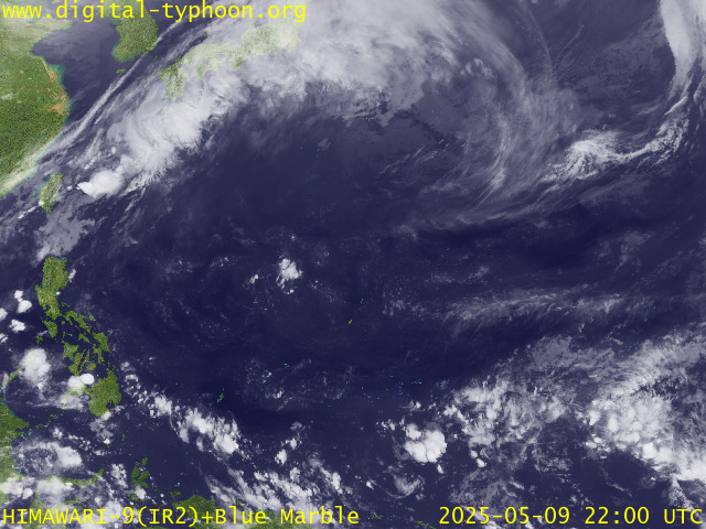
RECENT MTSAT-1R SATELLITE IMAGE:

> Image source: Digital-Typhoon.Org (http://www.digital-typhoon.org/ )
__________________________________________________________________________________________
NOTES:

> Image source: Digital-Typhoon.
^ - JTWC commentary remarks (for Meteorologists) from their
latest warning.
latest warning.
* - Based on PAGASA's Philippine Storm Warning Signals,
# 4 being the highest. For more explanations on these
signals, visit: http://www.typhoon2000.ph/signals.htm
** - Based on the Tropical Cyclone's Wave Height near
its center.
__________________________________________________________________________________________
>> To know the meteorological terminologies and acronyms
used on this update visit the ff:
http://typhoon2000.ph/tcterm.htm
http://www.nhc.noaa.gov/aboutgloss.shtml
http://www.srh.noaa.gov/oun/severewx/glossary.php
http://www.srh.weather.gov/fwd/glossarynation.html
http://www.nhc.noaa.gov/acronyms.shtml
__________________________________________________________________________________________
:: Typhoon2000.com (T2K) Mobile >> Powered by: Synermaxx
Receive the latest 6-hrly storm updates directly to your mobile phones! To get:
Send T2K TYPHOON to: 2800 (GLOBE & TM) | 216 (SMART & TNT) | 2288 (SUN)
Note: Globe & Smart charges P2.50 per message, while Sun at P2.00.
__________________________________________________________________________________________
For the complete details on TD 13W (NONAME)...go visit
our website @:
> http://www.typhoon2000.com
> http://www.maybagyo.com
# 4 being the highest. For more explanations on these
signals, visit: http://www.typhoon2
** - Based on the Tropical Cyclone's Wave Height near
its center.
____________
>> To know the meteorological terminologies and acronyms
used on this update visit the ff:
http://typhoon2000.
http://www.nhc.
http://www.srh.
http://www.srh.
http://www.nhc.
____________
:: Typhoon2000.
Receive the latest 6-hrly storm updates directly to your mobile phones! To get:
Send T2K TYPHOON to: 2800 (GLOBE & TM) | 216 (SMART & TNT) | 2288 (SUN)
Note: Globe & Smart charges P2.50 per message, while Sun at P2.00.
For the complete details on TD 13W (NONAME)...go visit
our website @:
> http://www.typhoon2
> http://www.maybagyo
Copyright © 2008 Typhoon2000.
Change settings via the Web (Yahoo! ID required)
Change settings via email: Switch delivery to Daily Digest | Switch format to Traditional
Visit Your Group | Yahoo! Groups Terms of Use | Unsubscribe
.
__,_._,___
No comments:
Post a Comment