Typhoon2000 STORM UPDATE #003
Name: TROPICAL STORM KAREN [13W]
Issued: 7:00 AM MANILA TIME (23:00 GMT) MON 18 AUGUST 2008
Source: JTWC TROPICAL CYCLONE WARNING NUMBER 004
Note: Kindly refer to your country's official warnings or bulletins. This update is for additional information purposes only.
Source: JTWC TROPICAL CYCLONE WARNING NUMBER 004
Note: Kindly refer to your country's official warnings or bulletins. This update is for additional information purposes only.
_____________________________________________________________________________
13W BECOMES A TROPICAL STORM LOCALLY NAMED KAREN...STILL MOVING FAST
ON A WESTERLY TRACK TOWARDS EXTREME NORTHERN LUZON.
*This system may start enhancing the SW Monsoon Rains across the Philippines starting
tomorrow.
+ FORECAST OUTLOOK: KAREN is expected to maintain its WNW track for the
*This system may start enhancing the SW Monsoon Rains across the Philippines starting
tomorrow.
+ FORECAST OUTLOOK: KAREN is expected to maintain its WNW track for the
next 2 days while traversing the Philippine Sea. The 3 to 5-day long-range
forecast shows KAREN becoming a Typhoon and turning gradually towards the
NW to NNW on Thursday and Friday (Aug 21-22) in the direction of Taiwan.
It shall be approaching the Eastern Coast of Taiwan on early Saturday
morning, Aug 23 with projected wind speed of 205 km/hr. *Alternate Fore-
cast Scenario: There is a possibilty that KAREN may continue moving WNW
passing over Northern Luzon-Batanes Area, if the High Pressure Steering
Ridge to its North remains strong and extends westward.
+ EFFECTS: KAREN's radial circulation and spiral bands remains at sea and
passing over Northern Luzon-Batanes Area, if the High Pressure Steering
Ridge to its North remains strong and extends westward.
+ EFFECTS: KAREN's radial circulation and spiral bands remains at sea and
is not yet affecting the Philippines. Once this system reaches the Phili-
ppine Sea, it may enhance the Southwest (SW) Monsoon and bring widespread
rains across the Philippines starting tomorrow.
+ CURRENT MONSOON TROUGH (ITCZ) INTENSITY: Strong ITCZ (aka. Monsoon Trough)
+ CURRENT MONSOON TROUGH (ITCZ) INTENSITY: Strong ITCZ (aka. Monsoon Trough)
& Southwest Windflow affecting Southern Visayas & Mindanao. It shall bring
widespread scattered rains and thunderstorms - most especially in the
afternoon or evening.
widespread scattered rains and thunderstorms - most especially in the
afternoon or evening.
Important Note: Please keep in mind that the above forecast outlook,
effects & current monsoon intensity, and tropical cyclone watch changes
every 06 to 12 hours!
_____________________________________________________________________________
TIME/DATE: 5:00 AM MANILA TIME (21:00 GMT) 18 AUGUST
LOCATION OF CENTER: LATITUDE 16.2º N...LONGITUDE 134.5º E
DISTANCE 1: 1,325 KM (715 NM) EAST OF CASIGURAN, AURORA
effects & current monsoon intensity, and tropical cyclone watch changes
every 06 to 12 hours!
____________
LOCATION OF CENTER: LATITUDE 16.2º N...LONGITUDE 134.5º E
DISTANCE 1: 1,325 KM (715 NM) EAST OF CASIGURAN, AURORA
DISTANCE 2: 1,145 KM (618 NM) ENE OF VIRAC, CATANDUANES, PH
DISTANCE 3: 1,380 KM (745 NM) ESE OF APARRI, CAGAYAN, PH
MAX WINDS [1-MIN AVG]: 75 KM/HR (40 KTS) NEAR THE CENTER
PEAK WIND GUSTS: 95 KM/HR (50 KTS)
SAFFIR-SIMPSON SCALE: N/A
MINIMUM CENTRAL PRESSURE (est.): 993 MILLIBARS (hPa)
RECENT MOVEMENT: WEST @ 28 KM/HR (15 KTS)
GENERAL DIRECTION: EXTREME NORTHERN LUZON
STORM'S SIZE (IN DIAMETER): --- KM (--- NM)/N/A
MAX WAVE HEIGHT**: 14 FEET (4.2 METERS)
VIEW TRACKING MAP: 2 AM MANILA TIME MON AUGUST 18
TSR WIND PROBABILITIES: CURRENT TO 120 HRS LEAD
PHILIPPINE STORM SIGNALS*: NONE
12, 24, 48 & 72 HR. FORECAST:
2 PM (06 GMT) 18 AUGUST: 16.8N 132.4E / 85-100 KPH / WNW @ 24 KPH
2 AM (18 GMT) 19 AUGUST: 17.5N 129.8E / 95-120 KPH / W @ 20 KPH
2 AM (18 GMT) 20 AUGUST: 18.4N 125.9E / 110-140 KPH / WNW @ 11 KPH
2 AM (18 GMT) 21 AUGUST: 19.7N 123.7E / 130-160 KPH / NW @ 09 KPH
REMARKS: 2 AM (18 GMT) 18 AUGUST POSITION: 16.0N 135.2E.
^THE SYSTEM WAS UPGRADED TO A TROPICAL STORM (TS) ON THE 17/12Z
WARNING CYCLE BASED ON MARKEDLY IMPROVED ORGANIZATION OF THE LOW-
LEVEL CIRCULATION CENTER (LLCC). ANIMATED SATELLITE IMAGERY AND A
171005Z SSMIS IMAGE REVEALED IMPROVED, CONVERGENT CONVECTIVE BANDING
OVER THE SOUTHERN SEMI-CIRCLE WRAPPING INTO THE SOUTHEASTERN QUAD-
RANT. THE SYSTEM HAS CONTINUED TO TRACK QUICKLY WESTWARD TO WEST-
NORTHWESTWARD UNDER THE STEERING INFLUENCE OF THE LOW- TO MID-
LEVEL SUBTROPICAL RIDGE NORTH OF THE SYSTEM. THE AVAILABLE DYNAMIC
MODEL TRACKERS REMAIN LIMITED BUT IN FAIRLY GOOD AGREEMENT THROUGH
TAU 72...(more)
_____________________________________________________________________________
PAGASA CURRENT POSITION, MOVEMENT AND INTENSITY (10-min. ave.):
RECENT WUNDERGROUND.COM TRACKING CHART :
2 AM (18 GMT) 21 AUGUST: 19.7N 123.7E / 130-160 KPH / NW @ 09 KPH
REMARKS: 2 AM (18 GMT) 18 AUGUST POSITION: 16.0N 135.2E.
^THE SYSTEM WAS UPGRADED TO A TROPICAL STORM (TS) ON THE 17/12Z
WARNING CYCLE BASED ON MARKEDLY IMPROVED ORGANIZATION OF THE LOW-
LEVEL CIRCULATION CENTER (LLCC). ANIMATED SATELLITE IMAGERY AND A
171005Z SSMIS IMAGE REVEALED IMPROVED, CONVERGENT CONVECTIVE BANDING
OVER THE SOUTHERN SEMI-CIRCLE WRAPPING INTO THE SOUTHEASTERN QUAD-
RANT. THE SYSTEM HAS CONTINUED TO TRACK QUICKLY WESTWARD TO WEST-
NORTHWESTWARD UNDER THE STEERING INFLUENCE OF THE LOW- TO MID-
LEVEL SUBTROPICAL RIDGE NORTH OF THE SYSTEM. THE AVAILABLE DYNAMIC
MODEL TRACKERS REMAIN LIMITED BUT IN FAIRLY GOOD AGREEMENT THROUGH
TAU 72...(more)
____________
PAGASA CURRENT POSITION, MOVEMENT AND INTENSITY (10-min. ave.):
> 2 AM (18 GMT) 18 AUGUST: 15.9N 134.1E / WNW @ 19 KPH / 65 kph
:: For the complete PAGASA bulletin, kindly visit their website at:
http://www.pagasa.dost.gov.ph/wb/tcupdate.shtml
:: For the complete PAGASA bulletin, kindly visit their website at:
http://www.pagasa.
_____________________________________________________________________________
RECENT WUNDERGROUND.
________________________
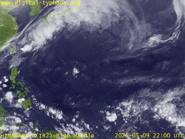
RECENT MTSAT-1R SATELLITE IMAGE:

> Image source: Digital-Typhoon.Org (http://www.digital-typhoon.org/ )
__________________________________________________________________________________________
NOTES:

> Image source: Digital-Typhoon.
^ - JTWC commentary remarks (for Meteorologists) from their
latest warning.
latest warning.
* - Based on PAGASA's Philippine Storm Warning Signals,
# 4 being the highest. For more explanations on these
signals, visit: http://www.typhoon2000.ph/signals.htm
** - Based on the Tropical Cyclone's Wave Height near
its center.
__________________________________________________________________________________________
>> To know the meteorological terminologies and acronyms
used on this update visit the ff:
http://typhoon2000.ph/tcterm.htm
http://www.nhc.noaa.gov/aboutgloss.shtml
http://www.srh.noaa.gov/oun/severewx/glossary.php
http://www.srh.weather.gov/fwd/glossarynation.html
http://www.nhc.noaa.gov/acronyms.shtml
__________________________________________________________________________________________
:: Typhoon2000.com (T2K) Mobile >> Powered by: Synermaxx
Receive the latest 6-hrly storm updates on KAREN directly to your mobile phones! To get:
Send T2K TYPHOON to: 2800 (GLOBE & TM) | 216 (SMART & TNT) | 2288 (SUN)
Note: Globe & Smart charges P2.50 per message, while Sun at P2.00.
__________________________________________________________________________________________
For the complete details on TS KAREN (13W)...go visit
our website @:
> http://www.typhoon2000.com
> http://www.maybagyo.com
# 4 being the highest. For more explanations on these
signals, visit: http://www.typhoon2
** - Based on the Tropical Cyclone's Wave Height near
its center.
____________
>> To know the meteorological terminologies and acronyms
used on this update visit the ff:
http://typhoon2000.
http://www.nhc.
http://www.srh.
http://www.srh.
http://www.nhc.
____________
:: Typhoon2000.
Receive the latest 6-hrly storm updates on KAREN directly to your mobile phones! To get:
Send T2K TYPHOON to: 2800 (GLOBE & TM) | 216 (SMART & TNT) | 2288 (SUN)
Note: Globe & Smart charges P2.50 per message, while Sun at P2.00.
For the complete details on TS KAREN (13W)...go visit
our website @:
> http://www.typhoon2
> http://www.maybagyo
Copyright © 2008 Typhoon2000.
Change settings via the Web (Yahoo! ID required)
Change settings via email: Switch delivery to Daily Digest | Switch format to Traditional
Visit Your Group | Yahoo! Groups Terms of Use | Unsubscribe
.
__,_._,___
No comments:
Post a Comment