Typhoon2000 STORM UPDATE #002
Name: TROPICAL STORM 04W [UNNAMED]
Issued: 7:00 PM MANILA TIME (11:00 GMT) SUN 08 JULY 2007
Next Update: 7:00 AM (23:00 GMT) MON 09 JULY
Source: JTWC TROPICAL CYCLONE WARNING #004
Next Update: 7:00 AM (23:00 GMT) MON 09 JULY
Source: JTWC TROPICAL CYCLONE WARNING #004
_______________________________________________________________________
TROPICAL STORM 04W (UNNAMED) CONTINUES MOVING NORTHWESTERLY
TOWARD FARAULEP-YAP-ULITHI ISLANDS .
+ FORECAST OUTLOOK: 04W is expected to continue intensifying TOWARD FARAULEP-YAP-
under favorable atmospheric conditions. This system shall move
in a generally steady NW'ly track for the next 3 to 5 days.
It shall be passing about 300 km to the NE of Yap Island early
Tuesday morning, July 10 as a Category 1 Typhoon, with pro-
jected 1-min. sustained winds of 140 km/hr. Majority of the
computer forecast models continues to show a Taiwan-Okinawa
trajectory sometime July 13-15. Based on its current speed,
04W is forecast to enter the Philippine Area of Responsibi-
lity (PAR) around Wednesday morning, July 11.
+ EFFECTS: 04W's circulation continues to expand with its
outer cloud bands expected to reach the islands of Yap
state, Guam & the Southern Mariana tonight & tomorrow.
+ MONSOON INTENSITY FORECAST: The advance 4 to 5-day long-
range forecasts suggest a surge of moderate to strong South-
west (SW) Monsoon which is likely to affect the Philippines
sometime July 12-14 (Thu-Sat) due to the passage of 04W,
which is expected to enhance the Monsoon system. Cloudy
skies with intermittent passing rains or thunderstorms can
be expected across the country w/ SW'ly winds of 20 km/hr
or higher, becoming more intense along Western Luzon & Wes-
tern Visayas including Metro Manila. Stay tuned for more
Monsoon updates in the coming days.
+ TROPICAL CYCLONE WATCH: The Tropical Disturbance (90W/
LPA/1008 MB) over the South China Sea has dissipated due
to unfavorable atmospheric conditions over the area.
Important Note: Please keep in mind that the above forecast
outlook, effects & current monsoon intensity, and tropical
cyclone watch changes every 06 to 12 hours!
____________
TIME/DATE: 5:00 PM MANILA TIME (09:00 GMT) 08 JULY
LOCATION OF CENTER: LATITUDE 7.8º N...LONGITUDE 145.5º E
DISTANCE 1: 630 KM (340 NM) SOUTH OF HAGATNA, GUAM
DISTANCE 2: 835 KM (450 NM) ESE OF COLONIA, YAP IS.
DISTANCE 3: 1,215 KM (655 NM) ENE OF PALAU
DISTANCE 4: 2,400 KM (1,295 NM) ESE OF BICOL REGION, PH
MAX SUSTAINED WINDS [1-MIN AVG]: 65 KM/HR (35 KTS)PEAK WIND GUSTS: 85 KM/HR (45 KTS)
SAFFIR-SIMPSON SCALE: N/A
MINIMUM CENTRAL PRESSURE (est.): 997 MILLIBARS (hPa)
RECENT MOVEMENT: NW @ 20 KM/HR (11 KTS)
GENERAL DIRECTION: FARAULEP-YAP-
STORM'S SIZE (IN DIAMETER): 670 KM (360 NM)/LARGE
VIEW TRACKING MAP: 2 PM HKT SUN JULY 08
TSR WIND PROBABILITIES: CURRENT TO 120 HRS LEAD
PHILIPPINE STORM SIGNALS*: N/A
12 & 24 HR. FORECAST:
2 AM (18 GMT) 09 JULY: 8.9N 144.1E / 95-120 KPH / NW @ 22 KPH
2 PM (06 GMT) 09 JULY: 10.2N 142.1E / 110-140 KPH / NW @ 22 KPH
REMARKS: 2 PM (06 GMT) 08 JULY POSITION: 7.5N 145.9E.
^A QUIKSCAT SATELLITE PASS AND ANIMATED MULTISPECTRAL SATELLITE
IMAGERY SUGGEST THE LOW LEVEL CIRCULATION CENTER (LLCC) IS STILL
BROAD IN NATURE AND THUS SOME UNCERTAINTY EXISTS WITH THE CURRENT
POSITION. TS 04W IS TRACKING ALONG THE SOUTHERN PERIPHERY OF THE
MID-LEVEL SUBTROPICAL HIGH PRESSURE RIDGE (STHPR) NORTH OF THE
STORM. THE OVERALL EXTENT OF CIRCULATION IS LARGE, AS IS INDICA-
TED BY DEEP SOUTHERLY WINDS OBSERVED AT CHUUK, OVER 300 NM
AWAY....(more info)
____________
_______________________________________________________________________
RECENT TRACKING CHART:
________________________
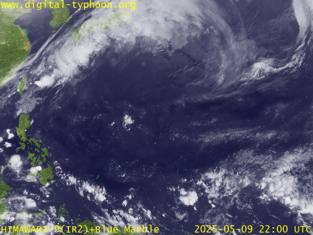
RECENT MTSAT-1R SATELLITE IMAGE:

> Image source: Digital-Typhoon.org (Nat'l. Institute of Informatics) (http://www.digital-typhoon.org )
__________________________________________________________________________________________
NOTES:

> Image source: Digital-Typhoon.
^ - JTWC commentary remarks (for Meteorologists) from their
latest warning.
latest warning.
* - Based on PAGASA's Philippine Storm Warning Signals,
# 4 being the highest. Red letters indicate new areas
being hoisted. For more explanations on these signals,
visit: http://www.typhoon2000.ph/signals.htm
** - Based on the Tropical Cyclone's Wave Height near
its center.
__________________________________________________________________________________________
>> To know the meteorological terminologies and acronyms
used on this update visit the ff:
http://typhoon2000.ph/tcterm.htm
http://www.nhc.noaa.gov/aboutgloss.shtml
http://www.srh.noaa.gov/oun/severewx/glossary.php
http://www.srh.weather.gov/fwd/glossarynation.html
http://www.nhc.noaa.gov/acronyms.shtml
__________________________________________________________________________________________
:: Typhoon2000.com (T2K) Mobile >> Powered by: Synermaxx
Receive the latest storm updates directly to your mobile phones! To know more:
Send T2K HELP to: 2800 (GLOBE & TM) | 216 (SMART & TNT) | 2288 (SUN)
Note: Globe & Smart charges P2.50 per message, while Sun at P2.00.
__________________________________________________________________________________________
For the complete details on TS 04W (UNNAMED)...go visit
our website @:
> http://www.typhoon2000.com
> http://www.maybagyo.com
# 4 being the highest. Red letters indicate new areas
being hoisted. For more explanations on these signals,
visit: http://www.typhoon2
** - Based on the Tropical Cyclone's Wave Height near
its center.
____________
>> To know the meteorological terminologies and acronyms
used on this update visit the ff:
http://typhoon2000.
http://www.nhc.
http://www.srh.
http://www.srh.
http://www.nhc.
____________
:: Typhoon2000.
Receive the latest storm updates directly to your mobile phones! To know more:
Send T2K HELP to: 2800 (GLOBE & TM) | 216 (SMART & TNT) | 2288 (SUN)
Note: Globe & Smart charges P2.50 per message, while Sun at P2.00.
For the complete details on TS 04W (UNNAMED)...
our website @:
> http://www.typhoon2
> http://www.maybagyo
Change settings via the Web (Yahoo! ID required)
Change settings via email: Switch delivery to Daily Digest | Switch format to Traditional
Visit Your Group | Yahoo! Groups Terms of Use | Unsubscribe
SPONSORED LINKS
.
__,_._,___
No comments:
Post a Comment