Sunday, April 20, 2008

TD NEOGURI (AMBO) - Final Update


Typhoon2000 STORM UPDATE #009 **FINAL**
Name: TYPHOON NEOGURI [AMBO/02W/0801] 
Issued: 7:00 AM MANILA TIME (23:00 GMT) SUN 20 APRIL 2008
Source: JTWC TROPICAL CYCLONE FIX
Note: Kindly refer to your country's official warnings or bulletins. This update is for additional information purposes only.
_____________________________________________________________________________
 
 
NEOGURI (AMBO) WEAKENED INTO A TROPICAL STORM AS IT MADE LANDFALL OVER
WESTERN GUANGDONG YESTERDAY EARLY EVENING...PASSING CLOSE TO MACAU
ISLAND
...NOW JUST A TROPICAL DEPRESSION, DISSIPATING OVER FUJIAN-
JIANGXI PROVINCE.

...THIS IS THE FINAL E-MAIL STORM UPDATE ON THIS SYSTEM.


+ FORECAST OUTLOOK: NEOGURI's complete dissipation is expected within
the next 12 hours
. 

+ EFFECTS: NEOGURI's dissipating circulation continues to dissipate,
dumping moderate to heavy rains with moderate winds across the pro-
vinces of Fujian and Jiangxi. People living in low-lying areas must
seek higher grounds for possible flooding due to the anticipated
heavy rains brought about by this dissipating storm. Precautionary
measures must be fully implemented.
 
Important Note: Please keep in mind that the above forecast outlook,
effects & current monsoon intensity, and tropical cyclone watch changes 
every 06 to 12 hours!

_____________________________________________________________________________

TIME/DATE: 5:00 AM MANILA TIME (21:00 GMT) 20 APRIL
LOCATION OF CENTER: LATITUDE 25.3º N...LONGITUDE 115.0º E
DISTANCE 1: 375 KM (203
NM) NNE OF MACAU, CHINA 
DISTANCE 2: 345 KM (185 NM) NNE OF HONG KONG, CHINA 
DISTANCE 3: 440 KM (237 NM) ESE OF FUZHOU, CHINA  
MAX WINDS [1-MIN AVG]: 55 KM/HR (30 KTS) NEAR THE CENTER
PEAK WIND GUSTS: 75 KM/HR (40 KTS)
SAFFIR-SIMPSON SCALE: N/A 
MINIMUM CENTRAL PRESSURE (est.): 1000 MILLIBARS (hPa)
RECENT MOVEMENT: NE @ 22 KM/HR (12 KTS)
GENERAL DIRECTION: JIANGXI-FUJIAN AREA
STORM'S SIZE (IN DIAMETER): ... KM (... NM)/N/A
MAX WAVE HEIGHT**: .. FEET (... METERS)
VIEW TRACKING MAP: 8 PM MANILA TIME SAT APRIL 19
TSR WIND PROBABILITIESCURRENT TO 24 HRS LEAD  
PHILIPPINE STORM SIGNALS*: NONE
_____________________________________________________________________________
_____________________________________________________________________________


RECENT WUNDERGROUND.COM TRACKING CHART:


_______________________________________________________________________________________

 
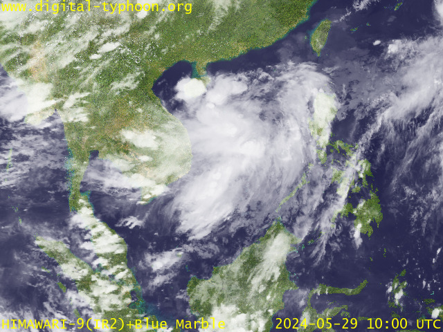
RECENT MTSAT-1R SATELLITE IMAGE:


> Image source:  Digital-Typhoon.org (Nat'l. Institute of Informatics) (http://www.digital-typhoon.org)
__________________________________________________________________________________________

NOTES:
 
  ^ - JTWC commentary remarks (for Meteorologists) from their 
      latest warning.
 
  * - Based on PAGASA's Philippine Storm Warning Signals, 
      # 4 being the highest. Red letters indicate new areas 
      being hoisted.
For more explanations on these signals, 
      visit:
http://www.typhoon2000.ph/signals.htm

 ** - Based on the Tropical Cyclone's Wave Height near 
      its center.

__________________________________________________________________________________________

>>
To know the meteorological terminologies and acronyms 
   used on this update visit the ff:

    http://typhoon2000.ph/tcterm.htm  
    http://www.nhc.noaa.gov/aboutgloss.shtml
    http://www.srh.noaa.gov/oun/severewx/glossary.php
    http://www.srh.weather.gov/fwd/glossarynation.html
    http://www.nhc.noaa.gov/acronyms.shtml
__________________________________________________________________________________________

:: Typhoon2000.com (T2K) Mobile >> Powered by: Synermaxx
Receive the latest storm updates directly to your mobile phones! To know more:
Send T2K HELP to: 2800
(GLOBE & TM) | 216 (SMART & TNT) | 2288 (SUN) 
Note: Globe & Smart charges P2.50 per message, while Sun at P2.00.
__________________________________________________________________________________________

For the complete final details on TD NEOGURI (AMBO)...go visit
our website @:

>
http://www.typhoon2000.com
http://www.maybagyo.com

:: Kindly view our site's disclaimer at: 
   
http://www.typhoon2000.ph/disclaimer.htm


Copyright © 2008  Typhoon2000.com All Rights Reserved

__._,_.___
Recent Activity
Visit Your Group
Featured Y! Groups

and category pages.

There is something

for everyone.

John McEnroe

on Yahoo! Groups

Join him for the

10 Day Challenge.

How-To Zone

on Yahoo! Groups

Find garden, home

& auto groups.

.

__,_._,___

Saturday, April 19, 2008

T2K Philippine Tropical Outlook [for week April 21-27, 2008]


Typhoon2000 Philippine Tropical Outlook
For Week: APRIL 21-27, 2008 [MONDAY TO SUNDAY] 
Issued: 8:00 AM MANILA TIME (00:00 GMT) SAT 19 APRIL 2008
Next Update: 8:00 AM (00:00 GMT) SAT 26 APRIL

_____________________________________________________________________________
 
 
[1] An increased chance of above-average rainfall across Southern
Philippines (Mindanao).
The ongoing La Niña event are expected to continue
bringing tropical convection & result in generally wet conditions across much
of the specified region. Confidence: MODERATE.

[2] An increased chance of drier and hot conditions with possible light
rainfall across Northern Philippines due to High Pressure
Area off Philippine Sea.
Confidence: HIGH. 


Important Note: Please keep in mind that the above weekly tropical forecast outlook, does
not guarantee 100% accuracy! Errors & changes can happen 
within the designated outlook week.
_____________________________________________________________________________

> This outlook is issued for planners every Saturday except during
  presence of Tropical Cyclones within the Philippine Area of Res-
  ponsibility (PAR).

> The next outlook will 
be issued on Saturday, April 26, 2008.

Sources: NOAA Global Benefits/Hazards Assessment & Various Numerical Computer Models
_____________________________________________________________________________
>>
To know the meteorological terminologies and acronyms 
   used on this update visit the ff:

    http://typhoon2000.ph/tcterm.htm  
    http://www.nhc.noaa.gov/aboutgloss.shtml
    http://www.srh.noaa.gov/oun/severewx/glossary.php
    http://www.srh.weather.gov/fwd/glossarynation.html
    http://www.nhc.noaa.gov/acronyms.shtml
_____________________________________________________________________________

:: Typhoon2000.com (T2K) Mobile >>
 
Powered by: Synermaxx
Receive the latest storm updates directly to your mobile phones! To know more:
Send T2K HELP to: 2800
(GLOBE & TM) | 216 (SMART & TNT) | 2288 (SUN) 
Note: Globe & Smart charges P2.50 per message, while Sun at P2.00.


_____________________________________________________________________________

Always visit these web addresses for the latest info on Philippine Tropical
Cyclones:

>
http://www.typhoon2000.com
http://www.maybagyo.com

:: Kindly view our site's disclaimer at: 
   
http://www.typhoon2000.ph/disclaimer.htm


Copyright © 2008 Typhoon2000.com All Rights Reserved

__._,_.___
Recent Activity
Visit Your Group
Dog Groups

on Yahoo! Groups

discuss everything

related to dogs.

Best of Y! Groups

Check it out

and nominate your

group to be featured.

Change your life

with Yahoo! Groups

balance nutrition,

activity & well-being.

.

__,_._,___

Typhoon NEOGURI (AMBO) to make landfall over Western Guangdong this PM... [Update #007]


Typhoon2000 STORM UPDATE #008
Name: TYPHOON NEOGURI [AMBO/02W/0801] 
Issued: 7:00 AM MANILA TIME (23:00 GMT) SAT 19 APRIL 2008
Source: JTWC TROPICAL CYCLONE WARNING NUMBER 020
Note: Kindly refer to your country's official warnings or bulletins. This update is for additional information purposes only.
_____________________________________________________________________________
 
 
TYPHOON NEOGURI (AMBO) WEAKENS TO CATEGORY ONE AS IT APPROACHES THE
SHORELINE OF WESTERN GUANGDONG...THREATENS HONG KONG AND MACAU.
HONG KONG UNDER STRONG WIND SIGNAL NUMBER THREE.

+ FORECAST OUTLOOK: NEOGURI is expected to continue moving NE'ly,
weakening further into a storm and make landfall over Western Guang-
dong or about 100 km. West of Macau this afternoon (approx 3-4 PM HK
time). The dissipating core (eye & eyewall) of this system shall make
its closest point approach (CPA) to Hong Kong at around 11 PM to 12
midnight tonight with a distance of 115 km. to the NE. NEOGURI is
forecast to disspate just NE of Hong Kong by tomorrow afternoon,
April 20th. 

+ EFFECTS: NEOGURI's shrinking circulation is now in between the
coasts of Hainan and Western Guangdong. The inner bands of this
typhoon has left eastern Hainan and is now spreading across Western
Guangdong, with its disorganized Northern Eyewall just along the
shores of Western Guangdong. Moderate to heavy rains accompanied with
tropical storm force winds reaching 100 km/hr can be expected along
Western Guangdong, Macau & Hong Kong this morning, increasing to mi-
nimal Typhoon force winds in the afternoon through the evening. Mean-
while, Its outer bands continues to spread across much of Southern
China. These bands will continue to bring widespread rains & thun-
derstorms with light to moderate winds across the area today. Dete-
riorating weather conditions can be expected tonight until tomorrow
as the typhoon makes landfall over Western Guangdong. People living
in low-lying areas of Southern China particularly Western Guangdong,
Macau & Hong Kong must seek higher grounds for possible flooding due
to the anticipated heavy rains brought about by this storm. Precau-
tionary measures must be fully implemented. Coastal Storm Surge floo-
ding of 4 to 5 feet above normal tide levels...along with large and
dangerous battering waves can be expected near and to the north of
NEOGURI's projected path particularly on where the center makes
landfall in Western Guangdong. Minimal damage is possible on this
type of storm surge. Far-fetched storm surge is also possible along
coastal areas of Hainan & Southern China.
 
Important Note: Please keep in mind that the above forecast outlook,
effects & current monsoon intensity, and tropical cyclone watch changes 
every 06 to 12 hours!

_____________________________________________________________________________

TIME/DATE: 5:00 AM MANILA TIME (21:00 GMT) 19 APRIL
LOCATION OF EYE: LATITUDE 20.4º N...LONGITUDE 111.8º E
DISTANCE 1: 275 KM (148
NM) SW OF MACAU, CHINA 
DISTANCE 2: 325 KM (175 NM) SW OF HONG KONG, CHINA 
DISTANCE 3: 170 KM (92 NM) SE OF ZHANJIANG, CHINA  
DISTANCE 4: 160 KM (85 NM) ENE OF HAIKOU, HAINAN IS. 
MAX WINDS [1-MIN AVG]: 140 KM/HR (75 KTS) NEAR THE CENTER
PEAK WIND GUSTS: 165 KM/HR (90 KTS)
SAFFIR-SIMPSON SCALE: CATEGORY ONE (1) 
MINIMUM CENTRAL PRESSURE (est.): 967 MILLIBARS (hPa)
RECENT MOVEMENT: NNE @ 15 KM/HR (08 KTS)
GENERAL DIRECTION: WESTERN GUANGDONG
STORM'S SIZE (IN DIAMETER): 500 KM (270 NM)/AVERAGE
MAX WAVE HEIGHT**: 18 FEET (5.4 METERS)
VIEW TRACKING MAP: 2 AM MANILA TIME SAT APRIL 19
TSR WIND PROBABILITIESCURRENT TO 36 HRS LEAD  
PHILIPPINE STORM SIGNALS*: NONE

12 & 24 HR. FORECAST:
2 PM (06 GMT) 19 APRIL: 21.6N 112.5E / 110-140 KPH / NE @ 17 KPH
2 AM (18 GMT) 20 APRIL: 23.1N 113.4E / 75-95 KPH / NE @ 17 KPH
_____________________________________________________________________________
_____________________________________________________________________________


RECENT WUNDERGROUND.COM TRACKING CHART:


_______________________________________________________________________________________

 
RECENT MTSAT-1R SATELLITE IMAGE:


> Image source:  Digital-Typhoon.org (Nat'l. Institute of Informatics) (http://www.digital-typhoon.org)
__________________________________________________________________________________________

NOTES:
 
  ^ - JTWC commentary remarks (for Meteorologists) from their 
      latest warning.
 
  * - Based on PAGASA's Philippine Storm Warning Signals, 
      # 4 being the highest. Red letters indicate new areas 
      being hoisted.
For more explanations on these signals, 
      visit:
http://www.typhoon2000.ph/signals.htm

 ** - Based on the Tropical Cyclone's Wave Height near 
      its center.

__________________________________________________________________________________________

>>
To know the meteorological terminologies and acronyms 
   used on this update visit the ff:

    http://typhoon2000.ph/tcterm.htm  
    http://www.nhc.noaa.gov/aboutgloss.shtml
    http://www.srh.noaa.gov/oun/severewx/glossary.php
    http://www.srh.weather.gov/fwd/glossarynation.html
    http://www.nhc.noaa.gov/acronyms.shtml
__________________________________________________________________________________________

:: Typhoon2000.com (T2K) Mobile >> Powered by: Synermaxx
Receive the latest storm updates directly to your mobile phones! To know more:
Send T2K HELP to: 2800
(GLOBE & TM) | 216 (SMART & TNT) | 2288 (SUN) 
Note: Globe & Smart charges P2.50 per message, while Sun at P2.00.
__________________________________________________________________________________________

For the complete details on TY NEOGURI (AMBO)...go visit
our website @:

>
http://www.typhoon2000.com
http://www.maybagyo.com

:: Kindly view our site's disclaimer at: 
   
http://www.typhoon2000.ph/disclaimer.htm


Copyright © 2008  Typhoon2000.com All Rights Reserved

__._,_.___
Recent Activity
Visit Your Group
Home Improvement

on Yahoo! Groups

Find tips & tricks

for doing it yourself.

10 Day Club

on Yahoo! Groups

Share the benefits

of a high fiber diet.

Check out the

Y! Groups blog

Stay up to speed

on all things Groups!

.

__,_._,___

Friday, April 18, 2008

Typhoon NEOGURI (AMBO) lashing Eastern Hainan... [Update #006]


Typhoon2000 STORM UPDATE #007
Name: TYPHOON NEOGURI [AMBO/02W/0801] 
Issued: 7:00 PM MANILA TIME (11:00 GMT) FRI 18 APRIL 2008
Source: JTWC TROPICAL CYCLONE WARNING NUMBER 018
Note: Kindly refer to your country's official warnings or bulletins. This update is for additional information purposes only.
_____________________________________________________________________________
 
 
TYPHOON NEOGURI (AMBO) HAS STARTED LOSING STRENGTH AS IT PASSES VERY
CLOSE TO THE EASTERN SHORELINE OF HAINAN...STRONG WINDS AND HEAVY
RAINS POUNDING THE ISLAND...AIMING TOWARDS WESTERN GUANGDONG.

+ FORECAST OUTLOOK: NEOGURI is expected to continue moving Northerly
passing very close to the northeastern coast of Hainan late tonightt.
The core (eye & eyewall) shall weaken slightly as it enters the Coast
of Southern China tomorrow morning and make its final landfall along
Western Guangdong tomorrow afternoon. The 2-day forecast shows NEOGURI
turning NNE'ly across Mainland China and dissipate by Sunday morning
(Apr 20). 

+ EFFECTS: NEOGURI's strong compact circulation is over the Eastern
Coast of Hainan. The inner bands of this typhoon has been spreading
across eastern Hainan with its strong western eyewall just along the
coast. Moderate to heavy rains accompanied with tropical storm force
winds reaching 100 km/hr can be expected along Eastern Hainan overnight.
Meanwhile, Its outer bands continues to spread across the whole of Hai-
nan and Guangdong Province including Macau & Hong Kong. These bands will
continue to bring widespread rains & thuderstorms with light to mode-
rate winds across the area overnight. Deteriorating weather conditions
can be expected tonight until tomorrow as the typhoon's inner bands and
its core moves closer to Western Guangdong. People living in low-lying
areas of Hainan and Southern China must seek higher grounds for possible
flooding due to the anticipated heavy rains brought about by this storm.
Precautionary measures must be implemented. Coastal Storm Surge flooding
of 6 to 8 feet above normal tide levels...along with large and dangerous
battering waves can be expected near and to the north of NEOGURI's pro-
jected path particularly on where the center makes landfall in Eastern
Hainan/Western Guangdong. Moderate damage is possible on this type of
storm surge. Far-fetched storm surge is also possible along coastal
areas of Northern Vietnam & Southern China.
 
Important Note: Please keep in mind that the above forecast outlook,
effects & current monsoon intensity, and tropical cyclone watch changes 
every 06 to 12 hours!

_____________________________________________________________________________

TIME/DATE: 5:00 PM MANILA TIME (09:00 GMT) 18 APRIL
LOCATION OF EYE: LATITUDE 19.0º N...LONGITUDE 111.3º E
DISTANCE 1: 85 KM (45
NM) ESE OF QIONGHAI, HAINAN IS. 
DISTANCE 2: 160 KM (85 NM) SE OF HAIKOU, HAINAN IS. 
DISTANCE 3: 270 KM (145 NM) SSE OF ZHANJIANG, CHINA  
DISTANCE 4: 430 KM (233 NM) SW OF MACAU, CHINA 
DISTANCE 5: 475 KM (255 NM) SW OF HONG KONG, CHINA
MAX WINDS [1-MIN AVG]: 160 KM/HR (85 KTS) NEAR THE CENTER
PEAK WIND GUSTS: 195 KM/HR (105 KTS)
SAFFIR-SIMPSON SCALE: CATEGORY TWO (2) 
MINIMUM CENTRAL PRESSURE (est.): 959 MILLIBARS (hPa)
RECENT MOVEMENT: NNW @ 11 KM/HR (06 KTS)
GENERAL DIRECTION: WESTERN GUANGDONG
STORM'S SIZE (IN DIAMETER): 555 KM (300 NM)/AVERAGE
MAX WAVE HEIGHT**: 23 FEET (7.0 METERS)
VIEW TRACKING MAP: 2 PM MANILA TIME FRI APRIL 18
TSR WIND PROBABILITIESCURRENT TO 48 HRS LEAD  
PHILIPPINE STORM SIGNALS*: NONE

12, 24 & 48 HR. FORECAST:
2 AM (18 GMT) 19 APRIL: 20.1N 111.3E / 130-160 KPH / N @ 15 KPH
2 PM (06 GMT) 19 APRIL: 21.7N 111.6E / 100-130 KPH / NNE @ 15 KPH
2 PM (06 GMT) 20 APRIL: 24.6N 112.8E / 35-55 KPH / NNE @ 15 KPH
_____________________________________________________________________________
_____________________________________________________________________________

RECENT WUNDERGROUND.COM TRACKING CHART:


_______________________________________________________________________________________

 
RECENT MTSAT-1R SATELLITE IMAGE:


> Image source:  Digital-Typhoon.org (Nat'l. Institute of Informatics) (http://www.digital-typhoon.org)
__________________________________________________________________________________________

NOTES:
 
  ^ - JTWC commentary remarks (for Meteorologists) from their 
      latest warning.
 
  * - Based on PAGASA's Philippine Storm Warning Signals, 
      # 4 being the highest. Red letters indicate new areas 
      being hoisted.
For more explanations on these signals, 
      visit:
http://www.typhoon2000.ph/signals.htm

 ** - Based on the Tropical Cyclone's Wave Height near 
      its center.

__________________________________________________________________________________________

>>
To know the meteorological terminologies and acronyms 
   used on this update visit the ff:

    http://typhoon2000.ph/tcterm.htm  
    http://www.nhc.noaa.gov/aboutgloss.shtml
    http://www.srh.noaa.gov/oun/severewx/glossary.php
    http://www.srh.weather.gov/fwd/glossarynation.html
    http://www.nhc.noaa.gov/acronyms.shtml
__________________________________________________________________________________________

:: Typhoon2000.com (T2K) Mobile >> Powered by: Synermaxx
Receive the latest storm updates directly to your mobile phones! To know more:
Send T2K HELP to: 2800
(GLOBE & TM) | 216 (SMART & TNT) | 2288 (SUN) 
Note: Globe & Smart charges P2.50 per message, while Sun at P2.00.
__________________________________________________________________________________________

For the complete details on TY NEOGURI (AMBO)...go visit
our website @:

>
http://www.typhoon2000.com
http://www.maybagyo.com

:: Kindly view our site's disclaimer at: 
   
http://www.typhoon2000.ph/disclaimer.htm


Copyright © 2008  Typhoon2000.com All Rights Reserved

__._,_.___
Recent Activity
Visit Your Group
Y! Groups blog

the best source

for the latest

scoop on Groups.

Move More

on Yahoo! Groups

This is your life

not a phys-ed class.

Best of Y! Groups

Discover groups

that are the best

of their class.

.

__,_._,___