Typhoon2000 STORM UPDATE #004
Name: TYPHOON KROSA [INENG/17W/0715]
Issued: 7:00 PM MANILA TIME (11:00 GMT) WED 03 OCTOBER 2007
Next Update: 7:00 AM (23:00 GMT) THU 04 OCTOBER
Source: JTWC TROPICAL CYCLONE WARNING NUMBER 008
Note: Kindly refer to your country's official warnings or bulletins. This update is for additional information purposes only.
Next Update: 7:00 AM (23:00 GMT) THU 04 OCTOBER
Source: JTWC TROPICAL CYCLONE WARNING NUMBER 008
Note: Kindly refer to your country's official warnings or bulletins. This update is for additional information purposes only.
_____________________________________________________________________________
TYPHOON KROSA (INENG) HAS TURNED WEST-NORTHWEST FOR THE PAST SIX HOURS
AND IS NOW AIMING FOR BATANES-TAIWAN AREA.+ FORECAST OUTLOOK: KROSA is expected to turn more NW'ly later tonight
and accelerate slightly. The 3 to 5-day forecast shows KROSA becoming
an extremely dangerous Category 4 Typhoon with winds reaching 215 km/hr
on Saturday, Oct 06. Its eye shall reach Yaeyama Islands Sunday after-
noon with a sudden slow in its NW track. It shall pass about 155 km.
East of Taipei, Taiwan early Monday morning, Oct 8 (approx 6 AM HK
Time) and start losing strength late Oct 8 due to increasing wind shear
and dry air over East China Sea.
+ EFFECTS: KROSA is not yet affecting any part of the Philippines or
+ EFFECTS: KROSA is not yet affecting any part of the Philippines or
nearby Pacific Islands. Its main circulation has expanded once again
over the Northern part of the Philippine Sea, affecting only the shi-
pping lanes. Far-fetched storm surge is possible along the eastern coas-
tal stretch of Luzon and Visayas. Coastal Storm Surge flooding of 4 to 5
feet above normal tide levels...along with large and dangerous battering
waves can be expected near and to the north of KROSA's projected path.
Minimal damage is possible on this type of storm surge.
+ CURRENT ITCZ/MONSOON INTENSITY: Weak to moderate Southwest (SW)
+ CURRENT ITCZ/MONSOON INTENSITY: Weak to moderate Southwest (SW)
Monsoon enhanced by Typhoon KROSA (INENG) - will continue to bring
mostly cloudy skies with possible intermittent afternoon or evening
rainfall & SW'ly winds of 10 km/hr or higher across Western Philippines
becoming more frequent over Pangasinan, Zambales, Bataan, Metro Manila
& portions of Visayas. Landslides and flooding is likely to occur along
steep mountain slopes, river banks, low-lying & flood-prone areas of the
affected areas, while big sea waves or surges generated by this monsoon
can affect the coastal and beach-front areas of Western Visayas and Wes-
tern Luzon. Meanwhile, the rest of the Philippines is under the ITCZ,
which will bring scattered rains and thunderstorms most especially in
the afternoon or evening.
Important Note: Please keep in mind that the above forecast outlook,
effects & current monsoon intensity, and tropical cyclone watch changes
every 06 to 12 hours!
_____________________________________________________________________________
TIME/DATE: 5:00 PM MANILA TIME (09:00 GMT) 03 OCTOBER
LOCATION OF EYE: LATITUDE 17.4º N...LONGITUDE 129.4º E
DISTANCE 1: 790 KM (427 NM) ENE OF CASIGURAN, AURORA, PH
effects & current monsoon intensity, and tropical cyclone watch changes
every 06 to 12 hours!
____________
LOCATION OF EYE: LATITUDE 17.4º N...LONGITUDE 129.4º E
DISTANCE 1: 790 KM (427 NM) ENE OF CASIGURAN, AURORA, PH
DISTANCE 2: 815 KM (440 NM) ESE OF TUGUEGARAO CITY, PH
DISTANCE 3: 820 KM (442 NM) ESE OF APARRI, CAGAYAN, PH
DISTANCE 4: 850 KM (458 NM) SE OF BASCO, BATANES, PH
DISTANCE 5: 950 KM (513 NM) NE OF METRO MANILA, PH
PEAK WIND GUSTS: 165 KM/HR (90 KTS)
SAFFIR-SIMPSON SCALE: CATEGORY ONE (1)
MINIMUM CENTRAL PRESSURE (est.): 967 MILLIBARS (hPa)
RECENT MOVEMENT: WNW @ 09 KM/HR (05 KTS)
GENERAL DIRECTION: BATANES-TAIWAN AREA
STORM'S SIZE (IN DIAMETER): 1,240 KM (670 NM)/VERY LARGE
MAX WAVE HEIGHT**: 26 FEET (7.9 METERS)
VIEW TRACKING MAP: 2 PM MANILA TIME WED OCTOBER 03
TSR WIND PROBABILITIES: CURRENT TO 120 HRS LEAD
PHILIPPINE STORM SIGNALS*: N/A
12, 24 & 48 HR. FORECAST:
2 AM (18 GMT) 04 OCTOBER: 18.1N 128.7E / 160-195 KPH / NW @ 15 KPH
2 PM (06 GMT) 04 OCTOBER: 19.2N 127.5E / 175-215 KPH / NW @ 13 KPH
2 PM (06 GMT) 05 OCTOBER: 21.2N 125.7E / 205-240 KPH / NW @ 09 KPH
REMARKS: 2 PM (06 GMT) 03 OCTOBER POSITION: 17.2N 129.7E.
^TYPHOON (TY) 17W (KROSA) HAS CONTINUED TO SLOWLY INTENSIFY OVER THE
REMARKS: 2 PM (06 GMT) 03 OCTOBER POSITION: 17.2N 129.7E.
^TYPHOON (TY) 17W (KROSA) HAS CONTINUED TO SLOWLY INTENSIFY OVER THE
PAST 12 HOURS DESPITE SOME IMPINGEMENT UPON THE NORTHWESTERN PORTION
OF THE STORM CAUSED BY AN INDUCED UPPER LEVEL TROUGH AND THE FACT
THAT IT HAS REMAINED OVER THE SAME AREA FOR 24 TO 36 HOURS.
PERSISTENT DEEP CONVECTION CONTINUES TO WRAP INTO THE LOW-LEVEL
CIRCULATION CENTER (LLCC), ALTHOUGH A LACK OF DEEP CONVECTION HAS
BEEN OBSERVED OVER THE NORTHERN QUADRANT OF THE STORM AS DEPICTED IN
THE ANIMATED WATER VAPOR IMAGERY. THE STORM HAS TRACKED MAINLY WESTWARD
OVER THE PAST 12 HOURS, AS THE SUBTROPICAL RIDGE (STR) TO THE NORTH OF
THE SYSTEM CONTINUES TO SLOWLY BECOME THE DOMINANT STEERING INFLUENCE.
THE STORM HAS MAINTAINED FAVORABLE EQUATORWARD AND EASTWARD OUTFLOW
CHANNELS OVER THE PAST 12 HOURS, WHICH HAS AIDED IN THE INTENSIFICATION
OF THE STORM...(more)
>> KROSA {pronounced: kro~saah}, meaning: Crane.
Name contributed by: Cambodia.
_____________________________________________________________________________
PAGASA CURRENT POSITION, MOVEMENT AND INTENSITY (10-min. ave.):
CIRCULATION CENTER (LLCC), ALTHOUGH A LACK OF DEEP CONVECTION HAS
BEEN OBSERVED OVER THE NORTHERN QUADRANT OF THE STORM AS DEPICTED IN
THE ANIMATED WATER VAPOR IMAGERY. THE STORM HAS TRACKED MAINLY WESTWARD
OVER THE PAST 12 HOURS, AS THE SUBTROPICAL RIDGE (STR) TO THE NORTH OF
THE SYSTEM CONTINUES TO SLOWLY BECOME THE DOMINANT STEERING INFLUENCE.
THE STORM HAS MAINTAINED FAVORABLE EQUATORWARD AND EASTWARD OUTFLOW
CHANNELS OVER THE PAST 12 HOURS, WHICH HAS AIDED IN THE INTENSIFICATION
OF THE STORM...(more)
>> KROSA {pronounced: kro~saah}, meaning: Crane.
Name contributed by: Cambodia.
____________
PAGASA CURRENT POSITION, MOVEMENT AND INTENSITY (10-min. ave.):
> 2 PM (06 GMT) 03 OCTOBER: 17.1N 129.7E / WNW @ 13 KPH / 120 kph
:: For the complete PAGASA bulletin, kindly visit their website at:
http://www.pagasa.dost.gov.ph/wb/tcupdate.shtml
:: For the complete PAGASA bulletin, kindly visit their website at:
http://www.pagasa.
_____________________________________________________________________________
RECENT TRACKING CHART:
RECENT TRACKING CHART:
________________________
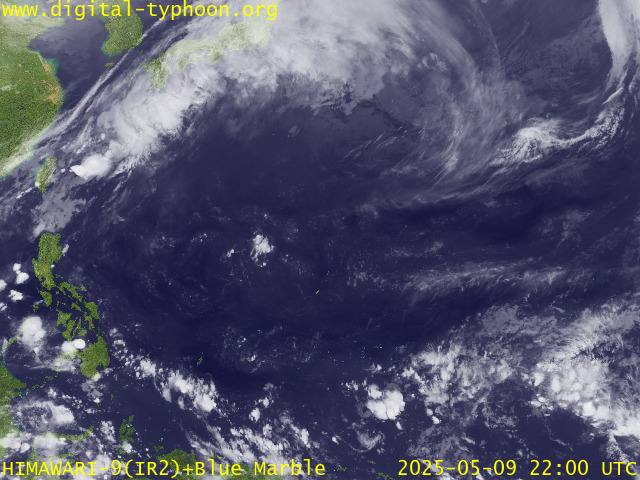
RECENT MTSAT-1R SATELLITE IMAGE:

> Image source: Digital-Typhoon.org (Nat'l. Institute of Informatics) (http://www.digital-typhoon.org )
__________________________________________________________________________________________
NOTES:

> Image source: Digital-Typhoon.
^ - JTWC commentary remarks (for Meteorologists) from their
latest warning.
latest warning.
* - Based on PAGASA's Philippine Storm Warning Signals,
# 4 being the highest. Red letters indicate new areas
being hoisted. For more explanations on these signals,
visit: http://www.typhoon2000.ph/signals.htm
** - Based on the Tropical Cyclone's Wave Height near
its center.
__________________________________________________________________________________________
>> To know the meteorological terminologies and acronyms
used on this update visit the ff:
http://typhoon2000.ph/tcterm.htm
http://www.nhc.noaa.gov/aboutgloss.shtml
http://www.srh.noaa.gov/oun/severewx/glossary.php
http://www.srh.weather.gov/fwd/glossarynation.html
http://www.nhc.noaa.gov/acronyms.shtml
__________________________________________________________________________________________
:: Typhoon2000.com (T2K) Mobile >> Powered by: Synermaxx
Receive the latest storm updates directly to your mobile phones! To know more:
Send T2K HELP to: 2800 (GLOBE & TM) | 216 (SMART & TNT) | 2288 (SUN)
Note: Globe & Smart charges P2.50 per message, while Sun at P2.00.
__________________________________________________________________________________________
For the complete details on TY KROSA (INENG)...go visit
our website @:
> http://www.typhoon2000.com
> http://www.maybagyo.com
# 4 being the highest. Red letters indicate new areas
being hoisted. For more explanations on these signals,
visit: http://www.typhoon2
** - Based on the Tropical Cyclone's Wave Height near
its center.
____________
>> To know the meteorological terminologies and acronyms
used on this update visit the ff:
http://typhoon2000.
http://www.nhc.
http://www.srh.
http://www.srh.
http://www.nhc.
____________
:: Typhoon2000.
Receive the latest storm updates directly to your mobile phones! To know more:
Send T2K HELP to: 2800 (GLOBE & TM) | 216 (SMART & TNT) | 2288 (SUN)
Note: Globe & Smart charges P2.50 per message, while Sun at P2.00.
For the complete details on TY KROSA (INENG)...go visit
our website @:
> http://www.typhoon2
> http://www.maybagyo
Change settings via the Web (Yahoo! ID required)
Change settings via email: Switch delivery to Daily Digest | Switch format to Traditional
Visit Your Group | Yahoo! Groups Terms of Use | Unsubscribe
.
__,_._,___
No comments:
Post a Comment