Typhoon2000 STORM UPDATE #014 **FINAL**
Name: TROPICAL STORM KROSA [INENG/17W/0715]
Issued: 7:00 PM MANILA TIME (11:00 GMT) MON 08 OCTOBER 2007
Source: JTWC TROPICAL CYCLONE WARNING NUMBER 028
Note: Kindly refer to your country's official warnings or bulletins. This update is for additional information purposes only.
Source: JTWC TROPICAL CYCLONE WARNING NUMBER 028
Note: Kindly refer to your country's official warnings or bulletins. This update is for additional information purposes only.
_____________________________________________________________________________
TROPICAL STORM KROSA (INENG) DISSIPATING OFF ZHEJIANG PROVINCE...TO
MOVE BACK TO SEA TONIGHT...THIS IS THE FINAL UPDATE ON THIS SYSTEM.
+ FORECAST OUTLOOK: KROSA is expected to be downgraded into a Tropical
Depression later tonight and accelerate ENE back into the East China Sea
tomorrow afternoon. This system shall continue to lose strength as it
enters an area of unfavorable atmospheric environment (cooler waters
and increasing wind shear conditions). Complete dissipation of KROSA
is likely by tomorrow evening, Oct 9.
+ EFFECTS: KROSA's inner rainbands remains over Zhejiang Province with
+ EFFECTS: KROSA's inner rainbands remains over Zhejiang Province with
its outer rainbands spreading across the rest of Fujian and Zhejiang.
Gale Force winds with heavy torrential rains will prevail near its
center, while strong winds not exceeding 30 kph with intermittent
rainfall can be expected along its inner rainbands. Cloudy skies with
passing light to moderate and sometimes heavy downpour can be expected
dissipated over the South China Sea. Climatic pattern shows transition
phase into the Northeast Monsoon which shall start sometime this
November.
Important Note: Please keep in mind that the above forecast outlook,
effects & current monsoon intensity, and tropical cyclone watch changes
every 06 to 12 hours!
_____________________________________________________________________________
TIME/DATE: 5:00 PM MANILA TIME (09:00 GMT) 08 OCTOBER
LOCATION OF CENTER: LATITUDE 27.9º N...LONGITUDE 120.4º E
DISTANCE 1: 30 KM (17 NM) SW OF WENZHOU, CHINA
effects & current monsoon intensity, and tropical cyclone watch changes
every 06 to 12 hours!
____________
LOCATION OF CENTER: LATITUDE 27.9º N...LONGITUDE 120.4º E
DISTANCE 1: 30 KM (17 NM) SW OF WENZHOU, CHINA
MAX SUSTAINED WINDS [1-MIN AVG]: 65 KM/HR (35 KTS)
PEAK WIND GUSTS: 85 KM/HR (45 KTS)
SAFFIR-SIMPSON SCALE: N/A
MINIMUM CENTRAL PRESSURE (est.): 996 MILLIBARS (hPa)
RECENT MOVEMENT: ENE @ 03 KM/HR (02 KTS)
GENERAL DIRECTION: ZHEJIANG PROVINCE
STORM'S SIZE (IN DIAMETER): 500 KM (270 NM)/AVERAGE
MAX WAVE HEIGHT**: 10 FEET (3.0 METERS)
VIEW TRACKING MAP: 2 PM MANILA TIME MON OCTOBER 08
TSR WIND PROBABILITIES: CURRENT TO 36 HRS LEAD
PHILIPPINE STORM SIGNALS*: N/A
12, 24 HR. FORECAST:
2 AM (18 GMT) 09 OCTOBER: 28.1N 120.9E / 55-75 KPH / ENE @ 09 KPH
2 PM (06 GMT) 09 OCTOBER: 28.5N 122.0E / 45-65 KPH / E @ 13 KPH
REMARKS: 2 PM (06 GMT) 08 OCTOBER POSITION: 27.8N 120.2E.
^TROPICAL STORM (TS) 17W (KROSA) HAS REMAINED QUASISTATIONARY
OVER LAND DURING THE LAST 12 HOURS. THE OVERALL MOTION HAS BEEN A
SLOW DRIFT NORTHWARD, BUT AT LESS THAN 2 KNOTS. DURING THIS TIME,
TS 17W WEAKENED TO A MINIMAL TROPICAL STORM AND HAS REMAINED OVER
LAND. TS 17W HAS MAINTAINED A WELL DEFINED LOW LEVEL CIRCULATION
CENTER (LLCC), DESPITE HAVING BEEN OVER LAND FOR THE PAST 24 HOURS.
RECENT ANIMATED ENHANCED INFRARED SATELLITE IMAGERY DEPICTS A
PARTIALLY TO FULLY EXPOSED LLCC WITH DIMINISHING DEEP
CONVECTION...(more)
>> KROSA {pronounced: kro~saah}, meaning: Crane.
Name contributed by: Cambodia.
____________
_____________________________________________________________________________
RECENT TRACKING CHART:
RECENT TRACKING CHART:
________________________
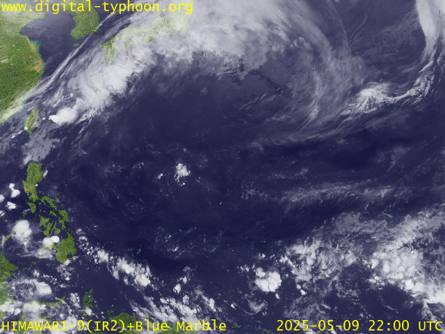
RECENT MTSAT-1R SATELLITE IMAGE:

> Image source: Digital-Typhoon.org (Nat'l. Institute of Informatics) (http://www.digital-typhoon.org )
__________________________________________________________________________________________
NOTES:

> Image source: Digital-Typhoon.
^ - JTWC commentary remarks (for Meteorologists) from their
latest warning.
latest warning.
* - Based on PAGASA's Philippine Storm Warning Signals,
# 4 being the highest. Red letters indicate new areas
being hoisted. For more explanations on these signals,
visit: http://www.typhoon2000.ph/signals.htm
** - Based on the Tropical Cyclone's Wave Height near
its center.
__________________________________________________________________________________________
>> To know the meteorological terminologies and acronyms
used on this update visit the ff:
http://typhoon2000.ph/tcterm.htm
http://www.nhc.noaa.gov/aboutgloss.shtml
http://www.srh.noaa.gov/oun/severewx/glossary.php
http://www.srh.weather.gov/fwd/glossarynation.html
http://www.nhc.noaa.gov/acronyms.shtml
__________________________________________________________________________________________
:: Typhoon2000.com (T2K) Mobile >> Powered by: Synermaxx
Receive the latest storm updates directly to your mobile phones! To know more:
Send T2K HELP to: 2800 (GLOBE & TM) | 216 (SMART & TNT) | 2288 (SUN)
Note: Globe & Smart charges P2.50 per message, while Sun at P2.00.
__________________________________________________________________________________________
For the complete details on TS KROSA (INENG)...go visit
our website @:
> http://www.typhoon2000.com
> http://www.maybagyo.com
# 4 being the highest. Red letters indicate new areas
being hoisted. For more explanations on these signals,
visit: http://www.typhoon2
** - Based on the Tropical Cyclone's Wave Height near
its center.
____________
>> To know the meteorological terminologies and acronyms
used on this update visit the ff:
http://typhoon2000.
http://www.nhc.
http://www.srh.
http://www.srh.
http://www.nhc.
____________
:: Typhoon2000.
Receive the latest storm updates directly to your mobile phones! To know more:
Send T2K HELP to: 2800 (GLOBE & TM) | 216 (SMART & TNT) | 2288 (SUN)
Note: Globe & Smart charges P2.50 per message, while Sun at P2.00.
For the complete details on TS KROSA (INENG)...go visit
our website @:
> http://www.typhoon2
> http://www.maybagyo
Change settings via the Web (Yahoo! ID required)
Change settings via email: Switch delivery to Daily Digest | Switch format to Traditional
Visit Your Group | Yahoo! Groups Terms of Use | Unsubscribe
.
__,_._,___
No comments:
Post a Comment