Friday, August 03, 2007

TD 06W - Update #01


Typhoon2000 STORM UPDATE #001 
Name: TROPICAL DEPRESSION 06W [UNNAMED] 
Issued: 7:00 PM MANILA TIME (11:00 GMT) FRI 03 AUGUST 2007
Next Update: 7:00 AM (23:00 GMT) SAT 04 AUGUST
Source: JTWC TROPICAL CYCLONE WARNING #003
_______________________________________________________________________
 
 
THE STRONG DISTURBANCE OVER THE SOUTH CHINA SEA HAS
STRENGTHENED INTO
TROPICAL DEPRESSION
06W
(UNNAMED)...
REMAINS SHEARED-OFF WITH ITS DEEP CLOUDS AWAY FROM THE
CENTER...MOVING SLOWLY WEST-NORTHWEST NEAR THE COAST
OF VIETNAM.

+ FORECAST OUTLOOK: 06W is expected to resume its NW track
in the direction of Hainan-Northern Vietnam area. The 2 to
3-day forecast shows 06W accelerating slightly NW-ward,
parallel to the coast of Vietnam and becoming a minimal
Tropical Storm tomorrow afternoon, Aug 4


+ EFFECTS: 06W's circulation especially the western outer
bands continues to spread across Central Vietnam, bringing
moderate to heavy rains with moderate winds across the area.
Flash floods and mudslides are imminent along river banks,
low-lying and mountainous areas of the affected areas of
Central Vietnam. Precautionary measures must be implemented
on the possible effects of this depression
.

Important Note: Please keep in mind that the above forecast
outlook, effects & current monsoon intensity, and tropical
cyclone watch changes every 06 to 12 hours!

_______________________________________________________________________

TIME/DATE: 5:00 PM MANILA TIME (09:00 GMT) 03 AUGUST
LOCATION OF CENTER: LATITUDE 13.7º N...LONGITUDE 112.5º E
DISTANCE 1: 390 KM (210 NM) NE OF NHA TRANG, VIETNAM
DISTANCE 2: 530 KM (285 NM) SE OF DA NANG, VIETNAM
DISTANCE 3: 595 KM (320 NM) SSE OF SANYA, HAINAN IS.
DISTANCE 4: 930 KM (500 NM) WEST OF METRO MANILA, PH
MAX SUSTAINED WINDS [1-MIN AVG]: 55 KM/HR (30 KTS)
PEAK WIND GUSTS: 75 KM/HR (40 KTS)
SAFFIR-SIMPSON SCALE: N/A
MINIMUM CENTRAL PRESSURE (est.): 1000 MILLIBARS (hPa)
RECENT MOVEMENT: WNW @ 07 KM/HR (04 KTS)
GENERAL DIRECTION: HAINAN-NORTHERN VIETNAM AREA
STORM'S SIZE (IN DIAMETER): 400 KM (215 NM)/AVERAGE
MAX WAVE HEIGHT**: 13 FEET (3.9 METERS)
VIEW TRACKING MAP: 2 PM HKT FRI AUGUST 03
TSR WIND PROBABILITIESCURRENT TO 72 HRS LEAD
  
PHILIPPINE STORM SIGNALS*: N/A
           
12, 24 & 48 HR. FORECAST:
2 AM (18 GMT) 03 AUGUST: 14.2N 112.0E / 55-75 KPH / NW @ 07 KPH
2 PM (06 GMT) 03 AUGUST: 14.7N 111.4E / 65-85 KPH / WNW @ 11 KPH
2 PM (06 GMT) 04 AUGUST: 16.0N 109.4E / 65-85 KPH / NW @ 09 KPH

REMARKS: 2 PM (06 GMT) 03 AUGUST POSITION: 13.6N 112.6E.
^TROPICAL DEPRESSION (TD) 06W (NONAME) HAS SLOWLY INTENSIFIED
OVER THE PAST TWELVE HOURS. THE DEPRESSION HAS BEEN SLOW TO
DEVELOP DUE TO MODERATE EASTERLY VERTICAL WIND SHEAR. ALTHOUGH
CONVECTION HAS NOT PERSISTED OVER THE SYSTEM CENTER, CONVECTIVE
BANDING HAS DEVELOPED TO THE WEST AND SOUTH OF THE NEARLY
FULLY-EXPOSED LOW LEVEL CIRCULATION CENTER (LLCC). THE STORM
HAS TRACKED SLOWLY NORTHWESTWARD UNDER THE COMPETING STEERING
INFLUENCES OF A SUBTROPICAL RIDGE (STR) TO THE NORTH-NORTHEAST
AND WEAK RIDGING TO THE SOUTHWEST OF THE LLCC..
.(more info)

_______________________________________________________________________
_______________________________________________________________________

RECENT TRACKING CHART:


_______________________________________________________________________________________

 
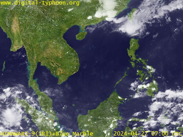
RECENT MTSAT-1R SATELLITE IMAGE:

> Image source:  Digital-Typhoon.org (Nat'l. Institute of Informatics) (http://www.digital-typhoon.org)
__________________________________________________________________________________________

NOTES:
 
  ^ - JTWC commentary remarks (for Meteorologists) from their 
      latest warning.
 
  * - Based on PAGASA's Philippine Storm Warning Signals, 
      # 4 being the highest. Red letters indicate new areas 
      being hoisted.
For more explanations on these signals, 
      visit:
http://www.typhoon2000.ph/signals.htm

 ** - Based on the Tropical Cyclone's Wave Height near 
      its center.

__________________________________________________________________________________________

>>
To know the meteorological terminologies and acronyms 
   used on this update visit the ff:

    http://typhoon2000.ph/tcterm.htm  
    http://www.nhc.noaa.gov/aboutgloss.shtml
    http://www.srh..noaa.gov/oun/severewx/glossary.php
    http://www.srh.weather.gov/fwd/glossarynation.html
    http://www.nhc.noaa.gov/acronyms.shtml
__________________________________________________________________________________________

:: Typhoon2000.com (T2K) Mobile >> Powered by: Synermaxx
Receive the latest storm updates directly to your mobile phones! To know more:
Send T2K HELP to: 2800
(GLOBE & TM) | 216 (SMART & TNT) | 2288 (SUN) 
Note: Globe & Smart charges P2.50 per message, while Sun at P2.00.
__________________________________________________________________________________________

For the complete details on TD 06W (UNNAMED)...go visit
our website @:

>
http://www.typhoon2000.com
http://www.maybagyo.com

:: Kindly view our site's disclaimer at: 
   
http://www.typhoon2000.ph/disclaimer.htm


__._,_.___
Recent Activity
Visit Your Group
SPONSORED LINKS
Get Low Fares

Yahoo! FareChase

Searches sites so

you don't have to

Yahoo! Groups

Beauty & Fashion

Connect & share

tips and advice.

Yahoo! Groups

Real Food Group

Share recipes

and favorite meals.

.

__,_._,___

TS USAGI (05W) - Final Update


Typhoon2000 STORM UPDATE #010 **FINAL**
Name: TROPICAL STORM USAGI [05W/0705] 
Issued: 7:00 PM MANILA TIME (11:00 GMT) FRI 03 AUGUST 2007
Source: JTWC TROPICAL CYCLONE WARNING #024
_______________________________________________________________________
 
 
USAGI (05W) WEAKENS INTO A TROPICAL STORM...TO BECOME
AN EXTRATROPICAL CYCLONE TOMORROW.

**THIS IS THE FINAL UPDATE ON THIS SYSTEM...PLEASE REFER
  REFER TO TROPICAL DEPRESSION 06W FOR MORE UPDATES.

+ FORECAST OUTLOOK: USAGI will continue accelerating to-
wards the NE to ENE'ly as it becomes Extratropical Cyclone
in 24 hours. The 36-hour forecast shows the system moving
fast across the Sea of Japan and becoming Extratropical
upon crossing Hokkaido, Japan tomorrow afternoon, Aug 4


+ EFFECTS: USAGI's circulation continues to weaken and re-
mains over the Sea of Japan. Inner bands continues to spread
across the coast of NW Honshu...while its outer bands spreads
across the Sea of Japan, Southwestern Japan & Northern Hon-
shu. Flash floods and mudslides are imminent along river
banks, low-lying and mountainous areas of the affected areas
of SW Japan
.

+ CURRENT MONSOON INTENSITY: Southwest (SW) Monsoon is now
starting to be enhanced by a developing LPA over the Pacific
Ocean north of Palau Island & TD 06W...Cloudy skies with po-
ssible intermittent passing rains or thunderstorms with SW'ly
winds of 10 km/hr or higher can be expected along the western
sections of Visayas & Mindanao particularly Western Zamboanga,
Palawan, Western Panay & Western Negros. This monsoon system
is expected to reach Luzon next week.

+ TROPICAL CYCLONE WATCH: The European Centre for Medium-Range
Weather Forecasts (ECMWF) continues to forecast the formation
of a Tropical Cyclone around August 7 or 8. During the latest
run of the model forecast (8 AM Aug 03), it showed the system
forming over the Philippine Sea, just to the East of Luzon -
then heading WNW to NW in the direction of Taiwan as a Tro-
pical Storm between Aug 9 to 10. This potential storm shall
enhance the Southwest Monsoon and bring moderate to heavy
rains over Luzon particularly the western portions. If this
happens, it may bring relief to the dry areas of Luzon par-
ticularly over Angat Dam and other reservoirs. This scenario
remains supported by the Global Tropics Benefits/Hazard
Assessment of NOAA. Watch out for continued updates on
this potential systems
.

Important Note: Please keep in mind that the above forecast
outlook, effects & current monsoon intensity, and tropical
cyclone watch changes every 06 to 12 hours!

_______________________________________________________________________

TIME/DATE: 5:00 PM MANILA TIME (09:00 GMT) 03 AUGUST
LOCATION OF CENTER: LATITUDE 37.9º N...LONGITUDE 134.5º E
DISTANCE 1: 360 KM (195 NM) NNE OF OKAYAMA, JAPAN
DISTANCE 2: 405 KM (220 NM) WEST OF NIIGATA, JAPAN
MAX SUSTAINED WINDS [1-MIN AVG]: 95 KM/HR (50 KTS)
PEAK WIND GUSTS: 120 KM/HR (65 KTS)
SAFFIR-SIMPSON SCALE: N/A
MINIMUM CENTRAL PRESSURE (est.): 985 MILLIBARS (hPa)
RECENT MOVEMENT: NE @ 37 KM/HR (20 KTS)
GENERAL DIRECTION: SEA OF JAPAN
STORM'S SIZE (IN DIAMETER): 520 KM (280 NM)/AVERAGE
MAX WAVE HEIGHT**: 16 FEET (4.8 METERS)
VIEW TRACKING MAP: 3 PM JST FRI AUGUST 03
TSR WIND PROBABILITIESCURRENT TO 72 HRS LEAD
  
PHILIPPINE STORM SIGNALS*: N/A
           
12, 24 & 36 HR. FORECAST:
2 AM (18 GMT) 04 AUGUST: 39.9N 137.3E / 75-95 KPH / ENE @ 39 KPH
2 PM (06 GMT) 04 AUGUST: 42.0N 142.1E / 65-85 KPH / ENE @ 42 KPH
2 AM (18 GMT) 05 AUGUST: 43.4N 148.0E / 55-75 KPH / ENE @ 42 KPH

REMARKS: 2 PM (06 GMT) 03 AUGUST POSITION: 37.2N 133.6E.
^TROPICAL STORM (TS) 05W - DOWNGRADED FROM TYPHOON -
EMERGED OVER THE SEA OF JAPAN AFTER CROSSING SOUTH-
WESTERN HONSHU. THE STORM CONTINUES TO WEAKEN UNDER
THE INFLUENCE OF INCREASING VERTICAL WIND SHEAR AND
COOLER SEA SURFACE TEMPERATURES. RECENT WATER VAPOR
AND MICROWAVE SATELLITE IMAGERY REVEAL A SIGNIFICANT
DISSIPATION OF DEEP CONVECTION DURING THE PAST 12 HOURS.
INTERACTION WITH THE BAROCLINIC ZONE TO THE NORTH AND
WEST OF THE STORM CENTER HAS INDUCED EXTRATROPICAL
TRANSITION..
.(more info)

>> USAGI {pronounced: usa-gi}, meaning: Lepus (rabbit)
  
Name contributed by: Japan.

_______________________________________________________________________
_______________________________________________________________________

RECENT TRACKING CHART:


_______________________________________________________________________________________

 
RECENT MTSAT-1R SATELLITE IMAGE:


> Image source:  Digital-Typhoon.org (Nat'l. Institute of Informatics) (http://www.digital-typhoon.org)
__________________________________________________________________________________________

NOTES:
 
  ^ - JTWC commentary remarks (for Meteorologists) from their 
      latest warning.
 
  * - Based on PAGASA's Philippine Storm Warning Signals, 
      # 4 being the highest. Red letters indicate new areas 
      being hoisted.
For more explanations on these signals, 
      visit:
http://www.typhoon2000.ph/signals.htm

 ** - Based on the Tropical Cyclone's Wave Height near 
      its center.

__________________________________________________________________________________________

>>
To know the meteorological terminologies and acronyms 
   used on this update visit the ff:

    http://typhoon2000.ph/tcterm.htm  
    http://www.nhc.noaa.gov/aboutgloss.shtml
    http://www.srh..noaa.gov/oun/severewx/glossary.php
    http://www.srh.weather.gov/fwd/glossarynation.html
    http://www.nhc.noaa.gov/acronyms.shtml
__________________________________________________________________________________________

:: Typhoon2000.com (T2K) Mobile >> Powered by: Synermaxx
Receive the latest storm updates directly to your mobile phones! To know more:
Send T2K HELP to: 2800
(GLOBE & TM) | 216 (SMART & TNT) | 2288 (SUN) 
Note: Globe & Smart charges P2.50 per message, while Sun at P2.00.
__________________________________________________________________________________________

For the complete details on TS USAGI (05W)...go visit
our website @:

>
http://www.typhoon2000.com
http://www.maybagyo.com

:: Kindly view our site's disclaimer at: 
   
http://www.typhoon2000.ph/disclaimer.htm


__._,_.___
Recent Activity
Visit Your Group
SPONSORED LINKS
Yahoo! Travel

Find Great Deals

Flights, Hotels,

Cars, Cruises...

Featured Y! Groups

and category pages.

There is something

for everyone.

Food Lovers

Real Food Group

on Yahoo! Groups

find out more.

.

__,_._,___

Typhoon USAGI (05W) - Update #09


Typhoon2000 STORM UPDATE #009 
Name: TYPHOON USAGI [05W/0705] 
Issued: 7:00 AM MANILA TIME (23:00 GMT) FRI 03 AUGUST 2007
Next Update: 7:00 PM (11:00 GMT) FRI 03 AUGUST
Source: JTWC TROPICAL CYCLONE WARNING #022
_______________________________________________________________________
 
 
TYPHOON USAGI (05W) HAS WEAKENED CONSIDERABLY TO CATEGORY
ONE AFTER CROSSING EASTERN KYUSHU AND WESTERNMOST HONSHU
LAST NIGHT...NOW OFF THE SEA OF JAPAN.

+ FORECAST OUTLOOK: USAGI will recurve towards the NE to
ENE'ly as it starts transitioning into an Extratropical
Cyclone. 2-day forecast shows the system accelerating
anew across the Sea of Japan and becoming Extratropical
upon crossing Hokkaido, Japan


+ EFFECTS: USAGI's core (eye + eyewall) is now weakening
and is now onshore along the Sea of Japan. Inner bands
continues to spread across Westernmost Honshu and Northern
Kyushu...while its outer bands remains across the Sea of
Japan, Southwestern Japan, Honshu and portions of South
Korea (east coast). Coastal Storm Surge flooding of 04 to
05 feet above normal tide levels...along with large and
dangerous battering waves can be expected near and to the
north of USAGI's projected path particularly the along the
coasts of Northern Kyushu, Westernmost Honshu. Flash floods
and mudslides are imminent along river banks, low-lying and
mountainous areas of the affected areas of SW Japan.
Precautionary measures must remain on high alert status
until the typhoon leaves
.

+ TROPICAL CYCLONE WATCH: The European Centre for Medium-Range
Weather Forecasts (ECMWF)
continues to forecast the formation
of a Tropical Cyclone around August 7 or 8. During the latest
run of the model forecast (8 PM Aug 02), it showed the system
forming over the Philippine Sea, just to the East of Luzon -
then heading WNW to NW in the direction of Taiwan as a Tropical
Storm between Aug 9 to 10
. This potential storm might enhance
the Southwest Monsoon and bring moderate to heavy rains over
Luzon particularly the western portions. If this happens, it
may bring relief to the dry areas of Luzon particularly over
Angat Dam and other reservoirs.
This scenario remains supported
by the Global Tropics Benefits/Hazard Assessment of NOAA. Watch
out for continued updates on this potential systems
.

Meanwhile, the Tropical Disturbance (99W/LPA/1001 MB) over the
South China is now a fully developed Tropical Cyclone...watch
for the first email update on Tropical Depression 06W to be
issued tonight. For more info, go to:

http://www.typhoon2000.ph/storm2.shtml

Important Note: Please keep in mind that the above forecast
outlook, effects & current monsoon intensity, and tropical
cyclone watch changes every 06 to 12 hours!

_______________________________________________________________________

TIME/DATE: 5:00 AM MANILA TIME (21:00 GMT) 03 AUGUST
LOCATION OF EYE: LATITUDE 35.1º N...LONGITUDE 131.8º E
DISTANCE 1: 140 KM (75 NM) NNW OF HIROSHIMA, JAPAN
DISTANCE 2: 210 KM (113 NM) WNW OF OKAYAMA, JAPAN
DISTANCE 3: 250 KM (135 NM) ENE OF PUSAN, SOUTH KOREA
DISTANCE 4: 705 KM (380 NM) WSW OF NIIGATA, JAPAN
MAX SUSTAINED WINDS [1-MIN AVG]: 120 KM/HR (65 KTS)
PEAK WIND GUSTS: 150 KM/HR (80 KTS)
SAFFIR-SIMPSON SCALE: CATEGORY ONE (1)
MINIMUM CENTRAL PRESSURE (est.): 974 MILLIBARS (hPa)
RECENT MOVEMENT: NORTH @ 24 KM/HR (13 KTS)
GENERAL DIRECTION: SEA OF JAPAN
STORM'S SIZE (IN DIAMETER): 590 KM (320 NM)/AVERAGE
MAX WAVE HEIGHT**: 20 FEET (6.0 METERS)
VIEW TRACKING MAP: 3 AM JST FRI AUGUST 03
TSR WIND PROBABILITIESCURRENT TO 48 HRS LEAD
  
PHILIPPINE STORM SIGNALS*: N/A
           
12, 24 & 48 HR. FORECAST:
2 PM (06 GMT) 03 AUGUST: 37.2N 133.0E / 100-130 KPH / NE @ 33 KPH
2 AM (18 GMT) 04 AUGUST: 39.8N 136.1E / 85-100 KPH / NE @ 38 KPH
2 AM (18 GMT) 05 AUGUST: 44.0N 146.9E / 65-85 KPH / ENE @ 44 KPH

REMARKS: 2 AM (18 GMT) 03 AUGUST POSITION: 34.4N 131.4E.
^TYPHOON (TY) 05W (USAGI) MADE LANDFALL NEAR NOBEOKA, JAPAN
ON THE ISLAND OF KYUSHU AROUND 020830Z. THE STORM HAS WEAKENED
SIGNIFICANTLY OVER THE PAST 12 HOURS AND CURRENT INTENSITY IS
NOW AT 75 KNOTS. ANIMATED INFRARED SATELLITE IMAGERY AS WELL AS
A MICROWAVE SATELLITE IMAGE REFLECT THIS WEAKENING TREND. WATER
VAPOR IMAGERY AND TOTAL PRECIPITABLE WATER CONTINUE TO INDICATE
DRY AIR OVER THE WEST AND SOUTH SEMI-CIRCLES. THE MID-LEVEL DRY
AIR ENTRAINMENT AND LAND INTERACTION ARE THE PRIMARY FACTORS IN
WEAKENING THE SYSTEM AT THIS TIME..
.(more info)

>> USAGI {pronounced: usa-gi}, meaning: Lepus (rabbit)
  
Name contributed by: Japan.

_______________________________________________________________________
_______________________________________________________________________

RECENT TRACKING CHART:


_______________________________________________________________________________________

 
RECENT MTSAT-1R SATELLITE IMAGE:


> Image source:  Digital-Typhoon.org (Nat'l. Institute of Informatics) (http://www.digital-typhoon.org)
__________________________________________________________________________________________

NOTES:
 
  ^ - JTWC commentary remarks (for Meteorologists) from their 
      latest warning.
 
  * - Based on PAGASA's Philippine Storm Warning Signals, 
      # 4 being the highest. Red letters indicate new areas 
      being hoisted.
For more explanations on these signals, 
      visit:
http://www.typhoon2000.ph/signals.htm

 ** - Based on the Tropical Cyclone's Wave Height near 
      its center.

__________________________________________________________________________________________

>>
To know the meteorological terminologies and acronyms 
   used on this update visit the ff:

    http://typhoon2000.ph/tcterm.htm  
    http://www.nhc.noaa.gov/aboutgloss.shtml
    http://www.srh.noaa.gov/oun/severewx/glossary.php
    http://www.srh.weather.gov/fwd/glossarynation.html
    http://www.nhc.noaa.gov/acronyms.shtml
__________________________________________________________________________________________

:: Typhoon2000.com (T2K) Mobile >> Powered by: Synermaxx
Receive the latest storm updates directly to your mobile phones! To know more:
Send T2K HELP to: 2800
(GLOBE & TM) | 216 (SMART & TNT) | 2288 (SUN) 
Note: Globe & Smart charges P2.50 per message, while Sun at P2.00.
__________________________________________________________________________________________

For the complete details on TY USAGI (05W)...go visit
our website @:

>
http://www.typhoon2000.com
http://www.maybagyo.com

:: Kindly view our site's disclaimer at: 
   
http://www.typhoon2000.ph/disclaimer.htm


__._,_.___
Recent Activity
Visit Your Group
SPONSORED LINKS
Yahoo! Travel

Find Great Deals

Flights, Hotels,

Cars, Cruises...

Yahoo! Groups

Be a Better Planet

Share with others

Help the Planet.

Best of Y! Groups

Discover groups

that are the best

of their class.

.

__,_._,___

Typhoon USAGI (05W) - Update #08


Typhoon2000 STORM UPDATE #008 
Name: TYPHOON USAGI [05W/0705] 
Issued: 7:00 PM MANILA TIME (11:00 GMT) THU 02 AUGUST 2007
Next Update: 7:00 AM (23:00 GMT) FRI 03 AUGUST
Source: JTWC TROPICAL CYCLONE WARNING #020
_______________________________________________________________________
 
 
TYPHOON USAGI (05W) IS NOW OFF THE COAST OF EASTERN KYUSHU...
STARTS TO MAKE LANDFALL
...STRONG WINDS AND HEAVY RAINS
EXPECTED.

+ FORECAST OUTLOOK: USAGI will cross Eastern Kyushu and
Southwestern Honshu overnight. It shall be off the Coast of
Westernmost Honshu early tomorrow and recurve towards the NE
across the Sea of Japan. Lower sea surface temperatures
(SSTs), strong upper level winds (vertical wind shear) and
land interaction continues to weaken this typhoon. It shall
then be downgraded into a Tropical Storm while moving thru
the Sea of Japan tomorrow evening thru Saturday, Aug 4.
USAGI is forecast become Extratropical upon crossing NE
Honshu-Southern Hokkaido area Saturday afternoon (Aug 4)


+ EFFECTS: USAGI's core (eye + eyewall) is now off the coast
of Eastern Kyushu. Typhoon conditions (very strong winds and
heavy rains) are expected this afternoon, tonight until early
tomorrow morning over Shikoku, Honshu and Westernmost Honshu
as USAGI passes over the area. Meanwhile, the inner bands of
the typhoon are now spreading across most of SW Japan, while
its outer bands are now spreading across Central Honsu, Sea
of Japan and along the Southern Coast of Korea. Light to mo-
derate rains with increasing winds can be expected along its
outer bands. Coastal Storm Surge flooding of 06 to 08 feet
above normal tide levels...along with large and dangerous
battering waves can be expected near and to the north of
USAGI's projected path particularly the along the coasts
of Kyushu, Shikoku and Western Honshu. Flash floods and
mudslides are imminent along river banks, low-lying and
mountainous areas of the affected areas of SW Japan. Pre-
cautionary measures must be on high alert status as the
typhoon approaches
.

+ TROPICAL CYCLONE WATCH: Tropical Disturbance (99W/LPA/
1001 MB) over the South China is now active and is likely
to become a Tropical Depression within the next 06 to 24
hours. It was located about 360 km East of Nha Trang,
Vietnam and 960 km WSW of Metro Manila (12.5N 112.5E)...
with wind speeds of 35 km/hr..moving WNW at 09 km/hr. Ma-
jority of forecast computer models shows this disturbance
becoming a storm or typhoon this weekend (Aug 03-05). Its
early possible projected path shows a Hainan-Northern
Vietnam landfall sometime Monday, Aug 06 or Tuesday,
Aug 07. Watch for more updates on this new threat
in the coming hours
.

Important Note: Please keep in mind that the above forecast
outlook, effects & current monsoon intensity, and tropical
cyclone watch changes every 06 to 12 hours!

_______________________________________________________________________

TIME/DATE: 5:00 PM MANILA TIME (09:00 GMT) 02 AUGUST
LOCATION OF EYE: LATITUDE 32.7º N...LONGITUDE 132.0º E
DISTANCE 1: 180 KM (97 NM) NE OF KAGOSHIMA, JAPAN
DISTANCE 2: 165 KM (90 NM) WSW OF KOCHI, JAPAN
DISTANCE 3: 195 KM (105 NM) SSW OF HIROSHIMA, JAPAN
DISTANCE 4: 285 KM (185 NM) SSW OF OKAYAMA, JAPAN
MAX SUSTAINED WINDS [1-MIN AVG]: 165 KM/HR (90 KTS)
PEAK WIND GUSTS: 205 KM/HR (110 KTS)
SAFFIR-SIMPSON SCALE: CATEGORY THREE (3)
MINIMUM CENTRAL PRESSURE (est.): 956 MILLIBARS (hPa)
RECENT MOVEMENT: NNW @ 30 KM/HR (16 KTS)
GENERAL DIRECTION: KYUSHU-SHIKOKU AREA
STORM'S SIZE (IN DIAMETER): 740 KM (400 NM)/LARGE
MAX WAVE HEIGHT**: 24 FEET (7.3 METERS)
VIEW TRACKING MAP: 3 PM JST THU AUGUST 02
TSR WIND PROBABILITIESCURRENT TO 96 HRS LEAD
  
PHILIPPINE STORM SIGNALS*: N/A
           
12, 24 & 48 HR. FORECAST:
2 AM (18 GMT) 03 AUGUST: 34.9N 132.1E / 130-160 KPH / NNE @ 30 KPH
2 PM (06 GMT) 03 AUGUST: 37.7N 133.9E / 100-130 KPH / NE @ 33 KPH
2 PM (06 GMT) 04 AUGUST: 41.7N 141.6E / 75-95 KPH / ENE @ 50 KPH

REMARKS: 2 PM (06 GMT) 02 AUGUST POSITION: 32.0N 132.0E.
^..
.(more info)

>> USAGI {pronounced: usa-gi}, meaning: Lepus (rabbit)
  
Name contributed by: Japan.

_______________________________________________________________________
_______________________________________________________________________

RECENT TRACKING CHART:


_______________________________________________________________________________________

 
RECENT MTSAT-1R SATELLITE IMAGE:


> Image source:  Digital-Typhoon.org (Nat'l. Institute of Informatics) (http://www.digital-typhoon.org)
__________________________________________________________________________________________

NOTES:
 
  ^ - JTWC commentary remarks (for Meteorologists) from their 
      latest warning.
 
  * - Based on PAGASA's Philippine Storm Warning Signals, 
      # 4 being the highest. Red letters indicate new areas 
      being hoisted.
For more explanations on these signals, 
      visit:
http://www.typhoon2000.ph/signals.htm

 ** - Based on the Tropical Cyclone's Wave Height near 
      its center.

__________________________________________________________________________________________

>>
To know the meteorological terminologies and acronyms 
   used on this update visit the ff:

    http://typhoon2000.ph/tcterm.htm  
    http://www.nhc.noaa.gov/aboutgloss.shtml
    http://www.srh.noaa.gov/oun/severewx/glossary.php
    http://www.srh.weather.gov/fwd/glossarynation.html
    http://www.nhc.noaa.gov/acronyms.shtml
__________________________________________________________________________________________

:: Typhoon2000.com (T2K) Mobile >> Powered by: Synermaxx
Receive the latest storm updates directly to your mobile phones! To know more:
Send T2K HELP to: 2800
(GLOBE & TM) | 216 (SMART & TNT) | 2288 (SUN) 
Note: Globe & Smart charges P2.50 per message, while Sun at P2.00.
__________________________________________________________________________________________

For the complete details on TY USAGI (05W)...go visit
our website @:

>
http://www.typhoon2000.com
http://www.maybagyo.com

:: Kindly view our site's disclaimer at: 
   
http://www.typhoon2000.ph/disclaimer.htm


__._,_.___
Recent Activity
Visit Your Group
SPONSORED LINKS
Yahoo! Travel

Find Great Deals

Flights, Hotels,

Cars, Cruises...

Yoga Groups

Find Enlightenment

& exchange insights

with other members

Yahoo! Groups

Find Green Groups

Share with others

Help the Planet.

.

__,_._,___