Typhoon2000 STORM UPDATE #001
Name: TROPICAL DEPRESSION CRISING [96W]
Issued: 7:00 AM MANILA TIME (23:00 GMT) FRI 01 MAY 2009
Source: PAGASA SEVERE WEATHER BULLETIN #003 / T2K XTRAPOLATION
Note: Kindly refer to your country's official warnings or bulletins. This update is for additional information purposes only.
Source: PAGASA SEVERE WEATHER BULLETIN #003 / T2K XTRAPOLATION
Note: Kindly refer to your country's official warnings or bulletins. This update is for additional information purposes only.
_____________________________________________________________________________
TROPICAL DEPRESSION CRISING (96W) NEWLY-FORMED OFF THE SOUTH CHINA
SEA...DRIFTING WESTWARD WITH WEAK RAINCLOUDS.
*Residents and visitors along Western Luzon should closely monitor the progress of CRISING.
+ FORECAST OUTLOOK: TD CRISING is expected to continue drifting West
for the next 2 to 3 days. The 3 to 5-day long-range forecast shows TD
CRISING changing track towards the NE direction, crossing Northern or
Central Luzon sometime early next week (May 4-6) as a developed
Tropical Storm.
+ EFFECTS: CRISING's circulation has become disorganized over the
South China Sea expected to bring scattered rains with passing squalls
and thunderstorms across Mindoro, and parts of Northern Palawan today.
Residents in low-lying areas & steep slopes must remain alert & seek
evacuation for possible life-threatening flash floods, mudslides &
landslides due to the anticipated heavy rains brought about by this
system. Precautionary measures must be initiated if necessary.
+ TROPICAL CYCLONE WATCH:
(1) Tropical Disturbance 94W (LPA) over Ragay Gulf or off the coast of
+ TROPICAL CYCLONE WATCH:
(1) Tropical Disturbance 94W (LPA) over Ragay Gulf or off the coast of
Burias Island has tracked NE and is now over Baao in Camarines Sur...
located near lat 13.5N lon 123.4E...about 10 km North of Iriga City or
25 km SE of Naga City...with 1-min maximum sustained winds of 30 kph,
with gusts up to 50 kph....currently passing between the mountains of
Iriga and Isarog. Light to moderate to sometimes heavy rainfall can be
expected along the Bicol Region becoming more intense along Camarines
Sur & Camarines Norte...Flooding over hazard risk areas of the Bicol
River Basin is possible at this time. At 4:46 AM this morning, The
Typhoon2000.com Weather Station recorded wind gust of 47 kph coming
from the NE. 45 mm. of rain has been measured from 12AM to 6AM May 1
...Barometer is at 1006.2 hectopascals (hPa).
Important Note: Please keep in mind that the above forecast outlook,
effects & current monsoon intensity, and tropical cyclone watch changes
every 06 to 12 hours!
_____________________________________________________________________________
TIME/DATE: 6:00 AM MANILA TIME (22:00 GMT) FRI 01 MAY 2009
LOCATION OF CENTER: LATITUDE 12.5º N...LONGITUDE 117.5º E
DISTANCE 1: 440 KM (238 NM) SW OF MANILA, PH
DISTANCE 2: 385 KM (208 NM) WSW OF PUERTO GALERA, PH
DISTANCE 3: 300 KM (160 NM) WNW OF CORON, PALAWAN, PH
effects & current monsoon intensity, and tropical cyclone watch changes
every 06 to 12 hours!
____________
LOCATION OF CENTER: LATITUDE 12.5º N...LONGITUDE 117.5º E
DISTANCE 1: 440 KM (238 NM) SW OF MANILA, PH
DISTANCE 2: 385 KM (208 NM) WSW OF PUERTO GALERA, PH
DISTANCE 3: 300 KM (160 NM) WNW OF CORON, PALAWAN, PH
MAX WINDS [10-MIN AVG]: 55 KM/HR (30 KTS) NEAR THE CENTER
PEAK WIND GUSTS: 70 KM/HR (38 KTS)
SAFFIR-SIMPSON SCALE: TROPICAL DEPRESSION
COASTAL STORM SURGE HEIGHT: 0 FEET (0 METER)
MINIMUM CENTRAL PRESSURE (est.): 1000 MILLIBARS (hPa)
RECENT MOVEMENT: WEST @ 07 KM/HR (04 KTS)
GENERAL DIRECTION: SOUTH CHINA SEA
STORM'S SIZE (IN DIAMETER): 300 KM (160 NM)/SMALL
MAX WAVE HEIGHT**: 08 FEET (2.4 METERS)
VIEW PAGASA TRACKING MAP: 4 AM MANILA TIME FRI MAY 01
PHILIPPINE STORM SIGNALS*:
#01 - PALAWAN & CALAMIAN GROUP OF ISLANDS.
24, 48 & 72 HR. FORECAST:
2 AM (18 GMT) 02 MAY: 12.5N 115.8E
2 AM (18 GMT) 03 MAY: 12.6N 114.1E
2 AM (18 GMT) 04 MAY: 12.7N 112.3E
REMARKS: 2 AM (18 GMT) 01 MAY POSITION: 12.5N 117.5E.
REMARKS: 2 AM (18 GMT) 01 MAY POSITION: 12.5N 117.5E.
____________
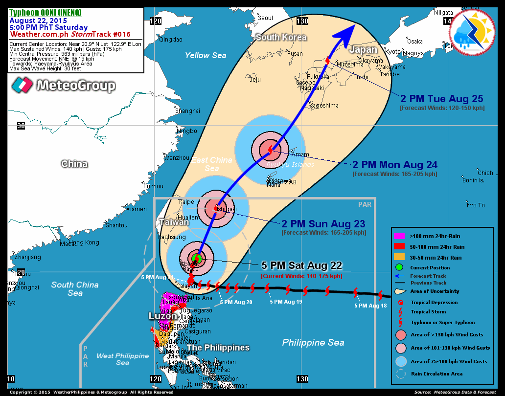
RECENT PAGASA TRACKING CHART:

________________________
____________

________________________
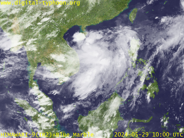
RECENT MTSAT-1R SATELLITE IMAGE:

> Image source: Digital-Typhoon.org (http://www.digital-typhoon.org ) __________________________________________________________________________________________

> Image source: Digital-Typhoon.
NOTES:
^ - JTWC commentary remarks (for Meteorologists) from their
latest warning.
latest warning.
* - Based on PAGASA's Philippine Storm Warning Signals,
# 4 being the highest. For more explanations on these
signals, visit: http://www.typhoon2000.ph/signals.htm
** - Based on the Tropical Cyclone's Wave Height near
its center.
__________________________________________________________________________________________
>> To know the meteorological terminologies and acronyms
used on this update visit the ff:
http://typhoon2000.ph/tcterm.htm
http://www.nhc.noaa.gov/aboutgloss.shtml
http://www.srh.noaa.gov/oun/severewx/glossary.php
http://www.srh.weather.gov/fwd/glossarynation.html
http://www.nhc.noaa.gov/acronyms.shtml
__________________________________________________________________________________________
:: Typhoon2000.com (T2K) Mobile >> Powered by: Synermaxx
Receive the latest 6-hrly storm updates directly to your mobile phones! To get:
Send T2K TYPHOON to: 2800 (GLOBE & TM) | 216 (SMART & TNT) | 2288 (SUN)
Note: Globe & Smart charges P2.50 per message, while Sun at P2.00.
__________________________________________________________________________________________
For the complete details on TD CRISING (96W)...go visit
our website @:
> http://www.typhoon2000.com
> http://www.maybagyo.com
# 4 being the highest. For more explanations on these
signals, visit: http://www.typhoon2
** - Based on the Tropical Cyclone's Wave Height near
its center.
____________
>> To know the meteorological terminologies and acronyms
used on this update visit the ff:
http://typhoon2000.
http://www.nhc.
http://www.srh.
http://www.srh.
http://www.nhc.
____________
:: Typhoon2000.
Receive the latest 6-hrly storm updates directly to your mobile phones! To get:
Send T2K TYPHOON to: 2800 (GLOBE & TM) | 216 (SMART & TNT) | 2288 (SUN)
Note: Globe & Smart charges P2.50 per message, while Sun at P2.00.
For the complete details on TD CRISING (96W)...go visit
our website @:
> http://www.typhoon2
> http://www.maybagyo
Copyright © 2009 Typhoon2000.
__._,_.___
MARKETPLACE
Change settings via the Web (Yahoo! ID required)
Change settings via email: Switch delivery to Daily Digest | Switch format to Traditional
Visit Your Group | Yahoo! Groups Terms of Use | Unsubscribe
.
__,_._,___
No comments:
Post a Comment