Wednesday, January 07, 2009

AURING just a Low Pressure... [Final Update]


Typhoon2000 STORM UPDATE #005 **FINAL**
Name: REMNANTS OF TD AURING [LPA] 
Issued: 7:00 AM MANILA TIME (23:00 GMT) WED 07 JANUARY 2009
Source: T2K XTRAPOLATION
Note: Kindly refer to your country's official warnings or bulletins. This update is for additional information purposes only.
_____________________________________________________________________________
 
 
AURING (99W) DISSIPATES INTO A LOW PRESSURE AREA...ITS REMNANTS
CROSSING NORTHERN VISAYAS...BRINGING RAINSHOWERS ACROSS BICOL
REGION AND THE VISAYAS.

*This is the Final E-mail Storm Update on this tropical system.

+ FORECAST OUTLOOK: The dissipating remants of TD AURING (LPA) is
expected to continue moving West to WSW for the next 12 to 24 hours
across Northern Visayas today
.

+ EFFECTS: AURING's remnants (rain clouds) is expected to bring wide-
spread rainshowers with some isolated squalls across the Visayas, Bicol
Region and Coastal Quezon today. Residents in low-lying areas & steep
slopes must remain alert & seek evacuation for possible life-threatening
flash floods, mudslides & landslides due to the anticipated heavy rains
brought about by this system. Precautionary measures must be initiated
if necessary.

+ CURRENT MONSOON INTENSITY
Strong surge of Northeast (NE) Monsoon 
continues to affect Northern and Eastern Luzon. Clear to cloudy skies
with possible passing drizzle to "on and off" rainshowers & NE'ly winds
not exceeding 40 km/hr will prevail on these areas for the next 24 hours.

Important Note: Please keep in mind that the above forecast outlook,
effects & current monsoon intensity, and tropical cyclone watch changes 
every 06 to 12 hours!

_____________________________________________________________________________

TIME/DATE: 6:00 AM MANILA TIME (22:00 GMT) WED 07 JAN 2009 
LOCATION OF CENTER: LATITUDE 11.7º N...LONGITUDE 125.0º
DISTANCE 1: 45 KM (25
NM) WNW OF BORONGAN, EASTERN SAMAR, PH 
DISTANCE 2: 45 KM (25 NM) NORTH OF TACLOBAN CITY, PH
DISTANCE 3: 100 KM (55 NM) SSE OF CATARMAN, NORTHERN SAMAR, PH
DISTANCE 4: 160 KM (85 NM) ESE OF MASBATE, PH 
DISTANCE 5: 290 KM (155 NM) SE OF NAGA CITY, PH 
MAX WINDS [10-MIN AVG]: 30 KM/HR (20 KTS) NEAR THE CENTER
PEAK WIND GUSTS: 45 KM/HR (25 KTS)
SAFFIR-SIMPSON SCALE: 
TROPICAL DISTURBANCE 
COASTAL STORM SURGE HEIGHT: 0 FEET (0 METER)
MINIMUM CENTRAL PRESSURE (est.): 1009 MILLIBARS (hPa)
RECENT MOVEMENT: WEST @ 17 KM/HR (09 KTS)
GENERAL DIRECTION: NORTHERN VISAYAS
STORM'S SIZE (IN DIAMETER): 230 KM (125 NM)/
SMALL
MAX WAVE HEIGHT**: 10 FEET (3.0 METERS)
VIEW T2K FINAL TRACKING MAP: 
6 PM MANILA TIME TUE JAN 06
PHILIPPINE STORM SIGNALS*: NONE

_____________________________________________________________________________
_____________________________________________________________________________

RECENT T2K TRACKING CHART:
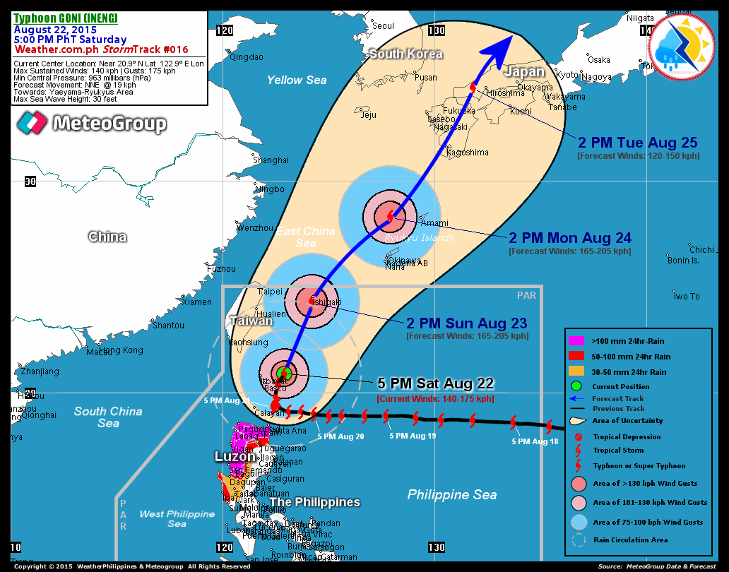

_______________________________________________________________________________________

 
RECENT MTSAT-1R SATELLITE IMAGE:


> Image source:  NOAA Satellite Service (http://www.noaa.gov/
__________________________________________________________________________________________

NOTES:
 
  ^ - JTWC commentary remarks (for Meteorologists) from their 
      latest warning.
 
  * - Based on PAGASA's Philippine Storm Warning Signals, 
      # 4 being the highest. For more explanations on these 
      signals, visit:
http://www.typhoon2000.ph/signals.htm

 ** - Based on the Tropical Cyclone's Wave Height near 
      its center.

__________________________________________________________________________________________

>>
To know the meteorological terminologies and acronyms 
   used on this update visit the ff:

    http://typhoon2000.ph/tcterm.htm  
    http://www.nhc.noaa.gov/aboutgloss.shtml
    http://www.srh.noaa.gov/oun/severewx/glossary.php
    http://www.srh.weather.gov/fwd/glossarynation.html
    http://www.nhc.noaa.gov/acronyms.shtml
__________________________________________________________________________________________

:: Typhoon2000.com (T2K) Mobile >> Powered by: Synermaxx
Receive the latest 6-hrly storm updates directly to your mobile phones! To get:
Send T2K TYPHOON to: 2800
(GLOBE & TM) | 216 (SMART & TNT) | 2288 (SUN) 
Note: Globe & Smart charges P2.50 per message, while Sun at P2.00.
__________________________________________________________________________________________

For the complete details on TD AURING (99W)...go visit
our website @:

>
http://www.typhoon2000.com
http://www.maybagyo.com

:: Kindly view our site's disclaimer at: 
   
http://www.typhoon2000.ph/disclaimer.htm


Copyright © 2008 Typhoon2000.com  All Rights Reserved

__._,_.___
Recent Activity
Visit Your Group
Get in Shape

on Yahoo! Groups

Find a buddy

and lose weight.

Group Charity

Hands On Network

Volunteering has

never been so easy

Y! Groups blog

the best source

for the latest

scoop on Groups.

.

__,_._,___

Tuesday, January 06, 2009

TD AURING weakens... [Update #004]


Typhoon2000 STORM UPDATE #004
Name: TROPICAL DEPRESSION AURING [99W] 
Issued: 7:00 AM MANILA TIME (23:00 GMT) TUE 06 JANUARY 2009
Source: JMA 18Z WARNING FOR HIGH SEAS / T2K XTRAPOLATION
Note: Kindly refer to your country's official warnings or bulletins. This update is for additional information purposes only.
_____________________________________________________________________________
 
 
TROPICAL DEPRESSION AURING (99W) WEAKENED SLIGHTLY BUT IS NOW TURNING
WESTWARD...THREATENS SAMAR-BICOL. SURGE OF NORTHEAST MONSOON PREVAILING
ACROSS LUZON, BICOL REGION AND VISAYAS.

*Residents and visitors along Northern Visayas & Bicol Region should closely monitor the progress
of AURING
.

+ FORECAST OUTLOOK: AURING is now expected to move West to WSW for the
next 24 hours and weaken further. The strong High Pressure Steering Ridge
has pushed the system into this new direction. It shall be off the Northern
Coast of Northern Samar tomorrow morning
.

+ EFFECTS: AURING's circulation has become more compact to the east of
Bicol Region
. Its convective rain bands is expected to bring widespread
rains with heavy squalls and winds not exceeding 50 kph
across the eas-
tern coast of Bicol and Samar today. 1-day rainfall accumulations of 75
up to 100 mm is possible along its rain bands...with isolated accumula-
tions of up to 200 mm near the center of AURING. Residents in low-lying
areas & steep
slopes must remain alert & seek evacuation for possible
life-threate
ning flash floods, mudslides & landslides due to the anti-
cipated heavy rains brought about by this system. Precautionary measures
must be initiated if necessary. Danger from Rip Currents or Rip Tides
can be expected along the beach-front areas of Luzon, Visayas, Bicol
Region and Northern Mindanao.

+ CURRENT MONSOON INTENSITY
Strong surge of Northeast (NE) Monsoon
continues
to affect Luzon, & Visayas becoming more intense across
Eastern Luzon, Bicol Region and Eastern Visayas.
Clear to cloudy
skies with possible passing drizzle to "on and
off" rainshowers &
NE'ly winds not exceeding 60 km/hr will
prevail on these areas for
the next 24 hours.

Important Note: Please keep in mind that the above forecast outlook,
effects & current monsoon intensity, and tropical cyclone watch changes 
every 06 to 12 hours!

_____________________________________________________________________________

TIME/DATE: 6:00 AM MANILA TIME (22:00 GMT) TUE 06 JAN 2009 
LOCATION OF MID-LEVEL CENTER: LATITUDE 13.1º N...LONGITUDE 128.5º
DISTANCE 1: 375 KM (202
NM) NE OF BORONGAN, EASTERN SAMAR, PH 
DISTANCE 2: 430 KM (232 NM) ENE OF CATARMAN, NORTHERN SAMAR, PH
DISTANCE 3: 460 KM (248 NM) ESE OF VIRAC, CATANDUANES, PH
DISTANCE 4: 520 KM (280 NM) EAST OF LEGAZPI CITY, PH 
DISTANCE 5: 575 KM (310 NM) ESE OF NAGA CITY, PH 
MAX WINDS [10-MIN AVG]: 45 KM/HR (25 KTS) NEAR THE CENTER
PEAK WIND GUSTS: 60 KM/HR (33 KTS)
SAFFIR-SIMPSON SCALE: 
TROPICAL DEPRESSION 
COASTAL STORM SURGE HEIGHT: 0 FEET (0 METER)
MINIMUM CENTRAL PRESSURE (est.): 1004 MILLIBARS (hPa)
RECENT MOVEMENT: WNW @ 15 KM/HR (08 KTS)
GENERAL DIRECTION: SAMAR-BICOL AREA
STORM'S SIZE (IN DIAMETER): 300 KM (160 NM)/
SMALL
MAX WAVE HEIGHT**: 12 FEET (3.6 METERS)
VIEW T2K TRACKING MAP: 
6 AM MANILA TIME TUE JAN 06
PHILIPPINE STORM SIGNALS*: NONE

12 & 24 HR. FORECAST:
2 PM (06 GMT) 06 JANUARY: 13.0N 126.9E
2 AM (18 GMT) 07 JANUARY: 12.8N 125.5E

REMARKS: 2 AM (18 GMT) 06 JANUARY POSITION: 13.0N 129.0E.
_____________________________________________________________________________
_____________________________________________________________________________

RECENT T2K TRACKING CHART:


_______________________________________________________________________________________

 
RECENT MTSAT-1R SATELLITE IMAGE:


> Image source:  NOAA Satellite Service (http://www.noaa.gov/
__________________________________________________________________________________________

NOTES:
 
  ^ - JTWC commentary remarks (for Meteorologists) from their 
      latest warning.
 
  * - Based on PAGASA's Philippine Storm Warning Signals, 
      # 4 being the highest. For more explanations on these 
      signals, visit:
http://www.typhoon2000.ph/signals.htm

 ** - Based on the Tropical Cyclone's Wave Height near 
      its center.

__________________________________________________________________________________________

>>
To know the meteorological terminologies and acronyms 
   used on this update visit the ff:

    http://typhoon2000.ph/tcterm.htm  
    http://www.nhc.noaa.gov/aboutgloss.shtml
    http://www.srh.noaa.gov/oun/severewx/glossary.php
    http://www.srh.weather.gov/fwd/glossarynation.html
    http://www.nhc.noaa.gov/acronyms.shtml
__________________________________________________________________________________________

:: Typhoon2000.com (T2K) Mobile >> Powered by: Synermaxx
Receive the latest 6-hrly storm updates directly to your mobile phones! To get:
Send T2K TYPHOON to: 2800
(GLOBE & TM) | 216 (SMART & TNT) | 2288 (SUN) 
Note: Globe & Smart charges P2.50 per message, while Sun at P2.00.
__________________________________________________________________________________________

For the complete details on TD AURING (99W)...go visit
our website @:

>
http://www.typhoon2000.com
http://www.maybagyo.com

:: Kindly view our site's disclaimer at: 
   
http://www.typhoon2000.ph/disclaimer.htm


Copyright © 2008 Typhoon2000.com  All Rights Reserved

__._,_.___
Recent Activity
Visit Your Group
Y! Groups blog

The place to go

to stay informed

on Groups news!

Special K Group

on Yahoo! Groups

Join the challenge

and lose weight.

All-Bran

Day 10 Club

on Yahoo! Groups

Feel better with fiber.

.

__,_._,___

Monday, January 05, 2009

TD AURING - Update #003


Typhoon2000 STORM UPDATE #003
Name: TROPICAL DEPRESSION AURING [99W] 
Issued: 7:00 PM MANILA TIME (11:00 GMT) MON 05 JANUARY 2009
Source: PAGASA WARNING FOR SHIPPING #009 / T2K XTRAPOLATION
Note: Kindly refer to your country's official warnings or bulletins. This update is for additional information purposes only.
_____________________________________________________________________________
 
 
TROPICAL DEPRESSION AURING (99W) HEADING NORTHEASTERLY ACROSS THE
CENTRAL PHILIPPINE SEA. SURGE OF NORTHEAST MONSOON PREVAILING OVER
LUZON, BICOL REGION AND VISAYAS.

*Residents and visitors along Northern Visayas & Bicol Region should closely monitor the progress
of AURING
.

+ FORECAST OUTLOOK: AURING is expected to continue moving NE in the
direction of the Central Philippine Sea and away from the Philippines.
*Alternate Forecast Scenario: There's a possibility that AURING shall
track-back to the West to WSW tomorrow and cross Bicol-Samar area on
Wednesday. This scenario is likely if the developing High Pressure
Steering Ridge off Taiwan strengthens and becomes the dominant
factor - bringing strong surge of NE Monsoon which will steer
AURING.

+ EFFECTS: AURING's circulation continues to consolidate to the east
of Bicol Region. Its convective rain bands is expected to bring
widespread rains with heavy squalls and winds not exceeding 60 kph
across the eastern coast of Bicol and Samar today. 1-day rainfall
accumulations of 75 up to 100 mm is
possible along its rain bands.
..with isolated accumulations of up to
200 mm near the center of
AURING.
Residents in low-lying areas & steep
slopes must remain
alert & seek evacuation for possible life-threate
ning flash
floods, mudslides & landslides due to the anticipated heavy rains
brought about by this system. Precautionary measures must be initiated
if necessary. Danger from Rip Currents or Rip Tides can be expected
along the beach-front areas of Luzon, Visayas, Bicol Region and
Northern Mindanao
.

+ CURRENT MONSOON INTENSITY
Strong surge of Northeast (NE) Monsoon
continues
to affect Luzon, & Visayas becoming more intense across
Eastern Luzon, Bicol Region and Eastern Visayas.
Clear to cloudy
skies with possible passing drizzle to "on and
off" rainshowers &
NE'ly winds not exceeding 60 km/hr will
prevail on these areas for
the next 24 hours.

Important Note: Please keep in mind that the above forecast outlook,
effects & current monsoon intensity, and tropical cyclone watch changes 
every 06 to 12 hours!

_____________________________________________________________________________

TIME/DATE: 6:00 PM MANILA TIME (10:00 GMT) MON 05 JAN 2009 
LOCATION OF MID-LEVEL CENTER: LATITUDE 13.7º N...LONGITUDE 128.7º
DISTANCE 1: 435 KM (235
NM) NE OF BORONGAN, EASTERN SAMAR, PH 
DISTANCE 2: 465 KM (250 NM) ENE OF CATARMAN, NORTHERN SAMAR, PH
DISTANCE 3: 475 KM (256 NM) EAST OF VIRAC, CATANDUANES, PH
DISTANCE 4: 545 KM (295 NM) ENE OF LEGAZPI CITY, PH 
DISTANCE 5: 595 KM (322 NM) EAST OF NAGA CITY, PH 
MAX WINDS [10-MIN AVG]: 55 KM/HR (30 KTS) NEAR THE CENTER
PEAK WIND GUSTS: 70 KM/HR (38 KTS)
SAFFIR-SIMPSON SCALE: 
TROPICAL DEPRESSION 
COASTAL STORM SURGE HEIGHT: 0 FEET (0 METER)
MINIMUM CENTRAL PRESSURE (est.): 1000 MILLIBARS (hPa)
RECENT MOVEMENT: NE @ 19 KM/HR (10 KTS)
GENERAL DIRECTION: CENTRAL PHILIPPINE SEA
STORM'S SIZE (IN DIAMETER): 335 KM (180 NM)/
SMALL/AVERAGE
MAX WAVE HEIGHT**: 15 FEET (4.5 METERS)
VIEW T2K TRACKING MAP: 
6 PM MANILA TIME MON JAN 05
PHILIPPINE STORM SIGNALS*: NONE

24, 48 & 72 HR. FORECAST:
2 PM (06 GMT) 06 JANUARY: 16.8N 131.8E
2 PM (06 GMT) 07 JANUARY: 20.5N 136.5E

REMARKS: 2 PM (06 GMT) 05 JANUARY POSITION: 13.5N 128.3E.
_____________________________________________________________________________
_____________________________________________________________________________

RECENT T2K TRACKING CHART:


_______________________________________________________________________________________

 
RECENT MTSAT-1R SATELLITE IMAGE:


> Image source:  NOAA Satellite Service (http://www.noaa.gov/
__________________________________________________________________________________________

NOTES:
 
  ^ - JTWC commentary remarks (for Meteorologists) from their 
      latest warning.
 
  * - Based on PAGASA's Philippine Storm Warning Signals, 
      # 4 being the highest. For more explanations on these 
      signals, visit:
http://www.typhoon2000.ph/signals.htm

 ** - Based on the Tropical Cyclone's Wave Height near 
      its center.

__________________________________________________________________________________________

>>
To know the meteorological terminologies and acronyms 
   used on this update visit the ff:

    http://typhoon2000.ph/tcterm.htm  
    http://www.nhc.noaa.gov/aboutgloss.shtml
    http://www.srh.noaa.gov/oun/severewx/glossary.php
    http://www.srh.weather.gov/fwd/glossarynation.html
    http://www.nhc.noaa.gov/acronyms.shtml
__________________________________________________________________________________________

:: Typhoon2000.com (T2K) Mobile >> Powered by: Synermaxx
Receive the latest 6-hrly storm updates directly to your mobile phones! To get:
Send T2K TYPHOON to: 2800
(GLOBE & TM) | 216 (SMART & TNT) | 2288 (SUN) 
Note: Globe & Smart charges P2.50 per message, while Sun at P2.00.
__________________________________________________________________________________________

For the complete details on TD AURING (99W)...go visit
our website @:

>
http://www.typhoon2000.com
http://www.maybagyo.com

:: Kindly view our site's disclaimer at: 
   
http://www.typhoon2000.ph/disclaimer.htm


Copyright © 2008 Typhoon2000.com  All Rights Reserved

__._,_.___
Recent Activity
Visit Your Group
Yahoo! Groups

Special K Challenge

Join others who

are losing pounds.

Health Groups

for people over 40

Join people who are

staying in shape.

Yahoo! Groups

Cats Group

Join a group for

cat owners like you

.

__,_._,___

TD AURING heading North...threat to Bicol remains [Update #002]


Typhoon2000 STORM UPDATE #002
Name: TROPICAL DEPRESSION AURING [99W] 
Issued: 7:00 AM MANILA TIME (23:00 GMT) MON 05 JANUARY 2009
Source: PAGASA SEVERE WEATHER BULLETIN #007 / T2K XTRAPOLATION
Note: Kindly refer to your country's official warnings or bulletins. This update is for additional information purposes only.
_____________________________________________________________________________
 
 
TROPICAL DEPRESSION AURING (99W) HAS ACCELERATED NORTHWARD...REMAINS
A THREAT TO BICOL REGION. SURGE OF NORTHEAST MONSOON AFFECTING NCR,
LUZON, BICOL AND VISAYAS.

*Residents and visitors along Northern Visayas & Bicol Region should closely monitor the progress
of AURING
.

+ FORECAST OUTLOOK: AURING is expected to continue moving North to NNE
in the direction of the Central Philippine Sea. The 2 to 3-day medium
forecast shows the depression recurving NE across the open waters of
the Central Philippine Sea as a developing frontal system off Taiwan
is expected to absorb the depression.

+ EFFECTS: AURING's circulation has become broad over the Philippine
Sea with multiple circulation centers located within the system. Its
convective rain bands is expected to bring widespread rains with heavy
squalls and winds not exceeding 60 kph across Eastern Samar today.
1-day rainfall accumulations of 75 up to 100 mm is possible along its
rain bands...with isolated accumulations of up to 200 mm near the
center of AURING. Residents in low-lying areas & steep slopes must
remain alert & seek evacuation for possible life-threatening flash
floods, mudslides & landslides due to the anticipated heavy rains
brought about by this system. Precautionary measures must be initiated
if necessary. Danger from Rip Currents or Rip Tides can be expected
along the beach-front areas of Visayas and along the beach front areas
of Bicol Region and Northern Mindanao.

+ CURRENT MONSOON INTENSITY
Strong surge of Northeast (NE) Monsoon
continues
to affect Metro Manila, Luzon, & Visayas becoming more
intense across Eastern Luzon, Bicol Region and Eastern Visayas.
Clear to cloudy skies with possible passing drizzle to "on and
off" rainshowers & NE'ly winds not exceeding 60 km/hr will
prevail on these areas for the next 24 hours.

Important Note: Please keep in mind that the above forecast outlook,
effects & current monsoon intensity, and tropical cyclone watch changes 
every 06 to 12 hours!

_____________________________________________________________________________

TIME/DATE: 6:00 AM MANILA TIME (22:00 GMT) MON 05 JAN 2009 
LOCATION OF MID-LEVEL CENTER: LATITUDE 12.9º N...LONGITUDE 126.8º
DISTANCE 1: 280 KM (150
NM) ESE OF VIRAC, CATANDUANES, PH 
DISTANCE 2: 210 KM (113 NM) NE OF BORONGAN, EASTERN SAMAR, PH
DISTANCE 3: 245 KM (132 NM) ESE OF CATARMAN, NORTHERN SAMAR, PH
DISTANCE 4: 335 KM (182 NM) ESE OF LEGAZPI CITY, PH 
DISTANCE 5: 395 KM (215 NM) ESE OF NAGA CITY, PH 
MAX WINDS [10-MIN AVG]: 55 KM/HR (30 KTS) NEAR THE CENTER
PEAK WIND GUSTS: 70 KM/HR (38 KTS)
SAFFIR-SIMPSON SCALE: 
TROPICAL DEPRESSION 
COASTAL STORM SURGE HEIGHT: 0 FEET (0 METER)
MINIMUM CENTRAL PRESSURE (est.): 1000 MILLIBARS (hPa)
RECENT MOVEMENT: NORTH @ 13 KM/HR (07 KTS)
GENERAL DIRECTION: CENTRAL PHILIPPINE SEA
STORM'S SIZE (IN DIAMETER): 335 KM (180 NM)/
SMALL/AVERAGE
MAX WAVE HEIGHT**: 15 FEET (4.5 METERS)
VIEW T2K TRACKING MAP: 
6 AM MANILA TIME MON JAN 05
PHILIPPINE STORM SIGNALS*: NONE

24, 48 & 72 HR. FORECAST:
2 AM (18 GMT) 06 JANUARY: 15.4N 127.4E
2 AM (18 GMT) 07 JANUARY: 18.0N 129.4E
2 AM (18 GMT) 08 JANUARY: 19.7N 130.8E

REMARKS: 2 AM (18 GMT) 05 JANUARY POSITION: 12.5N 126.6E.
_____________________________________________________________________________
_____________________________________________________________________________

RECENT T2K TRACKING CHART:


_______________________________________________________________________________________

 
RECENT MTSAT-1R SATELLITE IMAGE:


> Image source:  NOAA Satellite Service (http://www.noaa.gov/
__________________________________________________________________________________________

NOTES:
 
  ^ - JTWC commentary remarks (for Meteorologists) from their 
      latest warning.
 
  * - Based on PAGASA's Philippine Storm Warning Signals, 
      # 4 being the highest. For more explanations on these 
      signals, visit:
http://www.typhoon2000.ph/signals.htm

 ** - Based on the Tropical Cyclone's Wave Height near 
      its center.

__________________________________________________________________________________________

>>
To know the meteorological terminologies and acronyms 
   used on this update visit the ff:

    http://typhoon2000.ph/tcterm.htm  
    http://www.nhc.noaa.gov/aboutgloss.shtml
    http://www.srh.noaa.gov/oun/severewx/glossary.php
    http://www.srh.weather.gov/fwd/glossarynation.html
    http://www.nhc.noaa.gov/acronyms.shtml
__________________________________________________________________________________________

:: Typhoon2000.com (T2K) Mobile >> Powered by: Synermaxx
Receive the latest 6-hrly storm updates directly to your mobile phones! To get:
Send T2K TYPHOON to: 2800
(GLOBE & TM) | 216 (SMART & TNT) | 2288 (SUN) 
Note: Globe & Smart charges P2.50 per message, while Sun at P2.00.
__________________________________________________________________________________________

For the complete details on TD AURING (99W)...go visit
our website @:

>
http://www.typhoon2000.com
http://www.maybagyo.com

:: Kindly view our site's disclaimer at: 
   
http://www.typhoon2000.ph/disclaimer.htm


Copyright © 2008 Typhoon2000.com  All Rights Reserved

__._,_.___
Recent Activity
Visit Your Group
Special K Group

on Yahoo! Groups

Join the challenge

and lose weight.

Yahoo! Groups

Join people over 40

who are finding ways

to stay in shape.

Group Charity

i-SAFE

Keep your kids

safer online

.

__,_._,___