
Saturday, July 14, 2007

TY MAN-YI (BEBENG) made landfall over Southern Kyushu... [Update #14]


Typhoon2000 STORM UPDATE #014
Name: TYPHOON MAN-YI [BEBENG/04W/0704] 
Issued: 7:00 PM MANILA TIME (11:00 GMT) SAT 14 JULY 2007
Next Update: 7:00 AM (23:00 GMT) SUN 15 JULY
Source: JTWC TROPICAL CYCLONE WARNING #028
_______________________________________________________________________
 
 
TYPHOON MAN-YI (BEBENG) HAS MADE LANDFALL OFF THE SOUTHERN
PART OF KYUSHU, JAPAN EARLY THIS AFTERNOON...NOW HEADING
FAST TOWARDS THE SOUTHERN COASTLINES OF SHIKOKU AND HONSHU.

+ FORECAST OUTLOOK: MAN-YI is expected to continue losing
strength and accelerate across the southern coastlines of
Shikoku & Honshu within 24 to 36 hours and is expected to
become an Extratropical Cyclone tomorrow. MAN-YI is fore-
cast to pass to the south of Tokyo tomorrow late afternoon
before moving back into the North Pacific Ocean tomorrow
night


+ EFFECTS: MAN-YI's outer bands continues to spread across
Okinawa-Ryukyus, Kyushu, Shikoku and Honshu. The inner
bands is now moving into Shikoku and Southwestern Honshu.
The Core (Eyewall+Eye) of the typhoon is now starting to
move into the coast of Southern Shikoku and is expected
to reach Southwestern Honshu tonight. Damaging typhoon-
force winds w/ moderate to heavy rains is expected over
the affected areas tonight until tomorrow. Coastal Storm
Surge flooding of 3 to 5 feet above normal tide levels...
along with large and dangerous battering waves can be ex-
pected near and to the north of MAN-YI's projected path
or over Southern Kyushu-Shikoku-Honshu today. Flash floods
and mudslides are imminent along river banks, low-lying
and mountainous areas of the affected areas. Extra-pre-
cautions must be implemented NOW as the dangerous
typhoon passes by
.

+ CURRENT MONSOON INTENSITY: Southwest (SW) Monsoon con-
tinues to weaken as MAN-YI loses strength. Cloudy skies
with possible intermittent passing rains or thunderstorms
can still be expected across the western sections of Luzon,
Southern Luzon and Visayas w/ SW'ly winds of 20 km/hr or
higher. Stay tuned for more Monsoon updates on the next
advisory
.

+ TROPICAL CYCLONE WATCH: N/A.


Important Note: Please keep in mind that the above forecast
outlook, effects & current monsoon intensity, and tropical
cyclone watch changes every 06 to 12 hours!

_______________________________________________________________________

TIME/DATE: 5:00 PM MANILA TIME (09:00 GMT) 14 JULY
LOCATION OF EYE: LATITUDE 32.1º N...LONGITUDE 132.0º E
DISTANCE 1: 145 KM (78 NM) ENE OF KAGOSHIMA, JAPAN
DISTANCE 2: 215 KM (115 NM) SW OF KOCHI, JAPAN
DISTANCE 3: 815 KM (440 NM) WSW OF TOKYO, JAPAN
MAX SUSTAINED WINDS [1-MIN AVG]: 150 KM/HR (80 KTS)
PEAK WIND GUSTS: 185 KM/HR (100 KTS)
SAFFIR-SIMPSON SCALE: CATEGORY ONE (1)
MINIMUM CENTRAL PRESSURE (est.): 963 MILLIBARS (hPa)
RECENT MOVEMENT: NE @ 37 KM/HR (20 KTS)
GENERAL DIRECTION: SOUTHERN COASTLINES OF SHIKOKU & HONSHU
STORM'S SIZE (IN DIAMETER): 1,075 KM (580 NM)/ VERY LARGE
MAX WAVE HEIGHT**: 26 FEET (7.9 METERS)
VIEW TRACKING MAP: 2 PM MANILA TIME JULY 14
TSR WIND PROBABILITIESCURRENT TO 36 HRS LEAD
  
PHILIPPINE STORM SIGNALS*: N/A
           
12, 24 & 36 HR. FORECAST:
2 AM (18 GMT) 15 JUL: 33.5N 134.6E / 130-160 KPH / ENE @ 35 KPH
2 PM (06 GMT) 15 JUL: 34.8N 138.8E / 110-140 KPH / ENE @ 37 KPH
2 AM (18 GMT) 16 JUL: 36.0N 143.4E / 95-120 KPH / ENE @ 37 KPH

REMARKS: 2 PM (06 GMT) 14 JULY POSITION: 31.6N 131.1E.
^TYPHOON (TY) 04W (MAN-YI) REMAINS A POWERFUL TYPHOON, BUT
HAS WEAKENED CONSIDERABLY FROM 24 HOURS AGO, WHILE MAINTAI-
NING INTENSITY OVER THE PAST 06 HOURS. A 132148Z TRMM MICRO-
WAVE SATELLITE IMAGE AND A MICROWAVE SATELLITE IMAGE BOTH
EVEAL THAT SOME EROSION OF THE EYEWALL HAS OCCURRED OVER
THE WESTERN QUADRANT OVER THE PAST 12 HOURS. DEEP CONVECTION
HAS PERSISTED ON THE SOUTHEASTERN PERIPHERY OF THE STORM.
THE STORM HAS TRACKED AT 15 KNOTS TO THE NORTHEAST OVER
THE PAST 6 HOURS, WHICH IS AN INCREASE IN TRACK SPEED OF
4-5 KNOTS FROM THE PREVIOUS 12 HOURS
...(more)

>> MAN-YI {pronounced: mun~yi}, meaning: Name of a strait ori-
   ginally. With the construction of a dam, that part of the 
   sea has become a reservoir. 
Name contributed by: Hong Kong.

_______________________________________________________________________
_______________________________________________________________________

RECENT TRACKING CHART:


_______________________________________________________________________________________

 
RECENT MTSAT-1R SATELLITE IMAGE:
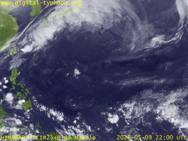

> Image source:  Digital-Typhoon.org (Nat'l. Institute of Informatics) (http://www.digital-typhoon.org)
__________________________________________________________________________________________

NOTES:
 
  ^ - JTWC commentary remarks (for Meteorologists) from their 
      latest warning.
 
  * - Based on PAGASA's Philippine Storm Warning Signals, 
      # 4 being the highest. Red letters indicate new areas 
      being hoisted.
For more explanations on these signals, 
      visit:
http://www.typhoon2000.ph/signals.htm

 ** - Based on the Tropical Cyclone's Wave Height near 
      its center.

__________________________________________________________________________________________

>>
To know the meteorological terminologies and acronyms 
   used on this update visit the ff:

    http://typhoon2000.ph/tcterm.htm  
    http://www.nhc.noaa.gov/aboutgloss.shtml
    http://www.srh.noaa.gov/oun/severewx/glossary.php
    http://www.srh.weather.gov/fwd/glossarynation.html
    http://www.nhc.noaa.gov/acronyms.shtml
__________________________________________________________________________________________

:: Typhoon2000.com (T2K) Mobile >> Powered by: Synermaxx
Receive the latest storm updates directly to your mobile phones! To know more:
Send T2K HELP to: 2800
(GLOBE & TM) | 216 (SMART & TNT) | 2288 (SUN) 
Note: Globe & Smart charges P2.50 per message, while Sun at P2.00.
__________________________________________________________________________________________

For the complete details on Typhoon MAN-YI (BEBENG)...go visit
our website @:

>
http://www.typhoon2000.com
http://www.maybagyo.com

:: Kindly view our site's disclaimer at: 
   
http://www.typhoon2000.ph/disclaimer.htm


__._,_.___
Recent Activity
Visit Your Group
SPONSORED LINKS
Get Low Fares

Yahoo! FareChase

Searches sites so

you don't have to

Yahoo! Groups

Get info and support

on Samsung HDTVs

and devices.

Yoga Groups

Find Enlightenment

& exchange insights

with other members

.

__,_._,___

Typhoon MAN-YI (BEBENG) - Update #13


Typhoon2000 STORM UPDATE #013
Name: TYPHOON MAN-YI [BEBENG/04W/0704] 
Issued: 7:00 AM MANILA TIME (23:00 GMT) SAT 14 JULY 2007
Next Update: 7:00 PM (11:00 GMT) SAT 14 JULY
Source: JTWC TROPICAL CYCLONE WARNING #026
_______________________________________________________________________
 
 
TYPHOON MAN-YI (BEBENG) SLOWS DOWN AND DOWNGRADED TO CATE-
GORY TWO...MOVING CLOSER TO WESTERN HONSHU
.

+ FORECAST OUTLOOK: MAN-YI is expected to make landfall over
SW Kyushu this afternoon around 4 PM Japan Time, passing
very close to Kagoshima, Japan. The 1 to 2-day medium-range
forecast (Jul 15 to 16) shows the system traversing the
beachfront-coastal areas of Shikoku and Honshu early tomorrow
morning until the whole day of Sunday (Jul 15). MAN-YI is
forecast to pass very close to the south of Metropolitan
Tokyo as a downgraded tropical storm or Extratropical Cyclone
by Sunday evening (approx 9 PM Japan Time, Jul 15). MAN-YI
shall exit Eastern Honshu during the early hours of July 16


+ EFFECTS: MAN-YI's over-all circulation has shrunked consi-
derably as it near Western Japan, with its outer bands sprea-
ding across Okinawa-Ryukyus, Kyushu, Shikoku and Honshu. The
inner bands is expected to arrive over Western Kyushu this
morning. Typhoon-force winds w/ moderate to heavy rains is
expected over the main Japanese islands of Kyushu and Shiko-
ku today until tomorrow as the core (eye + eyewall) of MAN-
YI starts to make landfall. Coastal Storm Surge flooding of
5 to 10 feet above normal tide levels...along with large and
dangerous battering waves can be expected near and to the
north of MAN-YI's projected path or over Western Kyushu
today. Flash floods and mudslides are imminent along river
banks, low-lying and mountainous areas of the affected
areas. Extra-precautions must be implemented NOW as the
dangerous typhoon passes by
.

+ CURRENT MONSOON INTENSITY: Southwest (SW) Monsoon has
started to retreat and weaken as MAN-YI loses strength.
Cloudy skies with possible intermittent passing rains or
thunderstorms can still be expected across the western
sections of Luzon, Southern Luzon and Visayas w/ SW'ly
winds of 30 km/hr or higher, becoming more frequent along
the Western sections of Palawan, Southern & Western Panay,
Western Negros, Boracay, Bataan, Zambales, Batangas, and
Western Mindoro
. Mudslides and flooding is likely along
river banks, low-lying & flood-prone areas of the affected
areas. Stay tuned for more Monsoon updates on the next
advisory
.

+ TROPICAL CYCLONE WATCH: N/A.


Important Note: Please keep in mind that the above forecast
outlook, effects & current monsoon intensity, and tropical
cyclone watch changes every 06 to 12 hours!

_______________________________________________________________________

TIME/DATE: 5:00 AM MANILA TIME (21:00 GMT) 14 JULY
LOCATION OF EYE: LATITUDE 29.8º N...LONGITUDE 128.6º E
DISTANCE 1: 280 KM (150 NM) SW OF KAGOSHIMA, JAPAN
DISTANCE 2: 375 KM (203 NM) ENE OF OKINAWA, JAPAN
DISTANCE 3: 875 KM (472 NM) NE OF TAIPEI, TAIWAN
DISTANCE 4: 1,235 KM (667 NM) NNE OF BASCO, BATANES, PH
MAX SUSTAINED WINDS [1-MIN AVG]: 165 KM/HR (90 KTS)
PEAK WIND GUSTS: 205 KM/HR (110 KTS)
SAFFIR-SIMPSON SCALE: CATEGORY TWO (2)
MINIMUM CENTRAL PRESSURE (est.): 956 MILLIBARS (hPa)
RECENT MOVEMENT: NNE @ 19 KM/HR (10 KTS)
GENERAL DIRECTION: KYUSHU, JAPAN
STORM'S SIZE (IN DIAMETER): 1,075 KM (580 NM)/ VERY LARGE
MAX WAVE HEIGHT**: 42 FEET (12.8 METERS)
VIEW TRACKING MAP: 2 AM MANILA TIME JULY 14
TSR WIND PROBABILITIESCURRENT TO 48 HRS LEAD
  
PHILIPPINE STORM SIGNALS*: N/A
           
12, 24 & 48 HR. FORECAST:
2 PM (06 GMT) 14 JUL: 31.4N 130.1E / 150-185 KPH / NE @ 30 KPH
2 AM (18 GMT) 15 JUL: 33.2N 133.3E / 120-150 KPH / ENE @ 35 KPH
2 AM (18 GMT) 16 JUL: 36.1N 142.6E / 95-120 KPH / ENE @ 41 KPH

REMARKS: 2 AM (18 GMT) 14 JULY POSITION: 29.3N 128.1E.
^TYPHOON (TY) 04W (MAN-YI) HAS BEGUN TO WEAKEN UNDER THE INFLU-
ENCE OF INCREASING VERTICAL WIND SHEAR FROM AN APPROACHING MID-
LATITUDE SYSTEM TO THE WEST AND DECREASING OCEAN HEAT CONTENT.
TY 04W HAS REACHED THE SUBTROPICAL RIDGE (STR) AXIS AND IS
BEGINNING TO TRACK TO THE NORTH-NORTHEAST UNDER THE INFLUENCE
OF THE MIDLATITUDE WESTERLIES..
.(more)

>> MAN-YI {pronounced: mun~yi}, meaning: Name of a strait ori-
   ginally. With the construction of a dam, that part of the 
   sea has become a reservoir. 
Name contributed by: Hong Kong.

_______________________________________________________________________
_______________________________________________________________________

RECENT TRACKING CHART:


_______________________________________________________________________________________

 
RECENT MTSAT-1R SATELLITE IMAGE:


> Image source:  Digital-Typhoon.org (Nat'l. Institute of Informatics) (http://www.digital-typhoon.org)
__________________________________________________________________________________________

NOTES:
 
  ^ - JTWC commentary remarks (for Meteorologists) from their 
      latest warning.
 
  * - Based on PAGASA's Philippine Storm Warning Signals, 
      # 4 being the highest. Red letters indicate new areas 
      being hoisted.
For more explanations on these signals, 
      visit:
http://www.typhoon2000.ph/signals.htm

 ** - Based on the Tropical Cyclone's Wave Height near 
      its center.

__________________________________________________________________________________________

>>
To know the meteorological terminologies and acronyms 
   used on this update visit the ff:

    http://typhoon2000.ph/tcterm.htm  
    http://www.nhc.noaa.gov/aboutgloss.shtml
    http://www.srh.noaa.gov/oun/severewx/glossary.php
    http://www.srh.weather.gov/fwd/glossarynation.html
    http://www.nhc.noaa.gov/acronyms.shtml
__________________________________________________________________________________________

:: Typhoon2000.com (T2K) Mobile >> Powered by: Synermaxx
Receive the latest storm updates directly to your mobile phones! To know more:
Send T2K HELP to: 2800
(GLOBE & TM) | 216 (SMART & TNT) | 2288 (SUN) 
Note: Globe & Smart charges P2.50 per message, while Sun at P2.00.
__________________________________________________________________________________________

For the complete details on Typhoon MAN-YI (BEBENG)...go visit
our website @:

>
http://www.typhoon2000.com
http://www.maybagyo.com

:: Kindly view our site's disclaimer at: 
   
http://www.typhoon2000.ph/disclaimer.htm


__._,_.___
Recent Activity
Visit Your Group
SPONSORED LINKS
Take a Trip

Find Great Deals

Yahoo! Travel

makes it easy

Yoga Groups

Exchange insights

with members of

the yoga community.

HDTV Support

on Yahoo! Groups

Help with Samsung

HDTVs and devices

.

__,_._,___

Friday, July 13, 2007

Super Typhoon MAN-YI (BEBENG) heads for Kyushu... [Update #12]


Typhoon2000 STORM UPDATE #012
Name: SUPER TYPHOON MAN-YI [BEBENG/04W/0704] 
Issued: 7:00 PM MANILA TIME (11:00 GMT) FRI 13 JULY 2007
Next Update: 7:00 AM (23:00 GMT) SAT 14 JULY
Source: JTWC TROPICAL CYCLONE WARNING #024
_______________________________________________________________________
 
 
SUPER TYPHOON MAN-YI (BEBENG) REMAINS AN EXTREMELY DANGEROUS
CATEGORY 4 STORM...WEAKENS TO 240 KM/HR.
..NOW MOVING AWAY
FROM OKINAWA AND THE RYUKYUS...AIMS FOR KYUSHU, JAPAN.


+ FORECAST OUTLOOK: MAN-YI is expected to recurve towards
the NE or ENE in the direction of Kyushu in the next 12
hours. The "eye" shall make landfall over SW Kyushu tomo-
rrow noon time around 1 PM Japan Time, passing very close
to Kagoshima, Japan. The 1 to 2-day medium-range forecast
(Jul 14 to 15) shows the system traversing the beachfront-
coastal areas of Shikoku and Honshu tomorrow evening until
the whole day of Sunday (Jul 15). MAN-YI is forecast to
pass very close to the south of Metropolitan Tokyo as a
downgraded tropical storm by Sunday afternoon (approx 4
or 5 PM Japan Time, Jul 15). MAN-YI is likely to become
an Extratropical Cyclone upon exiting Eastern Honshu or
over the North Pacific Ocean late Sunday night or
Monday morning


+ EFFECTS: MAN-YI's over-all circulation remains large
and continues to cover most of the Northernmost Phili-
ppine Sea and the East China Sea and is now spreading
across Kyushu and Shikoku. The inner bands is expected
to arrive over Western Kyushu before tonight or early
tomorrow morning. Typhoon-force winds w/ moderate to
heavy rains is forecast tomorrow morning (Sat Jul 14)
over the main Japanese islands of Kyushu and Shikoku
as the core (eye + eyewall) of MAN-YI approaches. Coas-
tal Storm Surge flooding of more than 15 to 20 feet
above normal tide levels...along with large and dange-
rous battering waves can be expected near and to the
north of MAN-YI's projected path. Flash floods and
mudslides are imminent along river banks, low-lying
and mountainous areas of the affected areas. Extra-
precautions must be implemented NOW as the dangerous
typhoon passes by
.

+ CURRENT MONSOON INTENSITY: Southwest (SW) Monsoon
affecting most of the Philippines tonight until tomorrow
or Sun (Jul 14-15) as Super Typhoon MAN-YI continues to
enhance it. Cloudy skies with possible intermittent pa-
ssing rains or thunderstorms can be expected across the
country w/ SW'ly winds of 30 km/hr or higher, becoming
more frequent along the Western sections of Luzon and
Visayas including Metro Manila, Palawan, Boracay, Wes-
tern Panay, Bataan, Zambales, Batangas, Pangasinan, La
Union, Mindoro and Ilocos Provinces. Mudslides and floo-
ding is likely along river banks, low-lying & flood-prone
areas of the affected areas. Stay tuned for more Monsoon
updates on the next advisory
.

+ TROPICAL CYCLONE WATCH: N/A.


Important Note: Please keep in mind that the above forecast
outlook, effects & current monsoon intensity, and tropical
cyclone watch changes every 06 to 12 hours!

_______________________________________________________________________

TIME/DATE: 5:00 PM MANILA TIME (09:00 GMT) 13 JULY
LOCATION OF EYE: LATITUDE 27.9º N...LONGITUDE 128.0º E
DISTANCE 1: 155 KM (85 NM) NORTH OF OKINAWA, JAPAN
DISTANCE 2: 715 KM (385 NM) NE OF TAIPEI, TAIWAN
DISTANCE 3: 480 KM (260 NM) SW OF KAGOSHIMA, JAPAN
DISTANCE 4: 1,030 KM (555 NM) NE OF BASCO, BATANES, PH
MAX SUSTAINED WINDS [1-MIN AVG]: 240 KM/HR (130 KTS)
PEAK WIND GUSTS: 295 KM/HR (160 KTS)
SAFFIR-SIMPSON SCALE: CATEGORY FOUR (4)
MINIMUM CENTRAL PRESSURE (est.): 926 MILLIBARS (hPa)
RECENT MOVEMENT: NORTH @ 24 KM/HR (13 KTS)
GENERAL DIRECTION: RYUKYU-KYUSHU AREA
STORM'S SIZE (IN DIAMETER): 1,075 KM (580 NM)/ VERY LARGE
MAX WAVE HEIGHT**: 42 FEET (12.8 METERS)
VIEW TRACKING MAP: 2 PM MANILA TIME JULY 13
TSR WIND PROBABILITIESCURRENT TO 72 HRS LEAD
  
PHILIPPINE STORM SIGNALS*: N/A
           
12, 24 & 48 HR. FORECAST:
2 AM (18 GMT) 14 JUL: 29.8N 128.7E / 195-240 KPH / NE @ 26 KPH
2 PM (06 GMT) 14 JUL: 31.9N 130.9E / 165-205 KPH / ENE @ 35 KPH
2 PM (06 GMT) 15 JUL: 35.1N 139.3E / 110-140 KPH / ENE @ 40 KPH

REMARKS: 2 PM (06 GMT) 13 JULY POSITION: 27.3N 127.7E.
^TYPHOON (TY) 04W (MAN-YI) HAS BEGUN TO WEAKEN UNDER THE INFLU-
ENCE OF INCREASING VERTICAL WIND SHEAR FROM AN APPROACHING MID-
LATITUDE SYSTEM TO THE WEST AND DECREASING OCEAN HEAT CONTENT.
TY 04W HAS REACHED THE SUBTROPICAL RIDGE (STR) AXIS AND IS
BEGINNING TO TRACK TO THE NORTH-NORTHEAST UNDER THE INFLUENCE
OF THE MIDLATITUDE WESTERLIES..
.(more)

>> MAN-YI {pronounced: mun~yi}, meaning: Name of a strait ori-
   ginally. With the construction of a dam, that part of the 
   sea has become a reservoir. 
Name contributed by: Hong Kong.

_______________________________________________________________________
_______________________________________________________________________

RECENT TRACKING CHART:


_______________________________________________________________________________________

 
RECENT MTSAT-1R SATELLITE IMAGE:


> Image source:  Digital-Typhoon.org (Nat'l. Institute of Informatics) (http://www.digital-typhoon.org)
__________________________________________________________________________________________

NOTES:
 
  ^ - JTWC commentary remarks (for Meteorologists) from their 
      latest warning.
 
  * - Based on PAGASA's Philippine Storm Warning Signals, 
      # 4 being the highest. Red letters indicate new areas 
      being hoisted.
For more explanations on these signals, 
      visit:
http://www.typhoon2000.ph/signals.htm

 ** - Based on the Tropical Cyclone's Wave Height near 
      its center.

__________________________________________________________________________________________

>>
To know the meteorological terminologies and acronyms 
   used on this update visit the ff:

    http://typhoon2000.ph/tcterm.htm  
    http://www.nhc.noaa.gov/aboutgloss.shtml
    http://www.srh.noaa.gov/oun/severewx/glossary.php
    http://www.srh.weather.gov/fwd/glossarynation.html
    http://www.nhc.noaa.gov/acronyms.shtml
__________________________________________________________________________________________

:: Typhoon2000.com (T2K) Mobile >> Powered by: Synermaxx
Receive the latest storm updates directly to your mobile phones! To know more:
Send T2K HELP to: 2800
(GLOBE & TM) | 216 (SMART & TNT) | 2288 (SUN) 
Note: Globe & Smart charges P2.50 per message, while Sun at P2.00.
__________________________________________________________________________________________

For the complete details on Super Typhoon MAN-YI (BEBENG)...go visit
our website @:

>
http://www.typhoon2000.com
http://www.maybagyo.com

:: Kindly view our site's disclaimer at: 
   
http://www.typhoon2000.ph/disclaimer.htm


__._,_.___
Recent Activity
Visit Your Group
SPONSORED LINKS
Travel Deals

Take a Trip Now

Yahoo! Travel

makes it easy

Yahoo! Groups

Real Food Group

Share recipes

and favorite meals.

Yoga Groups

Exchange insights

with members of

the yoga community.

.

__,_._,___

