Friday, December 12, 2008

TS DOLPHIN heading towards the Philippines... [Update #004]


Typhoon2000 STORM UPDATE #004
Name: TROPICAL STORM DOLPHIN [PRE-ULYSSES/27W/0822] 
Issued: 7:00 PM MANILA TIME (11:00 GMT) FRI 12 DECEMBER 2008
Source: US JTWC WARNING #008 / T2K XTRAPOLATION
Note: Kindly refer to your country's official warnings or bulletins. This update is for additional information purposes only.
_____________________________________________________________________________
 
 
TROPICAL STORM DOLPHIN (PRE-ULYSSES) GAINING STRENGTH ACROSS THE
WESTERN PACIFIC OCEAN...TURNS WEST-NORTHWESTWARD.

*Residents and visitors along Eastern Philippines  from Aurora, Quezon, Bicol down to Northern
Mindanao should 
closely monitor the progress of DOLPHIN.

+ FORECAST OUTLOOK: DOLPHIN shall enter the Philippine Area of Respon-
sibility (PAR) tomorrow evening, and is expected to resume its westerly
track for the next 2 days, reaching near-Typhoon strength on Sunday
afternoon with peak 1-min sustained winds of 110 kph. The 3 to 5-day
long-range forecast shows DOLPHIN turning slightly WNW-ward on Monday
evening Dec 15 and weakening down to 85 or 75 kph. Its center shall
pass more or less 100 km to the North of Catanduanes-Camarines Provinces
area on Tuesday evening Dec 16 til Wednesday morning Dec 17. *Alternate
Forecast Scenario: There's a possibilty that DOLPHIN may track WNW to NW
earlier than forecasted and recurve - sparing the Bicol Region and Cen-
tral Luzon on a close pass by. This scenario is likely possible if the
developing frontal system off SE China digs in and break the high pre-
ssure ridge north of the storm. 

+ EFFECTS: DOLPHIN's circulation continues to improve & expand with the
development of its spiral bands. The system is not yet affecting any
major islands at this time. 1-day rainfall accumulations of 75 up to
100 mm is possible along its rain bands...with isolated accumulations
of up to 200 mm near the center of DOLPHIN.
 
Important Note: Please keep in mind that the above forecast outlook,
effects & current monsoon intensity, and tropical cyclone watch changes 
every 06 to 12 hours!

_____________________________________________________________________________

TIME/DATE: 6:00 PM MANILA TIME (10:00 GMT) FRI 12 DEC 2008 
LOCATION OF CENTER: LATITUDE 13.9º N...LONGITUDE 139.6º E 
DISTANCE 1: 495 KM (267
NM) EAST OF PAR 
DISTANCE 2: 1,665 KM (900 NM) EAST OF VIRAC, CATANDUANES, PH
DISTANCE 3: 1,720 KM (928 NM) ENE OF LEGAZPI CITY, PH
DISTANCE 4: 1,750 KM (945 NM) EAST OF IRIGA CITY, PH 
DISTANCE 5: 1,770 KM (955 NM) EAST OF NAGA CITY, PH 
MAX WINDS [1-MIN AVG]: 75 KM/HR (40 KTS) NEAR THE CENTER
PEAK WIND GUSTS: 95 KM/HR (50 KTS)
SAFFIR-SIMPSON SCALE: 
TROPICAL STORM 
COASTAL STORM SURGE HEIGHT: 0-3 FEET (0-0.9 METER)
MINIMUM CENTRAL PRESSURE (est.): 993 MILLIBARS (hPa)
RECENT MOVEMENT: WNW @ 17 KM/HR (09 KTS)
GENERAL DIRECTION: PHILIPPINE SEA
STORM'S SIZE (IN DIAMETER): 500 KM (270 NM)/
AVERAGE
MAX WAVE HEIGHT**: 16 FEET (4.8 METERS)
VIEW T2K TRACKING MAP: 
6 PM MANILA TIME FRI DEC 12
TSR WIND PROBABILITIES: CURRENT TO 120 HRS LEAD  
PHILIPPINE STORM SIGNALS*: NONE

12, 24, 48 & 72 HR. FORECAST:
2 AM (18 GMT) 13 DECEMBER: 14.0N 138.0E / 85-100 KPH / W @ 19 KPH
2 PM (06 GMT) 13 DECEMBER: 14.1N 135.9E / 95-120 KPH / W @ 19 KPH
2 PM (06 GMT) 14 DECEMBER: 13.8N 132.1E / 110-140 KPH / W @ 15 KPH
2 PM (06 GMT) 15 DECEMBER: 13.8N 128.6E / 95-120 KPH / W @ 13 KPH

REMARKS: 2 PM (06 GMT) 12 DECEMBER POSITION: 13.6N 140.1E.
^OVER THE PAST 12 HOURS, THE SYSTEM HAS QUICKLY CONSOLIDATED
INTO A TROPICAL STORM (TS) AND SLOWED TO APPROXIMATELY 10 KNOTS SOA.
ANIMATED MULTISPECTRAL IMAGERY DEPICTS A LARGE CDO FEATURE WITH THE
LOW-LEVEL CIRCULATION CENTER POSITIONED UNDER THE NORTHWESTERN EDGE
OF THE CDO. IMAGERY ALSO SHOWS IMPROVED INFLOW ALONG THE SOUTHERN
FLANK. ANIMATED WATER IMAGERY SHOWS FAIR BUT IMPROVED OUTFLOW WITH
A WEAK POLEWARD CHANNEL DEVELOPING AND IMPROVED EQUATORWARD OUT-
FLOW. AN 112352Z AMSU IMAGE SHOWED INTENSE DEEP CONVECTION PRIMARILY
OVER THE EASTERN SEMI-CIRCLE. AN 112033Z QUIKSCAT IMAGE AND THE
GUAM VAD WIND PROFILE DATA SHOW THAT THE SYSTEM HAS MODIFIED THE
SURROUNDING WINDFLOW, WHICH IS NOW FEEDING INTO THE STORM RATHER
THAN HINDERING DEVELOPMENT
...
(more)

>> DOLPHIN, meaning: A Chinese white dolphin which lives in HK 
   waters, and also a mascot of HK
. Name contributed by: 
   
Hong Kong, China.

_____________________________________________________________________________
_____________________________________________________________________________

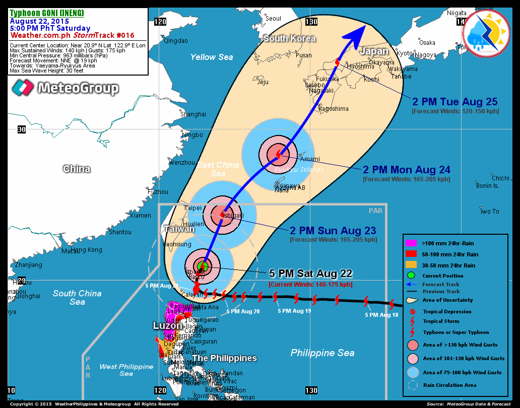
RECENT T2K TRACKING CHART:


_______________________________________________________________________________________

 
RECENT MTSAT-1R SATELLITE IMAGE:


> Image source:  NOAA Satellite Service (http://www.noaa.gov/)

_______________________________________________________________________________________
 
RECENT WUNDERGROUND SATELLITE ANIMATION:


> Image source:  Wunderground.com (http://www.wunderground.com/)
__________________________________________________________________________________________

NOTES:
 
  ^ - JTWC commentary remarks (for Meteorologists) from their 
      latest warning.
 
  * - Based on PAGASA's Philippine Storm Warning Signals, 
      # 4 being the highest. For more explanations on these 
      signals, visit:
http://www.typhoon2000.ph/signals.htm

 ** - Based on the Tropical Cyclone's Wave Height near 
      its center.

__________________________________________________________________________________________

>>
To know the meteorological terminologies and acronyms 
   used on this update visit the ff:

    http://typhoon2000.ph/tcterm.htm  
    http://www.nhc.noaa.gov/aboutgloss.shtml
    http://www.srh.noaa.gov/oun/severewx/glossary.php
    http://www.srh.weather.gov/fwd/glossarynation.html
    http://www.nhc.noaa.gov/acronyms.shtml
__________________________________________________________________________________________

:: Typhoon2000.com (T2K) Mobile >> Powered by: Synermaxx
Receive the latest 6-hrly storm updates directly to your mobile phones! To get:
Send T2K TYPHOON to: 2800
(GLOBE & TM) | 216 (SMART & TNT) | 2288 (SUN) 
Note: Globe & Smart charges P2.50 per message, while Sun at P2.00.
__________________________________________________________________________________________

For the complete details on TS DOLPHIN (PRE-ULYSSES/27W)...go visit
our website @:

>
http://www.typhoon2000.com
> http://www.maybagyo.com

:: Kindly view our site's disclaimer at: 
   
http://www.typhoon2000.ph/disclaimer.htm


Copyright © 2008 Typhoon2000.com All Rights Reserved

__._,_.___
Recent Activity
Visit Your Group
Dog Groups

on Yahoo! Groups

discuss everything

related to dogs.

John McEnroe

on Yahoo! Groups

Join him for the

10 Day Challenge.

Get in Shape

on Yahoo! Groups

Find a buddy

and lose weight.

.

__,_._,___

27W now a Tropical Storm (TS)... [Update #003]


Typhoon2000 STORM UPDATE #003
Name: TROPICAL STORM 27W [UNNAMED] 
Issued: 1:00 PM MANILA TIME (05:00 GMT) FRI 12 DECEMBER 2008
Source: US JTWC WARNING #007 / GUAM DOPPLER RADAR / T2K XTRAPLOT
Note: Kindly refer to your country's official warnings or bulletins. This update is for additional information purposes only.
_____________________________________________________________________________
 
 
27W (UNNAMED) NOW A TROPICAL STORM...HEADING TOWARDS THE PHILIPPINES.

*Residents and visitors along Eastern Philippines  from Aurora, Quezon, Bicol down to Northern
Mindanao should 
closely monitor the progress of 27W.

**This email update now includes a brand new SATELLITE ANIMATION from Wunderground.com. 
Kindly browse below.


+ FORECAST OUTLOOK: The latest forecast package now shows 27W intensi-
fying to near-typhoon strength after entering the Philippine Area of
Responsibility (PAR) tomorrow afternoon, reaching 1-min sustained winds
of 100 kph. The 3 to 5-day long-range forecast shows 27W turning WNW-
ward on Monday morning Dec 15 and weakening down to 75 or 65 kph. Its
center shall pass more or less 100 km to the NE of Catanduanes-Camarines
Provinces area on Tuesday evening Dec 16 til Wednesday morning Dec 17.
*Alternate Forecast Scenario: There's a possibilty that 27W may track
WSW & make landfall over Samar Island as a weakened Tropical Depression
on Tuesday Dec 16. This scenario is likely possible if the strong stee-
ring high pressure ridge over SE China strengthens. 

+ EFFECTS: 27W's circulation is no longer affecting The Marianas as it
continued on its westerly track but has began to expand with the deve-
lopment of spiral bands especially along the SE and NE quadrant of the
storm. 1-day rainfall accumulations of 75 up to 100 mm is possible
along its rain bands...with isolated accumulations of up to 200 mm
near the center of 27W.
 
Important Note: Please keep in mind that the above forecast outlook,
effects & current monsoon intensity, and tropical cyclone watch changes 
every 06 to 12 hours!

_____________________________________________________________________________

TIME/DATE: 12:00 PM MANILA TIME (04:00 GMT) FRI 12 DEC 2008 
LOCATION OF CENTER: LATITUDE 13.6º N...LONGITUDE 140.5º E 
DISTANCE 1: 465 KM (250
NM) WEST OF HAGATNA, GUAM, CNMI 
DISTANCE 2: 590 KM (318 NM) WSW OF SAIPAN, CNMI
DISTANCE 3: 525 KM (285 NM) NNE OF COLONIA, YAP, FSM
DISTANCE 4: 595 KM (322 NM) EAST OF P.A.R. 
DISTANCE 5: 1,750 KM (945 NM) EAST OF BICOL REGION, PH 
MAX WINDS [1-MIN AVG]: 65 KM/HR (35 KTS) NEAR THE CENTER
PEAK WIND GUSTS: 85 KM/HR (45 KTS)
SAFFIR-SIMPSON SCALE: 
TROPICAL STORM 
COASTAL STORM SURGE HEIGHT: 0-3 FEET (0-0.9 METER)
MINIMUM CENTRAL PRESSURE (est.): 996 MILLIBARS (hPa)
RECENT MOVEMENT: WNW @ 19 KM/HR (10 KTS)
GENERAL DIRECTION: PHILIPPINE SEA
STORM'S SIZE (IN DIAMETER): 350 KM (188 NM)/
AVERAGE
MAX WAVE HEIGHT**: 16 FEET (4.8 METERS)
VIEW T2K TRACKING MAP: 
12 PM MANILA TIME FRI DEC 12
TSR WIND PROBABILITIES: CURRENT TO 120 HRS LEAD  
PHILIPPINE STORM SIGNALS*: NONE

12, 24, 48 & 72 HR. FORECAST:
8 PM (12 GMT) 12 DECEMBER: 13.4N 138.9E / 75-95 KPH / W @ 20 KPH
8 AM (00 GMT) 13 DECEMBER: 13.4N 136.7E / 85-100 KPH / W @ 20 KPH
8 AM (00 GMT) 14 DECEMBER: 13.2N 132.3E / 100-130 KPH / W @ 17 KPH
8 AM (00 GMT) 15 DECEMBER: 13.0N 128.6E / 85-100 KPH / WNW @ 13 KPH

REMARKS: 8 AM (00 GMT) 12 DECEMBER POSITION: 13.2N 140.9E.
^OVER THE PAST 12 HOURS, THE SYSTEM HAS QUICKLY CONSOLIDATED
INTO A TROPICAL STORM (TS) AND SLOWED TO APPROXIMATELY 10 KNOTS SOA.
ANIMATED MULTISPECTRAL IMAGERY DEPICTS A LARGE CDO FEATURE WITH THE
LOW-LEVEL CIRCULATION CENTER POSITIONED UNDER THE NORTHWESTERN EDGE
OF THE CDO. IMAGERY ALSO SHOWS IMPROVED INFLOW ALONG THE SOUTHERN
FLANK. ANIMATED WATER IMAGERY SHOWS FAIR BUT IMPROVED OUTFLOW WITH
A WEAK POLEWARD CHANNEL DEVELOPING AND IMPROVED EQUATORWARD OUT-
FLOW. AN 112352Z AMSU IMAGE SHOWED INTENSE DEEP CONVECTION PRIMARILY
OVER THE EASTERN SEMI-CIRCLE. AN 112033Z QUIKSCAT IMAGE AND THE
GUAM VAD WIND PROFILE DATA SHOW THAT THE SYSTEM HAS MODIFIED THE
SURROUNDING WINDFLOW, WHICH IS NOW FEEDING INTO THE STORM RATHER
THAN HINDERING DEVELOPMENT
...
(more)

_____________________________________________________________________________
_____________________________________________________________________________

RECENT T2K TRACKING CHART:


_______________________________________________________________________________________

 
RECENT MTSAT-1R SATELLITE IMAGE:


> Image source:  NOAA Satellite Service (http://www.noaa.gov/)

_______________________________________________________________________________________
 
RECENT WUNDERGROUND SATELLITE ANIMATION:


> Image source:  Wunderground.com (http://www.wunderground.com/)
__________________________________________________________________________________________

NOTES:
 
  ^ - JTWC commentary remarks (for Meteorologists) from their 
      latest warning.
 
  * - Based on PAGASA's Philippine Storm Warning Signals, 
      # 4 being the highest. For more explanations on these 
      signals, visit:
http://www.typhoon2000.ph/signals.htm

 ** - Based on the Tropical Cyclone's Wave Height near 
      its center.

__________________________________________________________________________________________

>>
To know the meteorological terminologies and acronyms 
   used on this update visit the ff:

    http://typhoon2000.ph/tcterm.htm  
    http://www.nhc.noaa.gov/aboutgloss.shtml
    http://www.srh.noaa.gov/oun/severewx/glossary.php
    http://www.srh.weather.gov/fwd/glossarynation.html
    http://www.nhc.noaa.gov/acronyms.shtml
__________________________________________________________________________________________

:: Typhoon2000.com (T2K) Mobile >> Powered by: Synermaxx
Receive the latest 6-hrly storm updates directly to your mobile phones! To get:
Send T2K TYPHOON to: 2800
(GLOBE & TM) | 216 (SMART & TNT) | 2288 (SUN) 
Note: Globe & Smart charges P2.50 per message, while Sun at P2.00.
__________________________________________________________________________________________

For the complete details on TS 27W (UNNAMED)...go visit
our website @:

>
http://www.typhoon2000.com
> http://www.maybagyo.com

:: Kindly view our site's disclaimer at: 
   
http://www.typhoon2000.ph/disclaimer.htm


Copyright © 2008 Typhoon2000.com All Rights Reserved

__._,_.___
Recent Activity
Visit Your Group
Group Charity

Give a laptop

Get a laptop: One

laptop per child

Yahoo! Groups

Everyday Wellness Zone

Check out featured

healthy living groups.

Yahoo! Groups

w/ John McEnroe

Join the All-Bran

Day 10 Club.

.

__,_._,___

TD 27W (UNNAMED) - Update #002


Typhoon2000 STORM UPDATE #002
Name: TROPICAL DEPRESSION 27W [UNNAMED] 
Issued: 1:00 AM MANILA TIME (17:00 GMT) FRI 12 DECEMBER 2008
Source: US JTWC WARNING #005 / GUAM DOPPLER RADAR / T2K XTRAPLOT
Note: Kindly refer to your country's official warnings or bulletins. This update is for additional information purposes only.
_____________________________________________________________________________
 
 
TROPICAL DEPRESSION 27W (UNNAMED) JUST PASSED CLOSE TO THE SOUTH OF
GUAM YESTERDAY AFTERNOON AND CONTINUES TO RACE FARTHER AWAY FROM
THE ISLAND.

*Residents and visitors along Eastern Philippines from Bicol Region down to Northern Mindanao should
closely monitor the progress of 27W.

+ FORECAST OUTLOOK: 27W is expected to continue on its fast WNW to west-
ward track for the next 3 to 5 days...becoming a minimal Tropical Storm
(65-kph) later today. It shall enter the Philippine Area of Responsibility
(PAR) on Saturday morning Dec 13. The 4 to 5-day long-range forecast shows
27W weakening into a Tropical Depression (TD) as it approaches the Eastern
Coast of the Bicol Region and Northern Samar on Tuesday morning Dec 16...
dissipating into a Tropical Disturbance (LPA) off Albay Tuesday evening as
cool, dry NE winds enters 27W's circulation. Watch for more forecast out-
look on this depression soon.

+ EFFECTS: 27W's circulation has become more elliptical and compact as its
rainbands starting to leave the Mariana Island Chain. These bands is expec-
ted to bring light to moderate to some isolated heavy rains with passing
strong squalls...wind gusts not in excess of 65 kph is possible across the
island chain today. 1-day rainfall accumulations of 25 up to 50 mm is
possible along its rain bands...with isolated accumulations of up to
75 mm near the center of 27W.
 
Important Note: Please keep in mind that the above forecast outlook,
effects & current monsoon intensity, and tropical cyclone watch changes 
every 06 to 12 hours!

_____________________________________________________________________________

TIME/DATE: 12:00 AM MANILA TIME (16:00 GMT) FRI 12 DEC 2008 
LOCATION OF CENTER: LATITUDE 13.0º N...LONGITUDE 142.5º E 
DISTANCE 1: 255 KM (138
NM) WEST OF HAGATNA, GUAM, CNMI 
DISTANCE 2: 415 KM (225 NM) WSW OF SAIPAN, CNMI
DISTANCE 3: 620 KM (335 NM) NE OF COLONIA, YAP, FSM
DISTANCE 4: 810 KM (438 NM) EAST OF P.A.R. 
DISTANCE 5: 1,970 KM (1,065 NM) EAST OF BICOL REGION, PH 
MAX WINDS [1-MIN AVG]: 55 KM/HR (30 KTS) NEAR THE CENTER
PEAK WIND GUSTS: 75 KM/HR (40 KTS)
SAFFIR-SIMPSON SCALE: 
TROPICAL DEPRESSION 
COASTAL STORM SURGE HEIGHT: 0 FEET (0 METER)
MINIMUM CENTRAL PRESSURE (est.): 1000 MILLIBARS (hPa)
RECENT MOVEMENT: WEST @ 31 KM/HR (17 KTS)
GENERAL DIRECTION: PHILIPPINE SEA
STORM'S SIZE (IN DIAMETER): 300 KM (160 NM)/
SMALL
MAX WAVE HEIGHT**: 16 FEET (4.8 METERS)
VIEW TRACKING MAP: 
8 PM MANILA TIME FRI DEC 12
TSR WIND PROBABILITIES: CURRENT TO 120 HRS LEAD  
PHILIPPINE STORM SIGNALS*: NONE

12, 24, 48 & 72 HR. FORECAST:
8 AM (00 GMT) 12 DECEMBER: 13.7N 140.3E / 65-85 KPH / W @ 24 KPH
8 PM (12 GMT) 12 DECEMBER: 14.1N 137.7E / 65-85 KPH / W @ 20 KPH
8 PM (12 GMT) 13 DECEMBER: 14.0N 133.4E / 45-65 KPH / W @ 17 KPH
8 PM (12 GMT) 14 DECEMBER: 13.7N 129.7E / 45-65 KPH / W @ 15 KPH

REMARKS: 8 PM (12 GMT) 11 DECEMBER POSITION: 12.9N 143.2E.
^TROPICAL DEPRESSION (TD) 27W HAS MAINTAINED INTENSITY WHILE
TRACKING RAPIDLY WESTWARD OVER THE PAST 12 HOURS. RECENT ANIMATED
METSAT IMAGERY DEPICTS A WEAK SYSTEM WITH A WELL DEFINED LOW-LEVEL
 CIRCULATION CENTER (LLCC) AND LIMITED DEEP CONVECTION. A 110828Z
37V SSMI MICROWAVE IMAGE INDICATES THAT THE SYSTEM HAS CONSOLIDATED
SLIGHTLY, AND NOW SHOWS EVIDENCE OF CONVECTIVE BANDING BEGINNING TO
ORGANIZE TO THE SOUTH AND WRAP INTO THE CENTER OF THE STORM. MODEL
GUIDANCE HAS REMAINED LIMITED OVER THE PAST 12 HOURS
...
(more)

_____________________________________________________________________________
_____________________________________________________________________________

RECENT WUNDERGROUND.COM TRACKING CHART:


_______________________________________________________________________________________

 
RECENT MTSAT-1R SATELLITE IMAGE:


> Image source:  NOAA Satellite Service (http://www.noaa.gov/)
__________________________________________________________________________________________

NOTES:
 
  ^ - JTWC commentary remarks (for Meteorologists) from their 
      latest warning.
 
  * - Based on PAGASA's Philippine Storm Warning Signals, 
      # 4 being the highest. For more explanations on these 
      signals, visit:
http://www.typhoon2000.ph/signals.htm

 ** - Based on the Tropical Cyclone's Wave Height near 
      its center.

__________________________________________________________________________________________

>>
To know the meteorological terminologies and acronyms 
   used on this update visit the ff:

    http://typhoon2000.ph/tcterm.htm  
    http://www.nhc.noaa.gov/aboutgloss.shtml
    http://www.srh.noaa.gov/oun/severewx/glossary.php
    http://www.srh.weather.gov/fwd/glossarynation.html
    http://www.nhc.noaa.gov/acronyms.shtml
__________________________________________________________________________________________

:: Typhoon2000.com (T2K) Mobile >> Powered by: Synermaxx
Receive the latest 6-hrly storm updates directly to your mobile phones! To get:
Send T2K TYPHOON to: 2800
(GLOBE & TM) | 216 (SMART & TNT) | 2288 (SUN) 
Note: Globe & Smart charges P2.50 per message, while Sun at P2.00.
__________________________________________________________________________________________

For the complete details on TD 27W (UNNAMED)...go visit
our website @:

>
http://www.typhoon2000.com
> http://www.maybagyo.com

:: Kindly view our site's disclaimer at: 
   
http://www.typhoon2000.ph/disclaimer.htm


Copyright © 2008 Typhoon2000.com All Rights Reserved

__._,_.___
Recent Activity
Visit Your Group
All-Bran

10 Day Challenge

Join the club and

feel the benefits.

Yahoo! Groups

Going Green Zone

Learn to go green.

Save energy. Save the planet.

Weight Loss Group

on Yahoo! Groups

Get support and

make friends online.

.

__,_._,___

Thursday, December 11, 2008

TD 27W (UNNAMED) - Update #001


Typhoon2000 STORM UPDATE #001
Name: TROPICAL DEPRESSION 27W [UNNAMED] 
Issued: 1:00 PM MANILA TIME (05:00 GMT) THU 11 DECEMBER 2008
Source: US JTWC WARNING #003 / GUAM DOPPLER RADAR / T2K XTRAPLOT
Note: Kindly refer to your country's official warnings or bulletins. This update is for additional information purposes only.
_____________________________________________________________________________
 
 
TROPICAL DEPRESSION 27W (UNNAMED) NEWLY-FORMED OFF THE SOUTHEASTERN
MARIANA ISLANDS...APPROACHING GUAM...MAY PASS CLOSE TO THE SOUTH OF
THE ISLAND LATER THIS AFTERNOON.

*Interests in Southern Marianas and Eastern Philippines should closely monitor the progress of 27W.

+ FORECAST OUTLOOK: 27W is expected to continue on its fast WNW to west-
ward track for the next 3 to 5 days...becoming a minimal Tropical Storm
(65-kph) tomorrow. It shall enter the Philippine Area of Responsibility
(PAR) on Saturday evening Dec 13. The 4 to 5-day long-range forecast
shows 27W weakening into a Tropical Depression (TD) as it approaches
the Eastern Coast of the Bicol Region and Samar Tuesday morning Dec 16.
Watch for more forecast outlook on this depression soon.

+ EFFECTS: 27W's developing rain bands spreading across the Mariana
Island Chain. These bands is expected to bring light to moderate to
some isolated heavy rains with passing strong squalls...wind gusts
not in excess of 75 kph is possible across the island chain today.
1-day rainfall accumulations of 25 up to 50 mm is possible along its
rain bands...with isolated accumulations of up to 75 mm near the
center of 27W.
 
Important Note: Please keep in mind that the above forecast outlook,
effects & current monsoon intensity, and tropical cyclone watch changes 
every 06 to 12 hours!

_____________________________________________________________________________

TIME/DATE: 12:00 PM MANILA TIME (04:00 GMT) THU 11 DEC 2008 
LOCATION OF CENTER: LATITUDE 12.8º N...LONGITUDE 145.3º E 
DISTANCE 1: 85 KM (45
NM) SE OF HAGATNA, GUAM, CNMI 
DISTANCE 2: 270 KM (146 NM) SSE OF SAIPAN, CNMI
DISTANCE 3: 865 KM (467 NM) NE OF COLONIA, YAP, FSM
DISTANCE 4: 1,115 KM (602 NM) EAST OF P.A.R. 
DISTANCE 5: 2,275 KM (1,228 NM) EAST OF BICOL REGION, PH 
MAX WINDS [1-MIN AVG]: 55 KM/HR (30 KTS) NEAR THE CENTER
PEAK WIND GUSTS: 75 KM/HR (40 KTS)
SAFFIR-SIMPSON SCALE: 
TROPICAL DEPRESSION 
COASTAL STORM SURGE HEIGHT: 0 FEET (0 METER)
MINIMUM CENTRAL PRESSURE (est.): 1000 MILLIBARS (hPa)
RECENT MOVEMENT: WNW @ 40 KM/HR (22 KTS)
GENERAL DIRECTION: GUAM-SOUTHERN MARIANA ISLANDS
STORM'S SIZE (IN DIAMETER): 350 KM (190 NM)/
AVERAGE
MAX WAVE HEIGHT**: 16 FEET (4.8 METERS)
VIEW TRACKING MAP: 
8 AM MANILA TIME THU DEC 11
TSR WIND PROBABILITIES: CURRENT TO 120 HRS LEAD  
PHILIPPINE STORM SIGNALS*: NONE

12, 24, 48 & 72 HR. FORECAST:
8 PM (12 GMT) 11 DECEMBER: 12.8N 144.5E / 55-65 KPH / W @ 28 KPH
8 AM (00 GMT) 12 DECEMBER: 13.3N 141.4E / 65-85 KPH / W @ 22 KPH
8 AM (00 GMT) 13 DECEMBER: 13.9N 136.5E / 65-85 KPH / W @ 17 KPH
8 AM (00 GMT) 14 DECEMBER: 13.7N 132.7E / 55-75 KPH / W @ 15 KPH

REMARKS: 8 AM (00 GMT) 11 DECEMBER POSITION: 12.5N 147.3E.
^TROPICAL DEPRESSION (TD) 27W HAS MAINTAINED INTENSITY OVER
THE PAST 12 HOURS. RECENT ANIMATED INFRARED IMAGERY INDICATED A
WEAK SYSTEM WITH LIMITED DEEP CONVECTION, WEAK BANDING AND A DEFINED
LOW-LEVEL CIRCULATION CENTER (LLCC). THE LATEST MULTISPECTRAL IMAGERY
SHOWS THAT THE LLCC MAY HAVE OPENED BACK UP INTO A MORE WAVE-LIKE
FEATURE AND SHOWED NO EVIDENCE OF A CLOSED CIRCULATION OVER THE
SOUTHERN QUADRANT E.G., NO WESTERLY LOW-LEVEL CLOUD LINES WRAPPING
INTO THE CENTER. INSTEAD DEEP CONVECTION IS FLARING IN A LINEAR
FASHION NORTHEAST TO SOUTHWEST. THE SYSTEM IS TRACKING RAPIDLY
WESTWARD AT 15-17 KNOTS. MODEL GUIDANCE HAS REMAINED LIMITED
AND MORE CONSISTENT OVER THE PAST 12 HOURS
...
(more)

_____________________________________________________________________________
_____________________________________________________________________________

RECENT WUNDERGROUND.COM TRACKING CHART:


_______________________________________________________________________________________

 
RECENT MTSAT-1R SATELLITE IMAGE:


> Image source:  NOAA Satellite Service (http://www.noaa.gov/)
__________________________________________________________________________________________

NOTES:
 
  ^ - JTWC commentary remarks (for Meteorologists) from their 
      latest warning.
 
  * - Based on PAGASA's Philippine Storm Warning Signals, 
      # 4 being the highest. For more explanations on these 
      signals, visit:
http://www.typhoon2000.ph/signals.htm

 ** - Based on the Tropical Cyclone's Wave Height near 
      its center.

__________________________________________________________________________________________

>>
To know the meteorological terminologies and acronyms 
   used on this update visit the ff:

    http://typhoon2000.ph/tcterm.htm  
    http://www.nhc.noaa.gov/aboutgloss.shtml
    http://www.srh.noaa.gov/oun/severewx/glossary.php
    http://www.srh.weather.gov/fwd/glossarynation.html
    http://www.nhc.noaa.gov/acronyms.shtml
__________________________________________________________________________________________

:: Typhoon2000.com (T2K) Mobile >> Powered by: Synermaxx
Receive the latest 6-hrly storm updates directly to your mobile phones! To get:
Send T2K TYPHOON to: 2800
(GLOBE & TM) | 216 (SMART & TNT) | 2288 (SUN) 
Note: Globe & Smart charges P2.50 per message, while Sun at P2.00.
__________________________________________________________________________________________

For the complete details on TD 27W (UNNAMED)...go visit
our website @:

>
http://www.typhoon2000.com
> http://www.maybagyo.com

:: Kindly view our site's disclaimer at: 
   
http://www.typhoon2000.ph/disclaimer.htm


Copyright © 2008 Typhoon2000.com All Rights Reserved

__._,_.___
Recent Activity
Visit Your Group
John McEnroe

on Yahoo! Groups

Join him for the

10 Day Challenge.

Yahoo! Groups

Going Green Zone

Resources for a greener planet.

Resources for a greener you.

Y! Groups blog

The place to go

to stay informed

on Groups news!

.

__,_._,___