Monday, November 26, 2007

Typhoon MITAG (MINA) weakens...[Update #010]


Typhoon2000 STORM UPDATE #010
Name: TYPHOON MITAG [MINA/24W/0723] 
Issued: 9:00 PM MANILA TIME (21:00 GMT) MON 26 NOVEMBER 2007
Source: JTWC TROPICAL CYCLONE WARNING NUMBER 025
Note: Kindly refer to your country's official warnings or bulletins. This update is for additional information purposes only.
_____________________________________________________________________________
 
 
TYPHOON MITAG {pronounced as: me~tok} (MINA) WILL BE DOWNGRADED INTO
A TROPICAL STORM SOON AS LAND INTERACTION AND INCREASING WIND SHEAR
PREVAILS...SHALL BECOME EXTRATROPICAL IN 36 TO 48 HOURS.

+ FORECAST OUTLOOK: MITAG (MINA) is expected to start recurving over the
Bashi Channel early tomorrow morning and shall start accelerating towards
the ENE in the direction of the NW Pacific Ocean. MITAG shall be downgra-
ded into a tropical storm, becoming an Extratropical Cyclone earlier than
expected (2 AM Wednesday, Nov 28th).

+ EFFECTS: MITAG's Eyewall rapidly dissipating...Its inner rainbands on
the other hand, continues to spread across the northern portions of Ex-
treme Northern Luzon, bringing strong winds not in excess of 100 kph
along w/ moderate to heavy rains today. Meanwhile, the outer rainbands
continues to spread across the southern portions of Northern Luzon.
Cloudy Skies with passing rainshowers and winds not exceeding 60 km/hr
can be expected along the typhoon's outer bands. Coastal Storm Surge
flooding of 4 to 5 feet above normal tide levels...along with large
and dangerous battering waves can be expected near and to the north of
MITAG's projected path particularly over Northwestern Luzon. Minimal
damage is possible on this type of storm surge. Far-fetched Storm Surge
is also possible along coastal areas of Taiwan.

+ CURRENT MONSOON INTENSITY: Strong Northeast (NE) Monsoon enhanced by
Typhoon MITAG (MINA) will continue to bring
cloudy skies with inter-
mittent rainshowers & strong NE'ly winds of 30 km/hr or higher across
Taiwan and SE China
. Landslides, mudflows (lahars) and flooding is
likely to
occur along steep mountain/volcano slopes, river banks,
low-lying &
flood-prone areas of the affected areas, while big sea
waves or
surges generated by this monsoon can affect the coastal and
beach-
front areas of Taiwan and SE China.
 
Important Note: Please keep in mind that the above forecast outlook,
effects & current monsoon intensity, and tropical cyclone watch changes 
every 06 to 12 hours!

_____________________________________________________________________________

TIME/DATE: 5:00 PM MANILA TIME (09:00 GMT) 26 NOVEMBER
LOCATION OF EYE: LATITUDE 19.7º N...LONGITUDE 120.5º E
DISTANCE 1: 115 KM (62
NM) WNW OF CALAYAN ISLAND, PH
DISTANCE 2: 165 KM (90 NM) NORTH OF LAOAG CITY, PH
DISTANCE 3: 180 KM (97 NM) WSW OF BASCO, BATANES, PH
DISTANCE 4: 325 KM (175 NM) SOUTH OF KAOHSIUNG, TAIWAN 
MAX WINDS [1-MIN AVG]: 120 KM/HR (65 KTS) NEAR THE EYE
PEAK WIND GUSTS: 150 KM/HR (80 KTS)
SAFFIR-SIMPSON SCALE: CATEGORY ONE (1) 
MINIMUM CENTRAL PRESSURE (est.): 974 MILLIBARS (hPa)
RECENT MOVEMENT: NW @ 15 KM/HR (08 KTS)
GENERAL DIRECTION: BABUYAN ISLANDS
STORM'S SIZE (IN DIAMETER): 650 KM (350 NM)/AVERAGE
MAX WAVE HEIGHT**: 36 FEET (10.9 METERS)
VIEW T2K TRACKING MAP: 5 PM MANILA TIME MON NOVEMBER 26
TSR WIND PROBABILITIES: CURRENT TO 120 HRS LEAD  

PHILIPPINE STORM SIGNALS*:

#03 - ISABELA, CAGAYAN, MT. PROVINCE, KALINGA, ABRA, ILOCOS NORTE, 
      APAYAO, BABUYAN & BATANES GROUP OF ISLANDS
.
#02 - NORTHERN AURORA, QUIRINO, NUEVA VIZCAYA, BENGUET, IFUGAO, 
      LA UNION & ILOCOS SUR
.
#01 -
REST OF AURORA, NUEVA ECIJA, TARLAC & PANGASINAN.

12, 24 & 48 HR. FORECAST:
2 AM (18 GMT) 27 NOVEMBER: 20.9N 120.5E / 100-130 KPH / NE @ 24 KPH
2 PM (06 GMT) 27 NOVEMBER: 22.1N 122.9E / 85-100 KPH / NE @ 19 KPH
2 PM (06 GMT) 28 NOVEMBER: 24.8N 133.5E / 120-150 KPH / ENE @ 22 KPH

REMARKS: 2 PM (06 GMT) 26 NOVEMBER POSITION: 19.3N 120.5E.
^TYPHOON (TY) 24W (MITAG) HAS TRACKED NORTHWESTWARD AND MAINTAINED
INTENSITY OVER THE PAST 12 HOURS. THE MID-LEVEL SUBTROPICAL RIDGE
NORTH AND EAST OF THE STORM HAS BEEN THE PRIMARY STEERING
INFLUENCE
.
..(more)
_____________________________________________________________________________

PAGASA CURRENT POSITION, MOVEMENT AND INTENSITY (10-min. ave.): 
> 4 PM (08 GMT) 26 NOVEMBER: 19.2N 120.6E / NNE @ 11 KPH / 110 kph

:: For the complete PAGASA bulletin, kindly visit their website at: 
   
http://www.pagasa.dost.gov.ph/wb/tcupdate_mina.shtml
_____________________________________________________________________________

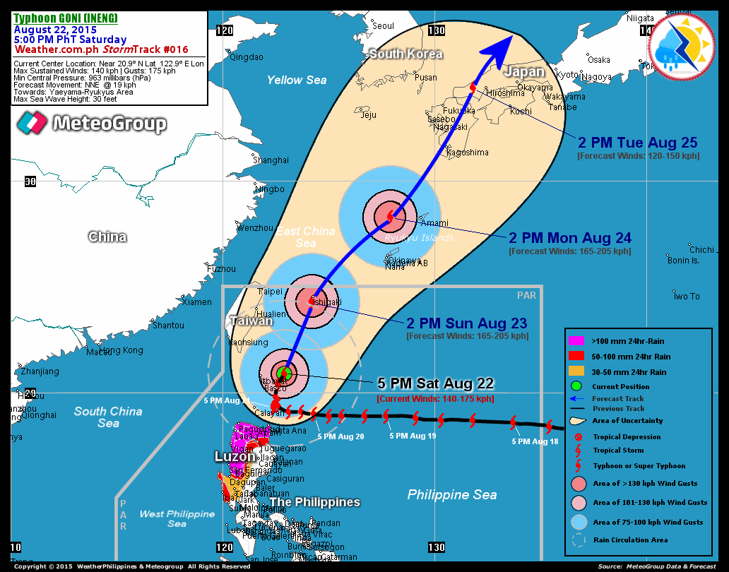
RECENT T2K TRACKING CHART:


_______________________________________________________________________________________

 
RECENT MTSAT-1R SATELLITE IMAGE:


> Image source:  NOAA Satellite Imagery, USA (http://www.ssd.noaa.gov/PS/TROP/mtsatfloat2.html)
_______________________________________________________________________________________
 
RECENT MTSAT-1R MICROWAVE IMAGE: new!
As of 5:08 AM Manila Time (21:08Z) 26 November 2007

> Image source:  NRL TC Page, USA (http://199.9.2.143/tc_pages/tc_home.html)
_______________________________________________________________________________________

NOTES:
 
  ^ - JTWC commentary remarks (for Meteorologists) from their 
      latest warning.
 
  * - Based on PAGASA's Philippine Storm Warning Signals, 
      # 4 being the highest. Red bold letters indicate new areas 
      being hoisted.
For more explanations on these signals, 
      visit:
http://www.typhoon2000.ph/signals.htm

 ** - Based on the Tropical Cyclone's Wave Height near 
      its center.

__________________________________________________________________________________________

>>
To know the meteorological terminologies and acronyms 
   used on this update visit the ff:

    http://typhoon2000.ph/tcterm.htm  
    http://www.nhc.noaa.gov/aboutgloss.shtml
    http://www.srh.noaa.gov/oun/severewx/glossary.php
    http://www.srh.weather.gov/fwd/glossarynation.html
    http://www.nhc.noaa.gov/acronyms.shtml
__________________________________________________________________________________________

:: Typhoon2000.com (T2K) Mobile >> Powered by: Synermaxx
Receive the latest storm updates directly to your mobile phones! To know more:
Send T2K HELP to: 2800
(GLOBE & TM) | 216 (SMART & TNT) | 2288 (SUN) 
Note: Globe & Smart charges P2.50 per message, while Sun at P2.00.
__________________________________________________________________________________________

For the complete details on TYPHOON MITAG (MINA)...go visit
our website @:

>
http://www.typhoon2000.com
> http://www.maybagyo.com

:: Kindly view our site's disclaimer at: 
   
http://www.typhoon2000.ph/disclaimer.htm


__._,_.___
Recent Activity
Visit Your Group
Real Food Group

Share recipes

and favorite meals

w/ Real Food lovers.

Yahoo! Groups

Endurance Zone

b/c every athlete

needs an edge.

Popular Y! Groups

Is your group one?

Check it out and

see.

.

__,_._,___

Typhoon MITAG (MINA) hits Northern Cagayan...[Update #009]


Typhoon2000 STORM UPDATE #009
Name: TYPHOON MITAG [MINA/24W/0723] 
Issued: 9:00 AM MANILA TIME (21:00 GMT) MON 26 NOVEMBER 2007
Source: JTWC TROPICAL CYCLONE WARNING NUMBER 023
Note: Kindly refer to your country's official warnings or bulletins. This update is for additional information purposes only.
_____________________________________________________________________________
 
 
TYPHOON MITAG {pronounced as: me~tok} (MINA) HAS MADE LANDFALL OVER
NORTHERN CAGAYAN, A COUPLE OF HOURS AGO AND IS NOW VERY NEAR THE TOWN
OF APARRI. ITS EYEWALL NOW BRINGING STRONG WINDS AND HEAVY RAINS LASHING
CAGAYAN, ISABELA, ILOCOS NORTE AND APAYAO.

+ FORECAST OUTLOOK: MITAG (MINA) is expected to move back to sea or
over the Balintang Channel and graze the Islands of the Babuyan this
afternoon. This typhoon shall slow down abruptly as it begins recurva-
ture towards Southern Japan as its Northern bands affects Southern
Taiwan and the Batanes Group of Islands. The 2 to 5-day forecast shows
MITAG accelerating towards the northeast and weakening further into a
Tropical Storm due to increasing wind shear (upper level winds) and
lower sea surface temperatures over the area. This system is likely
to become Extratropical on Friday, Nov 30th.

+ EFFECTS: MITAG's Eyewall continues to blast the provinces of Isabela
& Cagayan with winds of 100 to 140 kph accompanied with very heavy
rains. Its inner rainbands on the other hand, continues to spread
across the northern portions of Northern Luzon, bringing strong winds
not in excess of 100 kph along w/ moderate to heavy rains today. Mean-
while, the outer rainbands continues to spread across the southern
portions of Northern & the rest of Central Luzon including Metro
Manila. Cloudy Skies with passing rainshowers and winds not exceeding
60 km/hr can be expected along the typhoon's outer bands. Coastal
Storm Surge flooding of 4 to 5 feet above normal tide levels...along
with large and dangerous battering waves can be expected near and to
the north of MITAG's projected path particularly over Northern &
Western Luzon and, on where the center makes landfall in Cagayan area.
Minimal damage is possible on this type of storm surge. Far-fetched
Storm Surge is also possible along coastal areas of Taiwan.

+ CURRENT MONSOON INTENSITY: Strong Northeast (NE) Monsoon enhanced by
Typhoon MITAG (MINA) will continue to bring
cloudy skies with inter-
mittent rainshowers & strong NE'ly winds of 30 km/hr or higher across
Taiwan and SE China
. Landslides, mudflows (lahars) and flooding is
likely to
occur along steep mountain/volcano slopes, river banks,
low-lying &
flood-prone areas of the affected areas, while big sea
waves or
surges generated by this monsoon can affect the coastal and
beach-
front areas of Taiwan and SE China.

+ TROPICAL CYCLONE WATCH: Tropical Storm HAGIBIS (LANDO) may re-enter
the Philippine Area of Responsibility (PAR) after stalling for 3-days
near the coast of Southeastern Vietnam. A separate update will be issued
later today.
 
Important Note: Please keep in mind that the above forecast outlook,
effects & current monsoon intensity, and tropical cyclone watch changes 
every 06 to 12 hours!

_____________________________________________________________________________

TIME/DATE: 5:00 AM MANILA TIME (21:00 GMT) 26 NOVEMBER
LOCATION OF EYE: LATITUDE 18.2º N...LONGITUDE 121.8º E
DISTANCE 1: 30 KM (16
NM) SE OF APARRI, CAGAYAN, PH
DISTANCE 2: 70 KM (37 NM) NORTH OF TUGUEGARAO CITY, PH
DISTANCE 3: 125 KM (67 NM) ENE OF LAOAG CITY, PH
DISTANCE 4: 255 KM (138 NM) SOUTH OF BASCO, BATANES, PH 
MAX WINDS [1-MIN AVG]: 140 KM/HR (75 KTS) NEAR THE EYE
PEAK WIND GUSTS: 165 KM/HR (90 KTS)
SAFFIR-SIMPSON SCALE: CATEGORY ONE (1) 
MINIMUM CENTRAL PRESSURE (est.): 967 MILLIBARS (hPa)
RECENT MOVEMENT: NW @ 26 KM/HR (14 KTS)
GENERAL DIRECTION: BABUYAN ISLANDS
STORM'S SIZE (IN DIAMETER): 555 KM (300 NM)/AVERAGE
MAX WAVE HEIGHT**: 36 FEET (10.9 METERS)
VIEW T2K TRACKING MAP: 5 AM MANILA TIME MON NOVEMBER 26
TSR WIND PROBABILITIES: CURRENT TO 120 HRS LEAD  

PHILIPPINE STORM SIGNALS*:

#03 - ISABELA, CAGAYAN, MT. PROVINCE, KALINGA, ABRA, ILOCOS NORTE, 
      APAYAO, BABUYAN & BATANES GROUP OF ISLANDS
.
#02 - NORTHERN AURORA, QUIRINO, NUEVA VIZCAYA, BENGUET, IFUGAO, 
      LA UNION & ILOCOS SUR
.
#01 -
REST OF AURORA, NUEVA ECIJA, TARLAC & PANGASINAN.

12, 24 & 48 HR. FORECAST:
2 PM (06 GMT) 26 NOVEMBER: 19.2N 121.0E / 140-165 KPH / N @ 11 KPH
2 AM (18 GMT) 27 NOVEMBER: 20.4N 121.1E / 140-165 KPH / NE @ 19 KPH
2 AM (18 GMT) 28 NOVEMBER: 23.2N 124.5E / 120-150 KPH / NE @ 24 KPH

REMARKS: 2 AM (18 GMT) 26 NOVEMBER POSITION: 17.9N 122.1E.
^TYPHOON (TY) 24W (MITAG) HAS TRACKED NORTHWESTWARD AND MAINTAINED
INTENSITY OVER THE PAST 12 HOURS. THE MID-LEVEL SUBTROPICAL RIDGE
NORTH AND EAST OF THE STORM HAS BEEN THE PRIMARY STEERING
INFLUENCE
.
..(more)
_____________________________________________________________________________

PAGASA CURRENT POSITION, MOVEMENT AND INTENSITY (10-min. ave.): 
> 4 AM (20 GMT) 26 NOVEMBER: 17.9N 121.4E / NNW @ 11 KPH / 140 kph

:: For the complete PAGASA bulletin, kindly visit their website at: 
   
http://www.pagasa.dost.gov.ph/wb/tcupdate_mina.shtml
_____________________________________________________________________________

RECENT T2K TRACKING CHART:


_______________________________________________________________________________________

 
RECENT MTSAT-1R SATELLITE IMAGE:


> Image source:  NOAA Satellite Imagery, USA (http://www.ssd.noaa.gov/PS/TROP/mtsatfloat2.html)
_______________________________________________________________________________________
 
RECENT MTSAT-1R MICROWAVE IMAGE: new!
As of 5:08 AM Manila Time (21:08Z) 26 November 2007

> Image source:  NRL TC Page, USA (http://199.9.2.143/tc_pages/tc_home.html)
_______________________________________________________________________________________

NOTES:
 
  ^ - JTWC commentary remarks (for Meteorologists) from their 
      latest warning.
 
  * - Based on PAGASA's Philippine Storm Warning Signals, 
      # 4 being the highest. Red bold letters indicate new areas 
      being hoisted.
For more explanations on these signals, 
      visit:
http://www.typhoon2000.ph/signals.htm

 ** - Based on the Tropical Cyclone's Wave Height near 
      its center.

__________________________________________________________________________________________

>>
To know the meteorological terminologies and acronyms 
   used on this update visit the ff:

    http://typhoon2000.ph/tcterm.htm  
    http://www.nhc.noaa.gov/aboutgloss.shtml
    http://www.srh.noaa.gov/oun/severewx/glossary.php
    http://www.srh.weather.gov/fwd/glossarynation.html
    http://www.nhc.noaa.gov/acronyms.shtml
__________________________________________________________________________________________

:: Typhoon2000.com (T2K) Mobile >> Powered by: Synermaxx
Receive the latest storm updates directly to your mobile phones! To know more:
Send T2K HELP to: 2800
(GLOBE & TM) | 216 (SMART & TNT) | 2288 (SUN) 
Note: Globe & Smart charges P2.50 per message, while Sun at P2.00.
__________________________________________________________________________________________

For the complete details on TYPHOON MITAG (MINA)...go visit
our website @:

>
http://www.typhoon2000.com
> http://www.maybagyo.com

:: Kindly view our site's disclaimer at: 
   
http://www.typhoon2000.ph/disclaimer.htm


__._,_.___
Recent Activity
Visit Your Group
Popular Y! Groups

Is your group one?

Check it out and

see.

Free airline tickets

Win a free trip

home for the

holidays from Yahoo!

Fitness Zone

on Yahoo! Groups

Find Groups all

about healthy living.

.

__,_._,___

Sunday, November 25, 2007

Typhoon MITAG (MINA) may miss Luzon...[Update #008]


Typhoon2000 STORM UPDATE #008
Name: TYPHOON MITAG [MINA/24W/0723] 
Issued: 6:00 PM MANILA TIME (10:00 GMT) SUN 25 NOVEMBER 2007
Source: JTWC TROPICAL CYCLONE WARNING NUMBER 021
Note: Kindly refer to your country's official warnings or bulletins. This update is for additional information purposes only.
_____________________________________________________________________________
 
 
TYPHOON MITAG {pronounced as: me~tok} (MINA) WEAKENS SLIGHTLY...MAY
BARELY MISS LUZON
AS ITS TRACK TURNED MORE NORTHWESTERLY...NOW EYEING
NORTHERN CAGAYAN
. EYEWALL EXPECTED TO MOVE ACROSS CAGAYAN OR ISABELA
EARLY TOMORROW (APPROX 2 TO 3 AM LOCAL TIME).

+ FORECAST OUTLOOK: MITAG (MINA) is expected to continue moving
more northwesterly, making landfall along the northern part of
Cagayan early tomorrow morning approx 2-3 AM local time. The 
typhoon shall start weakening upon returning back to sea and 
may stall anew along the Balintang Channel due to weak steering
flow. The 3 to 5-day forecast shows MITAG drifting towards the 
northeast and weakening further into a Tropical Storm then 
later into a Tropical Depression due to increasing wind shear
(upper
level winds) and lower sea surface over the area. This
system is likely to become Extratropical on the 6th day. Landfall
Impact Forecast
(LIF) of this system now shows MITAG barely
hitting Luzon and is now expected to come ashore across the Nor-
thern part of Cagayan in Northern Luzon, Philippines early tomo-
rrow morning. 

+ EFFECTS: MITAG's Inner rainbands now spreading across the eastern
provinces of Northern Luzon (Cagayan, Isabela & Aurora). Strong
winds not in excess of 100 kph w/ moderate to heavy rains can be
expected within these areas tonight & tomorrow. Meanwhile, the outer
rainbands continues to spread across the whole of Northern & Central
Luzon including Metro Manila and Bicol Provinces. Cloudy Skies with
passing rainshowers and winds not exceeding 60 km/hr can be expected
along the typhoon's outer bands
. Coastal Storm Surge flooding of 4 to 
5 feet above normal tide levels...along with large and dangerous ba-
ttering waves can be expected near and to the north of MITAG's pro-
jected path particularly over Northeastern Luzon and, on where the
center makes landfall in Cagayan area. Minimal damage is possible
on this type of storm surge. Far-fetched Storm Surge is also possible
along coastal areas of Bicol Region
.

+ CURRENT MONSOON INTENSITY: Strong Northeast (NE) Monsoon enhanced by
Typhoon MITAG (MINA) will continue to bring
cloudy skies with inter-
mittent rainshowers & strong NE'ly winds of 30 km/hr or higher across
Taiwan and SE China
. Landslides, mudflows (lahars) and flooding is
likely to
occur along steep mountain/volcano slopes, river banks,
low-lying &
flood-prone areas of the affected areas, while big sea
waves or
surges generated by this monsoon can affect the coastal and
beach-
front areas of Taiwan and SE China.
 
Important Note: Please keep in mind that the above forecast outlook,
effects & current monsoon intensity, and tropical cyclone watch changes 
every 06 to 12 hours!

_____________________________________________________________________________

TIME/DATE: 5:00 PM MANILA TIME (09:00 GMT) 25 NOVEMBER
LOCATION OF EYE: LATITUDE 16.9º N...LONGITUDE 123.5º E
DISTANCE 1: 205 KM (110
NM) ESE OF TUGUEGARAO CITY, PH
DISTANCE 2: 260 KM (140 NM) SE OF APARRI, CAGAYAN, PH
DISTANCE 3: 370 KM (200 NM) NORTH OF NAGA CITY, PH
DISTANCE 4: 425 KM (230 NM) NNW OF LEGAZPI CITY, PH 
DISTANCE 5: 170 KM (92 NM) NE OF CASIGURAN, AURORA, PH
DISTANCE 6: 360 KM (195 NM) NE OF METRO MANILA, PH
MAX WINDS [1-MIN AVG]: 150 KM/HR (80 KTS) NEAR THE EYE
PEAK WIND GUSTS: 185 KM/HR (100 KTS)
SAFFIR-SIMPSON SCALE: CATEGORY ONE (1) 
MINIMUM CENTRAL PRESSURE (est.): 963 MILLIBARS (hPa)
RECENT MOVEMENT: NW @ 19 KM/HR (10 KTS)
GENERAL DIRECTION: NORTHERN CAGAYAN
STORM'S SIZE (IN DIAMETER): 555 KM (300 NM)/AVERAGE
MAX WAVE HEIGHT**: 36 FEET (10.9 METERS)
VIEW T2K TRACKING MAP: 5 PM MANILA TIME SUN NOVEMBER 25
TSR WIND PROBABILITIES: CURRENT TO 120 HRS LEAD  

PHILIPPINE STORM SIGNALS*:

#03 - ISABELA, CAGAYAN, APAYAO, KALINGA, MT. PROVINCE, IFUGAO
      NUEVA VIZCAYA, QUIRINO, AURORA AND POLILLO ISLAND
.
#02 - CATANDUANES, CAMARINES NORTE, NORTHERN QUEZON, NUEVA
      ECIJA, BENGUET, LA UNION, ILOCOS PROVINCES, ABRA & BABUYAN
      GROUP OF ISLANDS.
#01 -
ALBAY, CAMARINES SUR, REST OF QUEZON, LAGUNA, RIZAL, BULACAN,
      PAMPANGA, TARLAC, ZAMBALES, PANGASINAN & THE BATANES GROUP OF
      ISLANDS.

12, 24 & 48 HR. FORECAST:
2 AM (18 GMT) 25 NOVEMBER: 18.2N 122.2E / 150-185 KPH / NW @ 17 KPH
2 PM (06 GMT) 26 NOVEMBER: 19.3N 120.8E / 140-165 KPH / NNW @ 05 KPH
2 PM (06 GMT) 27 NOVEMBER: 20.4N 120.8E / 100-130 KPH / NE @ 05 KPH

REMARKS: 2 PM (06 GMT) 25 NOVEMBER POSITION: 16.5N 123.9E.
^TYPHOON (TY) 24W (MITAG) HAS TRACKED WEST-NORTHWESTWARD
OVER THE PAST 12 HOURS. THE STORM HAS BEEN LOCATED IN A WEAK
STEERING ENVIRONMENT ON THE SOUTHWESTERN PERIPHERY OF THE SUB-
TROPICAL RIDGE (STR). TY 24W HAS MAINTAINED INTENSITY OVER THE PAST
12 HOURS, THOUGH CENTRAL CONVECTIVE BANDING HAS BECOME LIMITED TO
THE SOUTHERN AND WESTERN QUADRANTS
.
..(more)
_____________________________________________________________________________

PAGASA CURRENT POSITION, MOVEMENT AND INTENSITY (10-min. ave.): 
> 4 PM (08 GMT) 25 NOVEMBER: 15.5N 123.6E / NW @ 15 KPH / 160 kph

:: For the complete PAGASA bulletin, kindly visit their website at: 
   
http://www.pagasa.dost.gov.ph/wb/tcupdate_mina.shtml
_____________________________________________________________________________

RECENT T2K TRACKING CHART:


_______________________________________________________________________________________

 
RECENT MTSAT-1R SATELLITE IMAGE:


> Image source:  NOAA Satellite Imagery, USA (http://www.ssd.noaa.gov/PS/TROP/mtsatfloat2.html)
_______________________________________________________________________________________
 
RECENT METEO-7 MICROWAVE IMAGE: new!
As of 4:30 PM Manila Time (08:30Z) 25 November 2007

> Image source:  NRL TC Page, USA (http://199.9.2.143/tc_pages/tc_home.html)
_______________________________________________________________________________________

NOTES:
 
  ^ - JTWC commentary remarks (for Meteorologists) from their 
      latest warning.
 
  * - Based on PAGASA's Philippine Storm Warning Signals, 
      # 4 being the highest. Red bold letters indicate new areas 
      being hoisted.
For more explanations on these signals, 
      visit:
http://www.typhoon2000.ph/signals.htm

 ** - Based on the Tropical Cyclone's Wave Height near 
      its center.

__________________________________________________________________________________________

>>
To know the meteorological terminologies and acronyms 
   used on this update visit the ff:

    http://typhoon2000.ph/tcterm.htm  
    http://www.nhc.noaa.gov/aboutgloss.shtml
    http://www.srh.noaa.gov/oun/severewx/glossary.php
    http://www.srh.weather.gov/fwd/glossarynation.html
    http://www.nhc.noaa.gov/acronyms.shtml
__________________________________________________________________________________________

:: Typhoon2000.com (T2K) Mobile >> Powered by: Synermaxx
Receive the latest storm updates directly to your mobile phones! To know more:
Send T2K HELP to: 2800
(GLOBE & TM) | 216 (SMART & TNT) | 2288 (SUN) 
Note: Globe & Smart charges P2.50 per message, while Sun at P2.00.
__________________________________________________________________________________________

For the complete details on TYPHOON MITAG (MINA)...go visit
our website @:

>
http://www.typhoon2000.com
> http://www.maybagyo.com

:: Kindly view our site's disclaimer at: 
   
http://www.typhoon2000.ph/disclaimer.htm


__._,_.___
Recent Activity
Visit Your Group
Yahoo! Groups

Find Green Groups

Share with others

Help the Planet.

Real Food Group

Share recipes,

restaurant ratings

and favorite meals.

10 pairs of tickets

a day from Yahoo!

Fly home for the

Holidays for free.

.

__,_._,___